Wichita, Kansas
Weather Forecast Office
July 2nd, 2011
|
A brief landspout tornado developed near Moundridge, KS early Saturday evening July 2nd 2011 around 7 pm. The thunderstorm which produced the rope-like tornado formed along and interacted with the surface stationary front draped from west to east across central Kansas. This surface boundary interacted with the low level wind flow into the storm updraft, causing the air to spin-up the brief landspout tornado. While no damage was reported, this landspout tornado was seen from several miles away. As the outflow from the parent thunderstorm surged west of the main updraft region, the source of the spinning updraft was cut-off, making the tornado rather brief. There were other reports of severe weather on the evening of July 2nd 2011, including strong damaging winds and large hail. Early in the evening, downburst winds downed power poles and large trees in the Arkansas City area. Later in the evening, after the landspout tornado, hail up to tennis ball size and 70 mph winds occurred across Ellsworth County in central Kansas. |
|
|
|
Landspout Tornado
Radar Images
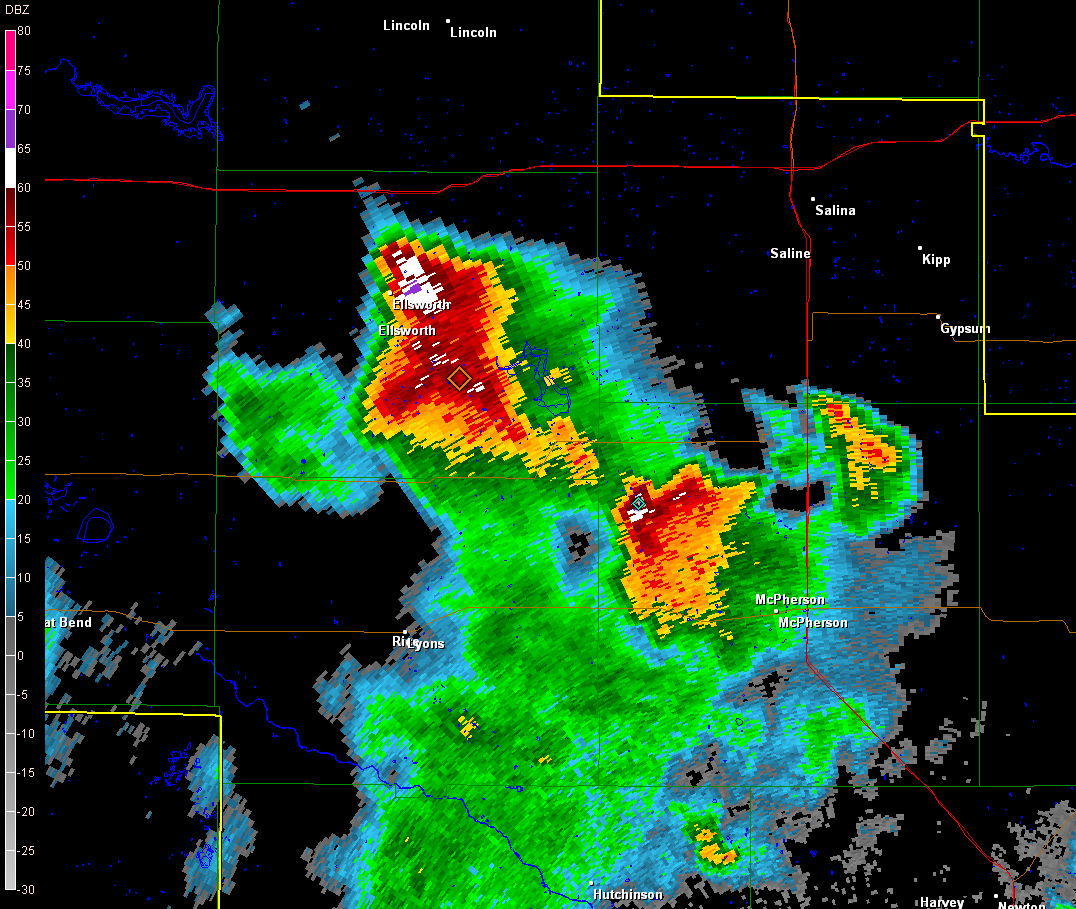
Base reflectivity image at 714 PM or shortly after a brief rope-like tornado was observed northwest of Moundridge.
|
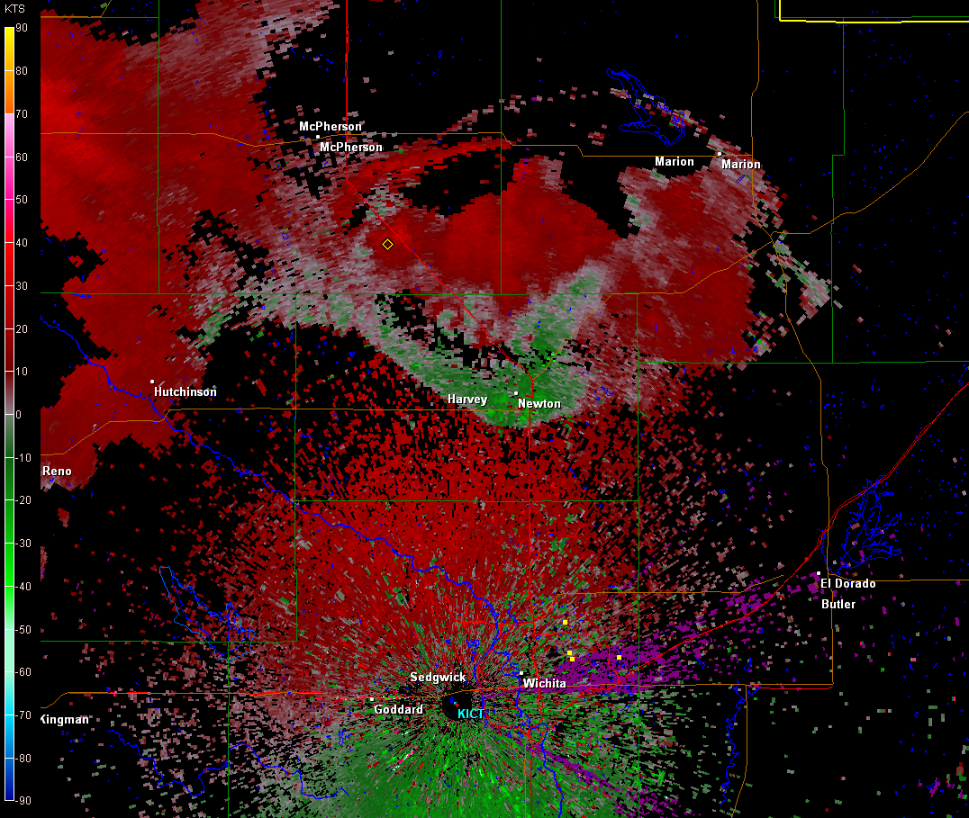
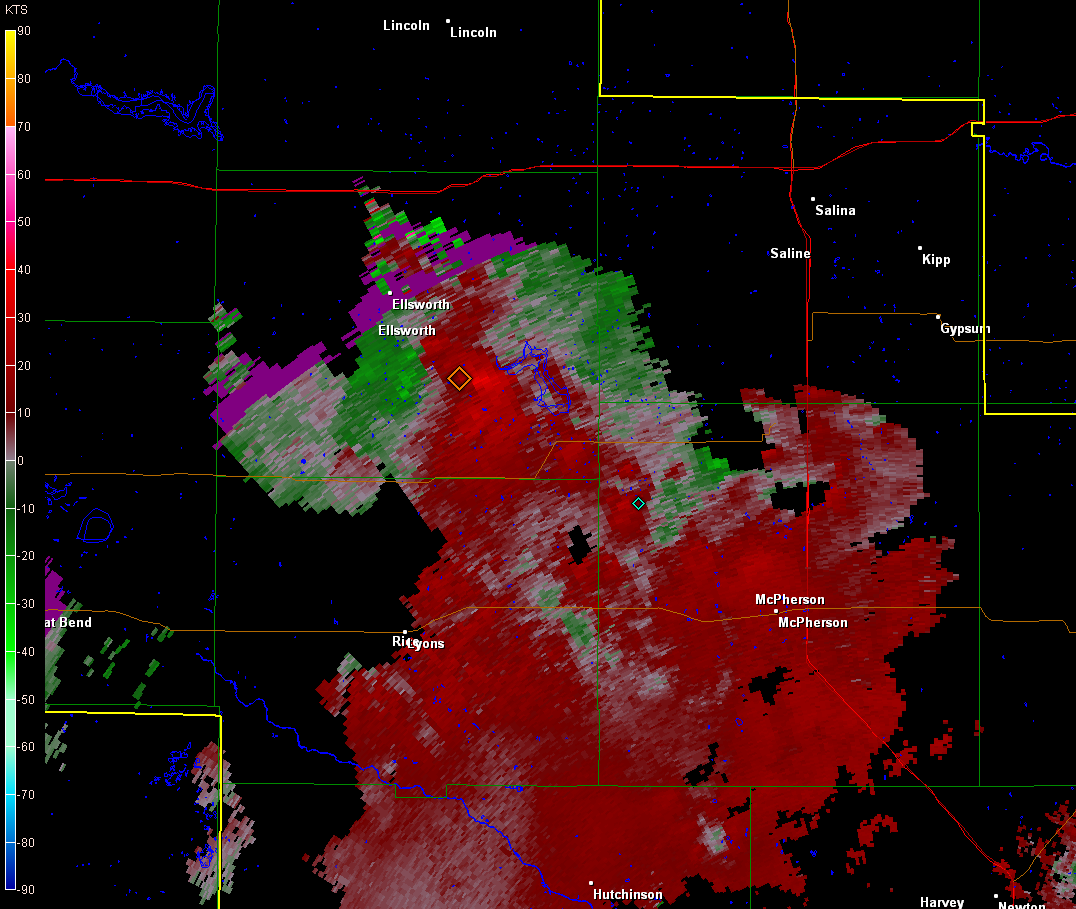
Base velocity image at 714 PM or shortly after a brief rope-like tornado was observed northwest of Moundridge.
|
|
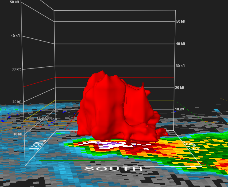
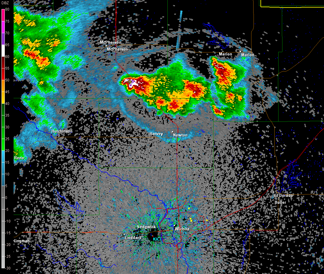
Base reflecivity image showing three body scatter spike (TBSS) or hail spike in Ellsworth county at 814 PM. |
Base velocity image with area of rotation southeast of Ellsworth at 814 PM. |
|
Hazards
Briefing pages
Local weather story
Submit a storm report
Storm Prediction Center
Enhanced Hazardous Weather Outlook
Hazardous Weather Outlook Text
Current Conditions
Local Radar
National Radar
Satellite
Hourly weather(text)
Precip Analysis
Snowfall analysis
This day in weather history
7 Day Lightning Archive
Forecasts
Forecast Discussion
Weather Story
Fire Weather
Activity Planner
Aviation Weather
Soaring Forecast
Hurricane Center
Graphical Forecasts
Regional Weather Summary
Probabilistic Snow
Probabilistic QPF
Wet Bulb Globe temp
Climate
Local Climate Page
Daily/Monthly data(F6)
Daily Records
Climate Normals
Local drought page
Latest Climate Report(ICT)
Latest Climate Report(SLN)
Latest Climate Report(CNU)
CoCoRaHS
7 Day Lightning Archive
US Dept of Commerce
National Oceanic and Atmospheric Administration
National Weather Service
Wichita, Kansas
2142 S. Tyler Road
Wichita, KS 67209-3016
316-942-3102
Comments? Questions? Please Contact Us.