For the second day in a row portions of Central and especially South Central Kansas were impacted by tornadoes, large hail and damaging winds. Storms first developed along a cold front around 5 pm and quickly became severe.
One of the more impressive supercell thunderstorms tracked across Chase County causing some minor damage. This tornado was rated an EF-0.
Chase county supercell
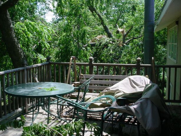 Tree damage about 6 miles Southwest of Cottonwood Falls along Buck Creek Road. |
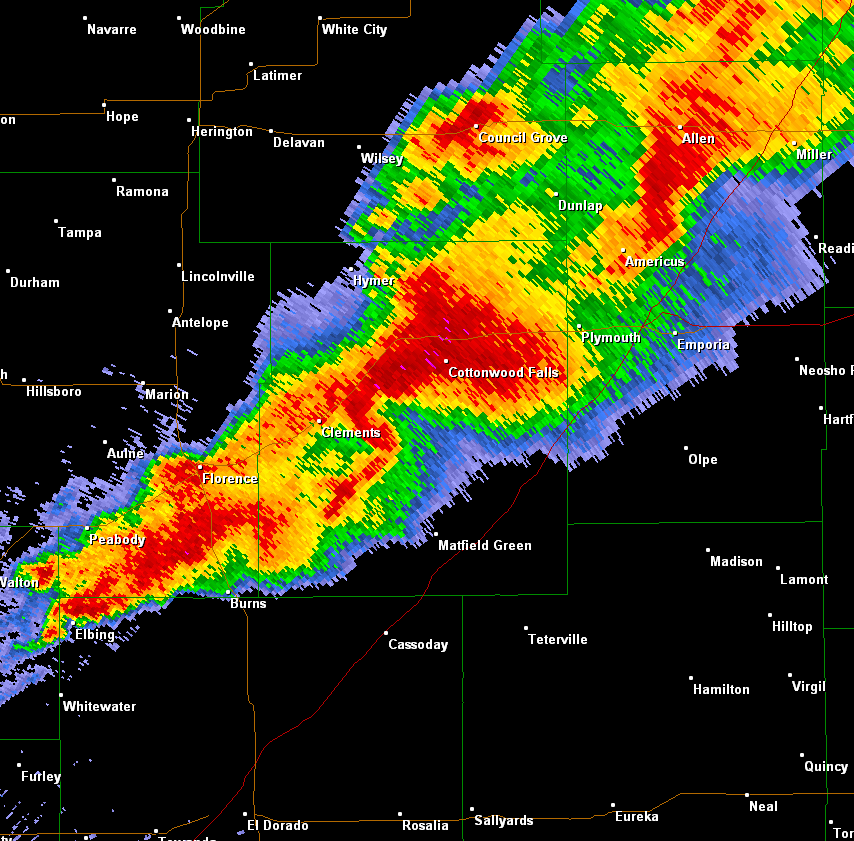 Radar image showing the classic 'hook echo' which is associated with supercell thunderstorms and often tornado development. |
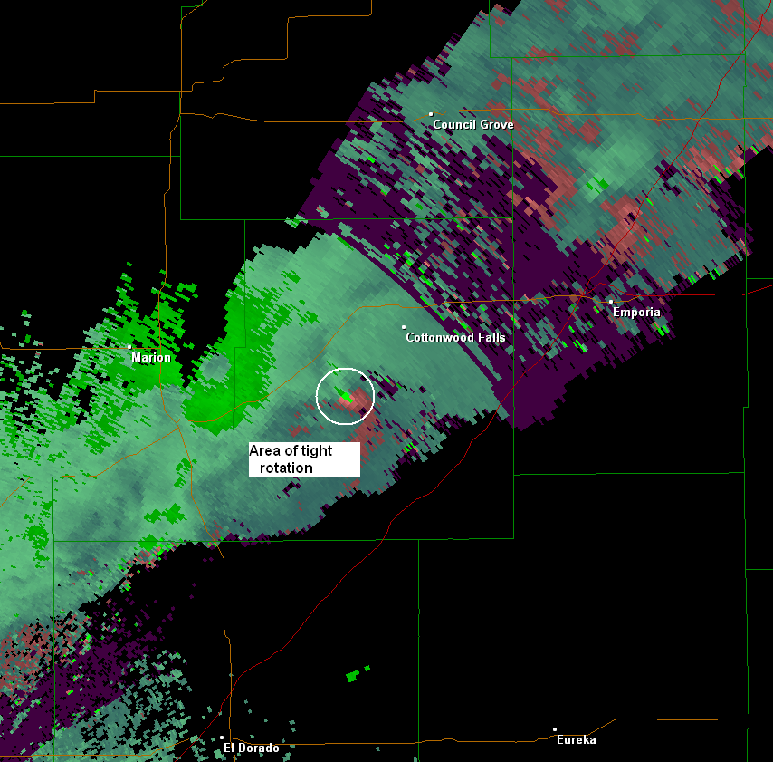 Radar velocity image showing the tight area of rotation in the area where the tornado was reported. |
Sedgwick County supercell
Thunderstorms continued to erupt southwest along the cold front as the evening hours progressed. Another intense storm developed across the southern portion of Sedgwick County around 830 pm.
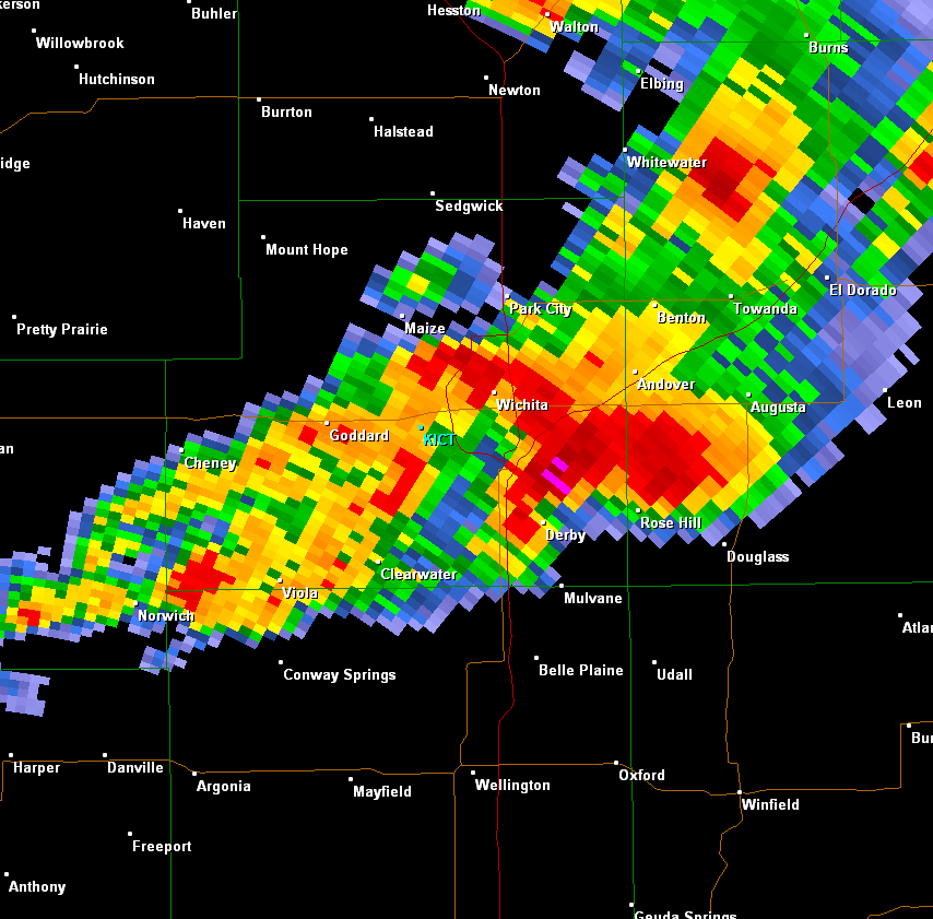 Radar image of the supercell over southeast Sedgwick County at around 840 pm. Note the classic hook signature near Derby indicating that this storm had rotation with it. |
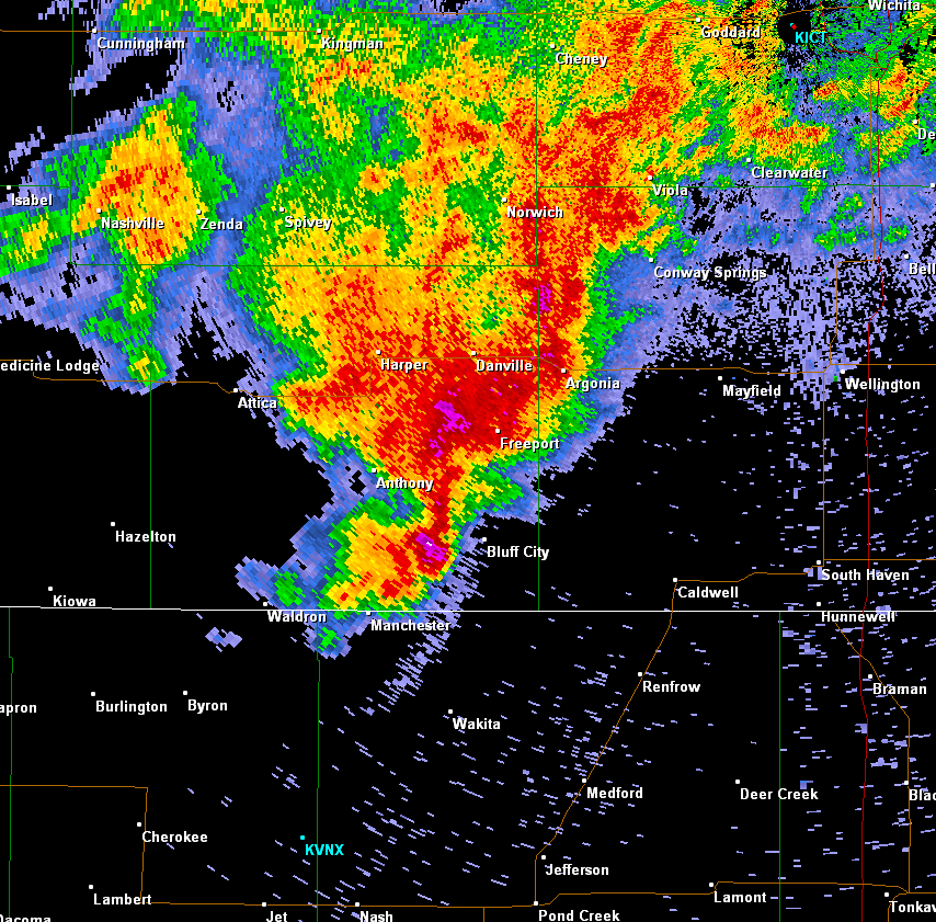
Cowley county supercell
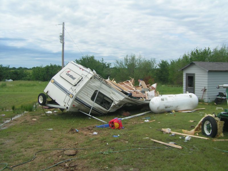
The severe weather continued after dark with another supercell producing a weak EF-1 tornado that caused damage over Central portions of Cowley County around 11 pm.
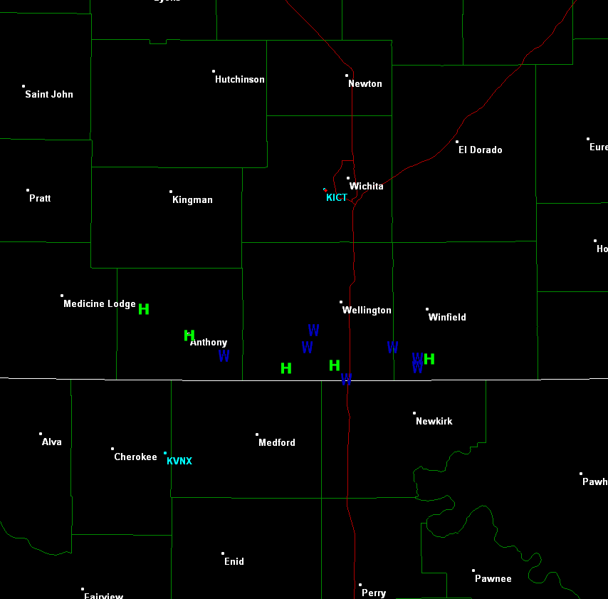
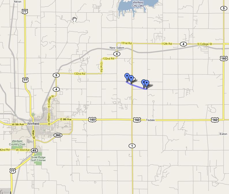 Map of where tornado damage occurred with the weak tornado that struck northeast of Winfield around 11 pm. |
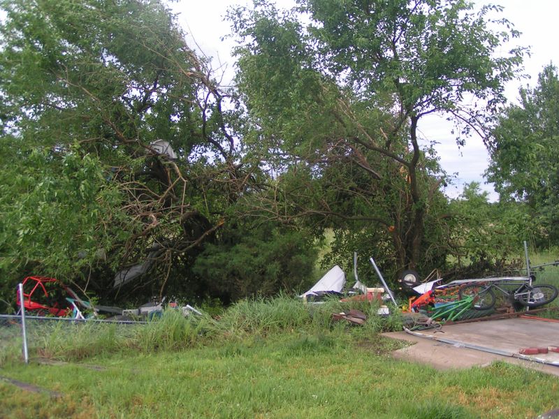 Tornado damage about 6 miles northeast of Winfield. Tornado damage about 6 miles northeast of Winfield. |
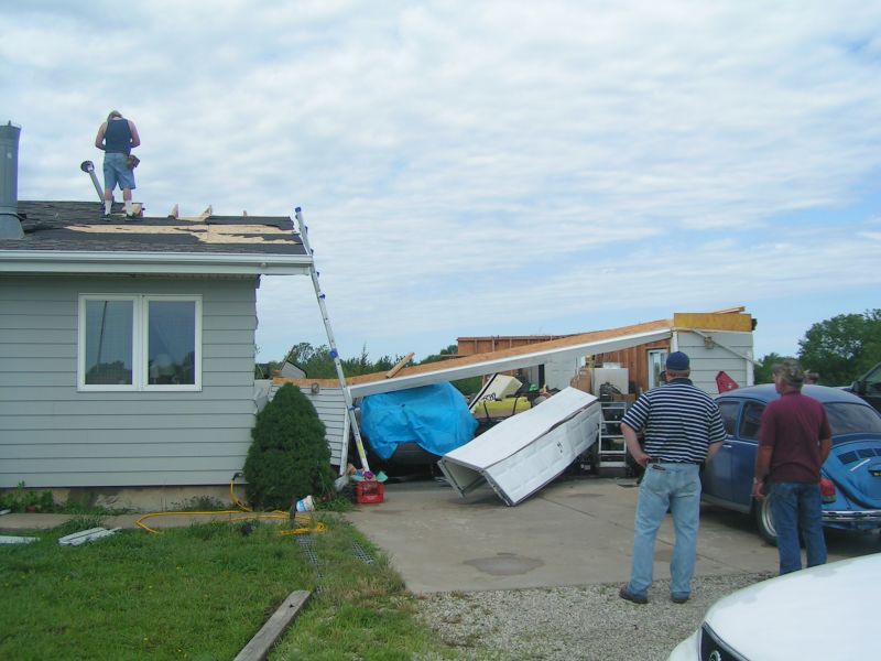 Tornado damage about 6 miles northeast of Winfield. Tornado damage about 6 miles northeast of Winfield. |
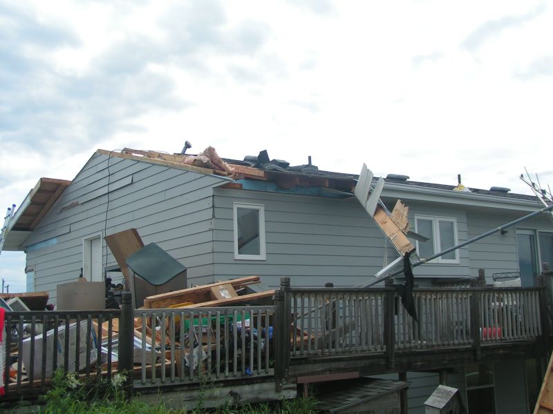 Tornado damage about 6 miles northeast of Winfield. |
 Tornado damage about 6 miles northeast of Winfield. |
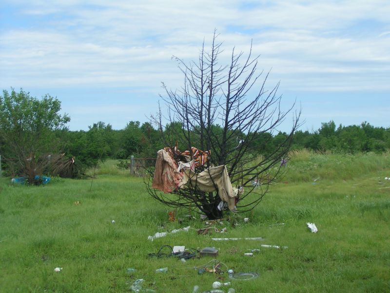 Tornado damage about 6 miles northeast of Winfield. |
Sumner county Supercell
To finish off the night one last storm developed over Barber County at around 3 am. As this storm tracked southeast, it intensified and produced a large swath of large hail and very high winds. Extremely strong straight line winds blew over a car just north of the state line south of Hunnewell(Sumner County) and two power poles were also snapped in this location. 75 mph winds were estimated in Geuda Springs which was also in Sumner County. This same storm also produced baseball size hail near South Haven along with Golf Ball size hail east of Arkansas City.
 Map showing severe weather reports produced from one intense thunderstorm during the late night hours of June 12th. |
 Radar image of the storm that produced 75 mph winds and baseball size hail over extreme South Central Kansas. |
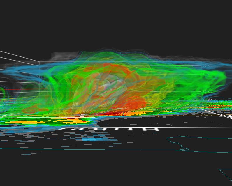 3-D radar image of this storm. Note the top of this storm reaches above 50,000 ft! |

