Small but Severe Storms Strike Sunday Night
Storms impact Central, South Central and SE Kansas
May 16th, 2010
|
A relatively weak upper level Low Pressure system moved across the central plains Sunday afternoon/evening. As this moved across the area, breaks in the clouds allowed for the sun to warm up the surface and increase the instability. Thunderstorms began to develop across central Kansas and another area across southeastern Kansas. While each area of storms was not overly widespread, the small storms packed a punch at times. Baseball sized hail was reported in Labette county, and a tornado was reported in western Kingman county. While it was not severe, a strong thunderstorm with heavy rain and pea sized hail, approached Great Bend during the late afternoon hours, threatening an outdoor graduation. |
 |
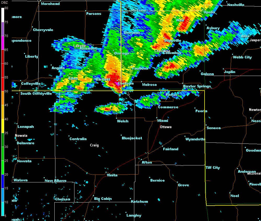
Labette County Supercell
| A strong and eventually severe Thunderstorm developed over Chautauqua county and moved eastward and eventually moving southeastward over Labette county. As it moved across northern Chautauqua county and Montgomery county it dropped large amounts of penny to nickel sized hail. However, as it moved into better atmospheric conditions over Labette county, it started to strengthen. Quarter to Ping Pong ball sized hail was reported over central and southern portions of the county with a final report of Baseball sized hail along the Kansas/Oklahoma Border near Highway 59. The storm eventually moved into Cherokee county and Ottawa County, Oklahoma and weakened. |
Pictures
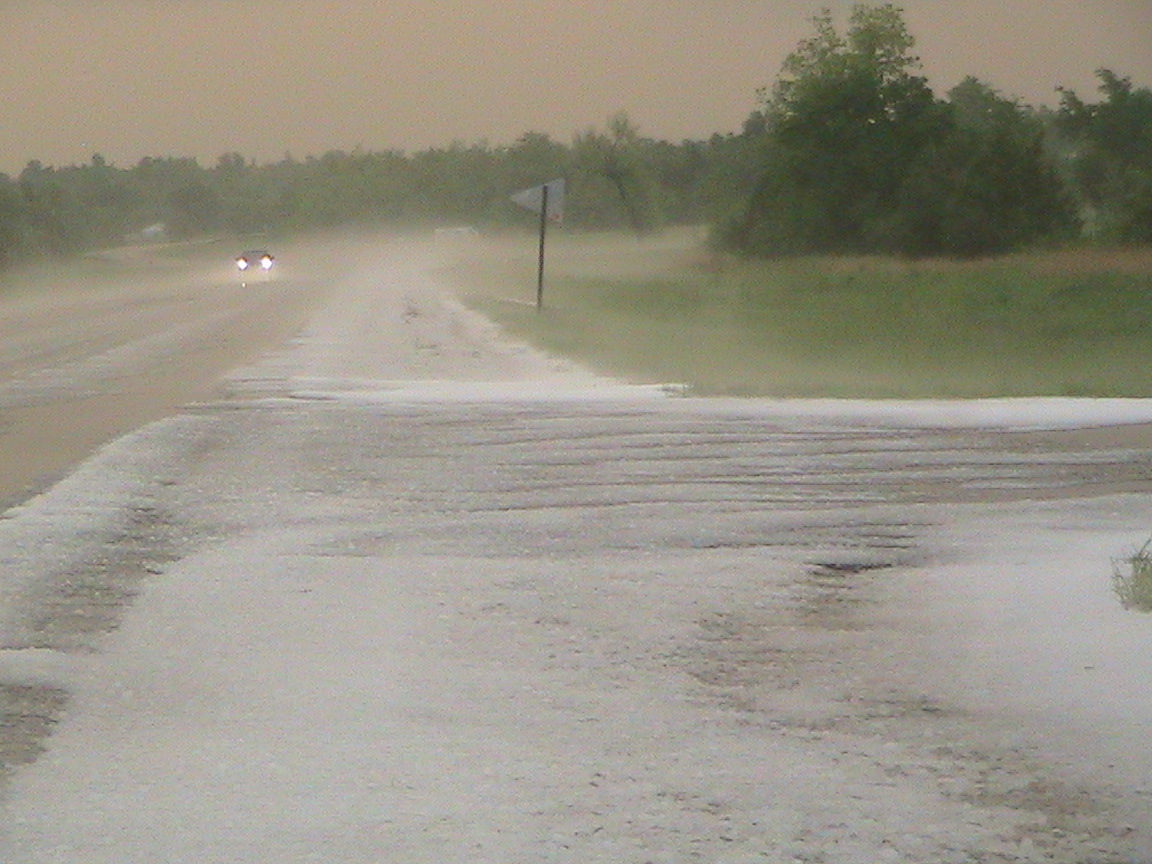 Hail covering the road near Chetopa, KS. Picture courtesy of JD Stewart
|
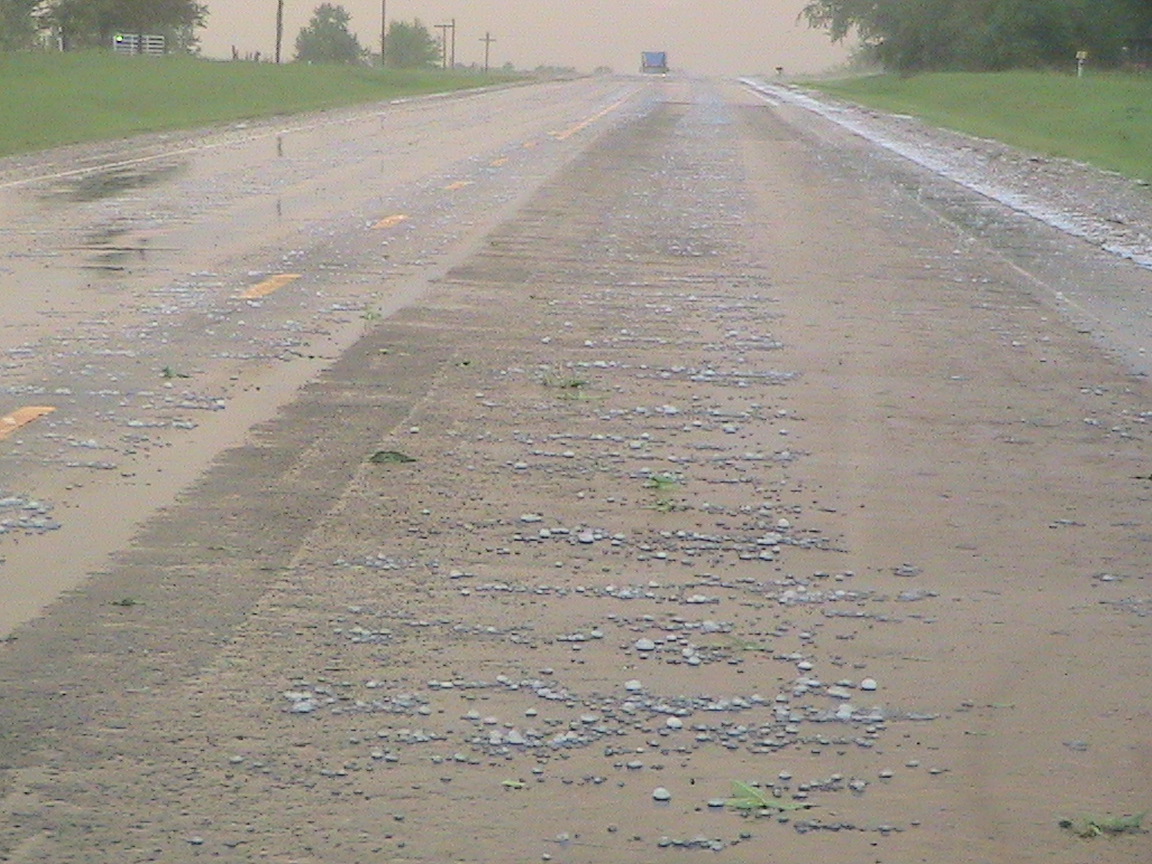 Hail covering the road near Chetopa, KS. Picture courtesy of JD Stewart
|
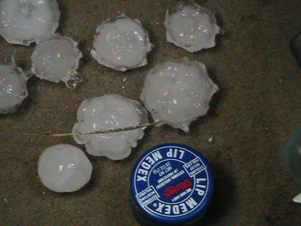 Picture courtesy of JD Stewart
|
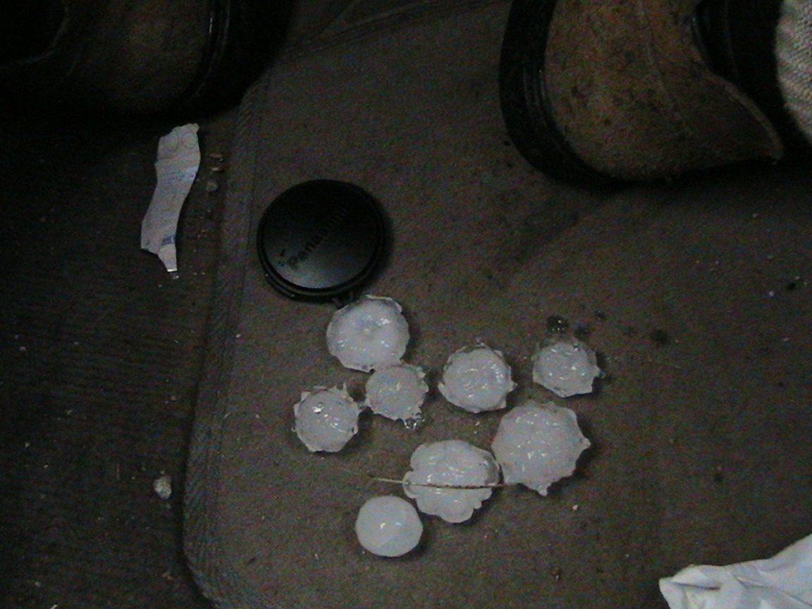 Picture courtesy of JD Stewart
|
Radar Imagery
 |
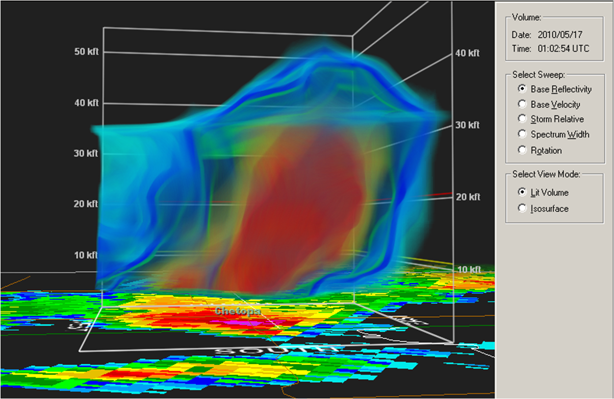 |
|
Two small yet powerful storms developed over central Kansas and continued to strengthen as they moved southeast. In Pratt county, the Dodge City Forecast office received reports of a tornado touching the ground near Preston. As this storm moved into Kingman county, it again showed signs of rotation and another touchdown 4 miles southwest of Penelosa. This storm also had some Quarter sized hail associated with it. A second storm further to the north moved across Reno county and while it displayed signals of mid-level rotation, it did not possess the strong, tight rotation indicative of a tornado. This storm dropped Quarter sized hail as it made its way across Reno county before weakening over Kingman county. |
Radar Imagery
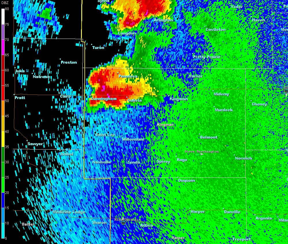 |
 |
| All Storm Reports Received Through 220AM Thursday |
NWUS53 KICT 170417
LSRICT

PRELIMINARY LOCAL STORM REPORT...SUMMARY
NATIONAL WEATHER SERVICE WICHITA KS
1116 PM CDT SUN MAY 16 2010

..TIME...   ...EVENT...      ...CITY LOCATION...     ...LAT.LON...
..DATE...   ....MAG....      ..COUNTY LOCATION..ST.. ...SOURCE....
            ..REMARKS..

0509 PM     FUNNEL CLOUD     5 NW EUREKA             37.87N 96.35W
05/16/2010                   GREENWOOD          KS   LAW ENFORCEMENT

            REPORTS OF A COLD AIR FUNNEL ASSOCITIATED WITH THE
            THUNDERSTORM MOVING THROUGH GREENWOOD COUNTY.

0625 PM     HAIL             INDEPENDENCE            37.23N 95.71W
05/16/2010  E0.75 INCH       MONTGOMERY         KS   AMATEUR RADIO

0643 PM     HAIL             5 S CHERRYVALE          37.20N 95.55W
05/16/2010  E0.88 INCH       MONTGOMERY         KS   CO-OP OBSERVER

            DIME TO NICKEL HAIL WITH HEAVY RAIN.

0705 PM     HAIL             1 SW MOUND VALLEY       37.20N 95.42W
05/16/2010  E1.00 INCH       LABETTE            KS   PUBLIC

            HAIL SIZE RANGED FROM DIME TO QUARTER.

0726 PM     HAIL             3 N EDNA                37.10N 95.36W
05/16/2010  E0.88 INCH       LABETTE            KS   TRAINED SPOTTER

0731 PM     TSTM WND GST     3 N EDNA                37.10N 95.36W
05/16/2010  E60.00 MPH       LABETTE            KS   TRAINED SPOTTER

0741 PM     TSTM WND GST     EDNA                    37.06N 95.36W
05/16/2010  E60.00 MPH       LABETTE            KS   TRAINED SPOTTER

0756 PM     HAIL             3 W CHETOPA             37.04N 95.15W
05/16/2010  E0.75 INCH       LABETTE            KS   BROADCAST MEDIA

            KJRH OUT OF TULSA...SPOTTER REPORTS DIME HAIL

0802 PM     HAIL             2 S CHETOPA             37.01N 95.09W
05/16/2010  E2.75 INCH       LABETTE            KS   TRAINED SPOTTER

            SPOTTERS OUT FOR COUNTY REPORT BASEBALL HAIL ALONG THE
            KANSAS/OKLAHOMA STATE LINE. HAIL RANGED FROM 1 WEST OF
            HIGHWAY 59 TO 3 EAST OF HIGHWAY 59 AND ABOUT 2-3 MILES
            INTO OKLAHOMA.

0806 PM     HAIL             CHETOPA                 37.04N 95.09W
05/16/2010  E1.50 INCH       LABETTE            KS   TRAINED SPOTTER

0944 PM     HAIL             2 N PLEVNA              38.00N 98.31W
05/16/2010  E1.00 INCH       RENO               KS   TRAINED SPOTTER

            WIND WAS ESTIMATED AT 40 TO 50 MPH.

1000 PM     HAIL             WNW PENALOSA            37.72N 98.32W
05/16/2010  E1.00 INCH       KINGMAN            KS   TRAINED SPOTTER

1000 PM     TORNADO          4 SW PENALOSA           37.67N 98.37W
05/16/2010                   KINGMAN            KS   TRAINED SPOTTER

            FUNNEL CLOUD WAS 80 PERCENT TO THE GROUND.

1006 PM     HAIL             2 W ARLINGTON           37.90N 98.21W
05/16/2010  E0.88 INCH       RENO               KS   EMERGENCY MNGR

            NICKEL HAIL AND 30MPH WINDS WITH HEAVY RAIN

1031 PM     HAIL             5 N KINGMAN             37.72N 98.11W
05/16/2010  E1.00 INCH       KINGMAN            KS   STORM CHASER

            NICKEL TO QUARTER HAIL COVERING THE GROUND

1040 PM     HAIL             3 NNE KINGMAN           37.69N 98.08W
05/16/2010  E0.88 INCH       KINGMAN            KS   TRAINED SPOTTER


&&

$$
|

