Wichita, Kansas
Weather Forecast Office
Overview
|
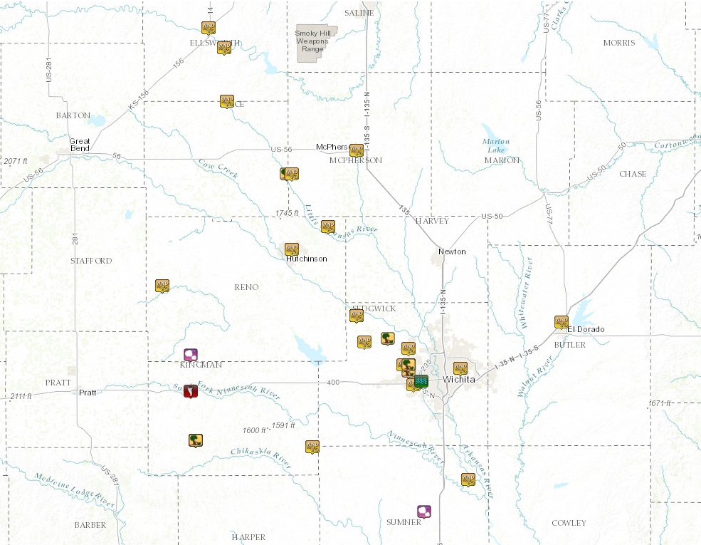
Storms developed during the late afternoon hours of July 28th and tracked southeast through the evening hours. These storms developed into a line and eventually a small bow echo, producing 60 to 85 mph winds as they tracked southeast. In addition, tennis ball size hail was reported over Reno county along with a brief tornado touchdown in Kingman county. |
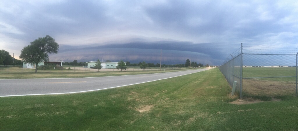
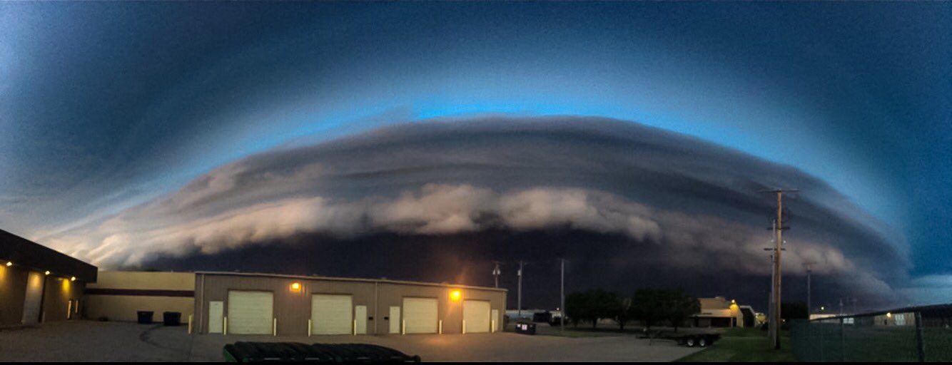 Shelf cloud in Wichita, KS. Taken by Rich Williams |
Wind & Hail:
Wind
 |
 |
 |
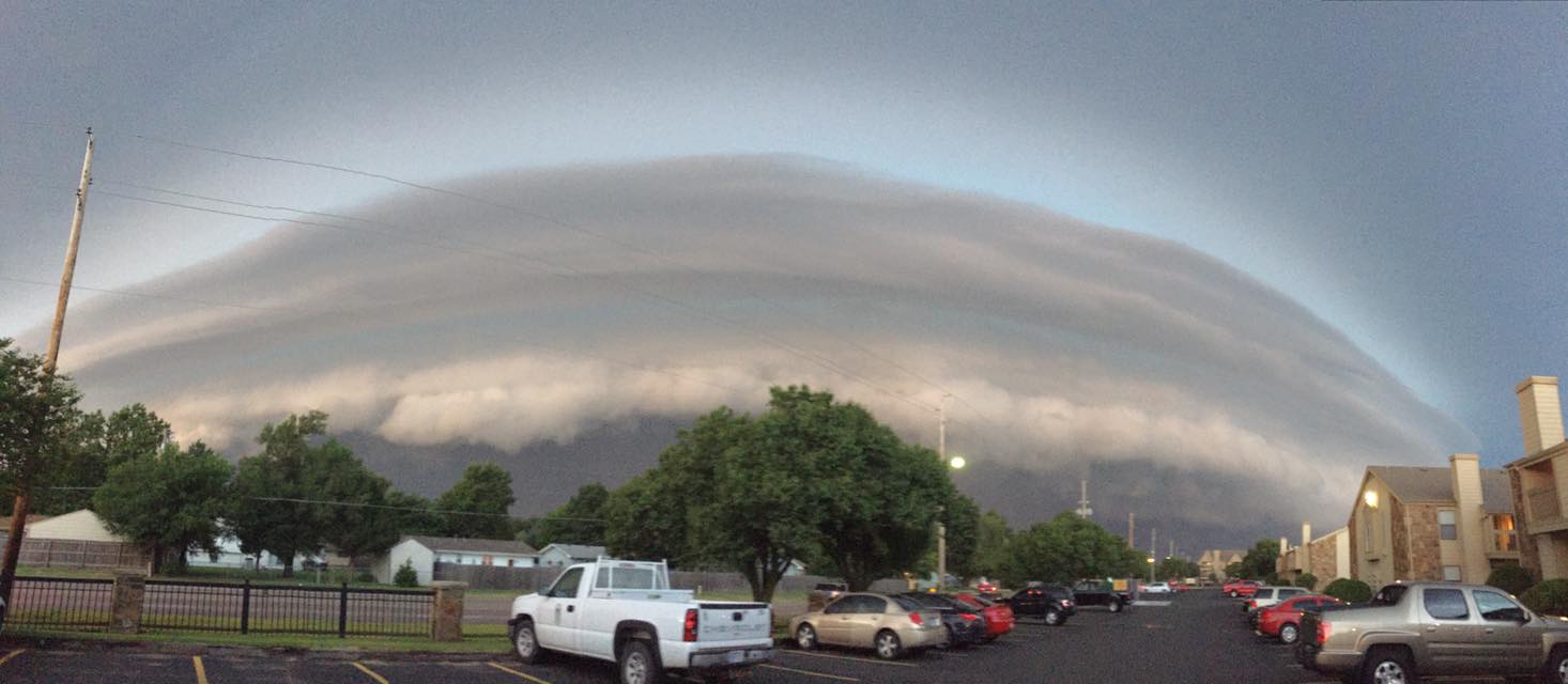 |
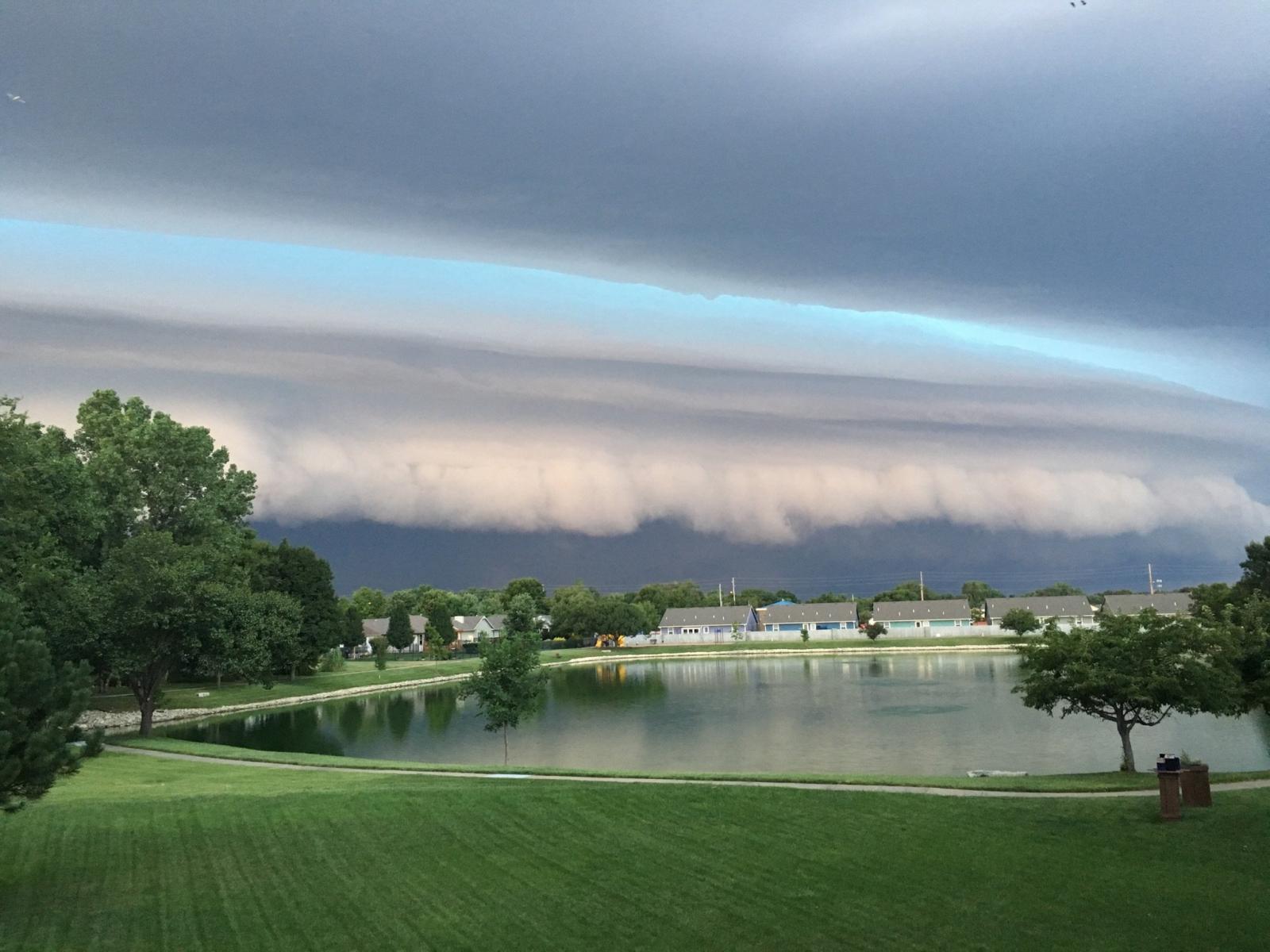
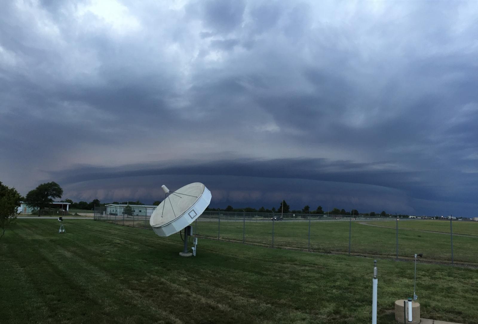
| Shelf cloud approaching Wichita. Picture taken by Chris Jakub | Picture of shelf cloud from the NWS Office in Wichita. Picture by Kevin Darmofal | Picture of shelf cloud from the NWS Office in Wichita. Picture by Mick McGuire | Shelf cloud over west Wichita. Taken by Jaclyn Ritzman |
Hail
 |
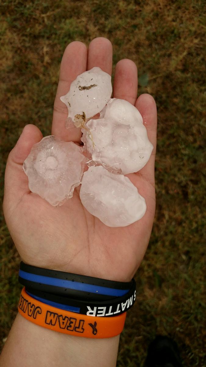 |
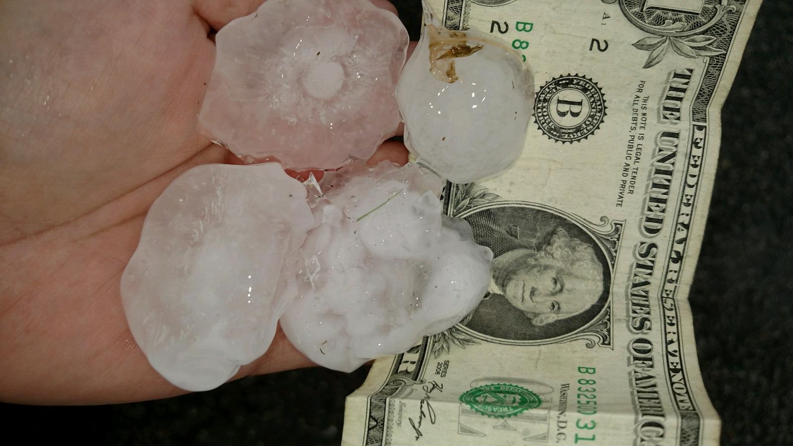
| Large hail in Penalosa | Large hail in Penalosa |
Radar:
Header
 |
 |
 |
| Radar animation showing the line of storms sweeping across central Kansas | Radar animation as the small bow echo moved through Wichita | Radar velocity as the storms moved through Wichita |
Storm Reports
|
Click on image above for a list of severe weather reports |
 |
Media use of NWS Web News Stories is encouraged! Please acknowledge the NWS as the source of any news information accessed from this site. |
|
Hazards
Briefing pages
Local weather story
Submit a storm report
Storm Prediction Center
Enhanced Hazardous Weather Outlook
Current Conditions
Local Radar
National Radar
Satellite
Hourly weather(text)
Precip Analysis
Snowfall analysis
This day in weather history
7 Day Lightning Archive
Forecasts
Forecast Discussion
Weather Story
Fire Weather
Activity Planner
Aviation Weather
Soaring Forecast
Hurricane Center
Graphical Forecasts
Regional Weather Summary
Probabilistic Snow
Probabilistic QPF
Wet Bulb Globe temp
Climate
Local Climate Page
Daily/Monthly data(F6)
Daily Records
Climate Normals
Local drought page
Latest Climate Report(ICT)
Latest Climate Report(SLN)
Latest Climate Report(CNU)
CoCoRaHS
7 Day Lightning Archive
US Dept of Commerce
National Oceanic and Atmospheric Administration
National Weather Service
Wichita, Kansas
2142 S. Tyler Road
Wichita, KS 67209-3016
316-942-3102
Comments? Questions? Please Contact Us.