Wichita, Kansas
Weather Forecast Office
Overview
|
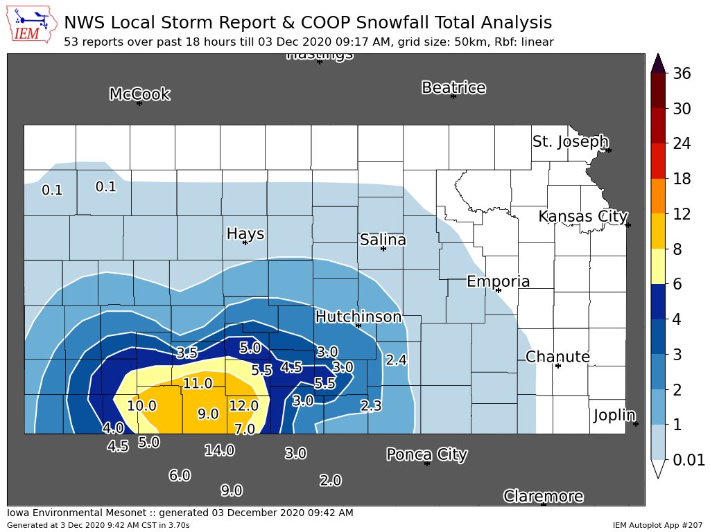
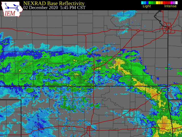
Slow moving upper level low pressure system brought the first significant snow of the season to parts of southern Kansas and northwest Oklahoma on December 2nd and 3rd. Locations generally between and south of Wichita and Dodge City received the higher snowfall totals. Some locations between Dodge City and Woodward Oklahoma picked-up around a foot of snow! |
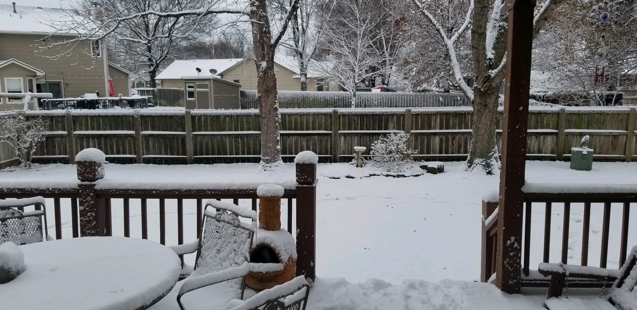 Picture by Janet Salazar |
Photos & Video
 |
 |
 |
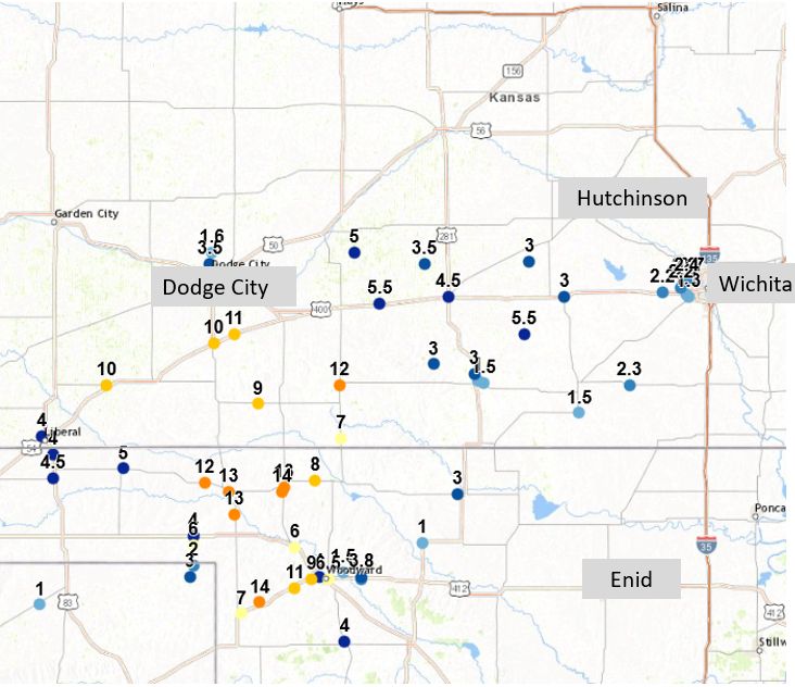
| Map of snowfall reports |
Crude snowfall map showing where the heaviest snow fell. |
Radar animation showing the long period of time the area was affected by precip |
|
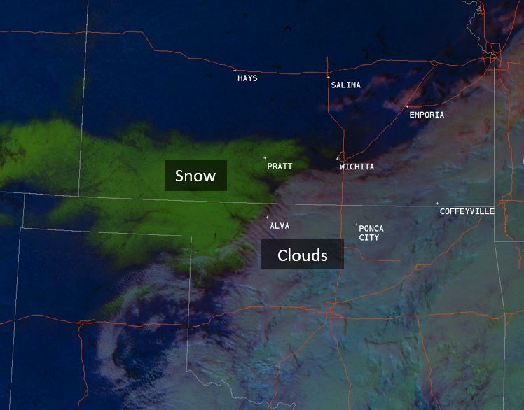
Day cloud phase distinction from GOES-16 showing there snow vs clouds are located |
||
|
|
|
 |
Media use of NWS Web News Stories is encouraged! Please acknowledge the NWS as the source of any news information accessed from this site. |
|
Hazards
Briefing pages
Local weather story
Submit a storm report
Storm Prediction Center
Enhanced Hazardous Weather Outlook
Hazardous Weather Outlook Text
Current Conditions
Local Radar
National Radar
Satellite
Hourly weather(text)
Precip Analysis
Snowfall analysis
This day in weather history
7 Day Lightning Archive
Forecasts
Forecast Discussion
Weather Story
Fire Weather
Activity Planner
Aviation Weather
Soaring Forecast
Hurricane Center
Graphical Forecasts
Regional Weather Summary
Probabilistic Snow
Probabilistic QPF
Wet Bulb Globe temp
Climate
Local Climate Page
Daily/Monthly data(F6)
Daily Records
Climate Normals
Local drought page
Latest Climate Report(ICT)
Latest Climate Report(SLN)
Latest Climate Report(CNU)
CoCoRaHS
7 Day Lightning Archive
US Dept of Commerce
National Oceanic and Atmospheric Administration
National Weather Service
Wichita, Kansas
2142 S. Tyler Road
Wichita, KS 67209-3016
316-942-3102
Comments? Questions? Please Contact Us.