Overview
|
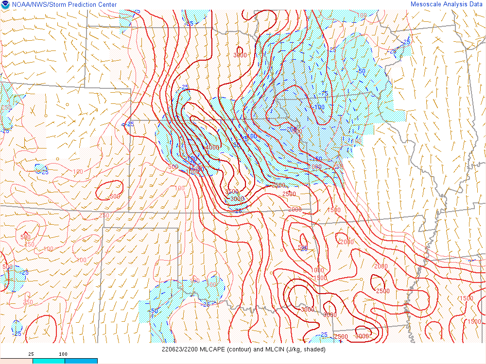
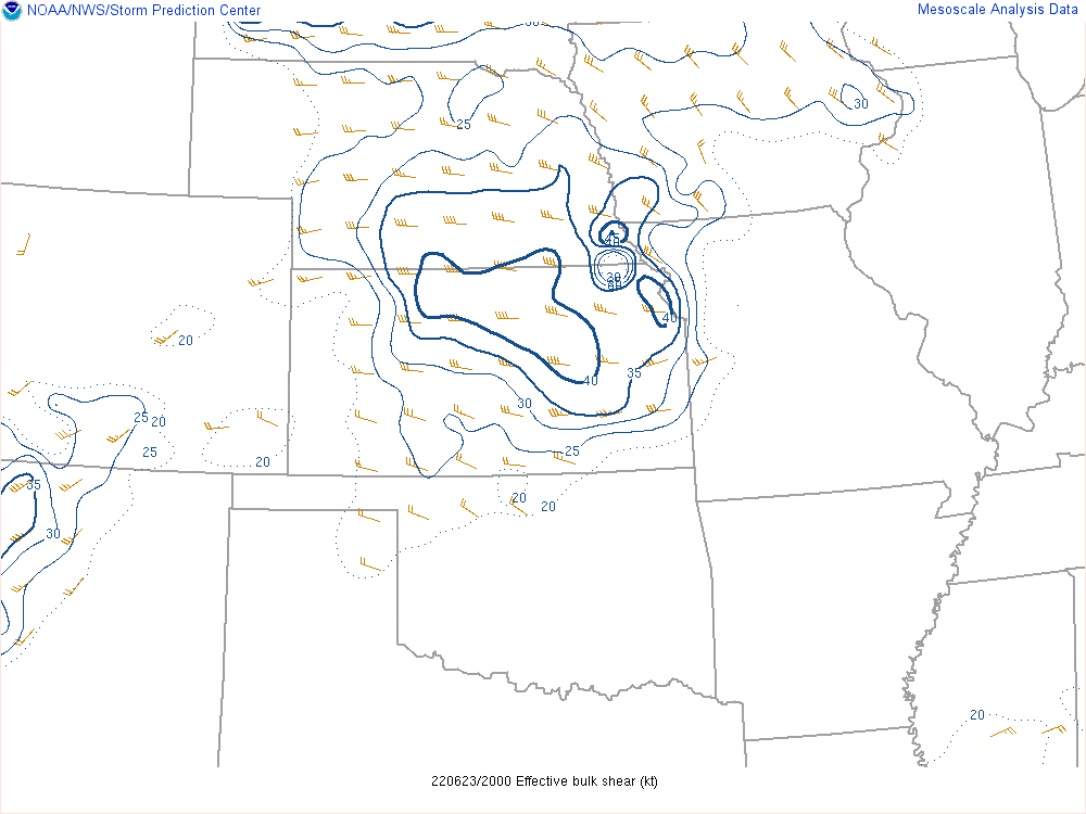
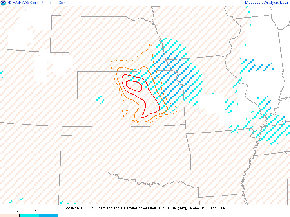
Hot and muggy conditions resulted in extreme instability over Central Kansas on Thursday June 23rd. A supercell storm developed around 4 pm and tracked very slowly along Interstate 70, producing numerous short-lived tornadoes along its path. Luckily these tornadoes did not cause any significant damage or injuries. |
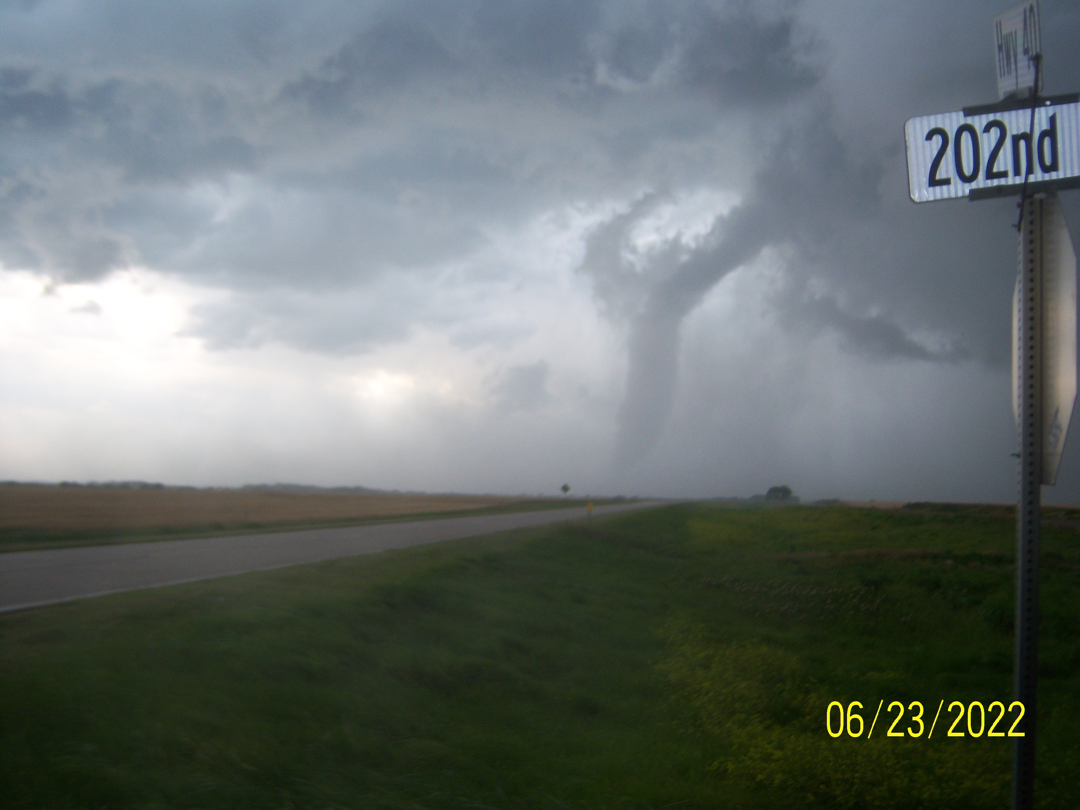 Picture by Henry Diehl |
Photos & Video
Radar & Satellite
 |
 |
 |
Additional images & video
 |
|
|
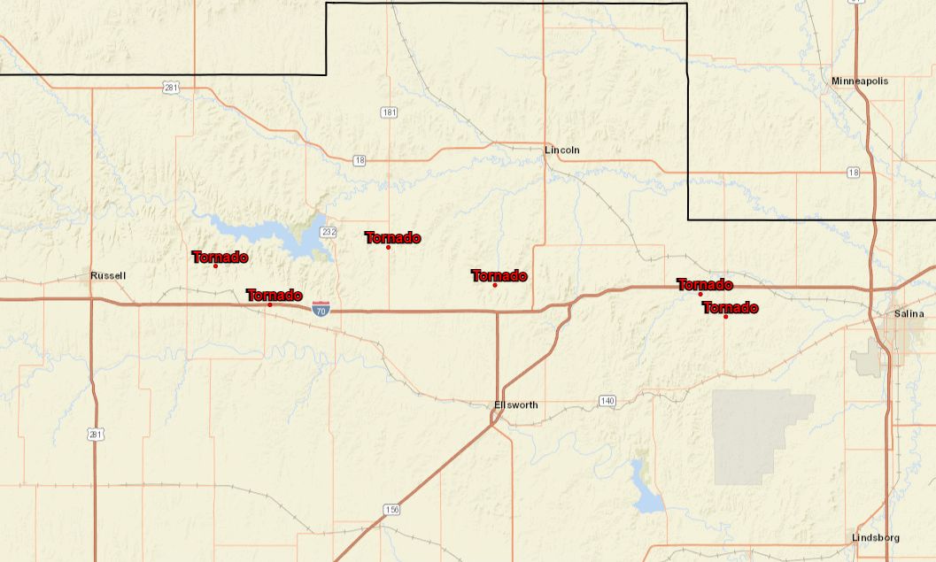
| Locations of tornado reports | Caption (source) |
Caption (source) |
|
|
|
|
|
|
Environment
 |
 |
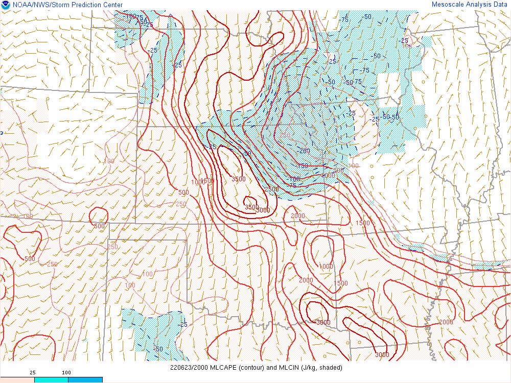 |
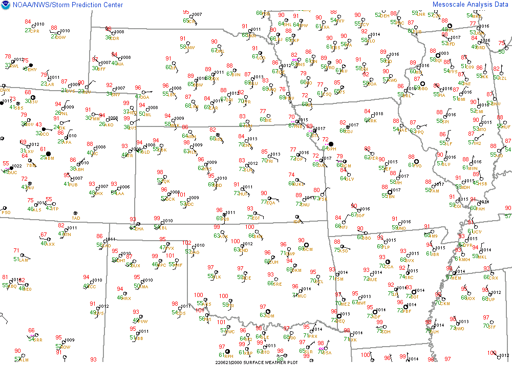
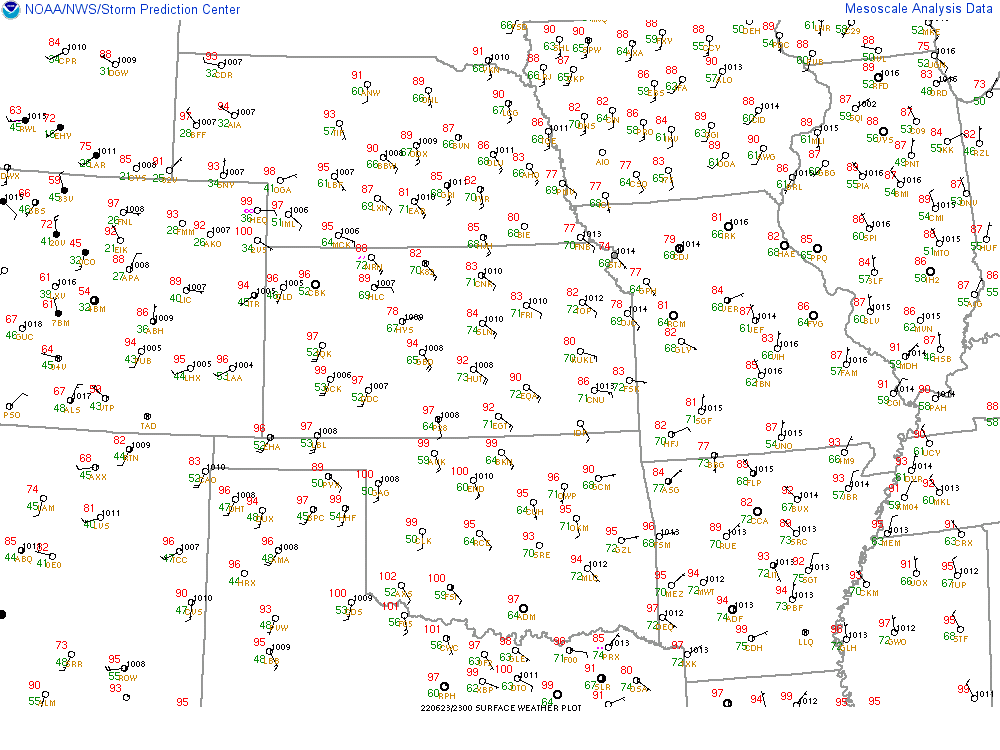
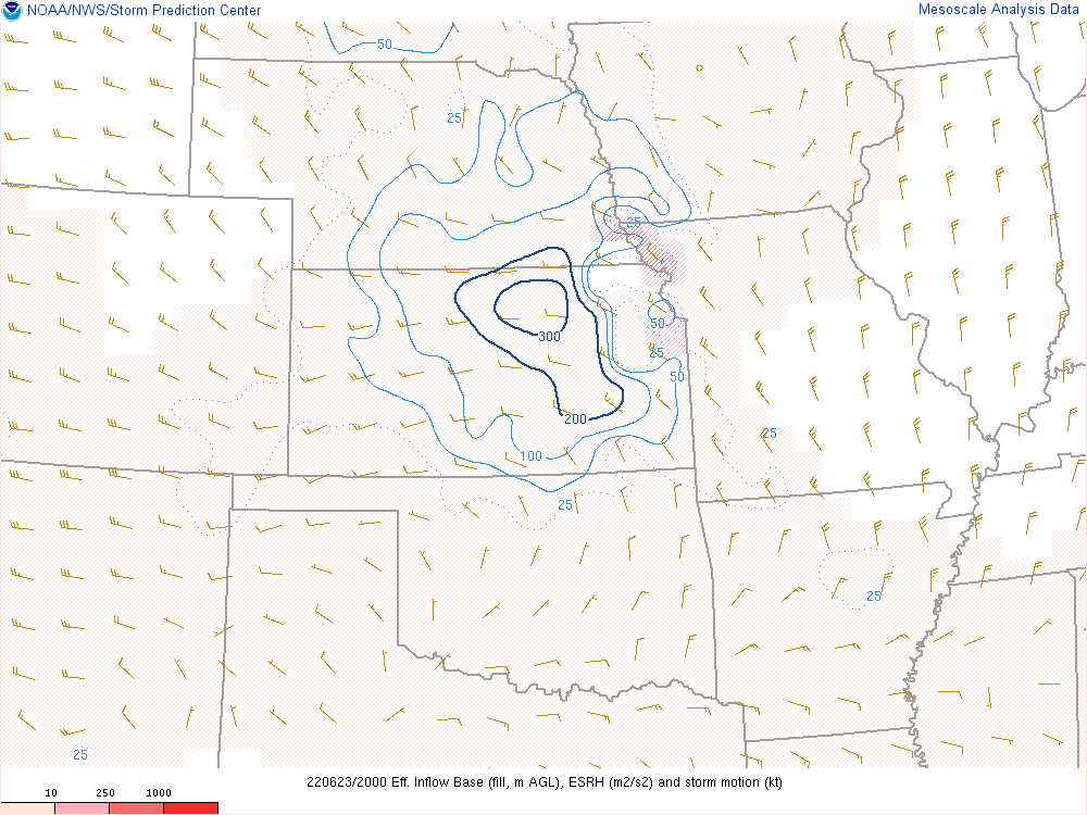
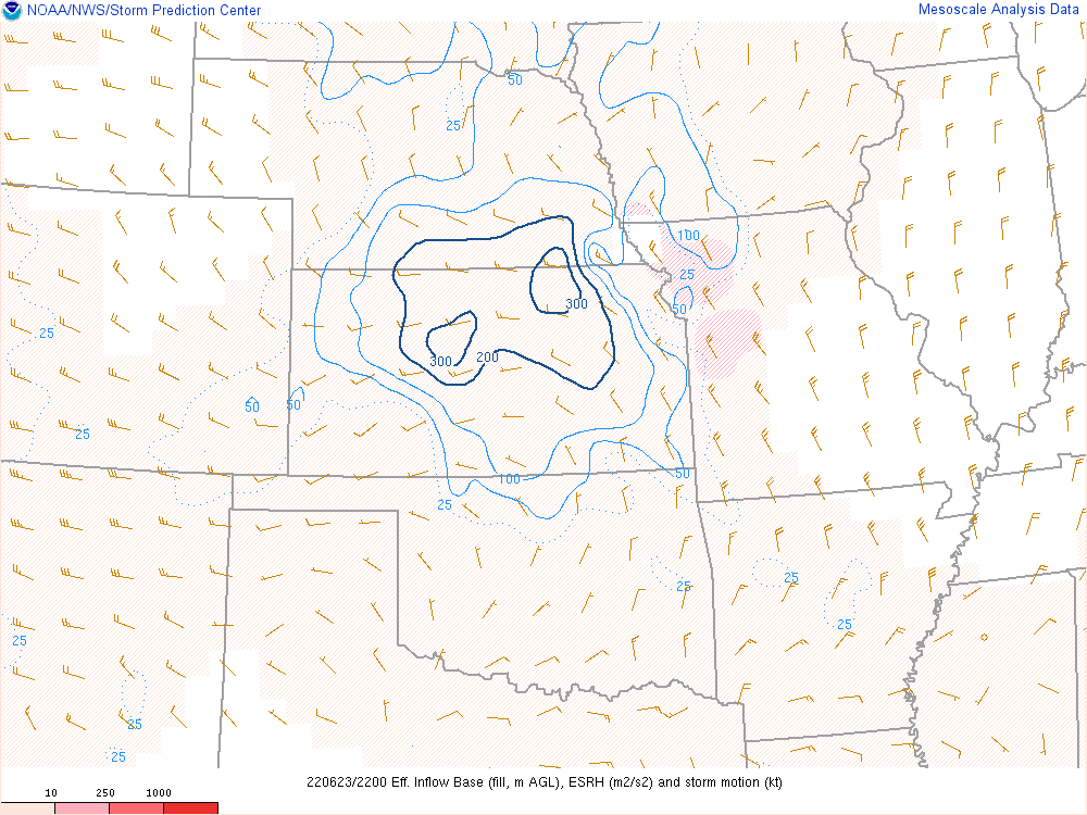
| 20z surface map | 23z surface map | 20z ML CAPE |
 |
 |
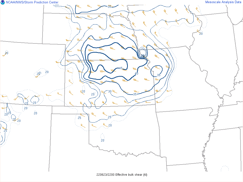 |
| 22z ML CAPE | 20z Effective deep layer shear | 22z effective deep layer shear |
 |
 |
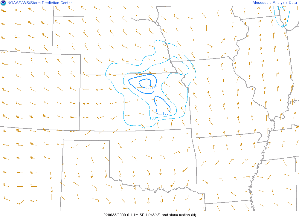 |
| 20z Effective storm relative helicity | 23z Effective storm relative helicity | 20z 0-1KM SRH |
 |
 |
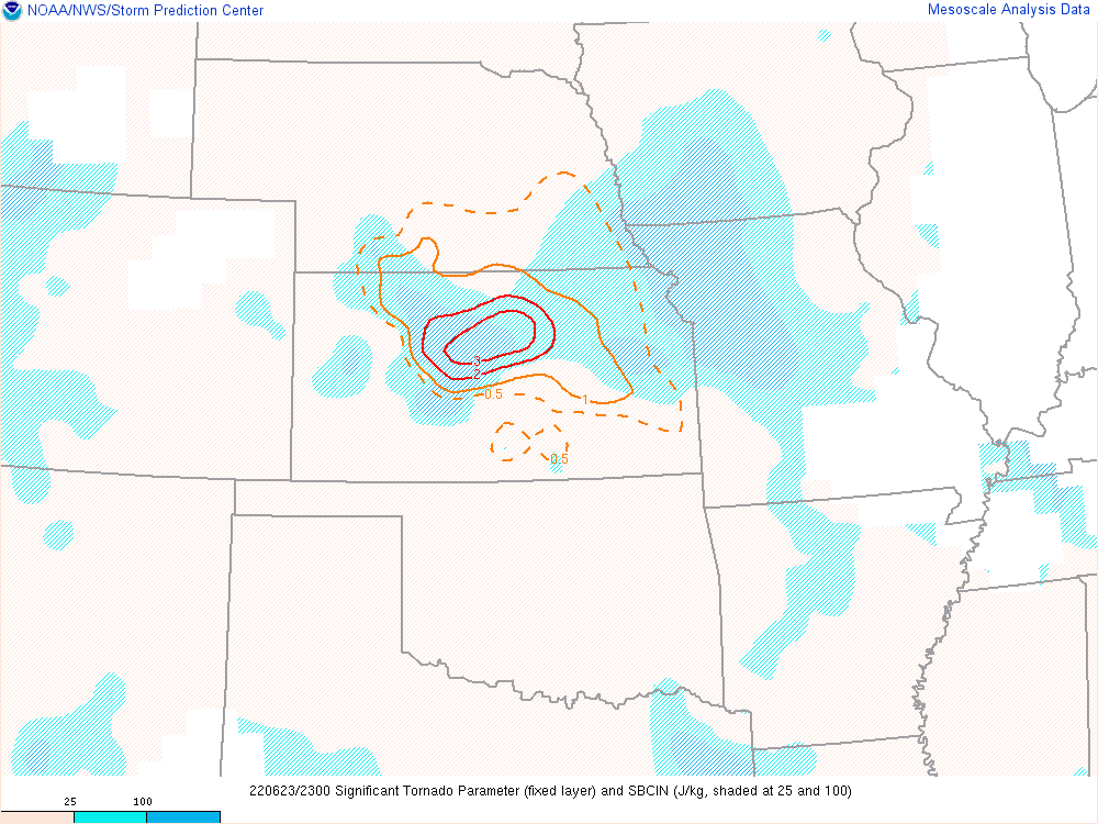 |
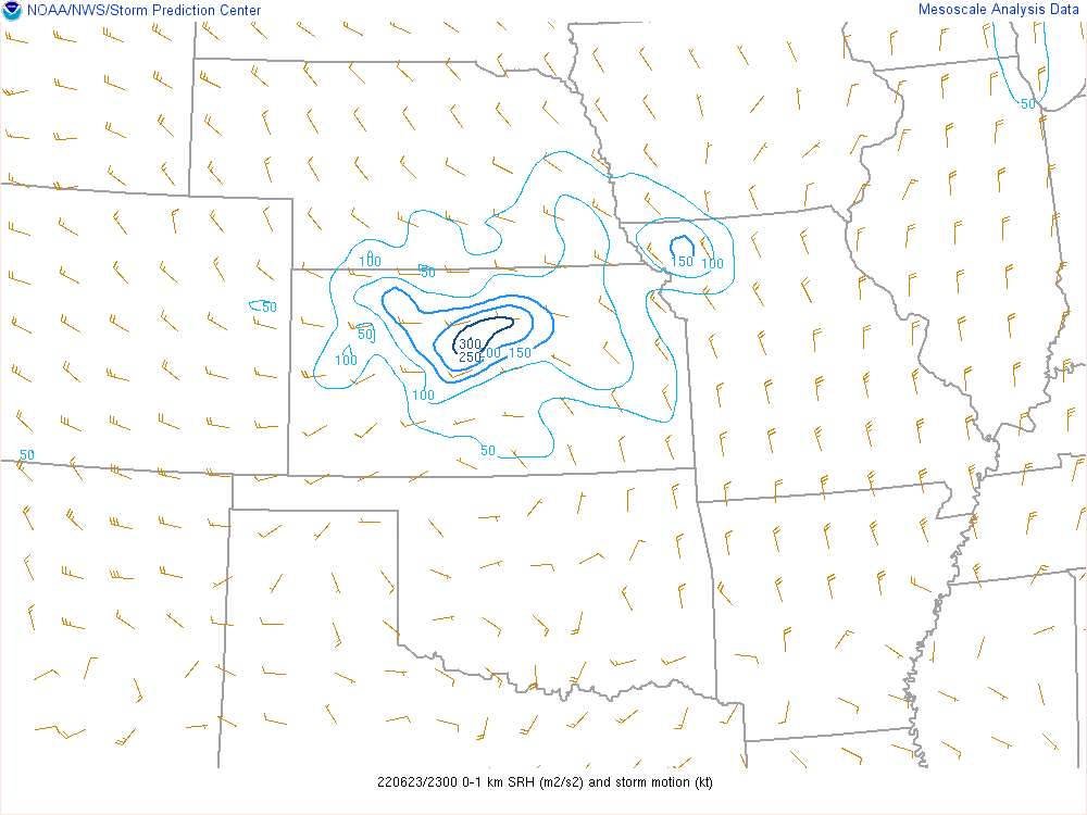
| 23z 0-1KM SRH | 20z Sig Tor | 23z Sig Tor |
 |
 |
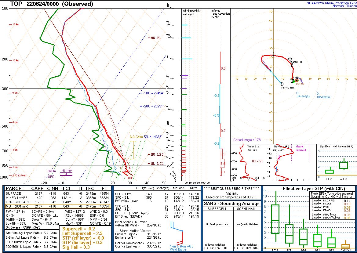 |
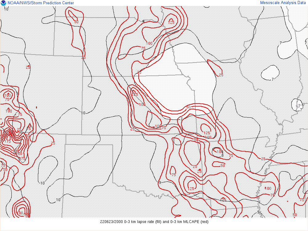
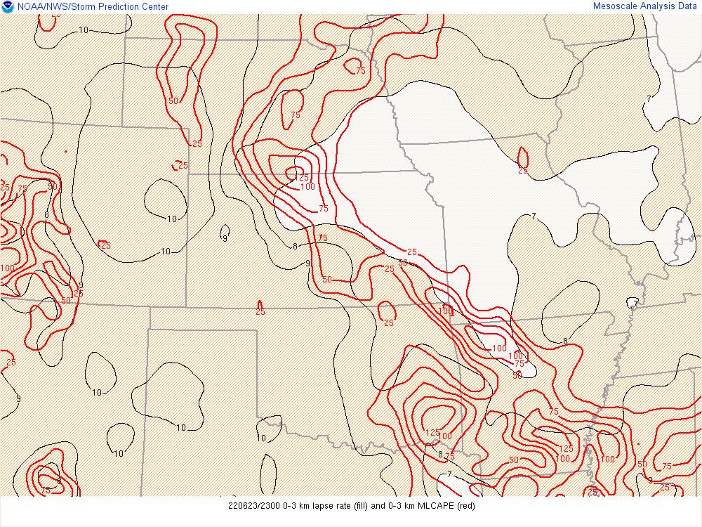
| 20z 0-3KM CAPE | 23z 0-3KM CAPE | Topeka 00z sounding |
 |
Media use of NWS Web News Stories is encouraged! Please acknowledge the NWS as the source of any news information accessed from this site. |
|

