|
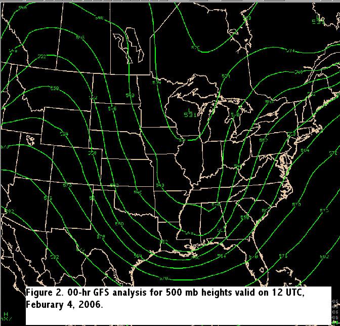
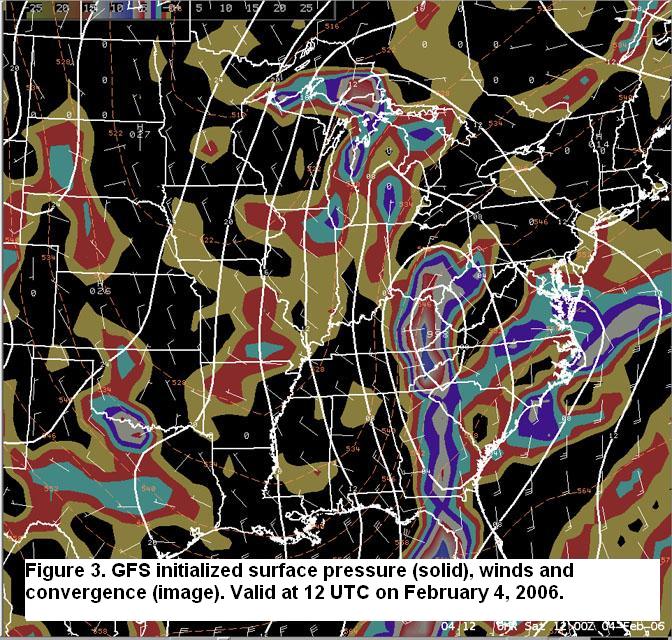
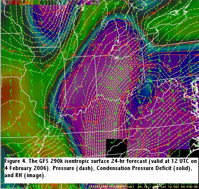
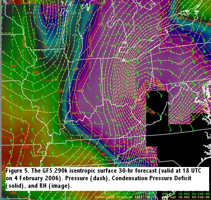
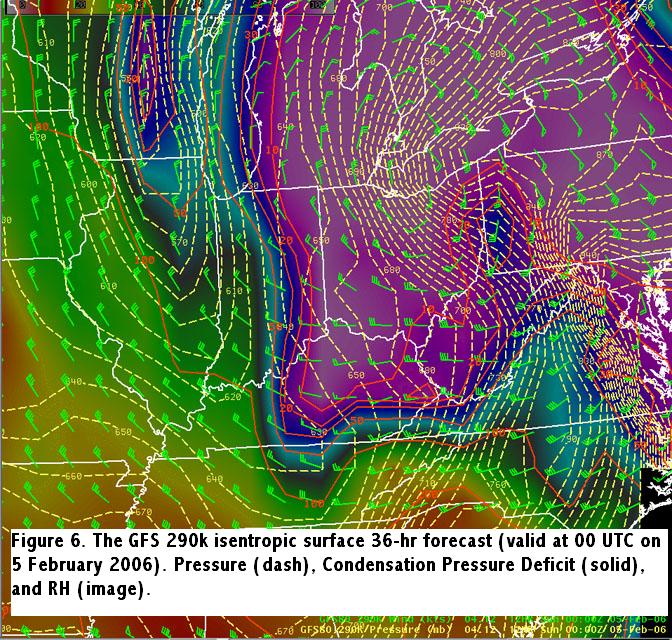
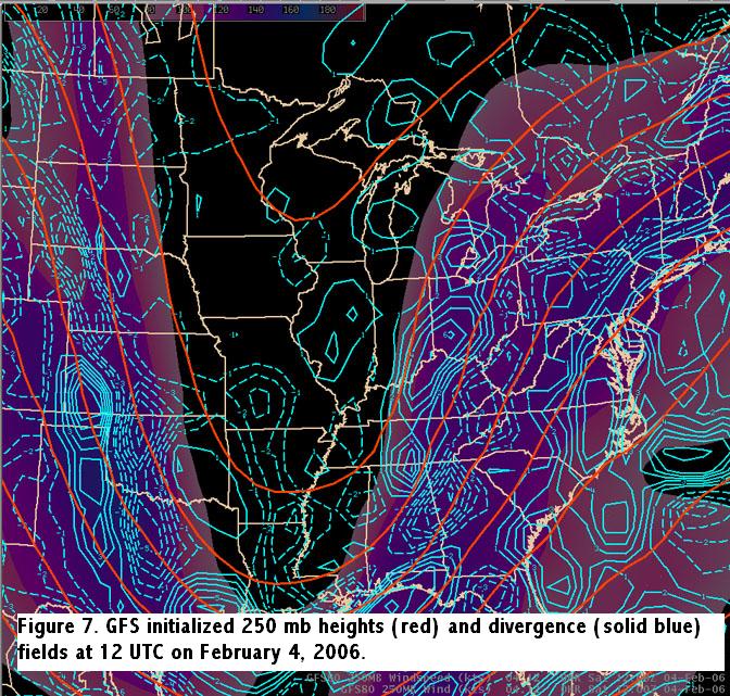
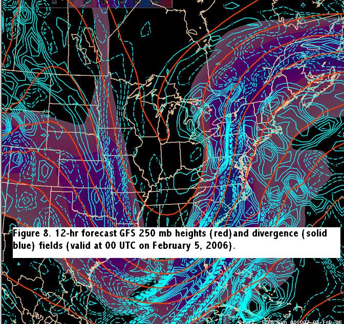
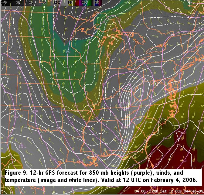
Winter Weather Event Review Section 2: Synoptic Overview Section 1 -- Section 2 -- Section 3 -- Section 4 -- Section 5 -- Section 6 A full latitude mid level (~500mb) trough over the Mississippi valley sharpened up and translated east as a strong short wave rotated around it's base. Figure 2 shows the analyzed 500 mb pattern at 12 UTC on Saturday, February 4. This short wave induced a deepening surface low which tracked from the Gulf states through the upper Ohio Valley, to a position over southeast Ohio by 18 UTC on Saturday. Figure 3 illustrates the analyzed surface low position over eastern Kentucky at 12 UTC on Saturday, February 4. All model solutions indicated strong isentropic lift developing late Friday night, and continuing into the day on Saturday. Figure 4 shows the GFS 290 K isentropic surface at 12 UTC on Saturday, with 30 to 45 knot cross contour lift and pressure condensation deficits below 30 mb. This strong lift quickly shifted north with down glide developing into ILN's western CWA by 18 UTC and across the entire CWA by 00 UTC on Sunday, February 5, as indicated by Figure 5 and Figure 6 respectively. The GFS 250mb analysis indicated a 130-135 knot jet streak with an axis of favorable upper level divergence over southwest Ohio at 12 UTC on Saturday (Fig. 7). The favorable upper level dynamics quickly lifted north and east as indicated by the 00 UTC Sunday 250 mb forecast (Fig. 8). The best forcing during the event occurred between 12 UTC and 18 UTC on the 4th. A warm airmass was in place leading up to this event, with high temperatures on Thursday, February 2nd ranging from the middle 40s in West Central Ohio to the upper 50s in South Central Ohio and Northeast Kentucky. High temperatures on Friday, February 3rd were in the upper 30s to middle 40s. Freezing levels were above 2000 feet agl at the start of the precipitation event. With the warm air in place, the boundary layer was sufficiently warm enough to support full melting of the precipitation and rain was observed at all observing sites at the onset of the event Friday night into Saturday morning. As colder air was advected into the region the rain transitioned over to snow across Eastern Indiana and Western Ohio during the mid to late morning hours. Precipitation did not change over to snow in the east until mid afternoon, with a change over to snow at Columbus observed at 347 pm. Moderate snow was observed for a period in the West during the late morning into the early afternoon when the favorable lift, deep moisture, and thermal profiles lined up for a brief period. It must be noted that the warm ground temperatures at the onset of the snow initially inhibited the snow accumulation. In the East, a favorable thermal profile for snow and lift was not in phase, and thus significant measurable snow was not observed. Figure 9 shows the 850 mb analysis at 12 UTC Saturday, with the low over Eastern Kentucky and -3 degree C isotherm into Western Ohio.
|