|
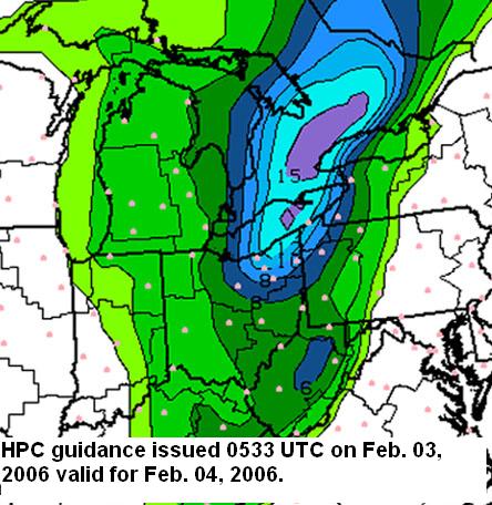
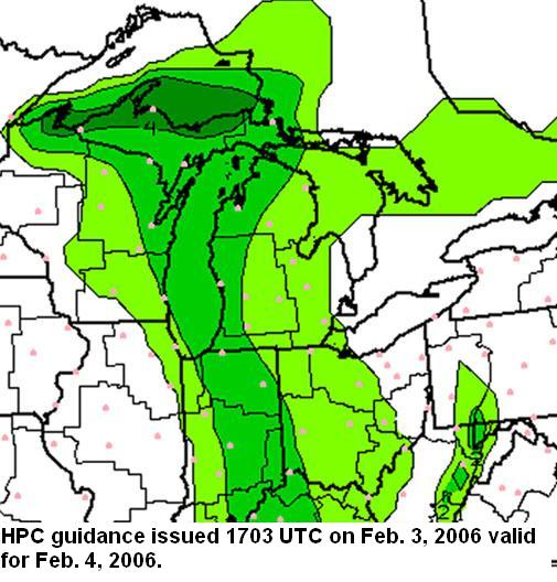
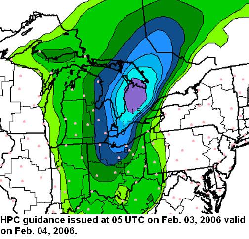
Winter Weather Event Review Section 5: Challenges Section 1 -- Section 2 -- Section 3 -- Section 4 -- Section 5 -- Section 6 This event provided an interesting forecast challenge due to a number of factors including but not limited to the following; model solution differences, timing of precipitation change-over, the affect of ground temperatures on snow accumulation, collaboration issues, HPC guidance changes, warning criteria differences across CWA boundaries, and GPRA lead time goals. Boundary layer temperatures and precipitation type was crucial to whether or not a 4 inch snow accumulation would be observed. Although the model solutions offered a definitive warmer and westward trend with the gross features, the forecast precipitation type and QPF showed the potential for warning criteria snowfall. So the forecaster was given mixed signals. The potential for enhanced lift indicated in the mesoscale section of this write up also pointed toward possible diabatic cooling and an earlier change over to snow and thus more snow. HPC guidance is also another factor which affects forecaster decisions. HPC WWD guidance issued at 533 UTC on 3 February indicated a day two snow accumulation in excess of 4 inches across the northeast portion of Wilmington's CWA (Fig. 14a). This solution trended west with the accumulating snow and below warning criteria on the day shift on the 3rd (Fig. 14b). The HPC solution issued at 05 UTC on February 4th trended higher and indicated 4 to 6 inches roughly across the northern half of Wilmington's CWA (Fig. 14c). When weighing all these factors into the decision making process the forecaster is also confronted with the increasing pressure from GPRA goals to increase lead time. This may also factor into decision making process.
|