|
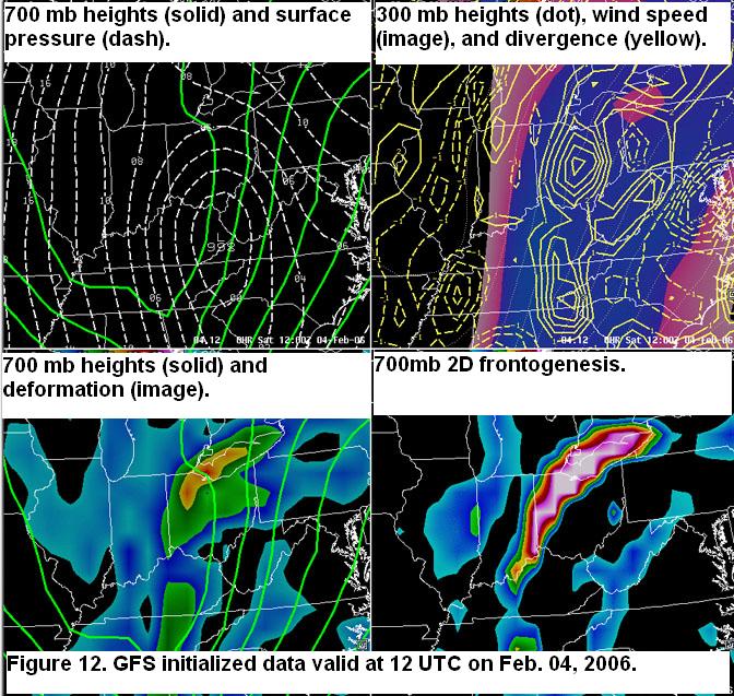
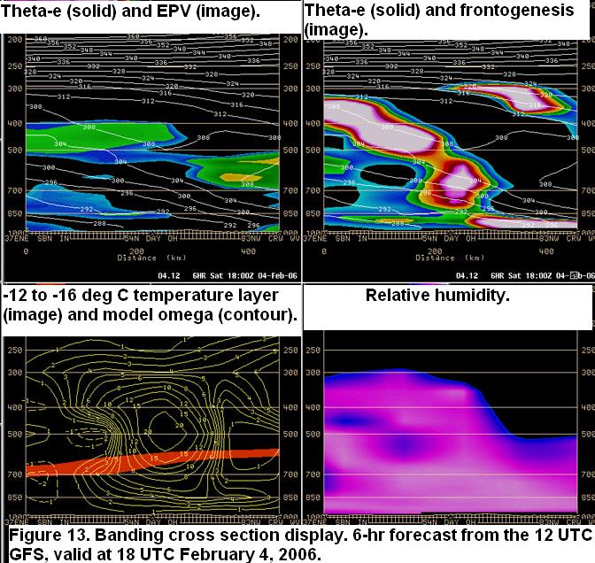
Winter Weather Event Review Section 4: Mesoscale Review Section 1 -- Section 2 -- Section 3 -- Section 4 -- Section 5 -- Section 6 While some favorable characteristics existed for banding all of the attributes necessary for development were not present. The 700 mb trough was initially an open wave which deepened and closed off over Ohio on Saturday, February 4 . This event also lacked the dual upper level jet structure. Although the classic potential for banding was not strongly indicated, the potential for enhanced forcing was indicated. Figure 12 shows an axis of 700 mb deformation and 2D frontogenesis over the western portion of the CWA at 12 UTC Saturday. By 18 UTC the 700mb low was closing off and this favorable frontogenesis was over the northwest and by 00 UTC this potential for enhanced lift had shifted north out of the CWA. Figure 13 shows a cross-sectional view northwest-southeast slice through the core of the mid-level frontogenesis at 18 UTC. Although lift is indicated in the zone of preferred dendritic growth, the best upward vertical motion is above the favored thermal ribbon.
|