Indianapolis, IN
Weather Forecast Office
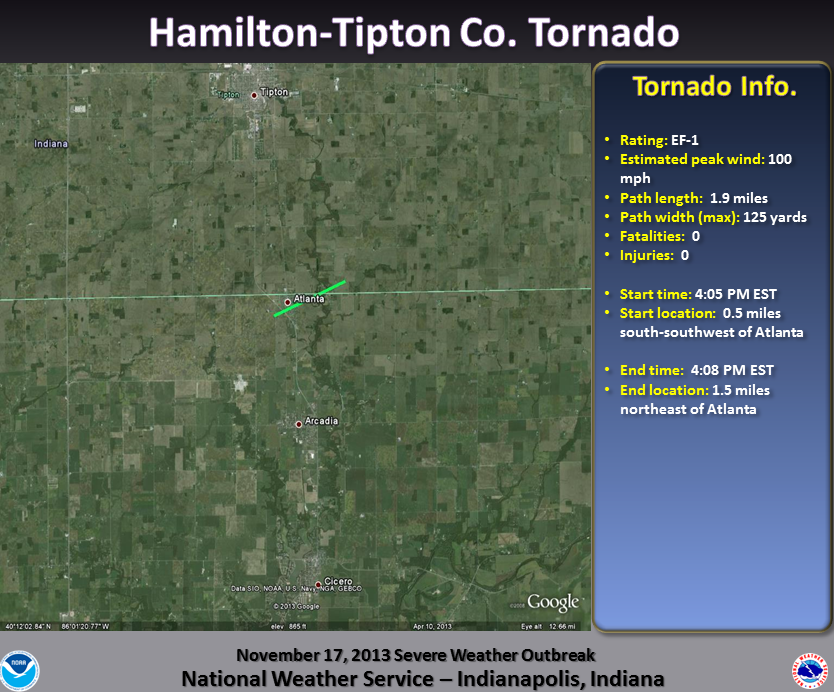
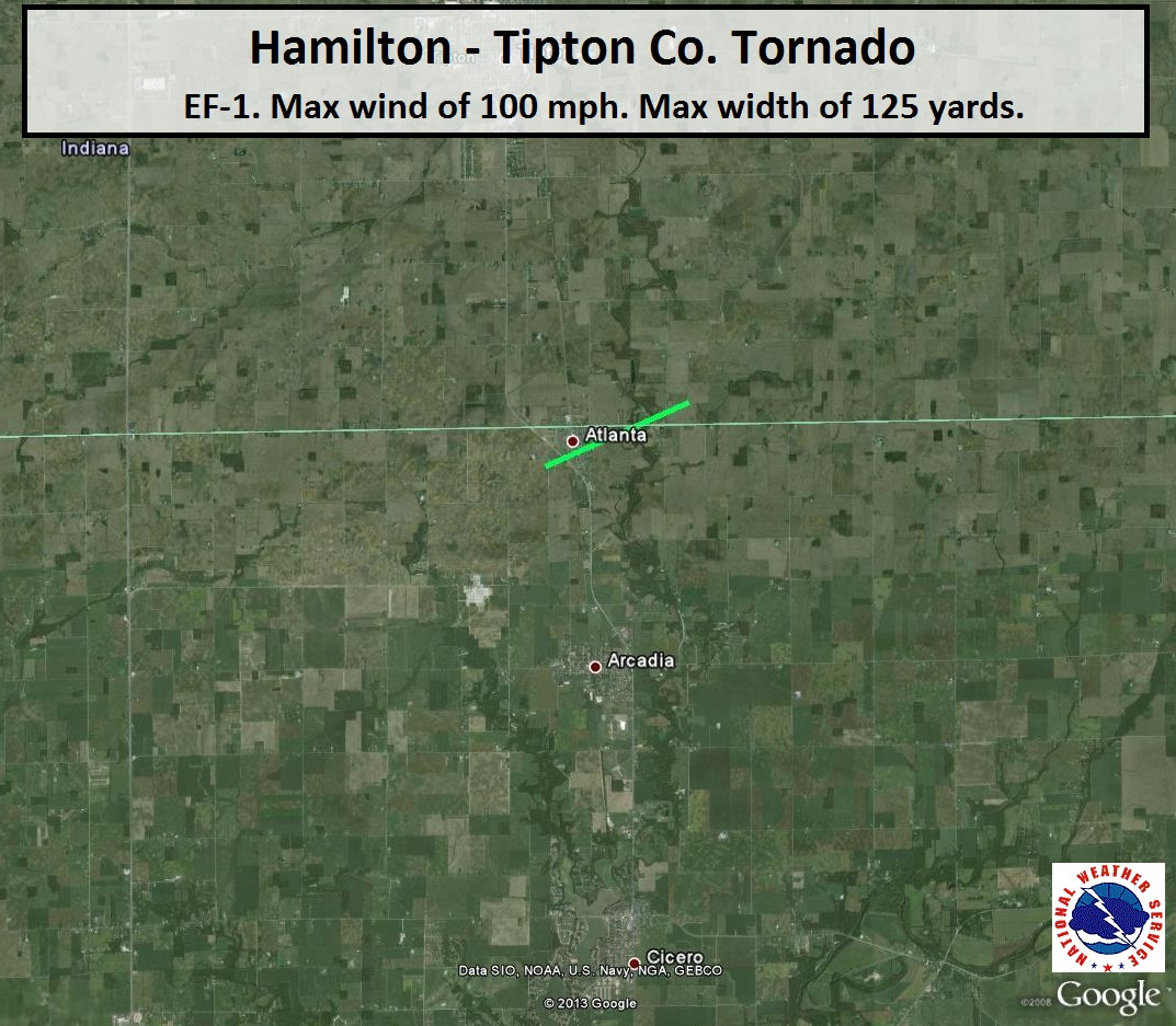
Damage Path (Click to enlarge):
Tornado Information:
RATING: EF-1 ESTIMATED PEAK WIND: 100 MPH PATH LENGTH /STATUTE/: 1.9 MILES PATH WIDTH /MAXIMUM/: 125 YARDS FATALITIES: 0 INJURIES: 0 START DATE: NOVEMBER 17 2013 START TIME: 405 PM EST START LOCATION: 0.5 MILES SOUTH-SOUTHWEST OF ATLANTA START LAT/LON: 40.2111/-86.0327 END DATE: NOVEMBER 17 2013 END TIME: 408 PM EST END LOCATION: 1.5 MILES NORTHEAST OF ATLANTA END LAT/LON: 40.2200/-85.9997 THE TORNADO TRACKED THROUGH THE TOWN OF ATLANTA...PRODUCING DAMAGE TO STRUCTURES IN TOWN. THE TORNADO PATH ENDED TO THE EAST OF CICERO CREEK AND JUST NORTH OF THE HAMILTON-TIPTON COUNTY LINE. |
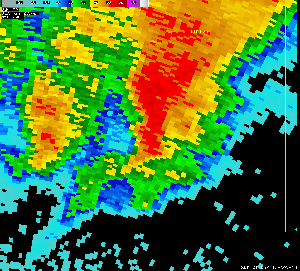
Radar Imagery: (Click to enlarge)
 |
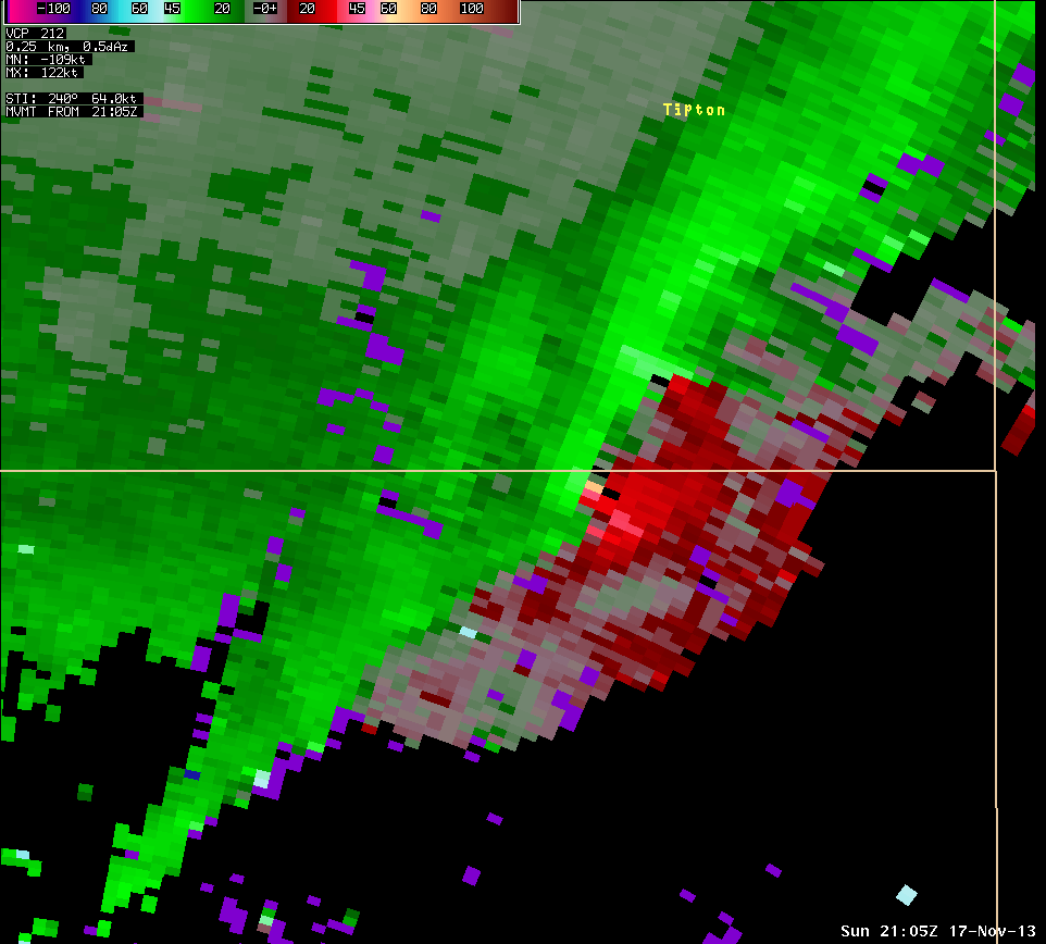 |
| Radar image from 4:05 PM centered on northern Hamilton and southern Tipton Counties. | Storm Relative Motion image from 4:05 PM for the same area. Radar is off to the southwest of this location. Green indicates winds toward the radar while reds indicate winds away from the radar. |
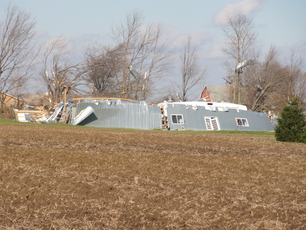
Damage Pictures: (click to enlarge)
 |
 |
|
|
|
||
Hazards
Drought Information
NOAA All Hazards Radio
Graphical Hazards Outlook
Spotter Information
Outdoor Event Watcher
Hazardous Weather Outlook
Local forecasts
Local Area
Aviation
Computer Model Forecasts
Fire Weather
Graphical
Precipitation
Air Quality
Text River Forecasts
Area Forecast Discussion
Central Indiana Weather Brief
US Dept of Commerce
National Oceanic and Atmospheric Administration
National Weather Service
Indianapolis, IN
6900 West Hanna Avenue
Indianapolis, IN 46241-9526
317-856-0664
Comments? Questions? Please Contact Us.


