Many types of flooding occurs in Mississippi. Flash flooding, which can occur any time of year, is a result of sudden, heavy rainfall commonly produced from slow-moving intense thunderstorms or multiple rounds of thunderstorms occurring over the same area. Flash flooding can also occur with a dam or levee failure. Flash floods become raging torrents of water which rip through creek beds, city streets, and areas of poor drainage, sweeping away everything before them.
Another common type of flooding that occurs in Mississippi is river flooding. Many big river flooding events have occurred in the spring months from spring thunderstorms and snow melt upstream. However, history has shown that major river flooding can also occur in the fall and winter months, primarily from heavy rain.
|
Flash Flood Watch |
Flash Flood Warning |
Flash Flood Emergency |
| Conditions are favorable in the atmosphere to where heavy rain could be possible over a specified area. | Flash flooding is occurring or imminent in the specified area. This can be from excessive rainfall or a dam or levee failure. | Extremely heavy rainfall has already occurred, will continue to occur, and emergency officials are reporting life threatening rises in water that are resulting in water rescues or evacuations. |
| Stay alert to the weather and think about where you would go if water begins to rise of you are put under a warning. Watch for development of heavy rain. | Move to higher ground immediately. Be on the lookout for water covered roadways. | Move to higher ground. Make sure to not cross water covered roadways or drive down roads that are barricaded due to high water. |
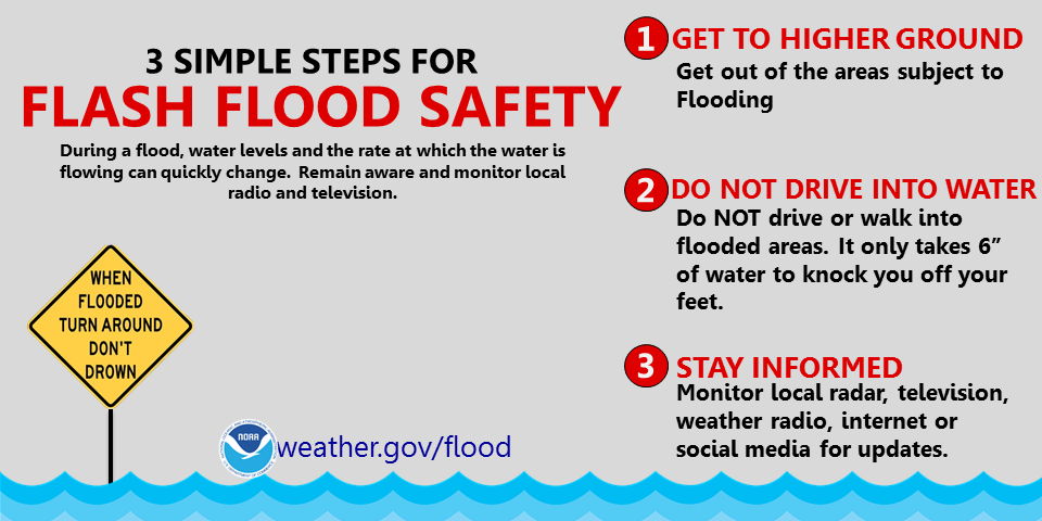
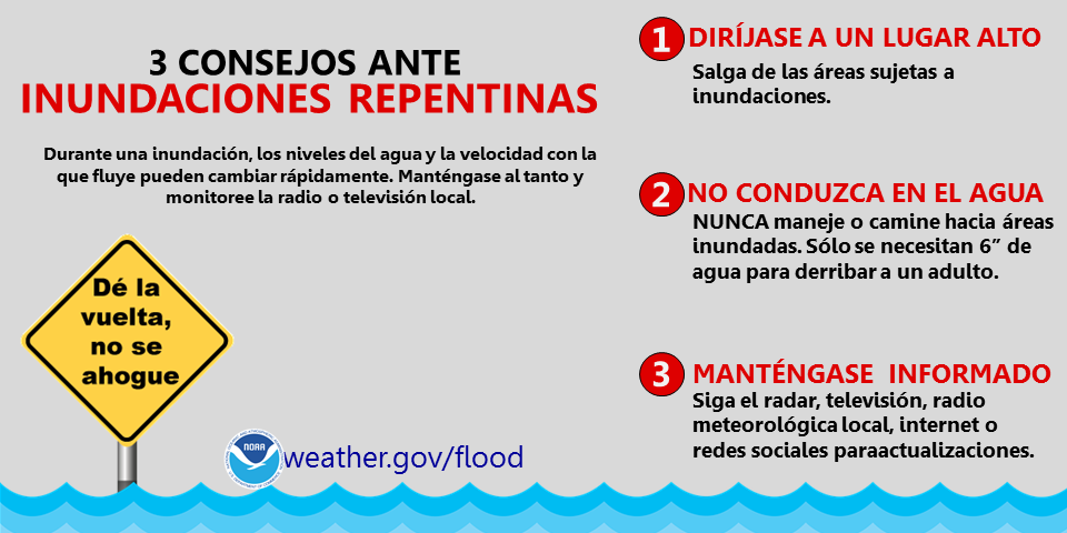

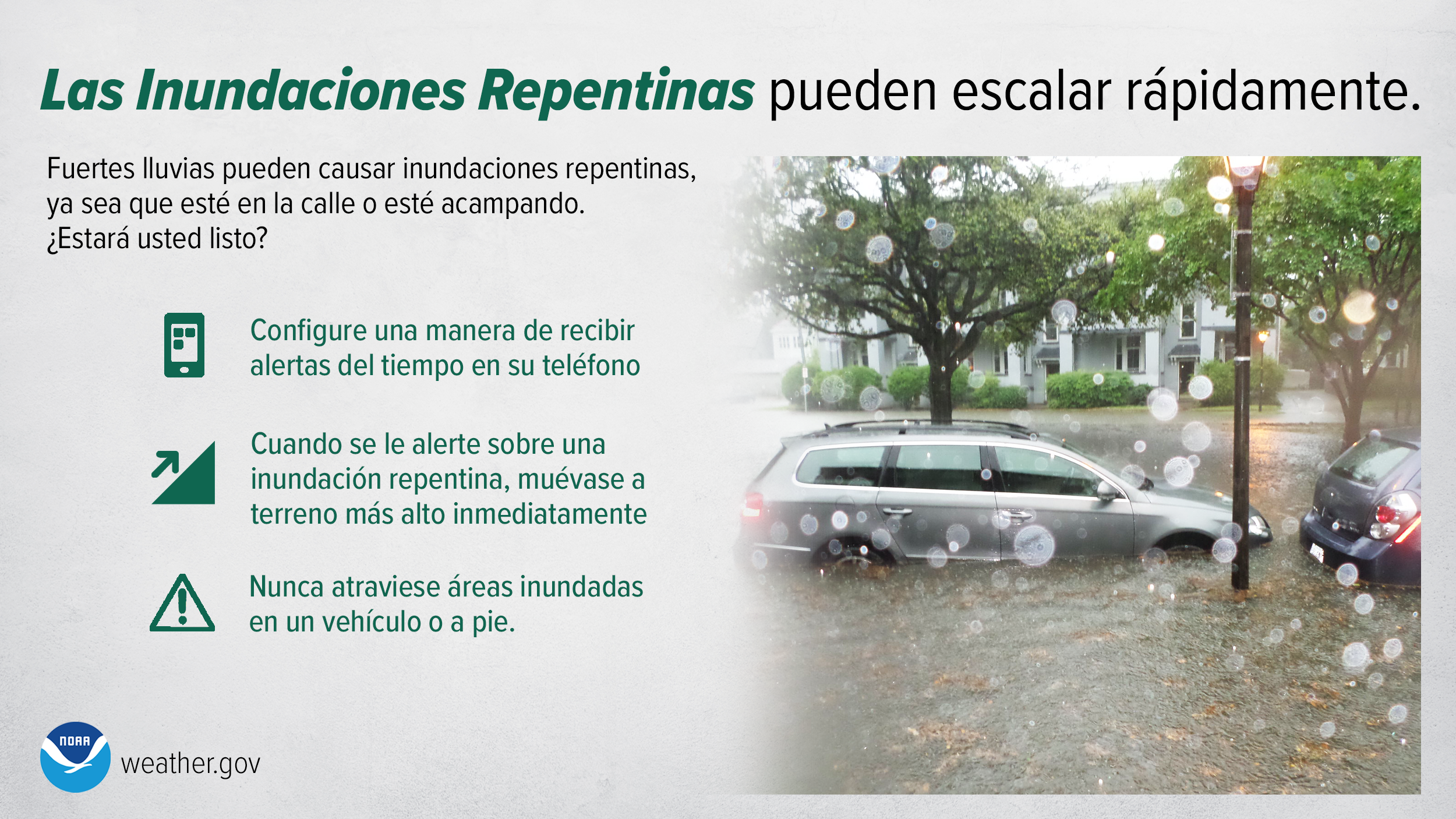

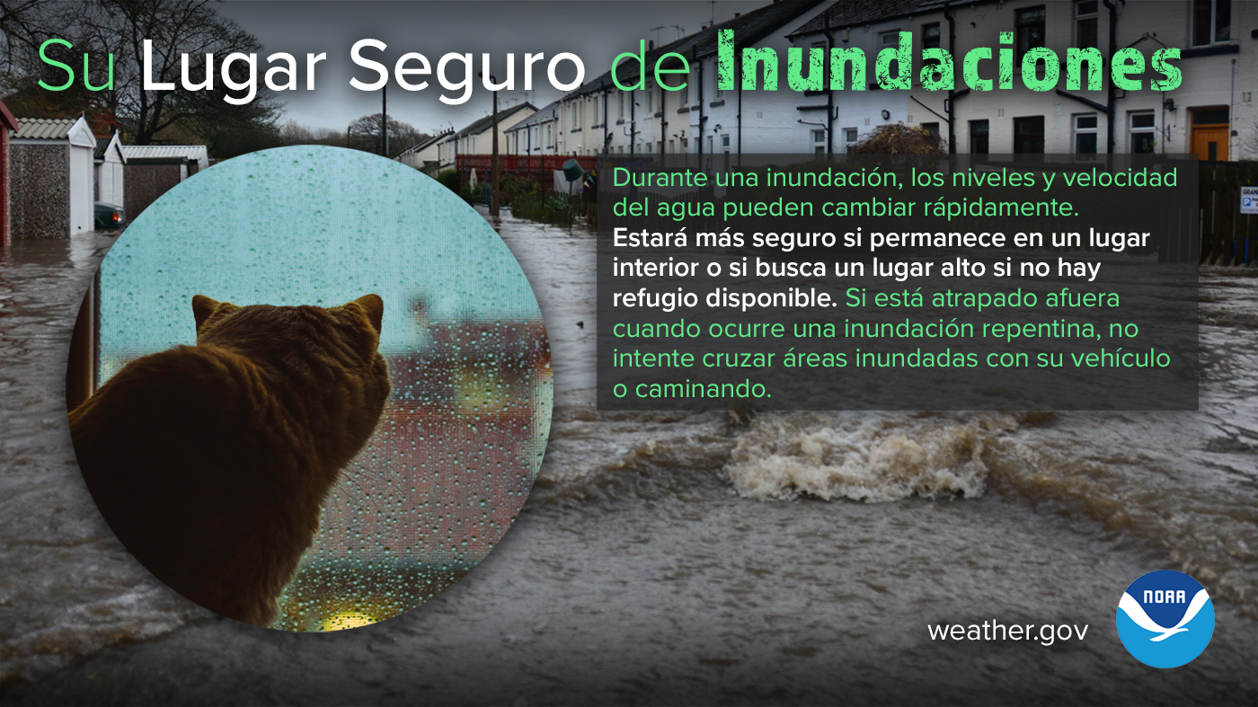

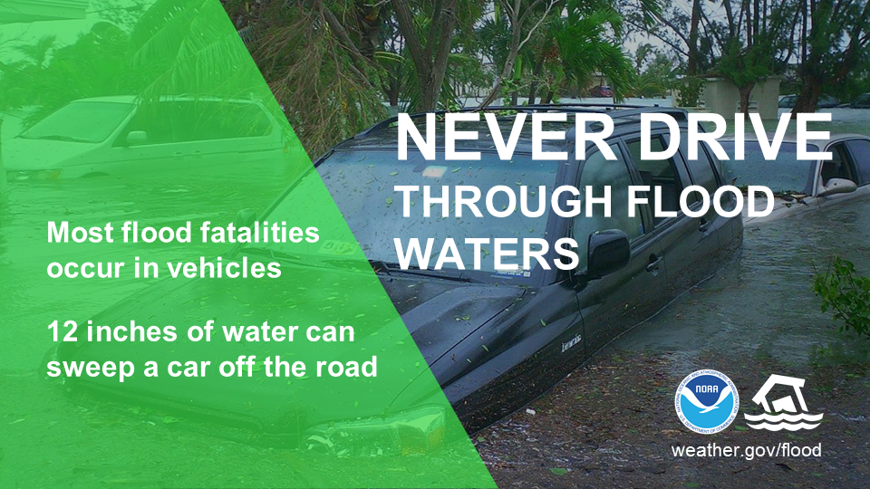
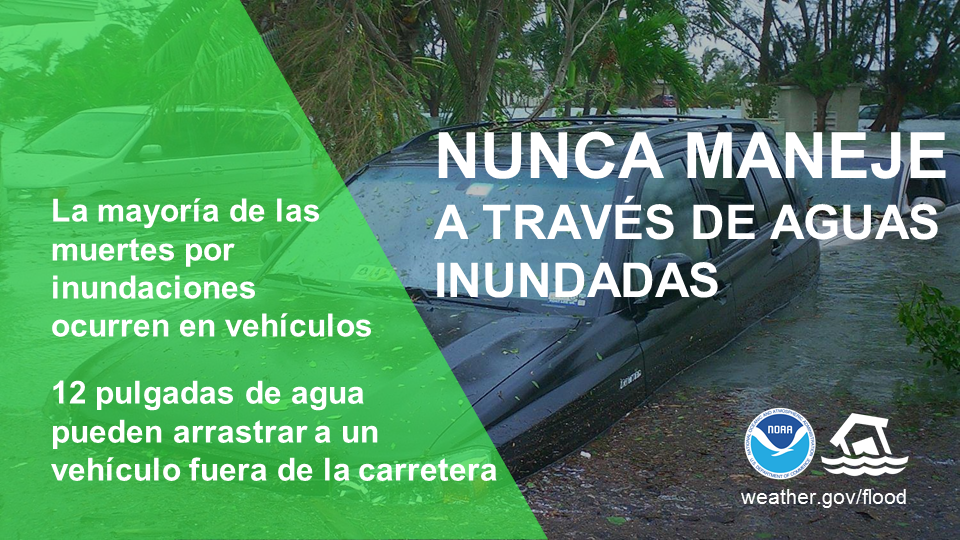
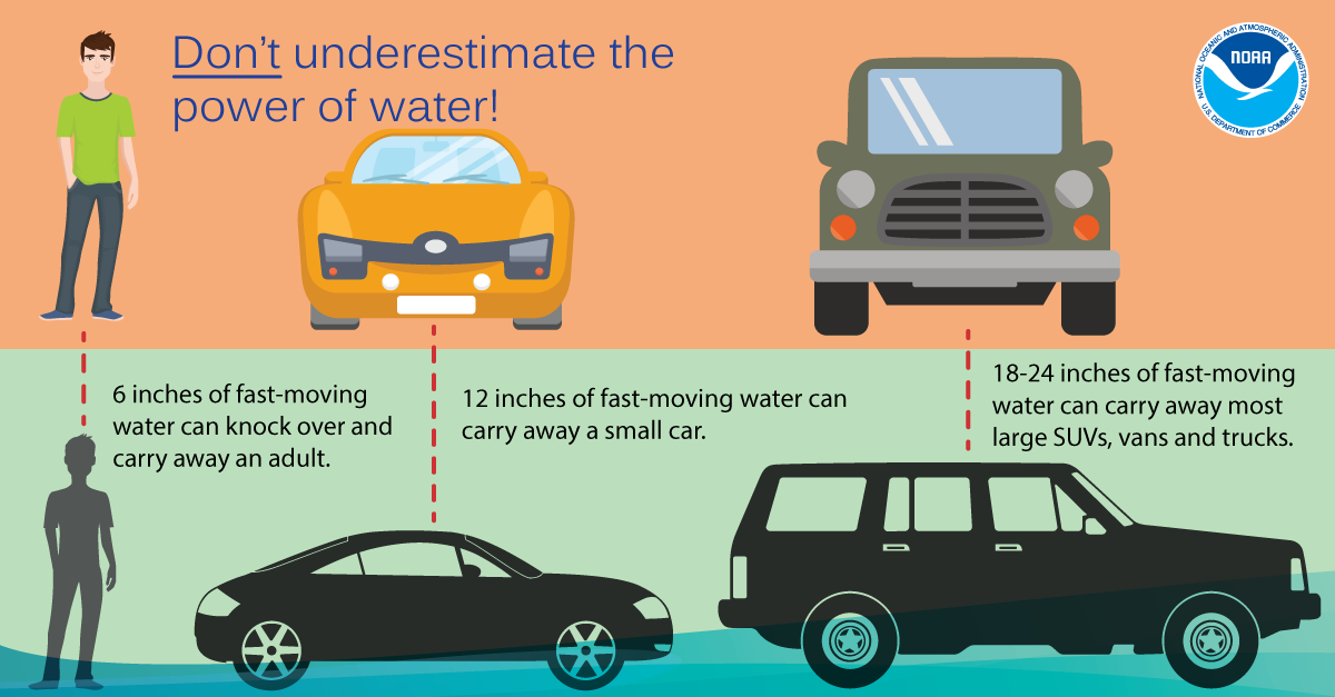
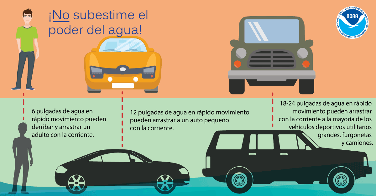
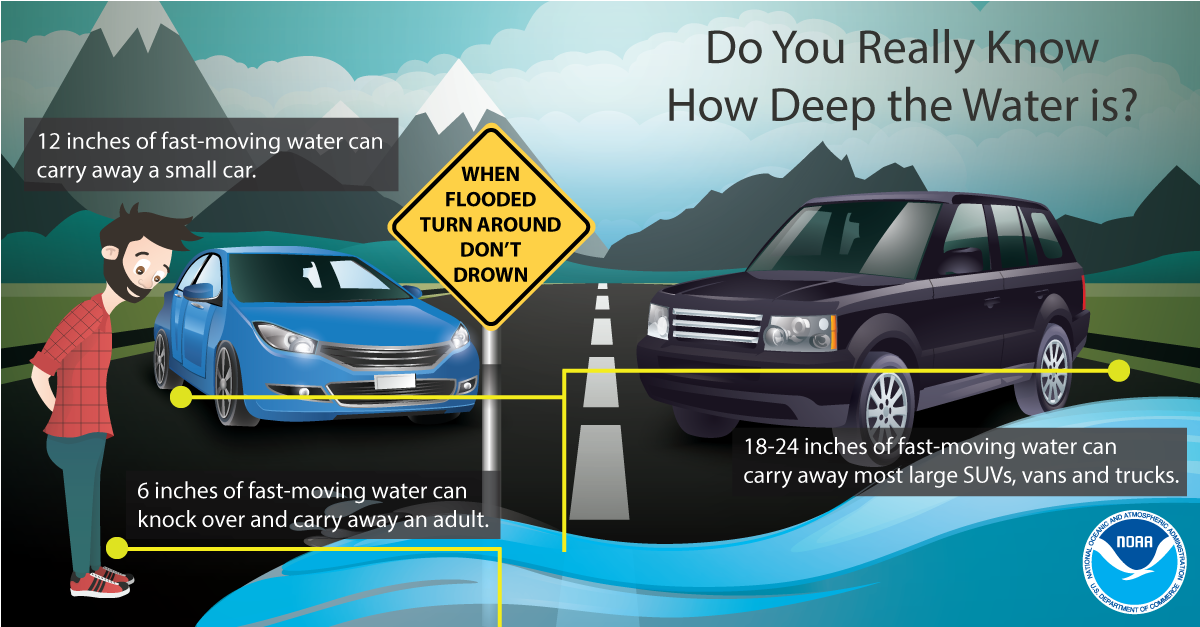
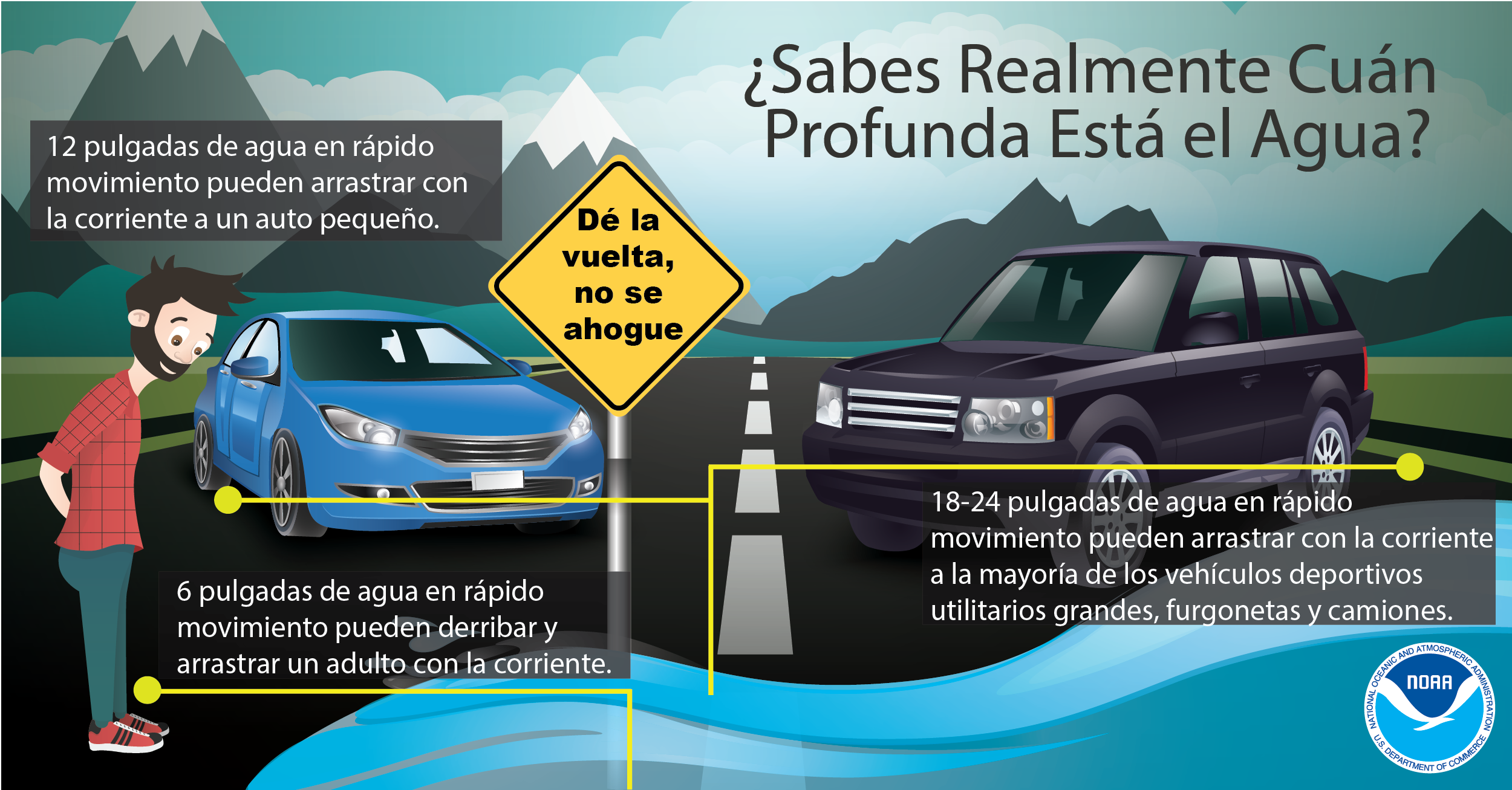
Most deaths from flash flooding occur when vehicle operators drive their automobiles into flood waters of unknown depths only to find the water is deeper than they thought. At this point, the motor becomes inundated then stalls and the vehicle is soon swept away, taking the passengers with it. It does not matter how big the car is. It only takes TWO FEET of water to wash a car away. In addition, it only takes six inches of water to wash away a person. A simple rule to remember is Turn Around Don't Drown.

Significant flash flooding can occur any time of the year. The most recent example of significant flash flooding occurred in March 2016, when a stalled front lingered across Louisiana and Mississippi. Anomalous moisture was present over the area and this helped to bring widespread rainfall to the area for three to four consecutive days. Water from both flash flooding and river flooding damaged numerous homes, businesses and closed many primary and secondary roads across the region. Water rescues occurred and much of this rain fell in the middle of the night, when flooding is most difficult to detect. Many area rivers also reached moderate to major flood stages. Another round of heavy rain and flooding occurred in some of the very same areas by the end of the month in March 2016.
Another regional example of significant flooding in the vicinity of a major metropolitan area was near Mobile in late April 2014. In this case the rainfall rates and totals overwhelmed the drainage systems and flooding beyond the experience of local residents occurred. A widespread 17-20 inches of rain fell with a maximum near 24 inches. This led to disastrous flooding in coastal Alabama and the western Florida panhandle. Many water rescues had to be conducted due to the widespread flooding and one fatality occurred. Many homes and businesses were flooded and many local rivers had drastic rises, with Fish River at Silver Hill in Baldwin County, Alabama reaching record levels.
In August 2012, Hurricane Isaac moved ashore very slowly causing tremendous flooding to portions of southeast Mississippi where storm total amounts were 10 to 15 inches. This flooded numerous structures and some water rescues were performed in the Pine Belt region. Coastal Mississippi received 15 to 25 inches of rain from this slow moving tropical system. Numerous flash flooding of small creeks and streams also occurred.
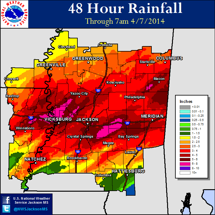
In early April 2014, a cold front stalled in the area, bringing lots of moisture into the region. Severe thunderstorms occurred along and southeast of the Natchez Trace corridor, with two tornadoes. The most significant portion of the event was the flash flooding that occurred across the area. Widespread 4-6 inches of rain fell across the region, including nearly 6-8 inches in the Delta and central Mississippi. Many reports of flash flooding occurred due to the extremely heavy rainfall. One fatality occurred as a young girl was swept into a drainage canal in Yazoo County. Rivers quickly rose due to the large volume of rain that fell across the region. The Strong River at D'Lo in Simpson County reached record levels (34.3 feet) and flooded across Highway 49, shutting down traffic for a few days. Tallahala Creek rose to major flood stage (19.36 feet) on April 8th.

