|
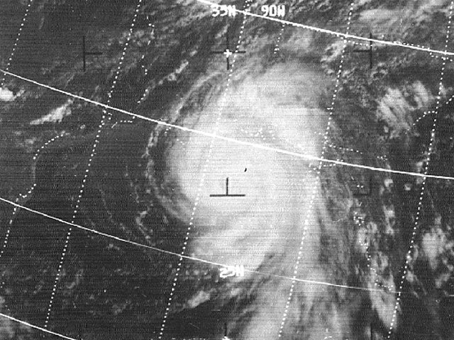
Above: NIMBUS-3 visible satellite photo of Hurricane Camille south-southeast of the Louisiana coast August 17, 1969 at 2:57 PM CDT.
The origin of Hurricane Camille can be traced back to August 5th as a tropical wave that exited the coast of Africa. For the next 9 days, the wave traveled westward across the tropical Atlantic and Caribbean Sea with little additional organization. By August 13th organization increased on visible satellite imagery and became a tropical depression just west of Jamaica by sunset that evening. The system quickly organized into a tropical storm overnight, being named Camille.
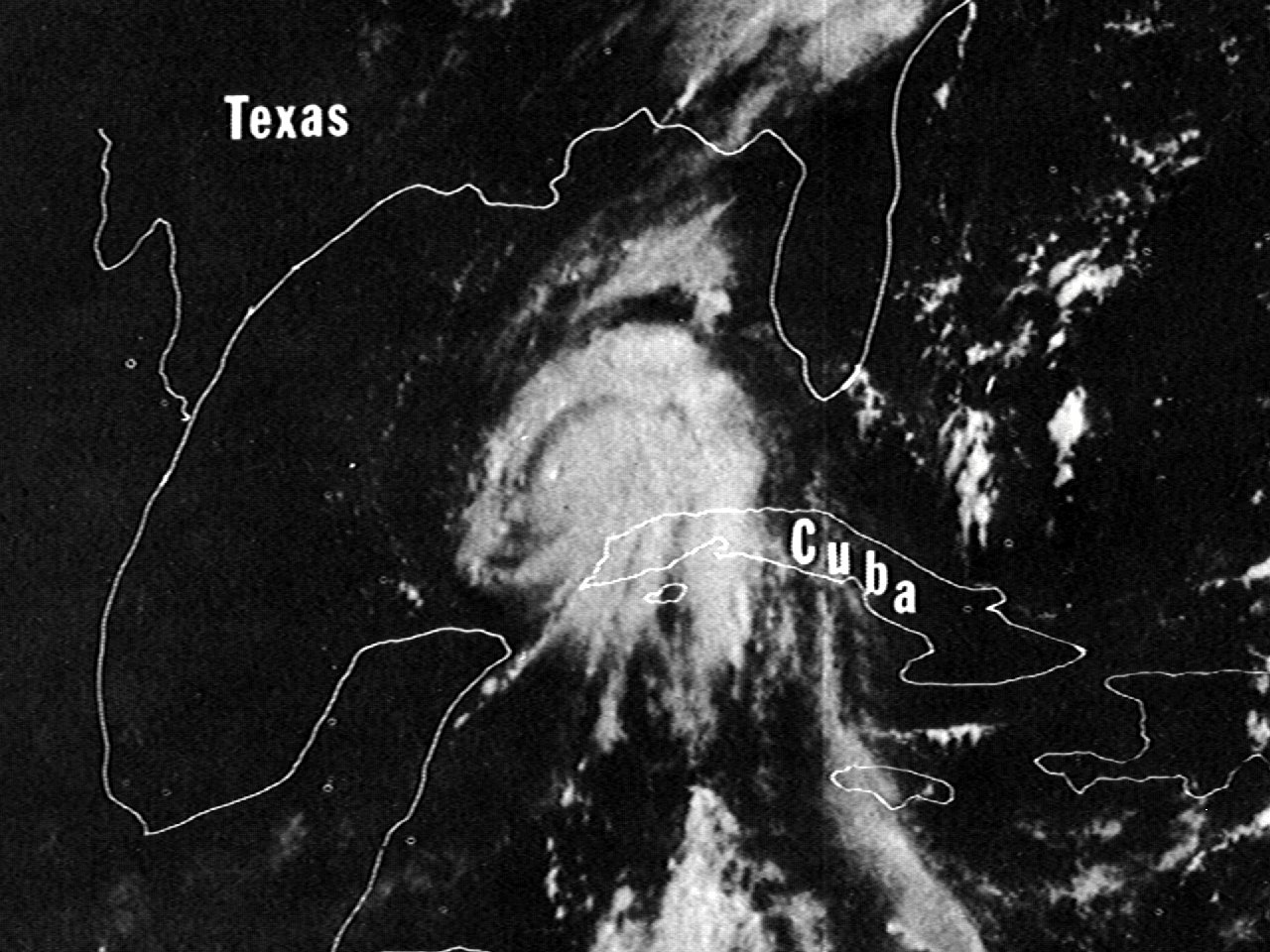
Camille continued to gain strength and organization on August 14th heading northwest across the Western Caribbean Sea. Camille attained hurricane strength early on August 15th, now heading north-northwest towards the western tip of Cuba. Camille continue to strengthen and eventually crossed the western tip of Cuba by 6 PM EDT as a category two hurricane and entered the Southeastern Gulf two hours later.
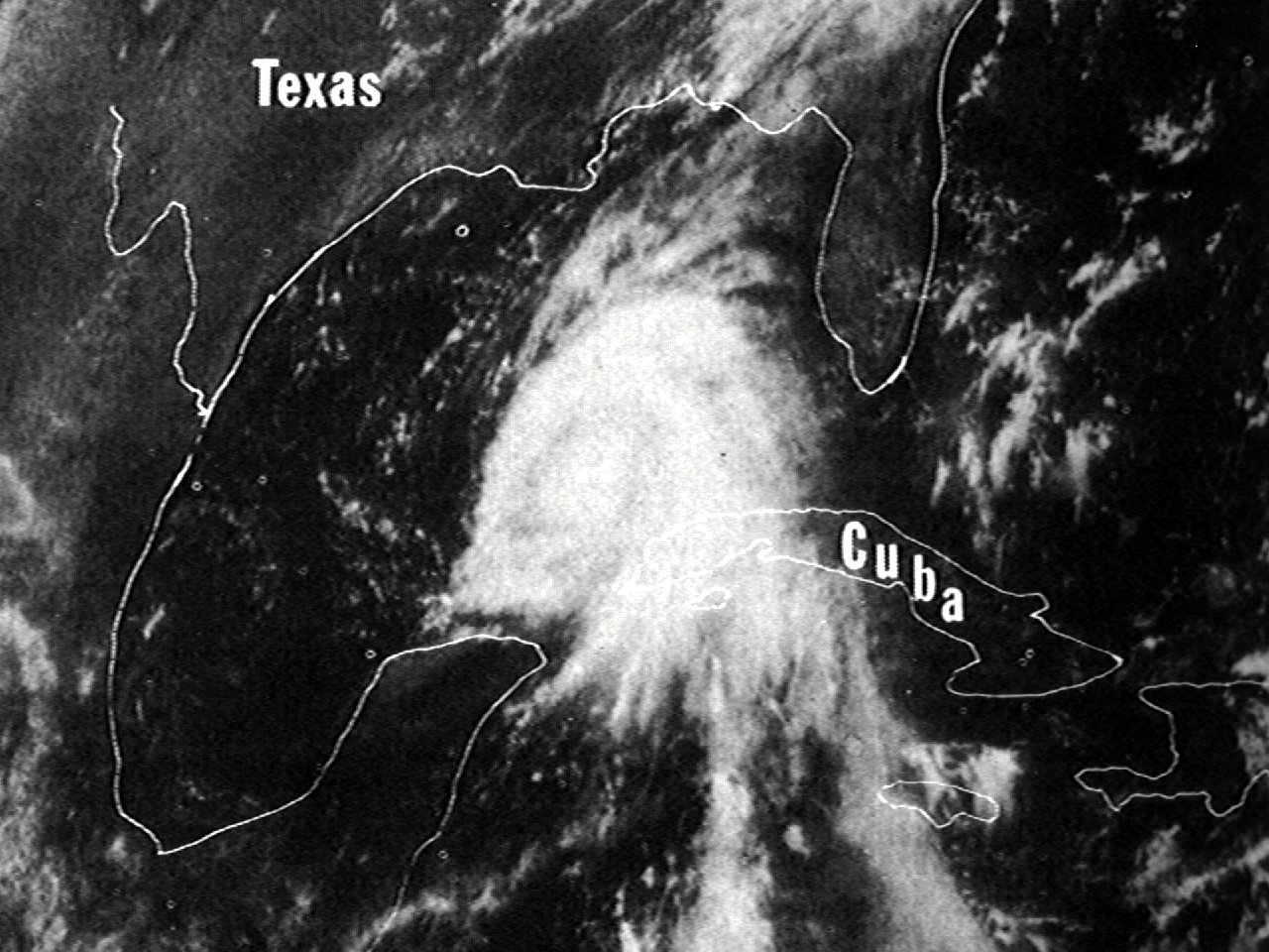
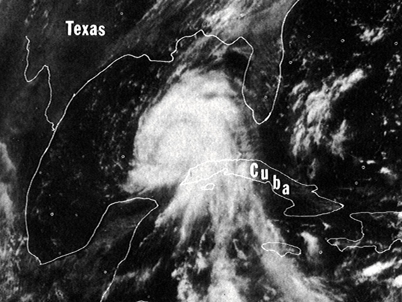
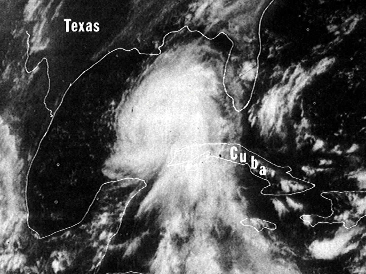
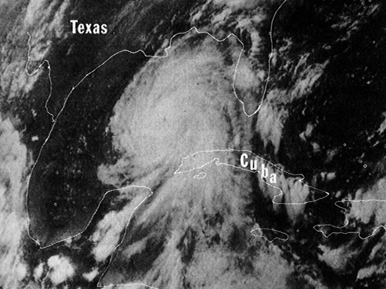
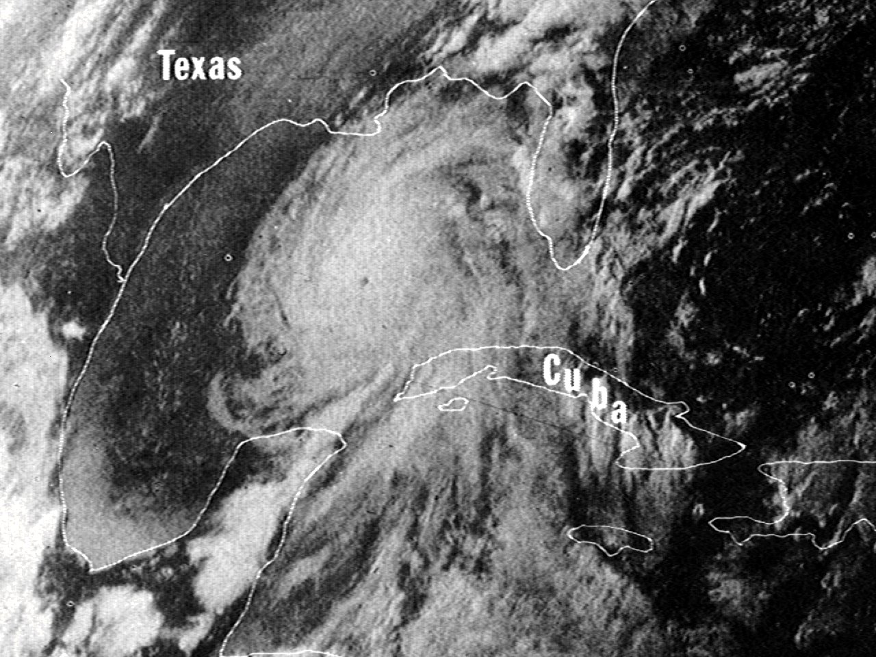
Once entering the Gulf, Camille underwent explosive strengthening on August 16th and began to move north northwest as a favorable upper level pattern set up with a mid to upper level ridge off the East Coast and longwave trough over the Midwest. Just after midnight, Camille had strengthened to a strong category three hurricane, and by daybreak, a strong category four hurricane. Camille continued to strengthen to a category five hurricane by early afternoon, and reached the first peak intensity of 175 mph (150 knots) with a minimum central pressure of 905 millibars (26.72 inches) by 7 PM CDT over the Eastern Gulf. At the time, this was the lowest central pressure measured by reconnaissance aircraft. A series of ATS-3 visible satellite images at 8:11 AM CDT, 10:07 AM CDT, 12:03 PM CDT, 2:30 PM CDT, 4:40 PM CDT, and 6:40 PM CDT shows the rapid intensification of Camille.
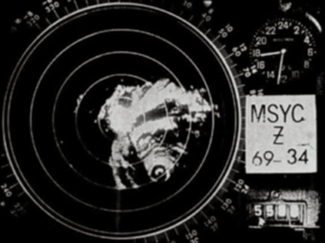
Camille weakened slightly overnight into most of the day on August 17th but remained a borderline category four/five hurricane as it continued to move north northwest towards Southeast Louisiana and Southern Mississippi. As seen by the U.S. Weather Bureau New Orleans, LA WSR-57 radar, it was suspected that an eyewall replacement cycle commenced during this period in the post analysis of Camille. The NIMBUS-3 visible satellite photo shows Hurricane Camille south-southeast of the Louisiana coast August 17, 1969 at 2:57 PM CDT.
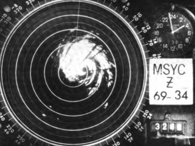
Camille re-strengthened to a category five hurricane as the eye approached and moved just a few miles east of Plaquemines and St. Bernard Parishes in Southeast Louisiana during the late afternoon and evening hours. Camille continued to strengthen in the very warm waters off the Louisiana and Mississippi coast, and made landfall near Waveland, Mississippi at 11 PM CDT with maximum sustained winds of 175 mph (150 knots) and a minimum central pressure of 900 millibars (26.58 inches). This ranks as the second strongest hurricane to make landfall in the U.S. by maximum sustained wind and minimum pressure, with only the 1935 Labor Day Florida Keys hurricane being stronger. The U.S. Weather Bureau New Orleans, LA WSR-57 radar animation from August 17, 1969 11:30 AM CDT to August 18, 1969 1:00 AM CDT shows Camille affecting Southeast Louisiana and the landfall across the Mississippi coast. This animation was painstakingly created by Margaret E. Kieper (a contributor to the Reanalysis of Hurricane Camille) by scanning the archived microfilm of the New Orleans LA WSR-57 radar.
Weakening commenced after landfall, but is noteworthy that Camille was still a minimum hurricane just east of Jackson Mississippi by the late morning hours on August 18th. Camille finally weakened to a tropical storm by the afternoon of August 18th across the remainder of Central and Northern Mississippi into Western Tennessee, and further weakened to a tropical depression as it moved eastward across Kentucky, West Virginia, and Virginia on August 19-20th. As Camille moved back across the waters off the Eastern Seaboard, it re-strengthened to a tropical storm and finally dissipated on August 22nd. Click here for an interactive track of Hurricane Camille.
WIND & PRESSURE:
With the storm making landfall well east of the region, no tropical storm or hurricane force winds were recorded west of the Atchafalaya River within the Lake Charles, LA area of responsibility. For complete meteorological statistics, see the Wind and Pressure section.
STORM SURGE:
With the storm making landfall well east of the region, no significant storm surge was observed west of the Atchafalaya River within the Lake Charles, LA area of responsibility. For other storm surge and high-water marks across our region, see the Storm Surge section.
RAINFALL:
With the storm making landfall well east of the region, most of the rainfall fell east of the Atchafalaya River. For complete rainfall totals reported across our region, see the Rainfall section.
TORNADOES:
No tornadoes were reported in Louisiana.
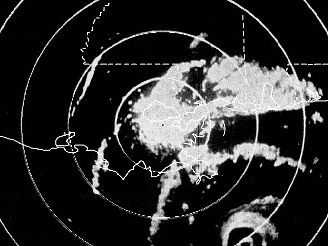
Above: U.S. Weather Bureau New Orleans, LA WSR-57 radar animation from August 17, 1969 11:30 AM CDT to August 18, 1969 1:00 AM CDT showing Camille affecting Southeast Louisiana and landfall across the Mississippi coast. Source of WSR-57 imagery: NECI. Animation created by Margaret E. Kieper from A Reanalysis of Hurricane Camille by Margaret E. Kieper, Christopher W. Landsea, and John L. Beven II.
|


