|
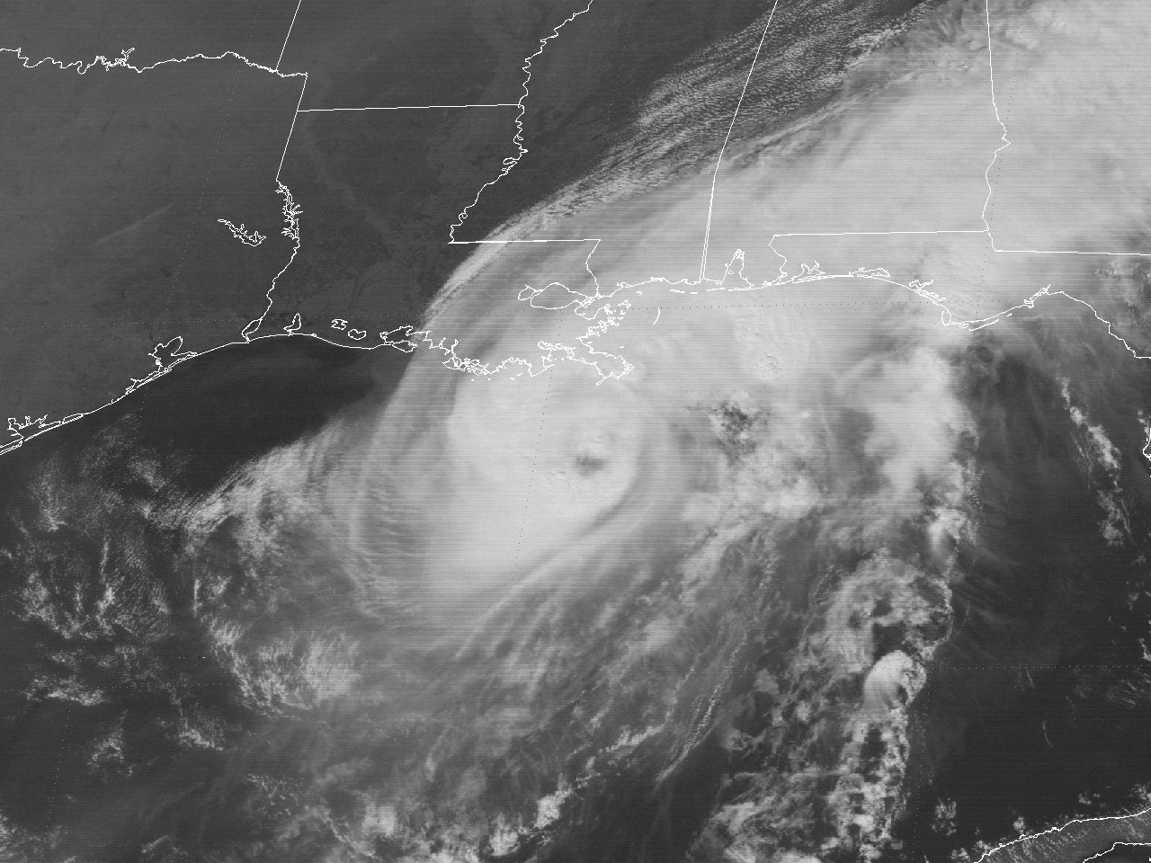
Above: GOES-7 visible satellite image of Hurricane Florence off the Southeast Louisiana Coast at 2:01 PM CDT September 9, 1988.
Florence had its origins from a cold front that moved southward into the Gulf the afternoon of September 4th, after absorbing the remnants of Tropical Depression #10 off the Louisiana coast the evening before. The front continued southward and eventually stalled across the Central Gulf on September 5th as a frontal wave developed and moved northeastward towards Florida. The southern end of the decaying frontal zone remained stalled over the Southwest Gulf where another surface low developed on September 6th. After daybreak on September 7th, the surface low organized further, and advisories on Tropical Depression #11 began at 11 AM CDT centered north northwest of the Yucatán Peninsula. An Air Force reconnaissance aircraft found tropical storm force winds shortly thereafter with the depression upgraded to Tropical Storm Florence by 1 PM CDT. The steering currents remained weak south of the longwave trough across the Southern United States and Northern Gulf, resulting in Florence stalling later that evening through the early morning hours of September 8th while centered around 100 miles north of the Yucatán Peninsula.
By daybreak on September 8th, Florence began to move in a general northward direction in response to the building surface and upper level Atlantic ridge of high pressure across the Western Atlantic and Caribbean Sea. Gradual strengthening commenced through September 9th, being upgraded to Hurricane Florence by 1 PM CDT. A GOES-7 visible satellite image shows newly upgraded Hurricane Florence off the Southeast Louisiana Coast at 2:01 PM CDT September 9th. Florence’s northward movement increased to near 15 mph by this time and reached a maximum intensity of 80 mph (70 knots) and a minimum central pressure of 982 millibars (29.00 inches) around 6 PM, centered about 30 miles south of the mouth of the Mississippi River. With little change in strength, Hurricane Florence made landfall near Pilottown, Louisiana at 9 PM CDT.
After landfall, Florence began to track to the northwest, being downgraded back to a tropical storm by 1 AM CDT on September 10th located some 25 miles southeast of the New Orleans metropolitan area. As the center moved further inland over New Orleans, rapid weakening commenced thereafter with most of the deep convection vanishing, likely due to the entrainment of dry environmental air to the north and west of the center. Florence was downgraded to a tropical depression by 7 AM CDT just northeast of Baton Rouge, Louisiana. Tropical Depression Florence continued to track northwest across Southwest Mississippi, and back over North Louisiana later that afternoon and evening. Tropical Depression Florence dissipated shortly after daybreak on September 11th across Northeast Texas. Click here for an interactive track of Hurricane Florence.
WIND & PRESSURE:
Winds across our region were in the 20 to 30 mph range. No tropical storm force winds were observed west of the Atchafalaya River. The highest winds were confined to extreme Southeast Louisiana, with the highest land-based gust of 76 mph (66 knots) recorded at Burrwood, Louisiana. Sustained winds of 40 mph (35 knots) with gusts of 61 mph (53 knots) was recorded at Lakefront Airport in New Orleans, Louisiana. For complete meteorological statistics, see the Wind and Pressure section.
STORM SURGE:
Tides of 2.0 to 3.0 feet MSL occurred across the Southwest and South Central Louisiana coast with 2.6 feet MSL recorded at Cameron, Louisiana. Further east across Southeast Louisiana and Lake Pontchartrain, tides of 5.0 to 7.5 feet occurred, causing minor storm surge flooding outside the levee system. For other storm surge and high-water marks, see the Storm Surge section.
RAINFALL:
Rainfall was fairly light across the region with most areas receiving between a quarter to a little over one inch of rainfall. The highest totals were 1.42 inches at Sulphur, Louisiana and 1.25 inches at De Ridder, Louisiana. Most of the rainfall associated with Florence occurred near and well east of the center. For complete rainfall totals reported across our region, see the Rainfall section.
TORNADOES:
No tornadoes were reported with this system across Louisiana.
|


