Lake Charles, LA
Weather Forecast Office
| Hurricane Laura | ||
| August 20-29, 2020 | ||
|
|
||
| Estimated Storm Surge Inundation​ (NOAA GeoPlatform Interactive Viewer) | |||||
| Hurricane Laura Estimated Storm Surge Inundation Maps Click on any image for a high resolution version |
|||||
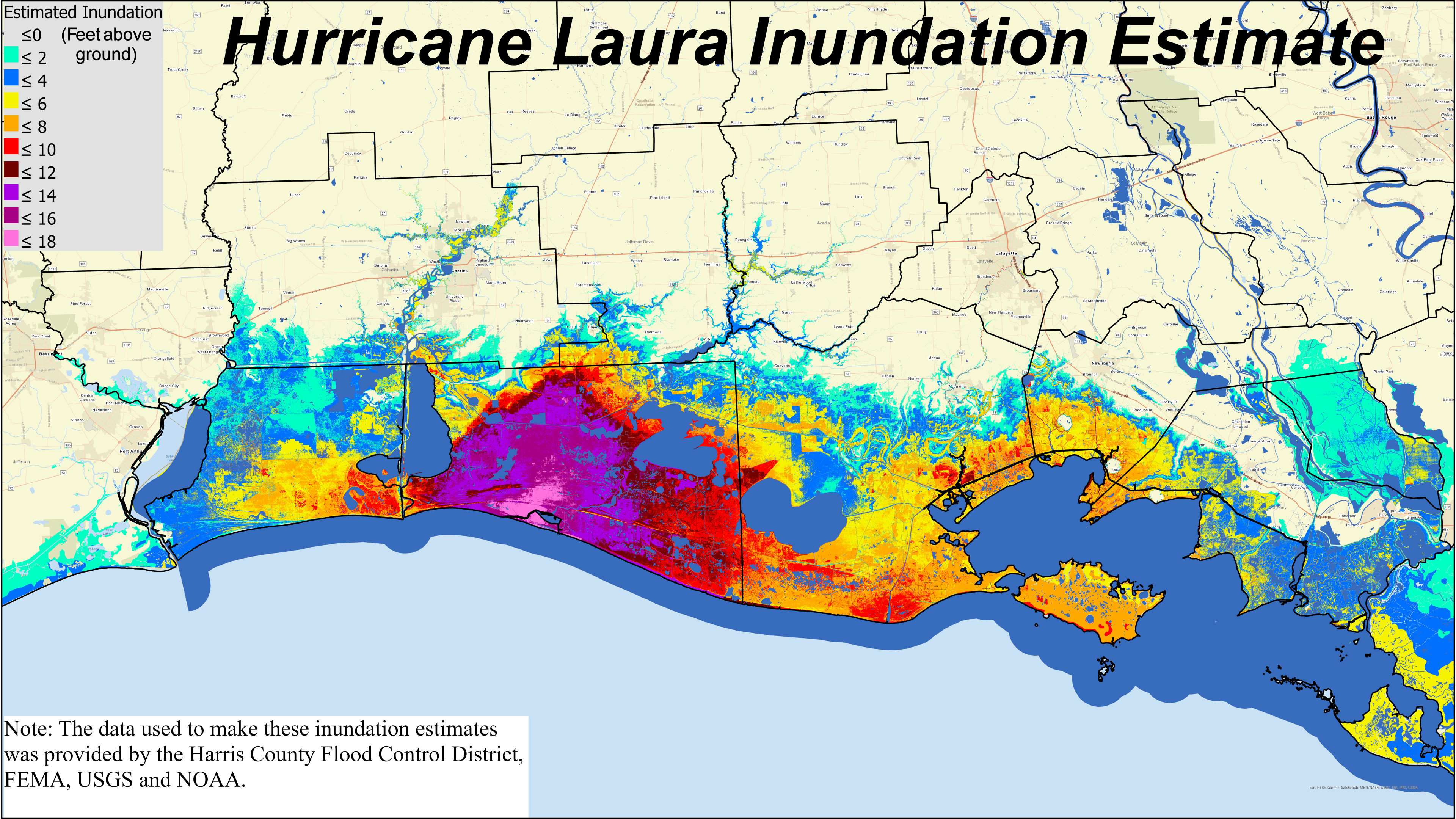 Southwest and South Central Louisiana |
|||||
 Cameron Parish |
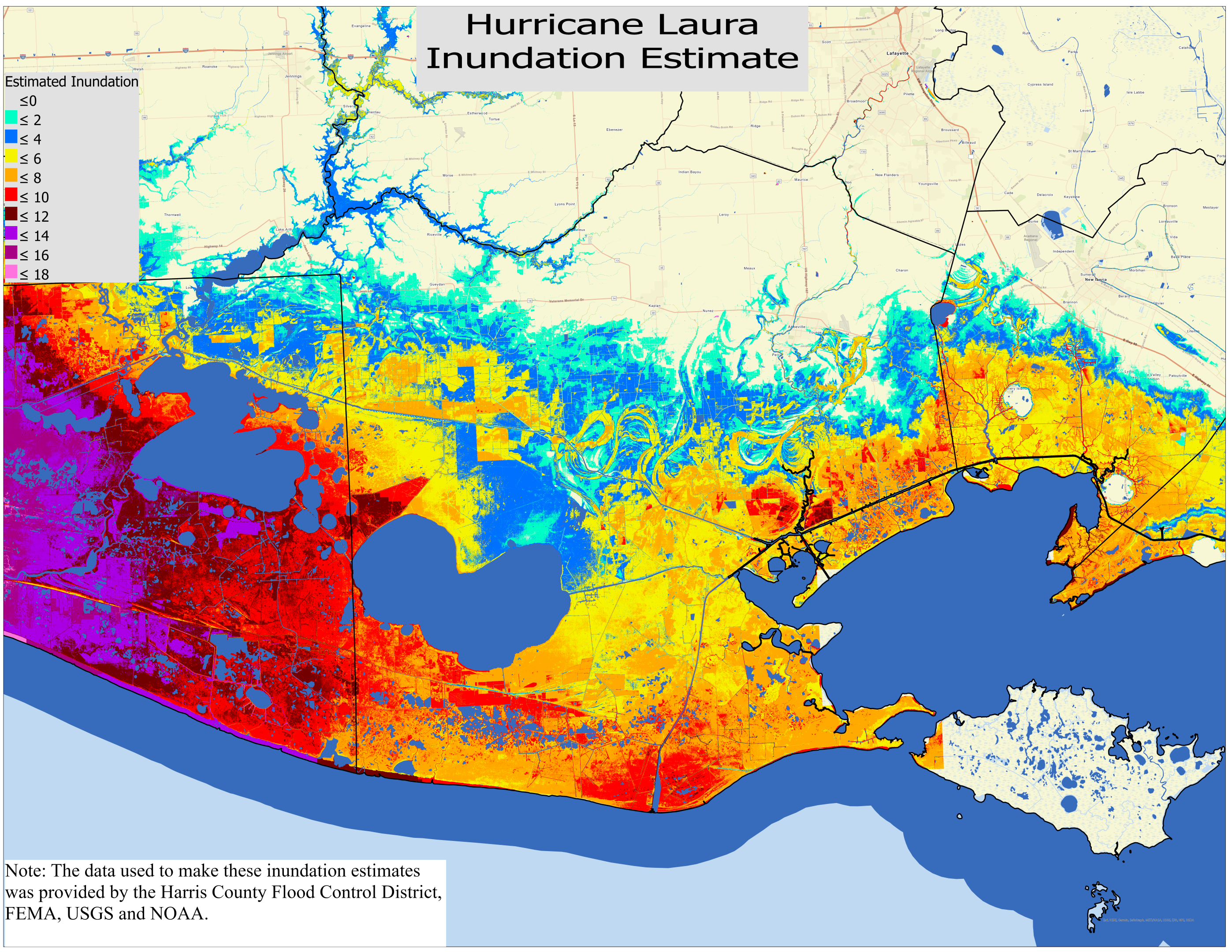 Vermilion Parish |
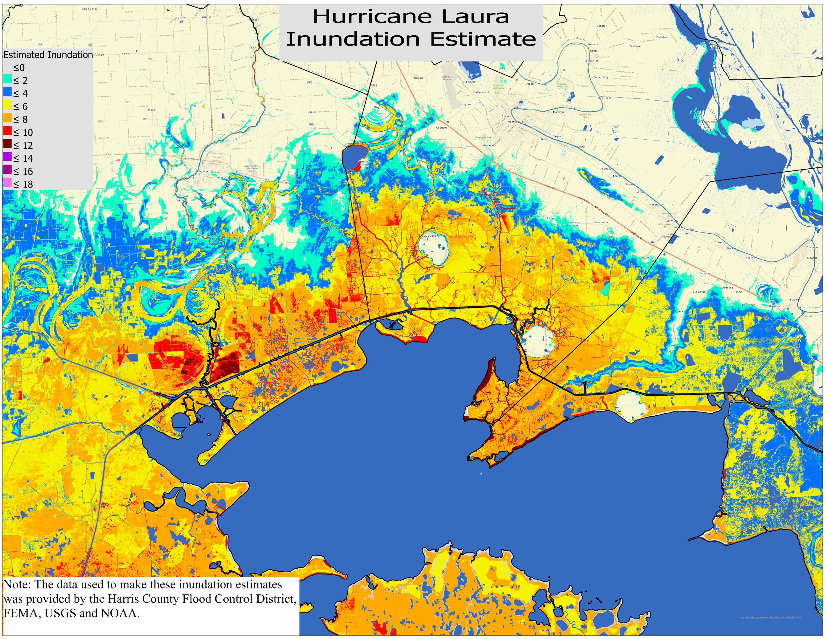 Iberia Parish |
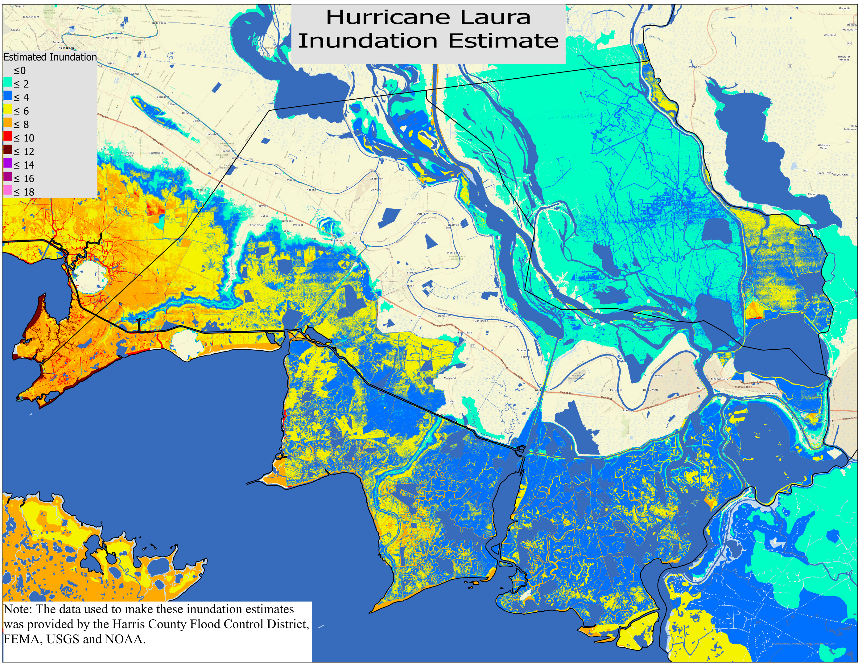 St. Mary Parish |
||
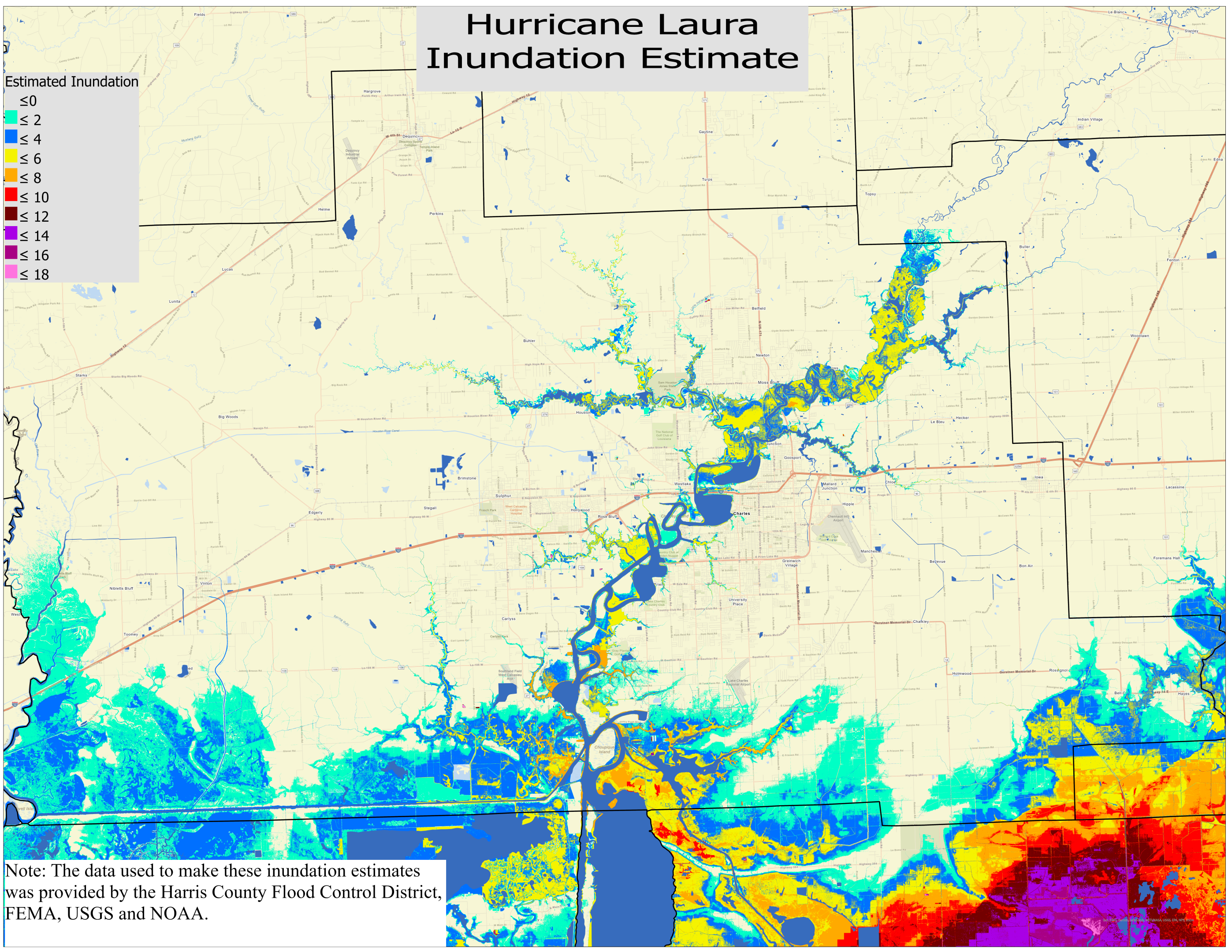 Calcasieu Parish |
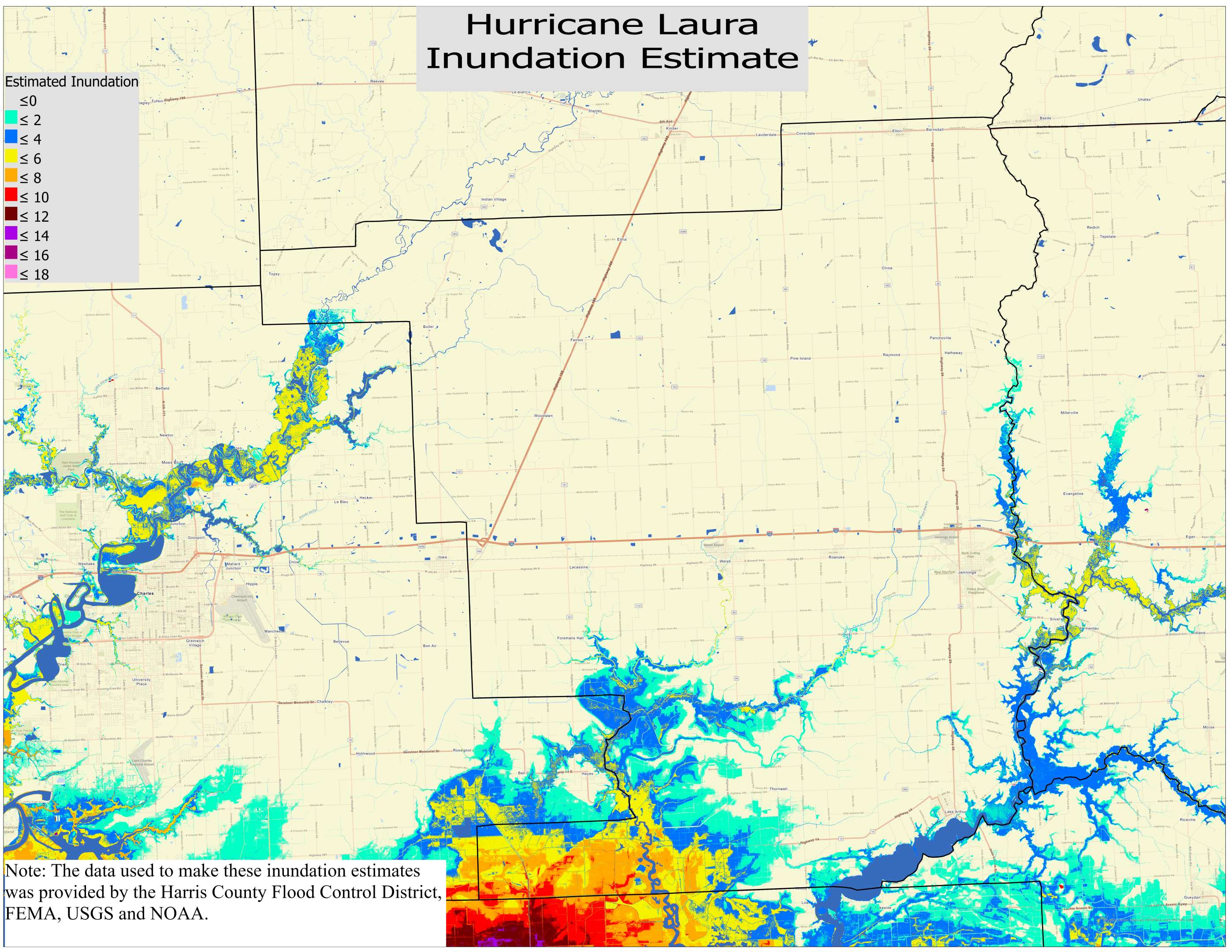 Jeff Davis Parish |
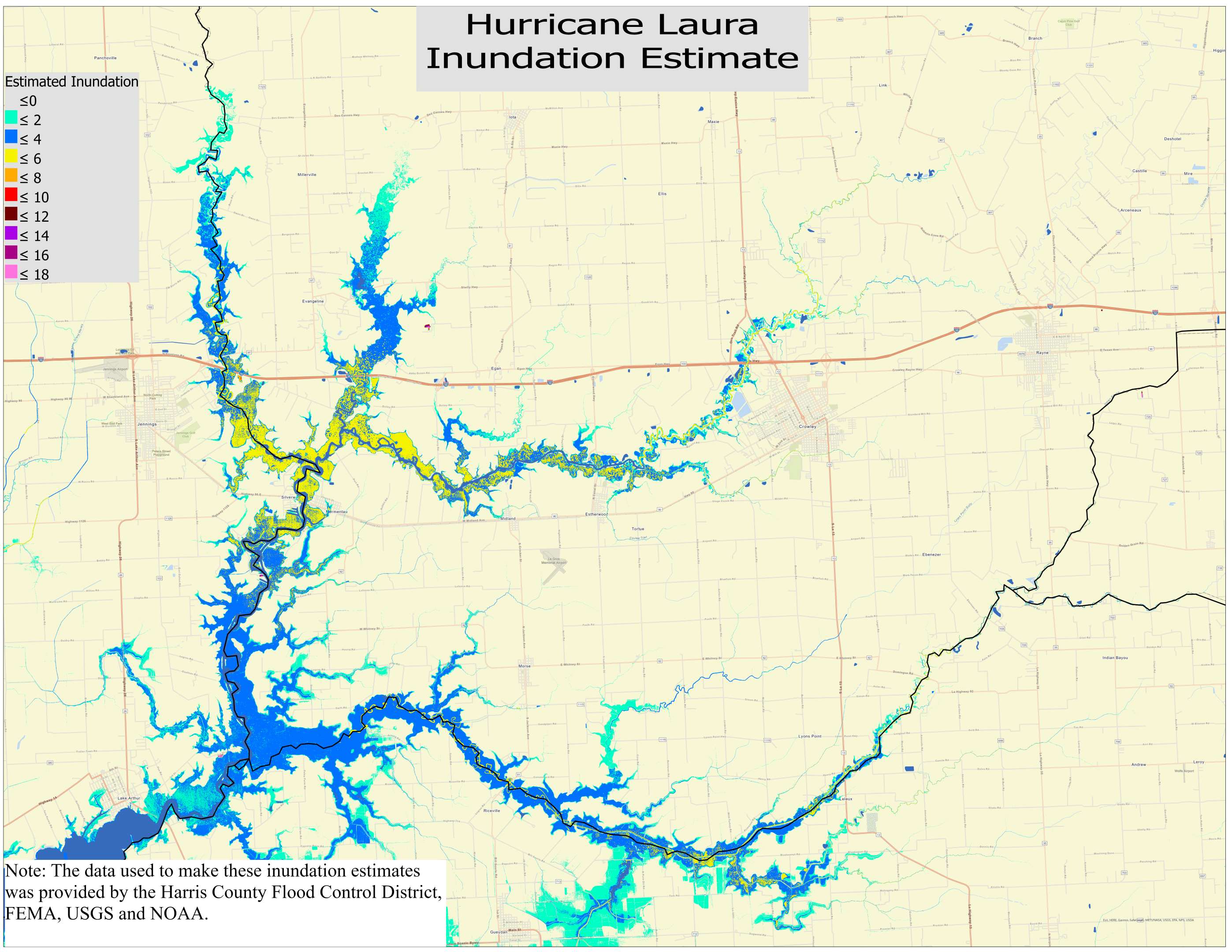 Acadia Parish |
|||
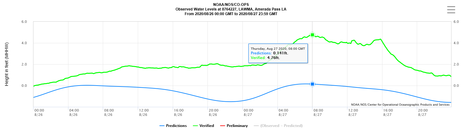
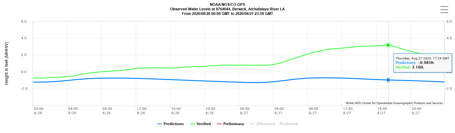
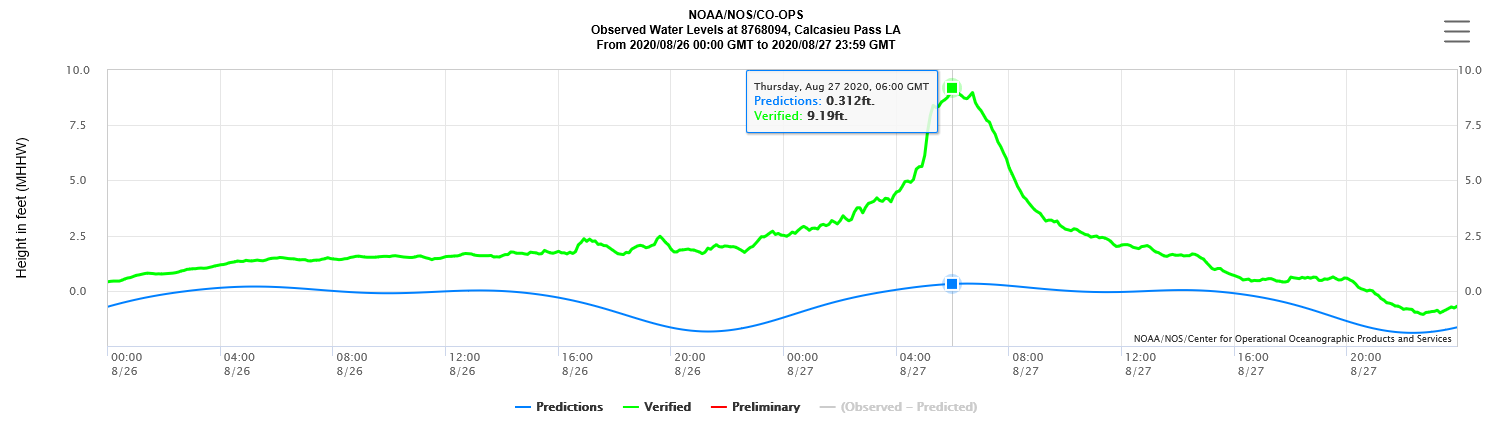
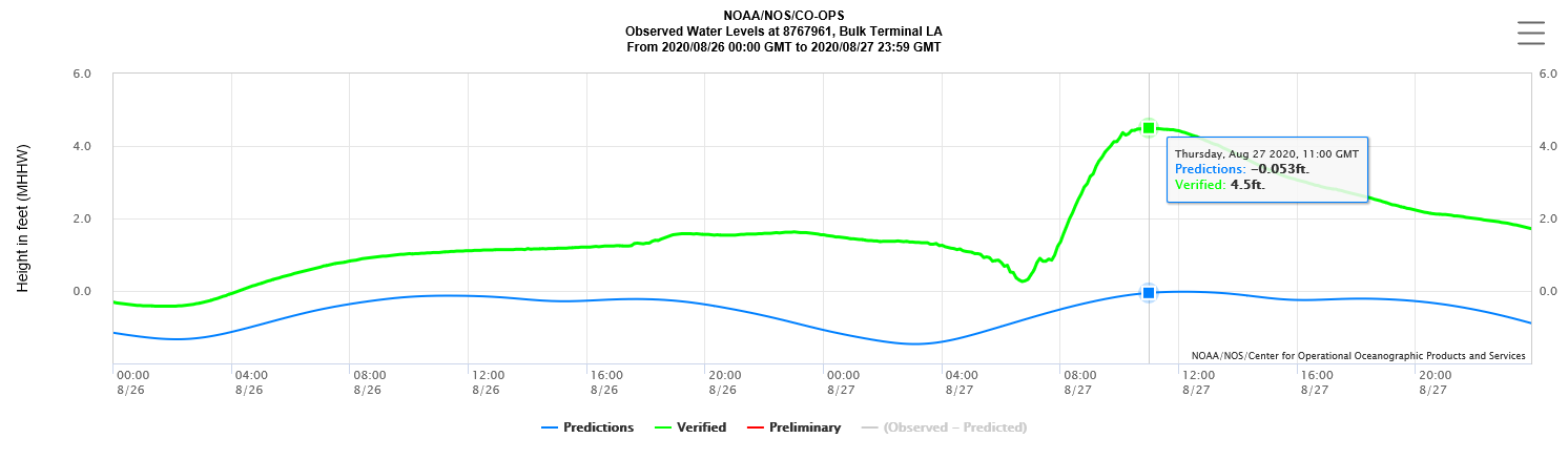
| Hurricane Laura Storm Surge Survey Marks​ | ||||
| USGS Interactive Flood Event Viewer | ||||
| All - AGL | All - NAVD 88 | |||
| Stillwater - AGL | Stillwater - AGL & NAVD 88 | |||
NAVD 88 = North American Vertical Datum of 1988
AGL = Above Ground Level
M = Missing Data
I = Incomplete Data
Forecasts
Model Data
Forecaster's Discussion
Fire Weather
Graphical Forecasts
Wet Bulb Globe Temps
Aviation Weather
Activity Planner
Mardi Gras Decision Support
Marine Forecasts
Local Products
Other Links
National Hurricane Ctr
Storm Prediction Ctr
Weather Prediction Ctr
Other Links
Office History
LCH StoryMap
Hazards
Severe Weather
Tropical Weather
National Outlooks
Local Storm Reports
Tropical Cyclone Reports
Current
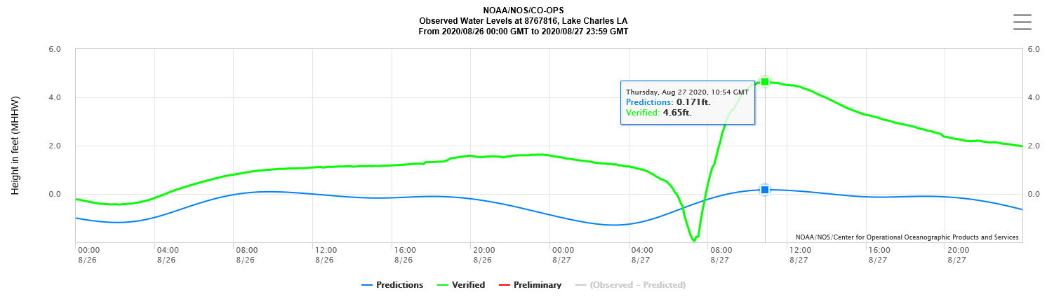
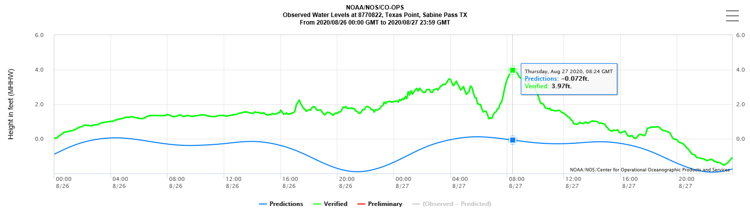
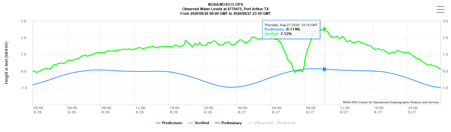
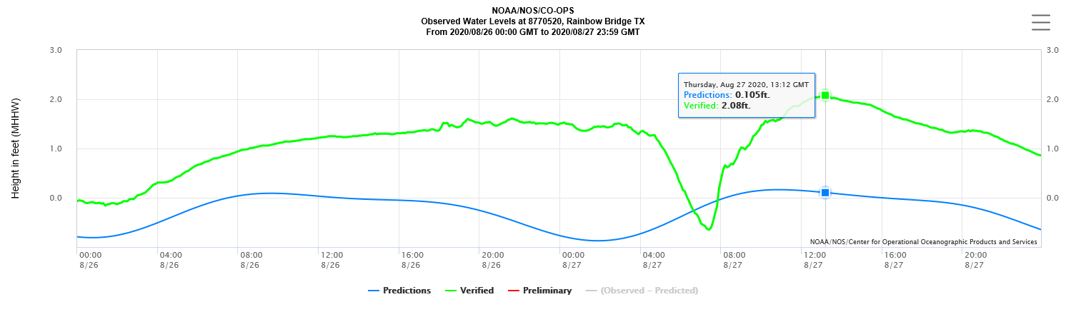
Tide Data
Satellite Data
Observations
Hydrology
River/Lake Forecasts
Calcasieu Par. Network
Jefferson Co. DD6 Network
Radar
Shreveport (SHV)
New Orleans (LIX)
Fort Polk (POE)
Houston/Galveston (HGX)
Lake Charles (LCH)
Probabilistic Pages
Probabilistic DSS
Probabilistic Snowfall
Probabilistic Rainfall
US Dept of Commerce
National Oceanic and Atmospheric Administration
National Weather Service
Lake Charles, LA
500 Airport Boulevard
Lake Charles, LA 70607
(337) 477-5285 M-F 8a to 4p only
Comments? Questions? Please Contact Us.

