Dangerous and extreme heat will remain across portions of the Central U.S. this week, persisting across the Mid to Lower Mississippi Valleys, Gulf Coast, Southern Plains and portions of Texas. A heat wave over the Southwest will intensify late this week. Severe thunderstorms and flash flooding will spread from the Great Lakes/Ohio Valley to the Mid-Atlantic and Northeast the next few days. Read More >
Lake Charles, LA
Weather Forecast Office
|
FEBRUARY 3-4 2011 WINTER STORM |
| Overview |
|
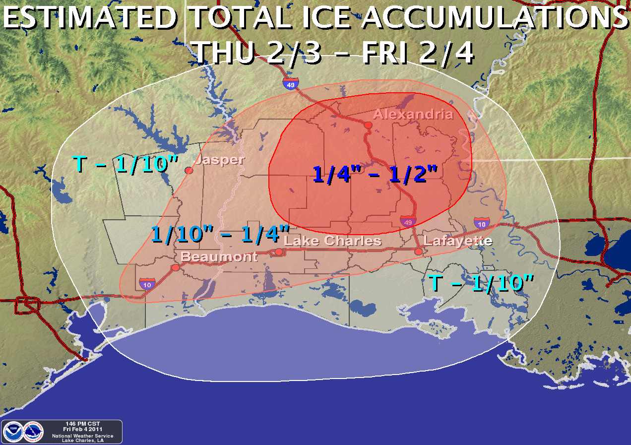
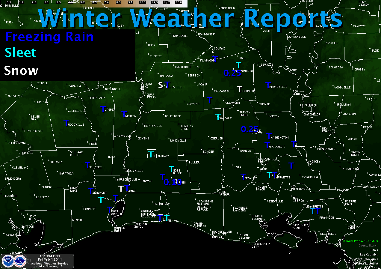
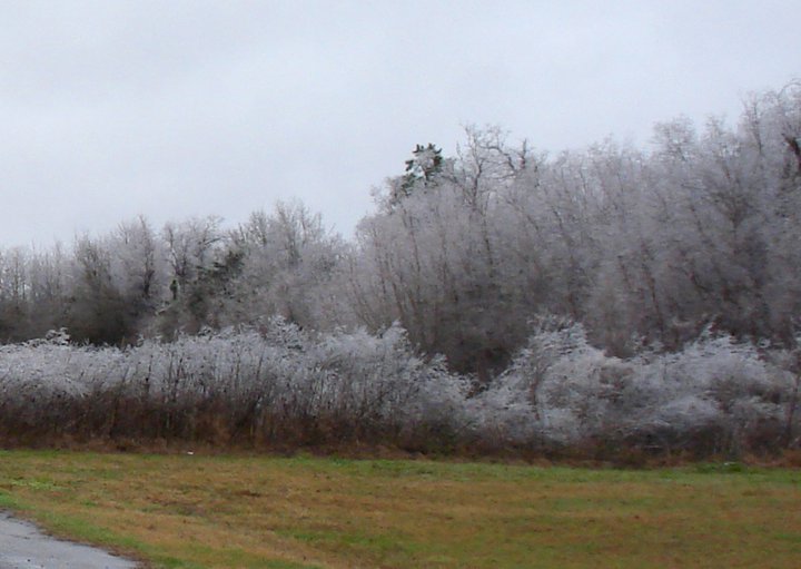
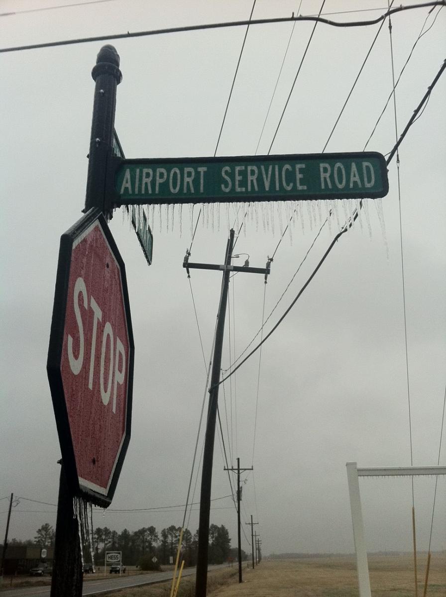
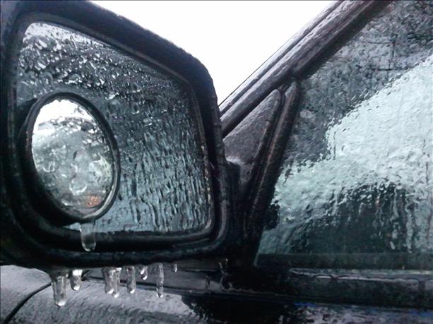
A strengthening upper level low over western Texas began to push east-northeast through Louisiana during the overnight hours of February 3rd and the morning of February 4th. Mid level moisture allowed for the development of light showers across the area on the morning of the 4th. While mid level temperatures remained above freezing, temperatures near the surface were running from 28-32 degrees, resulting in widespread winter precipitation. Freezing rain mixing with sleet and snow developed across southeast Texas and southwest Louisiana on the morning of February 3rd, with some ice accumulations on elevated surfaces across south central Louisiana. All areas saw a changeover to freezing rain by the evening of February 3rd, with freezing rain continuing into the morning of February 4th. The hardest hit areas were across central Louisiana, including Alexandria and Ville Platte, which experienced nearly a quarter inch of ice accumulation from the freezing rain. Beaumont/Port Arthur saw around one tenth of an inch of ice accumulation, and one tenth of an inch of ice was also measured at the NWS office in Lake Charles. The entire region saw at least a trace of freezing rain which resulted in numerous road closures and car accidents (with 1 fatality), as well as widespread power outages affecting over 26,000 customers. |
| Local Storm Reports |
| List of all Local Winter Storm Reports for February 3-4 2011 |
|
Maps |
|
|
|
|
|
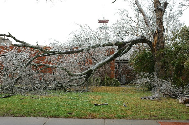
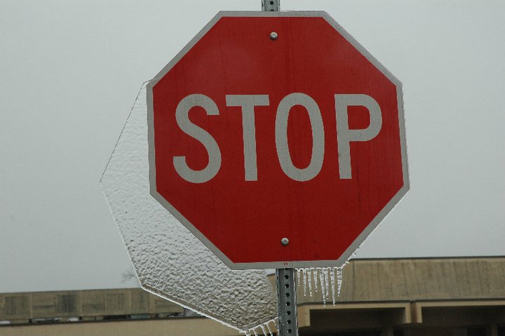
Pictures |
||
|
|
|
|
|
|
|
|
Forecasts
Aviation Weather
Activity Planner
Mardi Gras Decision Support
Marine Forecasts
Local Products
Model Data
Forecaster's Discussion
Fire Weather
Graphical Forecasts
Wet Bulb Globe Temps
Other Links
National Hurricane Ctr
Storm Prediction Ctr
Weather Prediction Ctr
Other Links
Office History
LCH StoryMap
Hazards
Severe Weather
Tropical Weather
National Outlooks
Local Storm Reports
Tropical Cyclone Reports
Current
Observations
Tide Data
Satellite Data
Hydrology
Calcasieu Par. Network
Jefferson Co. DD6 Network
River/Lake Forecasts
Radar
Shreveport (SHV)
New Orleans (LIX)
Fort Polk (POE)
Houston/Galveston (HGX)
Lake Charles (LCH)
Probabilistic Pages
Probabilistic Snowfall
Probabilistic Rainfall
Probabilistic DSS
US Dept of Commerce
National Oceanic and Atmospheric Administration
National Weather Service
Lake Charles, LA
500 Airport Boulevard
Lake Charles, LA 70607
(337) 477-5285 M-F 8a to 4p only
Comments? Questions? Please Contact Us.