
Dangerous and extreme heat will remain across portions of the central U.S. this week, persisting across the mid to lower Mississippi Valley, Gulf Coast, southern Plains and portions of Texas. A heat wave over the Southwest U.S. will peak this weekend. Heavy to excessive rainfall may produce flash flooding from the Delmarva Peninsula north into the Hudson Valley today and tonight. Read More >
Lake Charles, LA
Weather Forecast Office
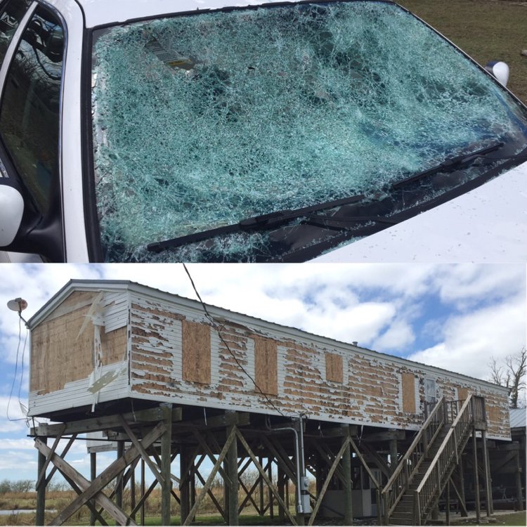
Left: Wind blown hail damage in Pecan Island (Image courtesy of Trevor Guillory, KATC)
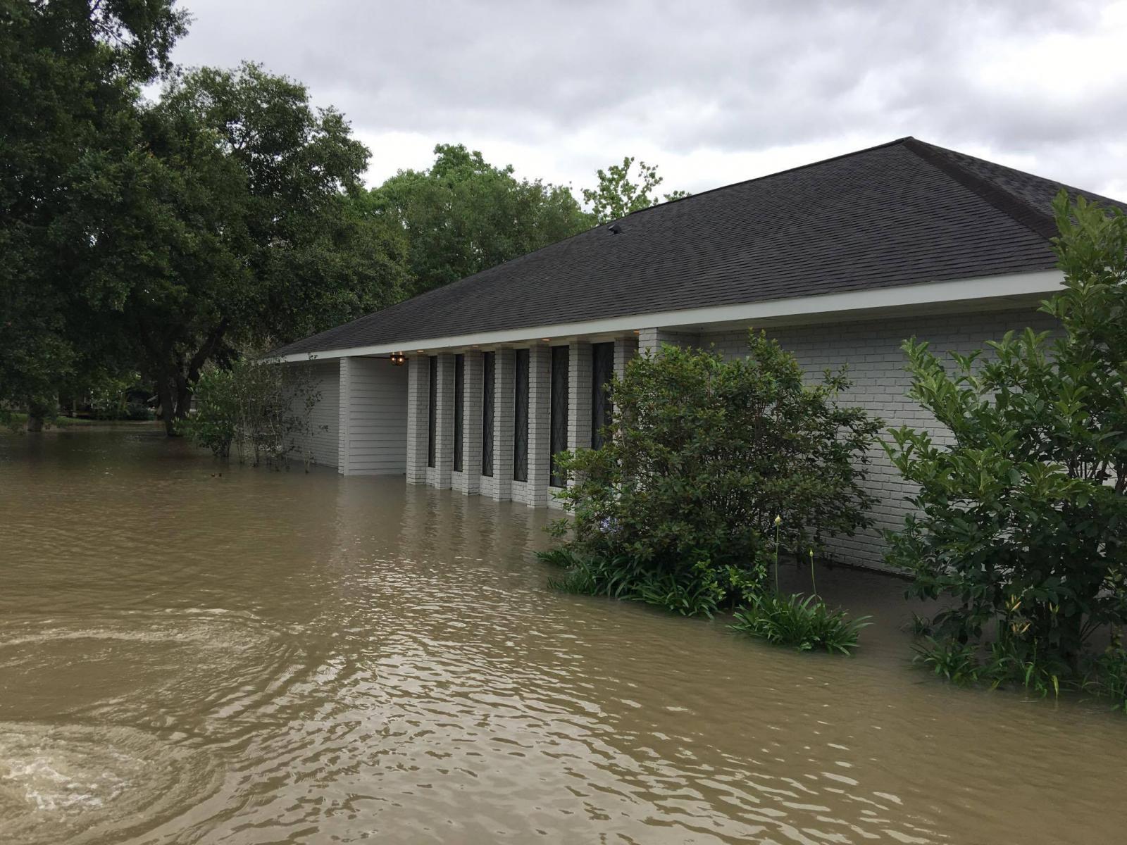
Right: Flash flooding in Welsh (Image courtesy of Cajun Weather Spotters)
Multiple rounds of severe weather occurred across Southeast Texas and Southwest Louisiana on May 3, 2017. Several supercell thunderstorms developed as a warm front lifted northward across the region during the morning hours. These storms produced very large hail with several locations reports hail up to the size of baseballs. Rain cooled air from these early morning thunderstorms and the warm front triggered additional rounds of thunderstorms throughout the day along the Interstate 10 corridor. The multiple rounds of thunderstorms produced 8 to 10+ inches of rainfall over a very short period of time. The heavy rainfall resulted in flash flooding with portions of Calcasieu and Jefferson Davis Parishes being most heavily impacted. The final round of severe weather occurred during the late evening hours as a squall line moved through the region producing sporadic wind damage and heavy rain over areas that had already experienced severe weather earlier in the day.
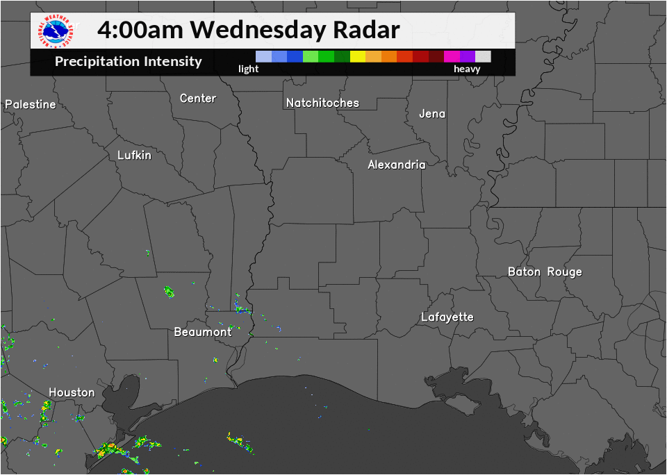
Radar loop from 4 AM May 3 through 6 AM May 4.
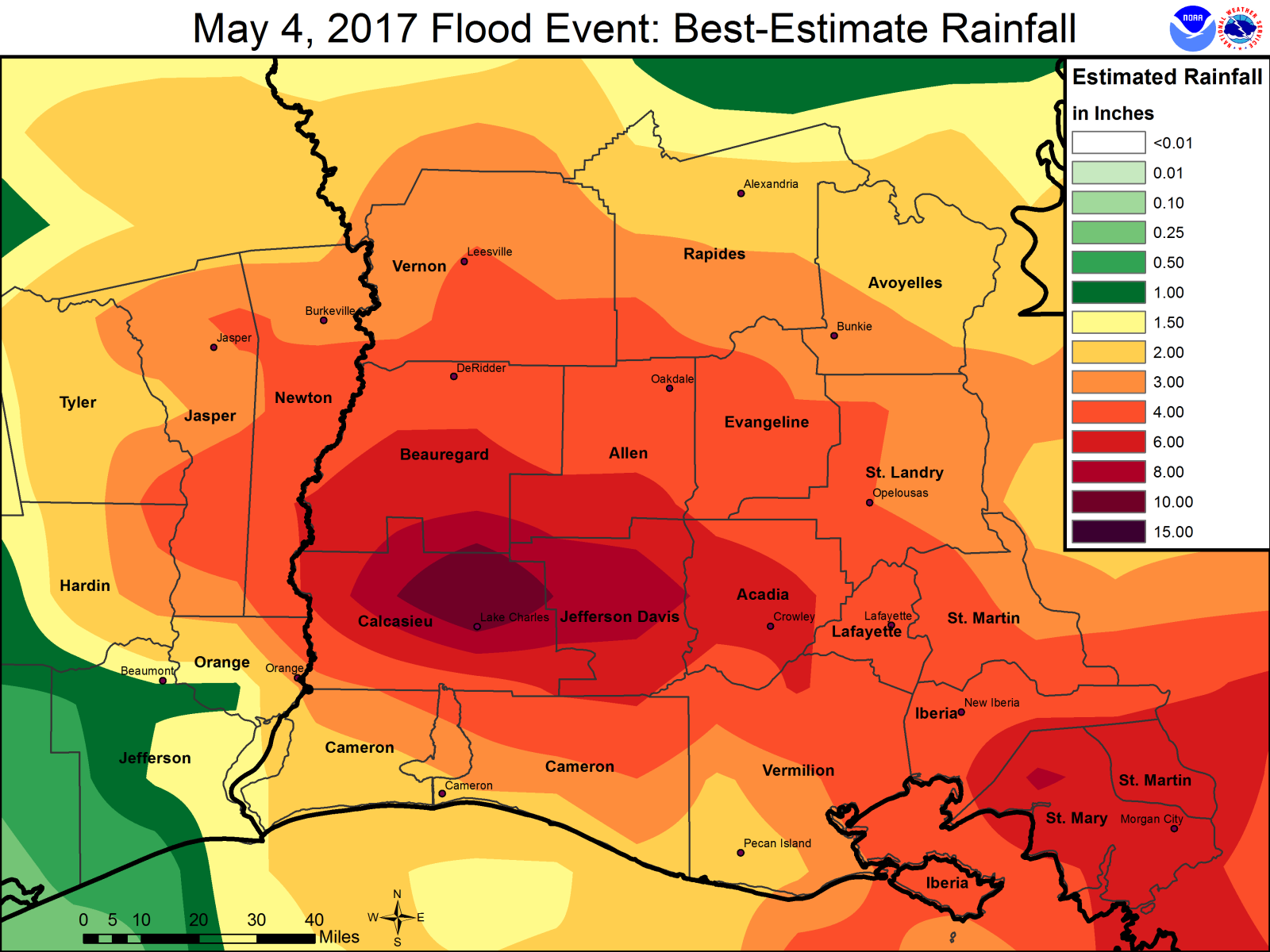
24 hour total rainfall ending on the morning of May 4, 2017.
Forecasts
Graphical Forecasts
Wet Bulb Globe Temps
Aviation Weather
Activity Planner
Mardi Gras Decision Support
Marine Forecasts
Local Products
Model Data
Forecaster's Discussion
Fire Weather
Other Links
National Hurricane Ctr
Storm Prediction Ctr
Weather Prediction Ctr
Other Links
Office History
LCH StoryMap
Hazards
Severe Weather
Tropical Weather
National Outlooks
Local Storm Reports
Tropical Cyclone Reports
Current
Satellite Data
Observations
Tide Data
Hydrology
Calcasieu Par. Network
Jefferson Co. DD6 Network
River/Lake Forecasts
Radar
Shreveport (SHV)
New Orleans (LIX)
Fort Polk (POE)
Houston/Galveston (HGX)
Lake Charles (LCH)
Probabilistic Pages
Probabilistic DSS
Probabilistic Snowfall
Probabilistic Rainfall
US Dept of Commerce
National Oceanic and Atmospheric Administration
National Weather Service
Lake Charles, LA
500 Airport Boulevard
Lake Charles, LA 70607
(337) 477-5285 M-F 8a to 4p only
Comments? Questions? Please Contact Us.

