Tornadoes, damaging thunderstorm winds, large hail, and flash floods can occur at any time of the year. However, late winter and spring usually bring the greatest chance of these severe weather events occurring in Louisiana.
The week beginning on February 13th has been designated as Severe Weather Awareness Week in the Pelican State. The goal of this special week is to call attention to the threats posed by these weather hazards, as well as to review severe weather safety rules in an attempt to reduce the loss of life and injury. Post-storm interviews with survivors of severe weather events prove that preventative safety measures greatly enhance the chance of survival.
Now is the time to develop a severe weather safety plan. A successful plan should include:
Emergency managers, schools, government agencies, private businesses, and local citizens are encouraged to review their severe weather safety plans and conduct drills as appropriate.
National Weather Service considers the following criteria as severe weather phenomenon:
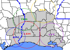
NOAA Weather Radio is a vital communication link in your severe weather safety plan. NOAA Weather Radio broadcasts continuous weather information. When severe weather watches and warnings are issued, most NOAA Weather Radios are automatically alerted and turned on so that you are alerted about a potential severe weather situation. Some receivers can be programmed specifically for the parish or county where you live.
In the southern United States...including the Gulf Coast states...tornadoes can occur at night. Unfortunately...nocturnal tornadoes have a much greater chance of causing fatalities and injuries as many people are asleep and not monitoring weather conditions or media to know if warnings have been issued. NOAA Weather Radios can be a life saving weather monitoring device during the overnight hours. The Weather Radio can be set in "stand-by" mode overnight and will automatically alarm and turn on if a severe weather watch or warning is issued. When a Severe Thunderstorm or Tornado Watch or Warning is issued, the weather radio will automatically alert and broadcast the warning.

Home Safety Tip |
|
 |
Move to a small interior room or hallway on the lowest floor and get under a sturdy piece of furniture. Put as many walls as possible between you and the outside. |
|
|
|
School Severe Weather Safety Tip |
|
 |
Practice a severe weather action plan that includes a means of receiving severe weather watches and warnings, and safety procedures to follow when warnings are issued or when severe weather develops. Seek shelter in an interior hallway on the lowest floor. |
|
|
|
Other Structures Safety Tips |
|
 |
If you live in a mobile home, move to a substantial shelter if severe weather threatens. The thin walls are vulnerable to wind blown debris, and they can be easily overturned by strong wind gusts. In large buildings such as office buildings, hospitals, or shopping centers, move rapidly to a designated shelter. Do not try to escape in your car. |
|
|
|
Outdoor Safety Tips |
|
 |
Move inside a sturdy building or car. Do not take shelter in small sheds or under isolated trees. Postpone outdoor activities if thunderstorms are imminent. |
|
|
|
Flash Flood Safety Tips |
|
 |
Avoid walking, swimming, or driving in flood waters. If you live in a flood prone area, move to higher ground. |
|
|
|
Tornado and Severe Thunderstorm Watches |
|
 |
Atmospheric conditions are favorable for the development of severe thunderstorms and/or tornadoes during the next several hours. Stay alert for rapidly changing weather conditions and be ready to take action if warnings are issued. |
|
|
|
Tornado and Severe Thunderstorm Warnings |
|
 |
A tornado or severe thunderstorm has been reported or indicated by radar. Seek appropriate safe shelter if you are in the path of the storm. |
|
|
|