Louisville, KY
Weather Forecast Office
With the exception of Frankfort in May, every climate site in central Kentucky was drier than normal for each of the three months of spring this year, resulting in a season that was about 2 to 5 inches drier than normal. Parts of the Louisville metro and also southern Kentucky, especially around Edmonton and Greensburg, received less than 70% of the normal amount of precipitation for spring. Fortunately we had a wet winter that helped to bolster groundwater levels, but by the end of May signs of dryness were beginning to appear.
| Average Temperature | Departure from Normal | Precipitation | Departure from Normal | Snow | Departure from Normal | |
| Bowling Green | 59.9° | +1.2° | 11.40" | -2.98" | 5.1" | |
| Frankfort | 57.0° | +0.9° | 12.55" | -1.82" | ||
| Lexington | 57.4° | +1.6° | 11.82" | -2.52" | 5.5" | +2.5" |
| Louisville Ali | 59.9° | +1.3° | 10.04" | -4.54" | 1.5" | -0.7" |
| Louisville Bowman | 58.5° | +0.9° | 10.53" | -3.69" |
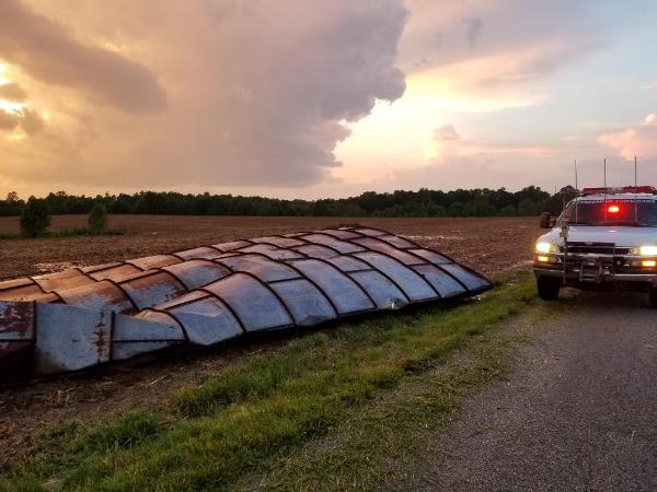
A downed silo in Casey County on the stormy evening of May 18.
Current Hazards
Hazardous Weather Outlook
Storm Prediction Center
Submit a Storm Report
Advisory/Warning Criteria
Radar
Fort Knox
Evansville
Fort Campbell
Nashville
Jackson
Wilmington
Latest Forecasts
El Nino and La Nina
Climate Prediction
Central U.S. Weather Stories
1-Stop Winter Forecast
Aviation
IDSS Forecast Points
Air Quality
Fire Weather
Recreation Forecasts
1-Stop Drought
Event Ready
1-Stop Severe Forecast
Past Weather
Climate Graphs
1-Stop Climate
CoCoRaHS
Local Climate Pages
Tornado History
Past Derby/Oaks/Thunder Weather
Football Weather
Local Information
About the NWS
Forecast Discussion
Items of Interest
Spotter Training
Regional Weather Map
Decision Support Page
Text Products
Science and Technology
Outreach
LMK Warning Area
About Our Office
Station History
Hazardous Weather Outlook
Local Climate Page
Tornado Machine Plans
Weather Enterprise Resources
US Dept of Commerce
National Oceanic and Atmospheric Administration
National Weather Service
Louisville, KY
6201 Theiler Lane
Louisville, KY 40229-1476
502-969-8842
Comments? Questions? Please Contact Us.


 Weather Story
 Weather Map
 Local Radar