Louisville, KY
Weather Forecast Office
This was a warm and wet winter, with little snowfall but plenty of rain. Christmas saw temperatures soar well into the 60s...followed by readings in the 70s on the 11th of January. Flooding developed in February for the third year in a row.
| Average Temperature | Departure from Normal | Precipitation | Departure from Normal | Snowfall | Departure from Normal | |
| Bowling Green | 43.3° | +5.3° | 16.34" | +3.96" | 2.3" | -5.3" |
| Frankfort | 40.1° | +5.4° | 12.39" | +1.83" | ||
| Lexington | 40.7° | +5.5° | 14.46" | +4.13" | 3.6" | -7.4" |
| Louisville Bowman | 41.4° | +4.8° | 11.05" | +0.48" | ||
| Louisville Ali | 42.1° | +4.9° | 11.14" | +0.89" | 2.4" | -8.4" |
3rd warmest winter on record at Bowling Green and Lexington
6th warmest winter on record at Frankfort
8th warmest winter on record at Louisville
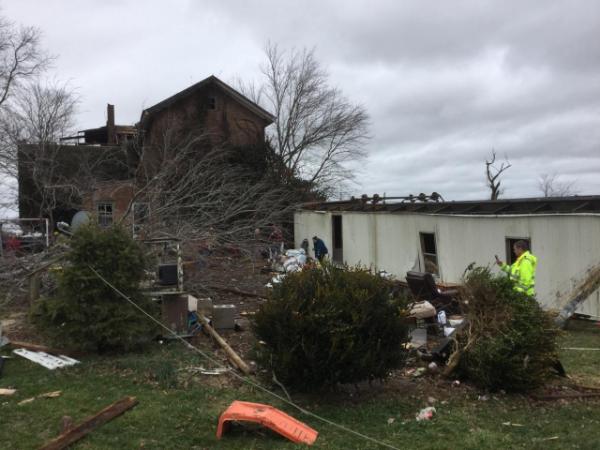
A mobile home was overturned by 80 mph winds in eastern Madison County on January 11. Three minor injuries occurred.
Current Hazards
Hazardous Weather Outlook
Storm Prediction Center
Submit a Storm Report
Advisory/Warning Criteria
Radar
Fort Knox
Evansville
Fort Campbell
Nashville
Jackson
Wilmington
Latest Forecasts
El Nino and La Nina
Climate Prediction
Central U.S. Weather Stories
1-Stop Winter Forecast
Aviation
IDSS Forecast Points
Air Quality
Fire Weather
Recreation Forecasts
1-Stop Drought
Event Ready
1-Stop Severe Forecast
Past Weather
Climate Graphs
1-Stop Climate
CoCoRaHS
Local Climate Pages
Tornado History
Past Derby/Oaks/Thunder Weather
Football Weather
Local Information
About the NWS
Forecast Discussion
Items of Interest
Spotter Training
Regional Weather Map
Decision Support Page
Text Products
Science and Technology
Outreach
LMK Warning Area
About Our Office
Station History
Hazardous Weather Outlook
Local Climate Page
Tornado Machine Plans
Weather Enterprise Resources
US Dept of Commerce
National Oceanic and Atmospheric Administration
National Weather Service
Louisville, KY
6201 Theiler Lane
Louisville, KY 40229-1476
502-969-8842
Comments? Questions? Please Contact Us.


 Weather Story
 Weather Map
 Local Radar