
Scattered thunderstorms with severe gusts, hail and a tornado risk are possible near a cold front from the Ohio Valley to the Mid-Atlantic tonight. Tropical Storm Bertha is expected to bring tropical storm conditions to portions of the Gulf Coast from the panhandle of Florida into Louisiana through Wednesday. Read More >
Synopsis
This event took place in conjunction with both a dry line along the Caprock and weak cold front moving south across the Southern Panhandle during the afternoon hours. Moisture content and low-level wind shear were supportive of heavy rains, hail, damaging winds, and a tornado. At around 2030Z, a severe storm developed with an area encompassing northern Motley and southern Hall counties. This cell was progressing northeast at 20 mph. Another intriguing cell developed just northeast of the storm in southeastern Hall county which remained stationary throughout its life. As the severe storm continued northeast a severe storm warning was issued at 2039Z for Motley and Hall counties.
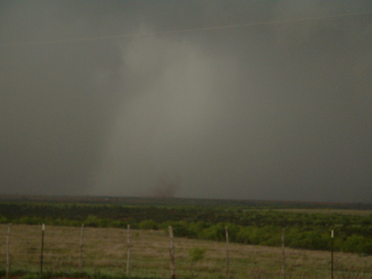
As the storm entered south eastern Hall county, the smaller cell remained stationary and was eventually engulfed by the severe storm at 2120Z. The now single cell moved into Childress county, and produced a tornado in southwest Childress county.
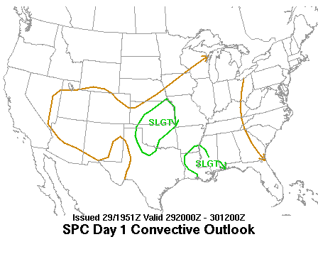
The SPC outlook for this time period included a slight risk for severe weather with the border of the slight area just east of storm development.
The reported tornado occurred from approximately 2125Z-2136Z.
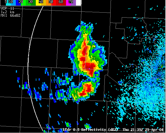
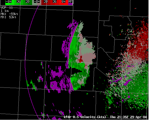
NOTE: Frederick, OK radar was having communication problems at the time of this event. Thus, Lubbock forecasters were unable to analyze most of the radar data from Frederick, OK available below for the time of the event. Also, there is still missing data from the Frederick, OK during the reported tornado event and 8 bit data was not available.
Below are reflectivity and velocity images from the Fredrick, Okla radar at 21:39 UTC, just after the tornado was reported (click on the images to view a larger version):
Click HERE to view more radar images from the event.

