
Scattered thunderstorms with severe gusts, hail and a tornado risk are possible near a cold front from the Ohio Valley to the Mid-Atlantic tonight. Tropical Storm Bertha is expected to bring tropical storm conditions to portions of the Gulf Coast from the panhandle of Florida into Louisiana through Wednesday. Read More >
Stationary Storm Brings Abundant Rains
10-13 March 2007
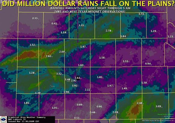
Above is an image displaying the estimated rainfall totals as determined by radar that fell between late Saturday (10 March 2007) and early Tuesday (13 March 2007). The yellows and oranges are the heavier amounts. Additionally, plotted on top of the image are the observed rainfall amounts (in inches) that were recorded by the West Texas Mesonet and the National Weather Service. (Image created by Marty Mullen).
A nearly stationary storm system brought a number of rounds of moderate to heavy rain to the region between late Saturday (10 March 2007) and early Tuesday (13 March 2007). Many locations received rainfall in excess of one inch, with a number of locations picking up 2 to 3 inches. The biggest rainfall winners were Reese Center, Anton 6SSW, and Aspermont 3NE, which totaled 3.48, 3.32, and 3.09 inches, respectively. Some of this rain did cause problems when low and poor drainage streets across the city of Lubbock filled with water and caused cars to stall out when motorists attempted to cross. The rainfall was winding down Tuesday, but some locations could still see some additionally rainfall before the pesky storm system finally exits to the east of the area by Wednesday.
A detailed compilation of rainfall reports assembled by the Lubbock NWS Office can be found HERE.
To view the preliminary local storm reports from the heavy rains click HERE.
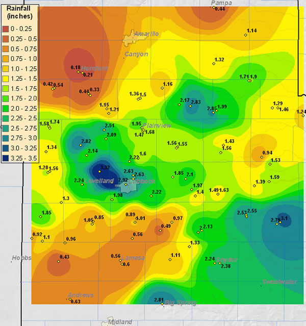
the map below shows the rainfall totals received from both the West Texas Mesonet and the NWS Co-op stations from Saturday through Tuesday. Click on the image for the full-sized version.
 |
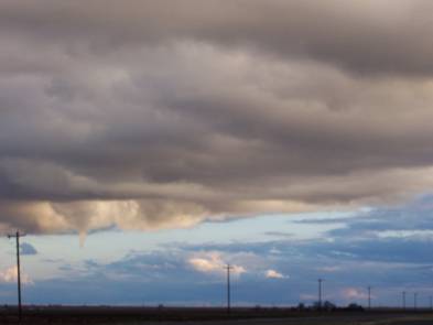
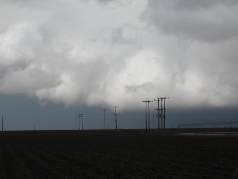
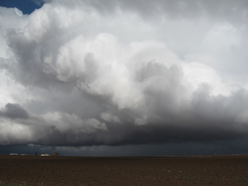
On Monday, with the storm system nearly overhead, the counter-clockwise spin in the atmosphere combined with atmospheric instability resulting from the very cold air aloft and some modest heating near the ground to produce several "cold-air funnels". These funnels seldom reach to the ground, but on rare occasions they can become tornadoes and cause minor damage. Below are two pictures of the funnels taken from near Tahoka.
 |
 |
|
These pictures are courtesy KCBD Channel 11 News viewer Katie Slone.
|
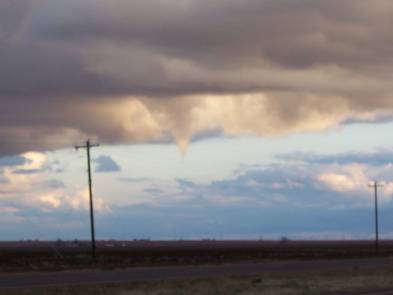
The following pictures were taken by Wes Burgett west of Ropesville:
 |
|
|
 |
|
|
 |
|
The middle picture in particular shows the tilting nature of the thunderstorm updraft - which is an indication of strong wind shear in the atmosphere - conducive for cold air funnel formation. Click on each image to enlarge it.
|

