|
Storms Produce Large Hail and Strong Winds |
||
 |
 |
 |
 |
 |
 |
|
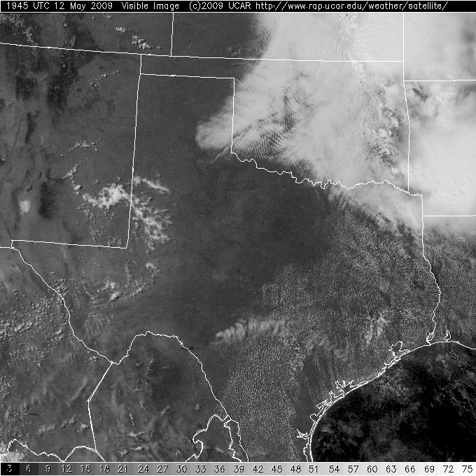
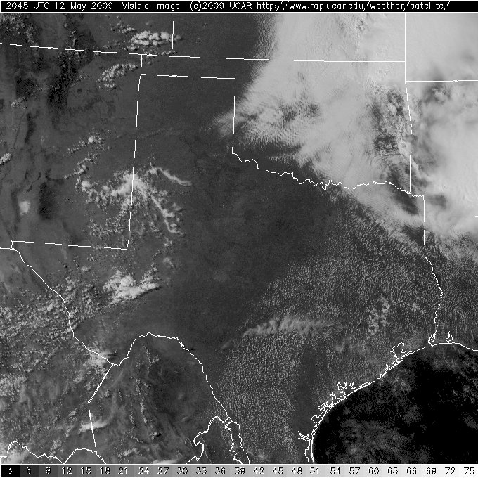
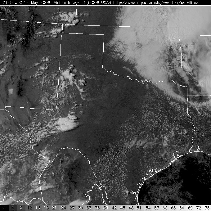
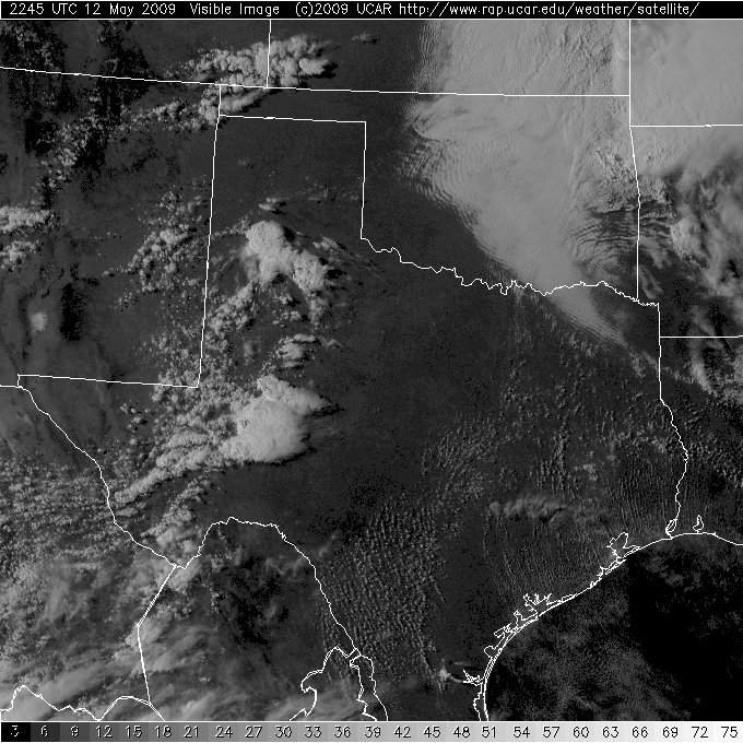
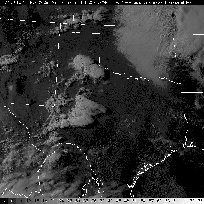
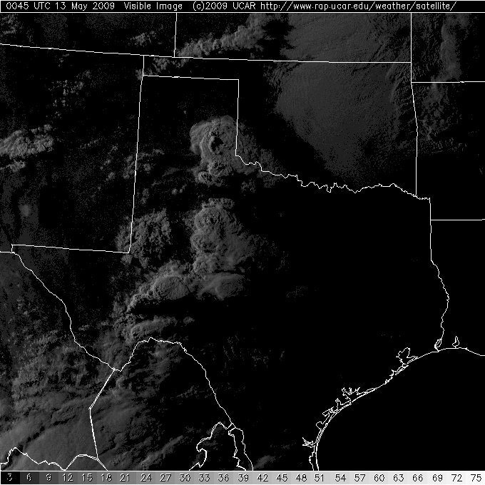
Series of visible satellite images taken during the afternoon and evening of 12 May 2009. The images, from upper left to lower right, are taken at 2:45 pm, 3:45 pm, 4:45 pm, 5:45 pm, 6:45 pm, and 7:45 pm, respectively. Click on the images for a larger view. Images are courtesy of The National Center for Atmospheric Research.
|
||
A weak upper level disturbance combined with a dryline, strong heating, moderate instability and modest wind shear to bring a round of thunderstorms to portions of the Texas Panhandle and the Rolling Plains. Additional high-based showers fell into very dry air west of the dryline and created isolated sprinkles/showers and localized strong downburst winds and blowing dust across portions of the South Plains.
The first severe thunderstorm formed over the south-central Texas Panhandle during the early evening and brought half dollar size hail near Happy and a 59 mph wind gust near Tulia. This storm moved off to the northeast, but other clusters of strong to severe storms then developed further to the east. One storm generated hail estimated to golf-ball size near Turkey, and later a wind gust measured to 65 mph near Childress. In addition, another cluster of strong to severe storms developed and moved across the southern Rolling Plains with strong winds and large hail. To view a more comprehensive preliminary storm report for the day CLICK HERE.
|
||||||||
|
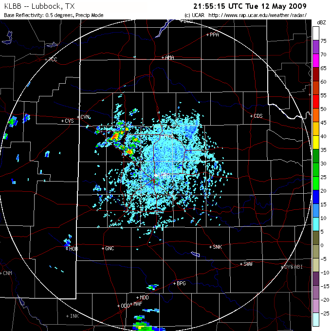
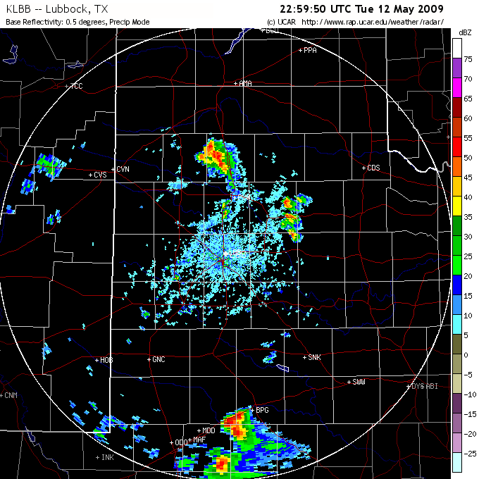
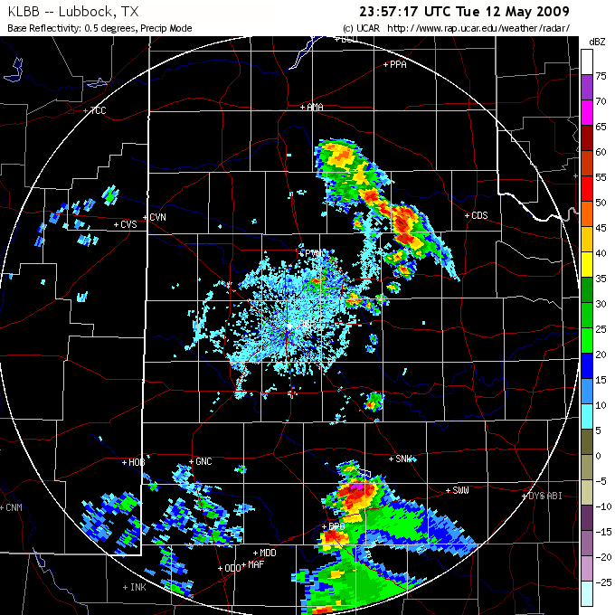
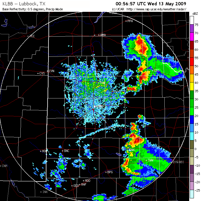
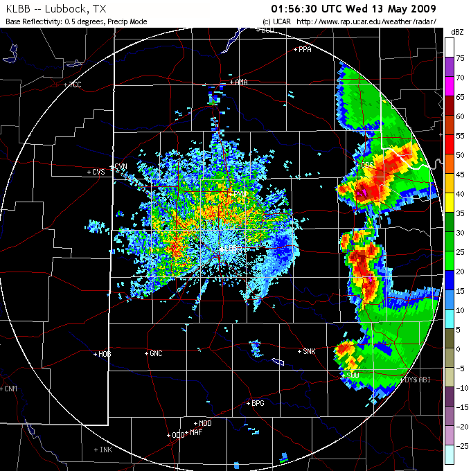
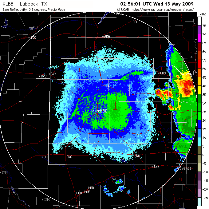
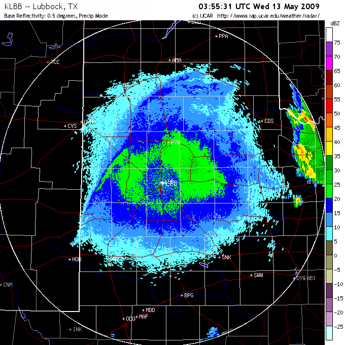
Series of radar images from the Lubbock NWS WSR-88D taken during the afternoon and evening of 12 May 2009. The images, from upper left to lower right, are taken at 3:26 pm, 4:55 pm, 6:00 pm, 6:57 pm, 7:57 pm, 8:57 pm, 9:56 pm, and 10:56 pm, respectively. Click on the images for a larger view. Images are courtesy of The National Center for Atmospheric Research.
|
In addition to the strong winds and large hail, some of the storms produced heatbursts. In particular, a heatburst was observed at the Texas Tech West Texas Mesonet station just north of Childress where winds gusted to 65 mph, the temperature climbed 10 degrees in about 10 minutes (from 81 to 91 degrees around 8 pm) and the dewpoint dropped 37 degrees. This was caused when air rapidly descended from aloft (forced by precipitation fall from high in the sky - near cloud anvil level), and then dried and compressionally warmed as it sank toward the earth. As is common with heat bursts, no precipitation made it to the ground, evaporating before it could do so. However, the Childress Mesonet did receive some rain about 40 minutes later, and this cooled temperatures back into the 70s.
To read more about the weather that transpired on this day please check out the page created by the West Texas Mesonet.


