|
Slow-moving storm system brings snow |
|
|
|
|
|
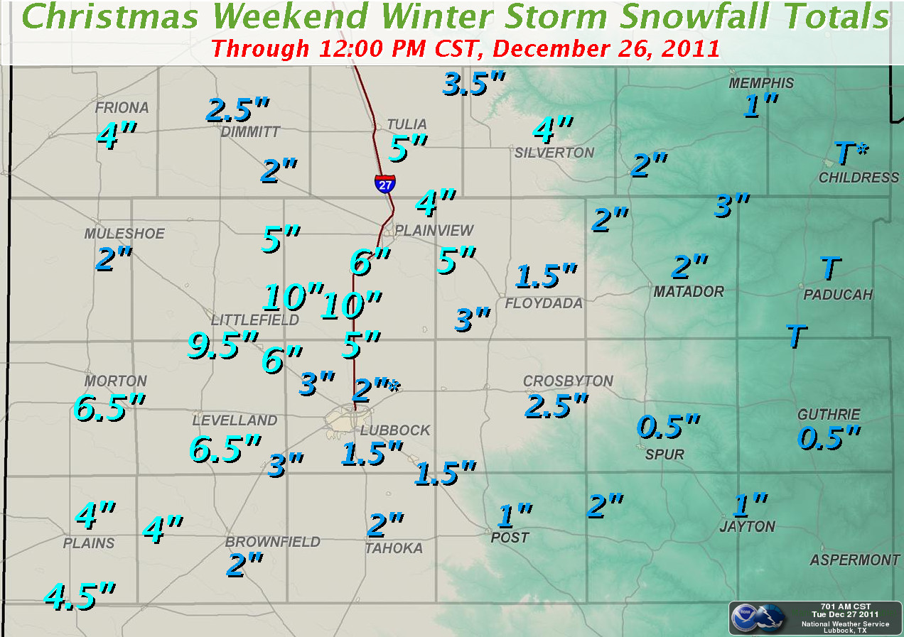
Snowfall totals received at our office from the Co-op observer network. Click on the map for a larger view. |
|
|
A strong upper-level low pressure system slowly pushed into western Texas Christmas Eve into Christmas Day, bringing snowfall and a rare white Christmas to the entire southern plains region. A solid 1 to 3 inches of snow fell across most of the region, with lighter amounts over the extreme southeastern Panhandle and eastern Rolling Plains. There was also a fairly large snow band that set up early Christmas Eve morning into the mid-afternoon that produced heavier snowfall across the western and northern South Plains. The greatest snowfall amounts occurred in an area stretching from Cochran and southern Bailey counties north and east through northern Hockley, southern Lamb, and southern Hale Counties, where accumulations of 6 inches or greater were common. The heaviest band of snow occurred along a narrow line stretching from Littlefield to Spade to Cotton Center where between 9-10 inches of snow was measured. Additionally, locally heavy snow showers developed across the southern Panhandle on Christmas Day and produced between 2 to 4 inches of snow across Parmer, Castro, Swisher and Briscoe counties, before tapering off later that evening. One final snow band developed early on the 26th and produced an additional 1 to 2 inches over parts of the southwest Panhandle into the northwest South Plains. To view a text listing of the snowfall reports received by the Lubbock NWS CLICK HERE. |
|
|
|
|
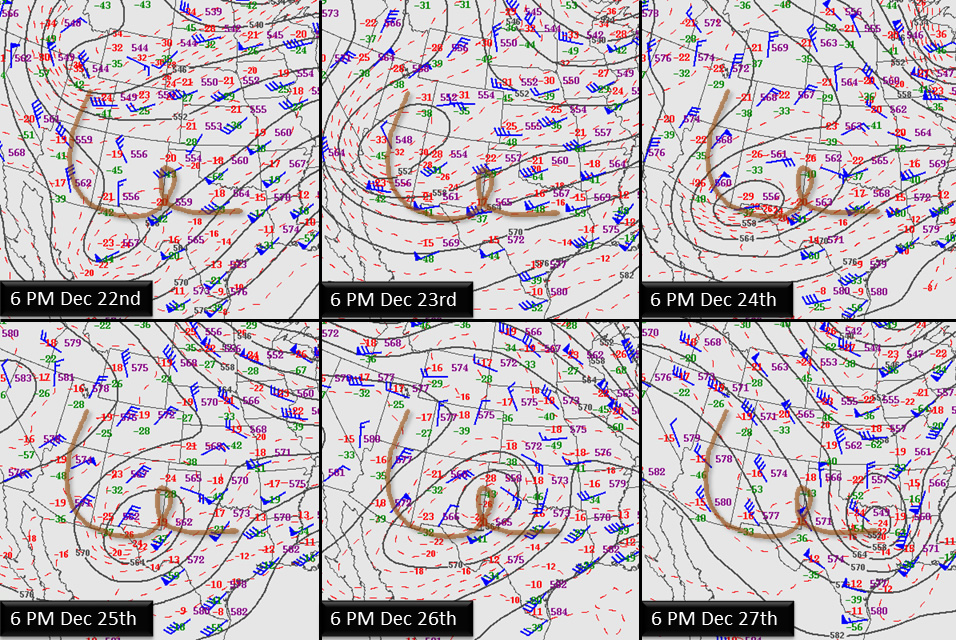
| Plot displaying the meander path of the upper level storm system (500 mb low track) that brought West Texas the prolonged period of winter weather. Click on the map for a larger view. | |
|
|
|
| The storm system responsible for the snow took its time moving from the Great Basin, south to near El Paso, lifting northeastward across the South Plains, looping west, then south and finally off to the east. This circuitous route took some time, spanning from December 22nd through the 27th. Snow fell over parts of western Texas from Friday (23 December) to early on Monday (26 December). | |
|
|
|
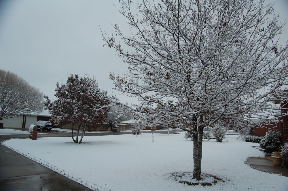
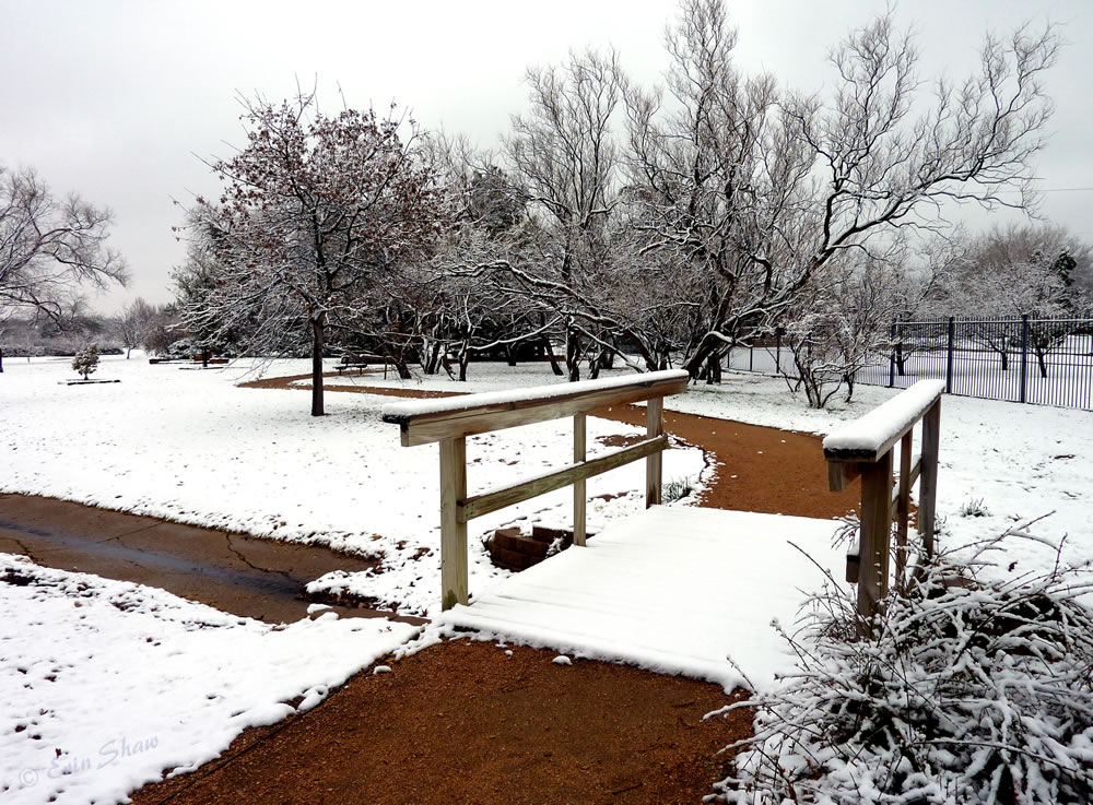
| Picture of Clapp Park, in Lubbock, taken on Christmas Day 2011. Picture courtesy of Erin Shaw. Click on the image for a larger view. | |
|
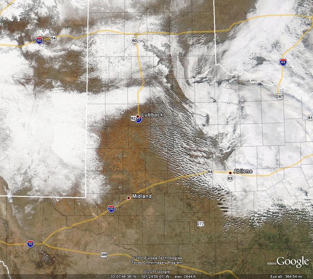
The above image shows what it looked like at ground level on Christmas Day in Lubbock. Below, you can see how this same scene looked from the next day from 438 miles above the earth. |
|
|
|
|
| MODIS visible satellite image captured Monday afternoon (26 December 2011). The large snowpack left behind by the holiday winter storm is visible across roughly the western half of the view. Clouds are present over the eastern portion of the image. Click on the frame for a larger view. | |
| Below are a couple more shots of the wintry scene. | |
 |
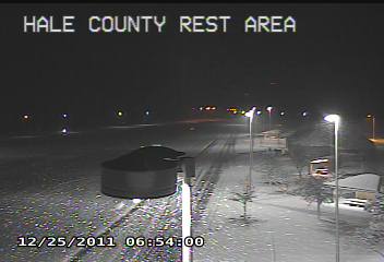 |
| Pictures of the snow taken in southwest Lubbock (left) and at the Hale County rest area (right) on Christmas morning 2011. Images courtesy of Jody James (left) and the Texas Department of Transportation (right). Click on the desired view for a larger version. | |
| Following are several radar animations captured during the prolonged period of winter weather. | |
|
|
|
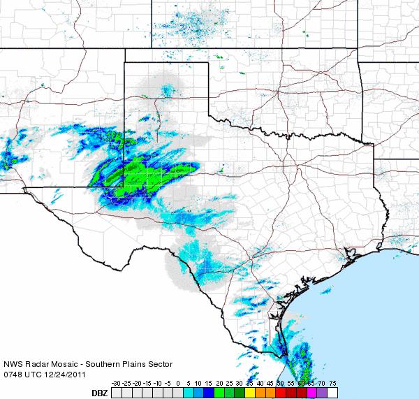
| Radar reflectivity animation valid from 1:48 am to 2:58 am on Christmas Eve (24 December 2011). | |
| The snow initially moved into the southwest South Plains and produced several inches in and around Plains late on the 23rd and early on the 24th (above). Bands of snow then spread northward across much of the remainder of the South Plains during the day on Christmas Eve. The below image shows a band of heavier snow beginning to set up across the central and northern South Plains. This band generated a swath of 6+ inches of snow over a several hour period. | |
|
|
|
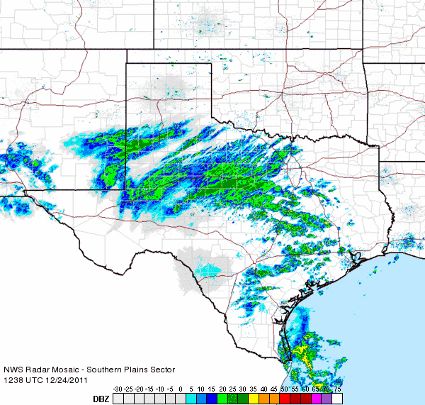
| Radar reflectivity animation valid from 6:38 am to 7:48 am on Christmas Eve (24 December 2011). | |
| The snow eventually expanded into the southern Texas Panhandle and Rolling Plains Christmas Eve night (below). | |
|
|
|
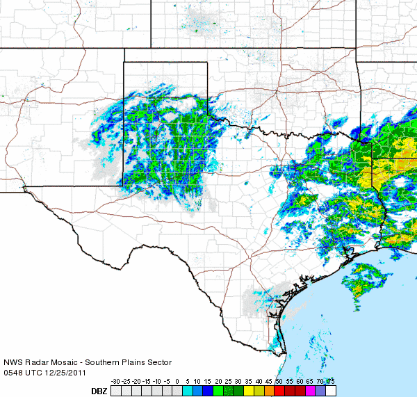
| Radar reflectivity animation valid from 11:48 am Christmas Eve to 12:58 am on Christmas Day. | |
| The snow persisted across a good portion of the southern Texas Panhandle through Christmas Day (below). One snow band even redeveloped early on the 26th and brought an inch or two to several locations across the extreme southwest Texas Panhandle into the northwest South Plains. | |
|
|
|
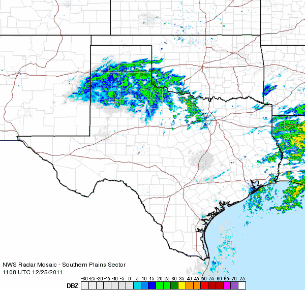
| Radar reflectivity animation valid from 5:08 am to 6:18 am on Christmas Day. | |

