| April 1, 2013 Severe Thunderstorms and A Tornado |
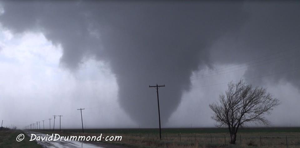 |
| Picture taken by David Drummond of the Silverton Tornado. The picture was taken about a mile east of the intersection of FM 145 and State Highway 86, looking west. The tornado at this time is just north of FM145. |
|
|
|||
|
Toggle Storm Reports
|
Toggle Tornado Damage Survey
|
Maximum Expected Hail Size
|
Radar Rotation Tracks
|
|
Some Data courtesy of the National Severe Storms Laboratory
|
|||
The Silverton tornado has been rated an EF1 by a survey team from the Lubbock NWS office. The Public Information Statement on the tornado can be found here.
A text summary of the preliminary storm reports for this severe event can be found here.
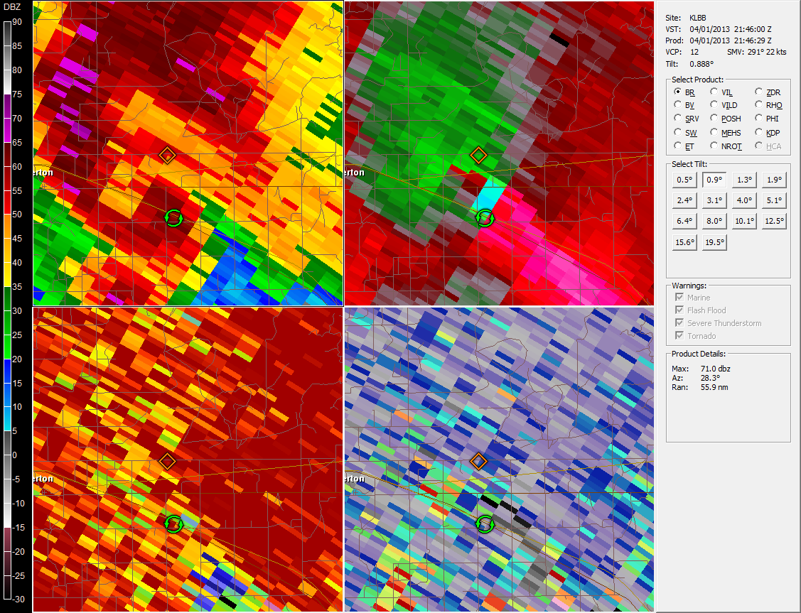 |
| Data from the Lubbock NWS Radar near the midpoint of the tornado track. The 0.9 degree tilt shown here is at an elevation approximately 7000 feet AGL. The circulation symbols in the upper two panes of the above photo show the radar estimate of the tornado TVS (tornado vortex signature). The actual track based on the survey put the tornado track a bit farther south than the radar data suggested. The radar data above are from approximately 4:46 pm CDT, Monday, April 1, 2013. |



 Follow us on X
 Follow us on Facebook
 Follow us on YouTube
 LUB RSS Feed


