
Dangerous heat will expand from the Gulf Coast into the Southern Plains and Desert Southwest through week's end. Additional extreme heat impacting the Pacific Northwest will shift to the northern Plains by the weekend. Tropical Storm Bertha is expected to continue to impact portions of the northern Gulf Coast from the western Florida Panhandle to southeastern Louisiana through tonight. Read More >
 |
|
 |
|
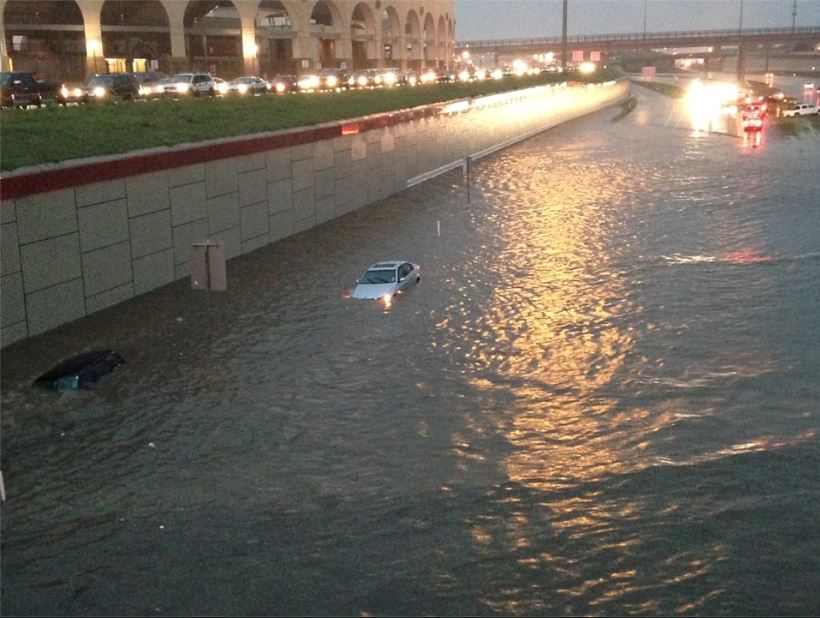
| Flooding of Marsha Sharp Freeway near University Avenue in Lubbock on the evening of Wednesday, September 24th. The image is courtesy of KCBD. | |
| After a couple of early month rainfall events this September, a long stretch of wet weather took place across the plains of West Texas from September 14th through September 24th. Along with this being the time of year where stronger cold fronts begin making their way south well into Texas, tropical weather also tends to peak in intensity through early to mid-September. The upper level forcing responsible for much of this rainfall was due to the remnant energy associated with former Hurricane Odile as it moved east from the Pacific Ocean and became nearly stationary near the Trans-Pecos and Permian Basin into southeastern New Mexico. In addition to providing upper level support, Odile also transported copious amounts of moisture into the region, setting the stage for heavy rainfall wherever showers and thunderstorms developed. | |
 |
|
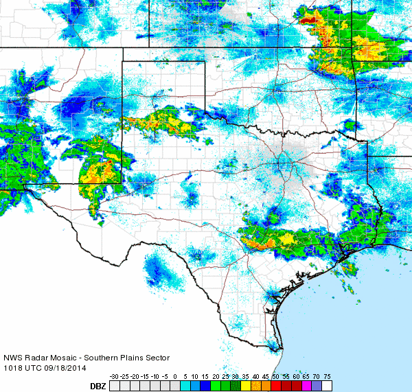
| Regional radar animation from 5:18 to 6:28 am on Thursday September 18th. | |
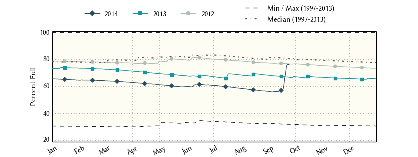
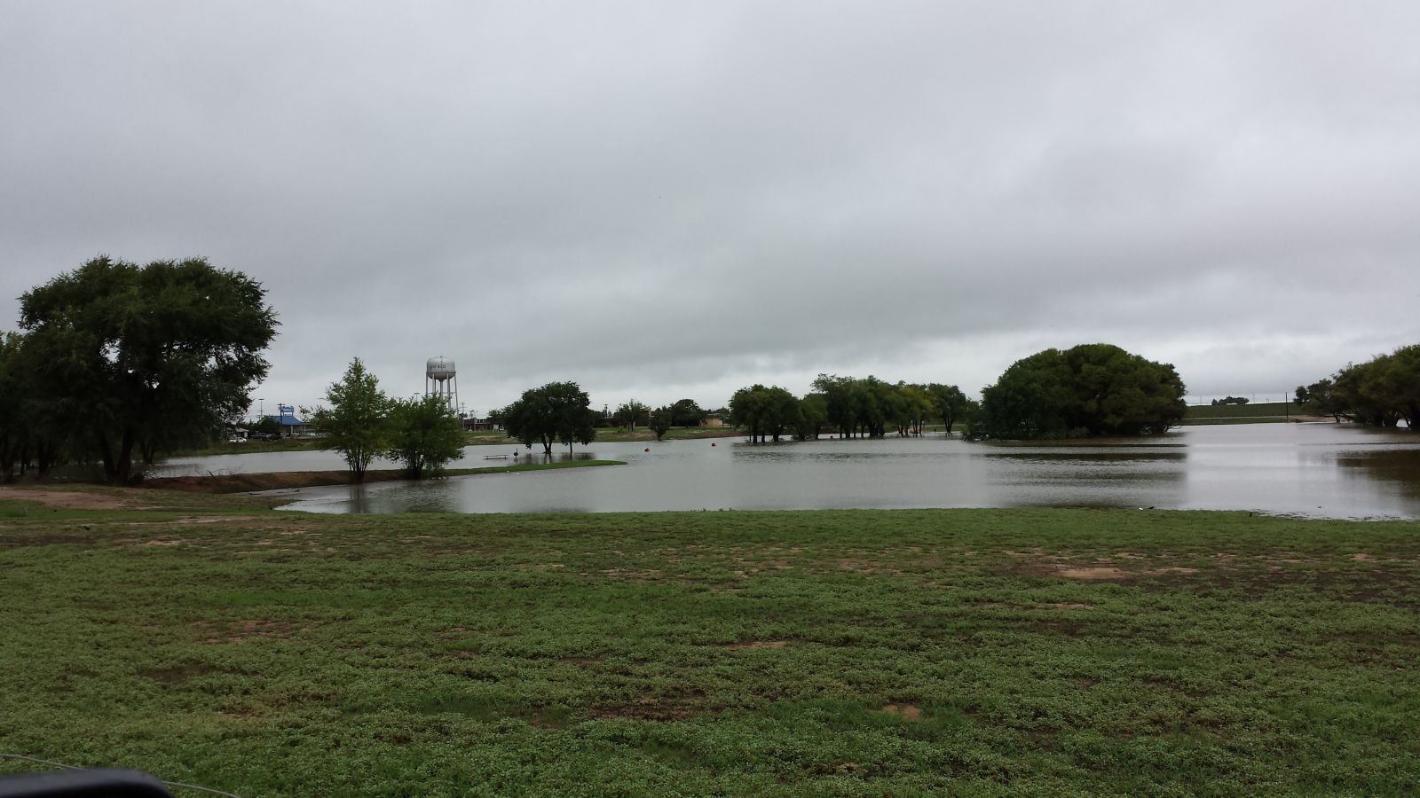
| Beneficial rainfall was received across much of the region, especially the southern South Plains where upwards of 10 inches fell in select locations. Area lakes all responded favorably, including Lake Alan Henry which experienced a 20% increase in water corresponding to a 9 foot rise during the past month. White River Lake's smaller watershed still managed to push its water level to the highest seen since early 2013. | |
 |
|
| Statistics for Lake Alan Henry over the past three years. | |
| Unfortunately, flooding was also a concern throughout the event. The most extensive flooding was noted during the morning and afternoon of the 18th (Thursday) from the northern South Plains into portions of the western Rolling Plains where several inches of rain fell in the span of mere hours. Although not as widespread, additional flooding was noted on the 20th (Saturday) and 21st (Sunday) generally from Terry County east to Garza County. Some highways were shut down as they became engulfed in standing water and thick mud. Many playa lakes were filled to capacity, and several over spilled and led to inundation flooding. The Double Mountain Fork of the Brazos River rose above action stage Saturday September 20th, but quickly fell below as the rain eased up. | |
 |
 |
|
Flooding of the Double Mountain Fork of the Brazos River along Highway 84 (left) and an over spilling playa lake in Brownfield (right) on Saturday, September 20th. The left picture is courtesy of KCBD and the right is from Mitch McElroy. |
|
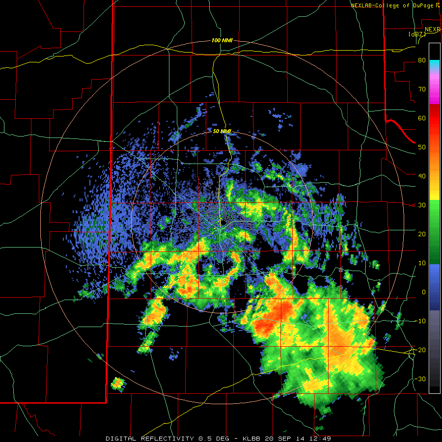
| The thrust of the heaviest rain on September 20th (Saturday) was across the southern South Plains and points south. An area of very heavy rain setup and did not move for several hours, with the torrential rains focused over Borden County. The West Texas Mesonet site near Gail recorded an incredible10.81 inches, much of which fell in a four hour period. This resulted in extensive flooding in Gail, but did provide a tremendous surge of water down the Colorado River and into Lake J.B. Thomas, raising its level 35 feet from 1% capacity to 46.5%. | |
 |
|
| Lubbock National Weather Service radar animation valid from 8 am to 5 pm on Saturday, September 20, 2014. | |
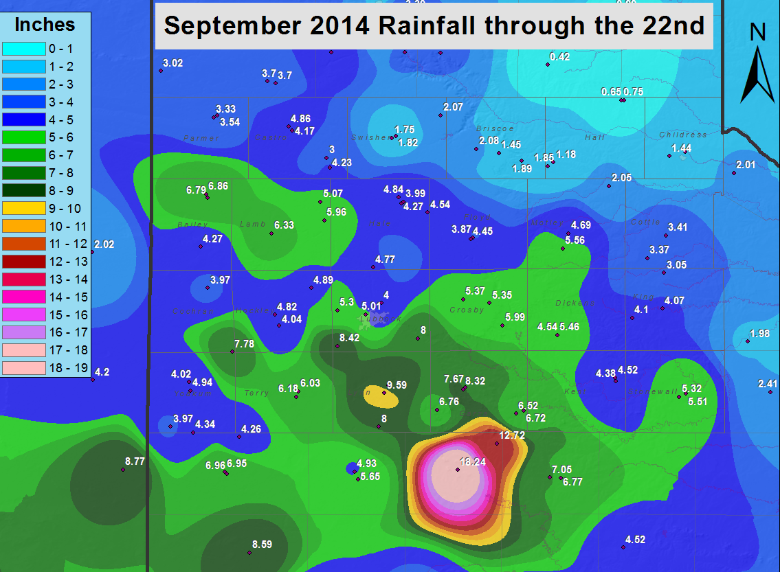
| Over the course of September (through the 22nd), many locations across the South and Rolling Plains recorded over 4 inches, with pockets of 8+ inches. As the below graphic illustrates, the heaviest rain was focused along an axis from southern Lubbock County through much of Lynn and Dawson Counties. On the other extreme, the southeast Texas Panhandle largely missed out on the heavy rain, tallying less than 2 inches for the whole period. | |
 |
|
| Rainfall totals from September 1st through 22nd. For a larger version, CLICK HERE. | |
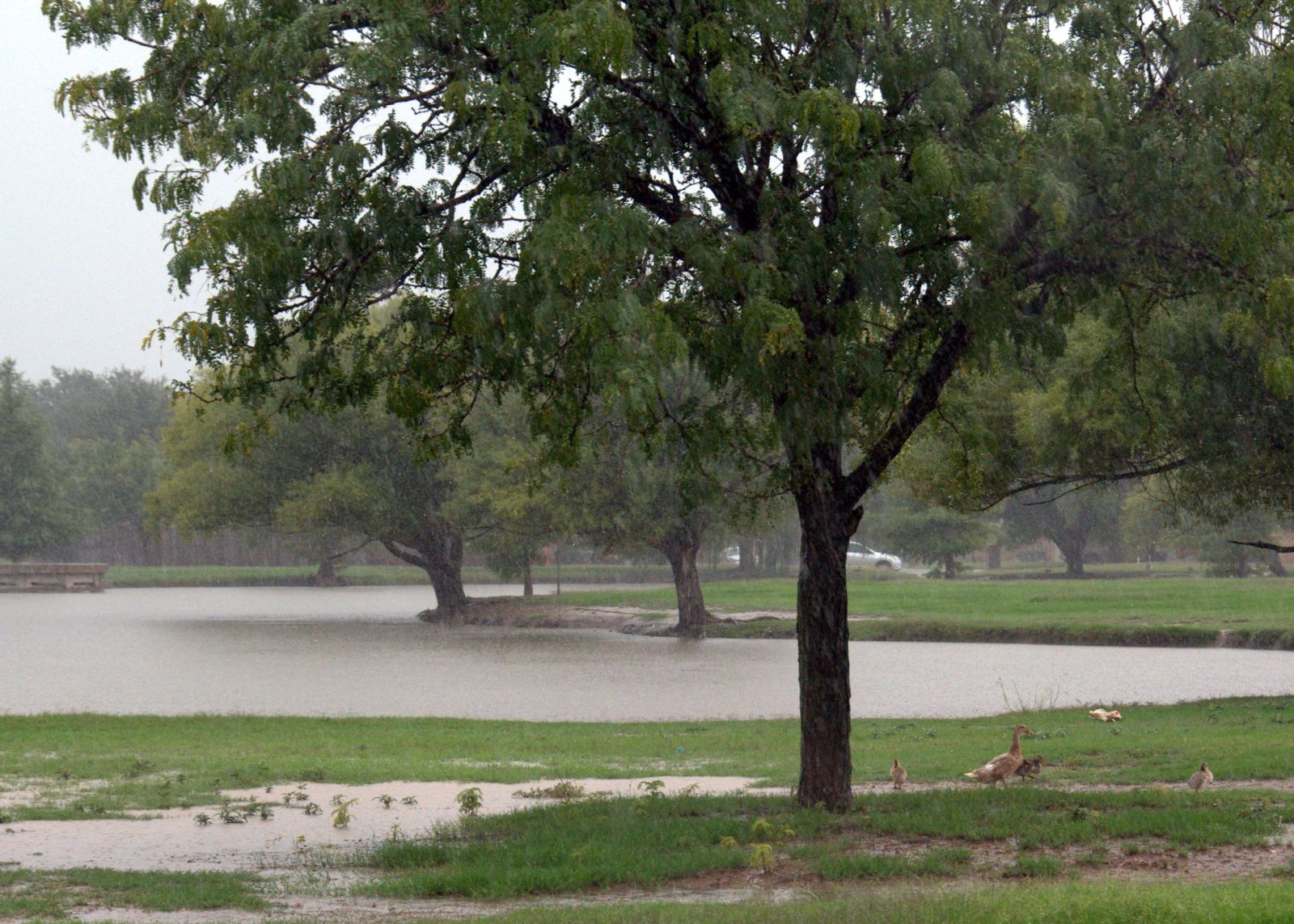
| Although the heavy rain did create some flooding problems, it also put an end to the short term drought in many spots, while also helping to ease the longer term hydrologic drought. The filled playas around the region were also a welcome sight to the waterfowl. | |
 |
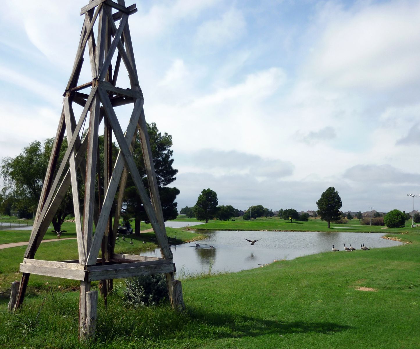 |
| Full playa lakes and happy waterfowl seen in Lubbock. The images are courtesy of Mark Conder. | |
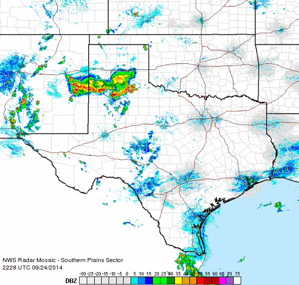
| After a couple day reprieve from the widespread heavy rain, Wednesday, September 24th brought one final round of heavy rain to the South Plains. Plentiful amounts of moisture remained in the region, and this time a southward dropping upper level disturbance sparked a complex of thunderstorms that sagged slowly southward, bring gusty winds, plenty of lightning and very heavy rainfall. This heavy rain fell on already saturated grounds and produced areas of flooding (like seen in the image at the top of this page). Lubbock officially recorded 2.94 inches with this final round of storms, much of which fell in a short amount of time. | |
 |
|
| Regional radar animation from 6:28 to 7:38 pm on Wednesday, September 24th. | |
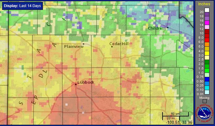
| The widespread rainfall gradually diminished late Wednesday night, though a small pocket of moderate to heavy rain did persist across the western South Plains into Thursday, dropping another 2.26 inches at the Plains West Texas Mesonet site that morning. After all was said and done, many locations across the South Plains and Rolling Plains recorded 2.5 to 6 inches of rain over the two week stretch ending on September 25th. | |
 |
|
| Fourteen day radar-estimated (and bias-corrected) rainfall ending at 10 am on Thursday, September 25, 2014. | |
| Even heavier rain impacted parts of the Permian Basin into southeast New Mexico over mid-September, with a few spots recording over a foot of rainfall. Unfortunately, flash flooding did claim the life of one oil field worker near Loving, NM, when his vehicle was overcome by flowing flood waters on Friday, September 19th. In addition, dozens of people were rescued over portions of southeast New Mexico into the Permian Basin. | |
 |
|
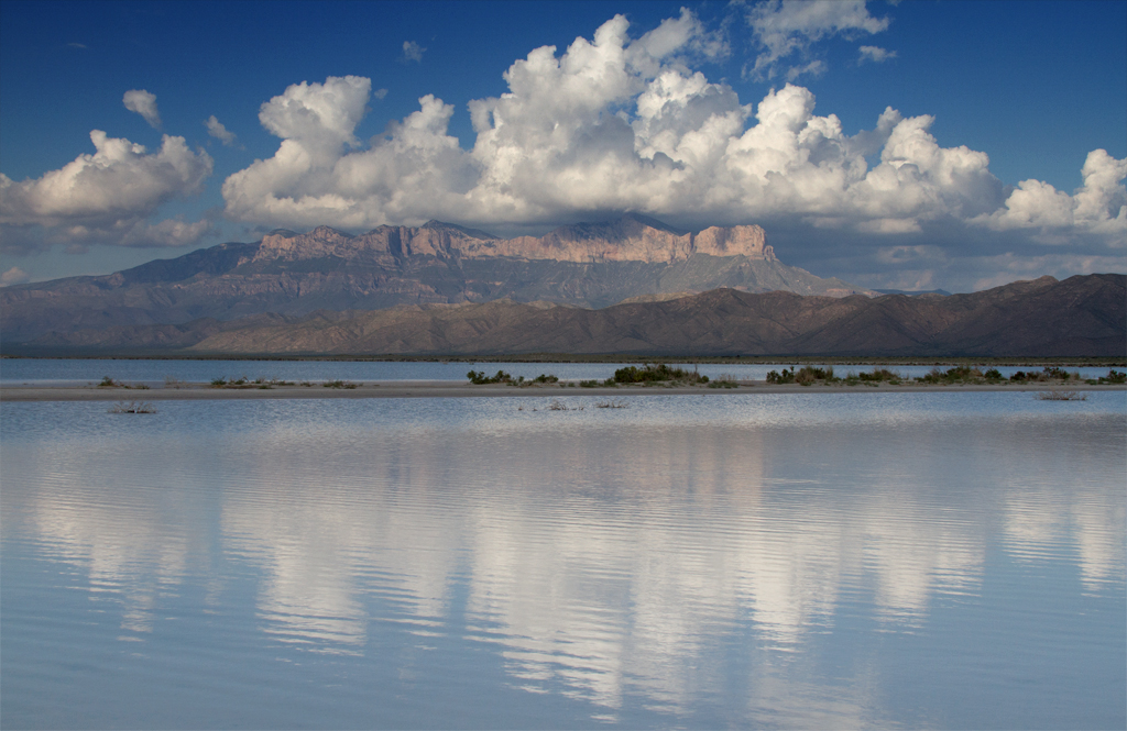
| Picture of the filled Salt Flats (foreground) and Guadalupe Mountains (background) on September 25, 2014. The image is courtesy of Bruce Haynie. | |
|
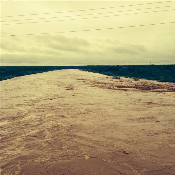
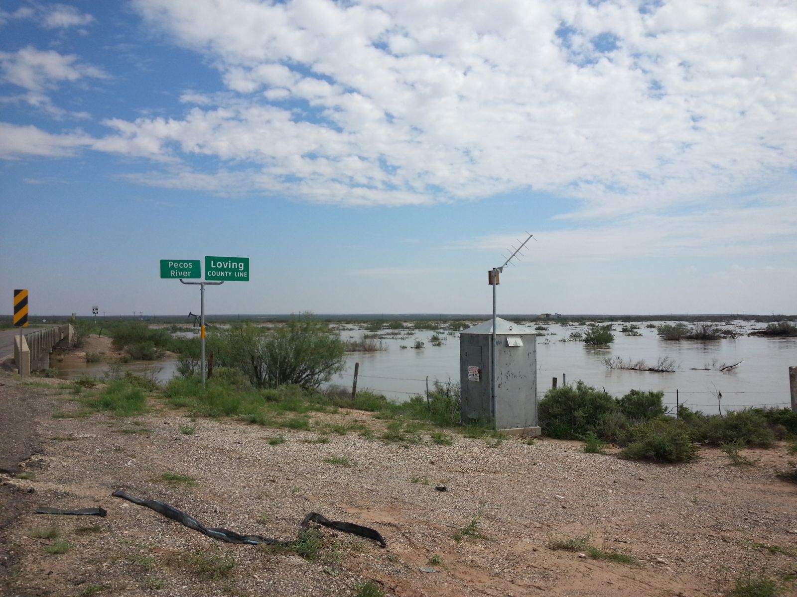
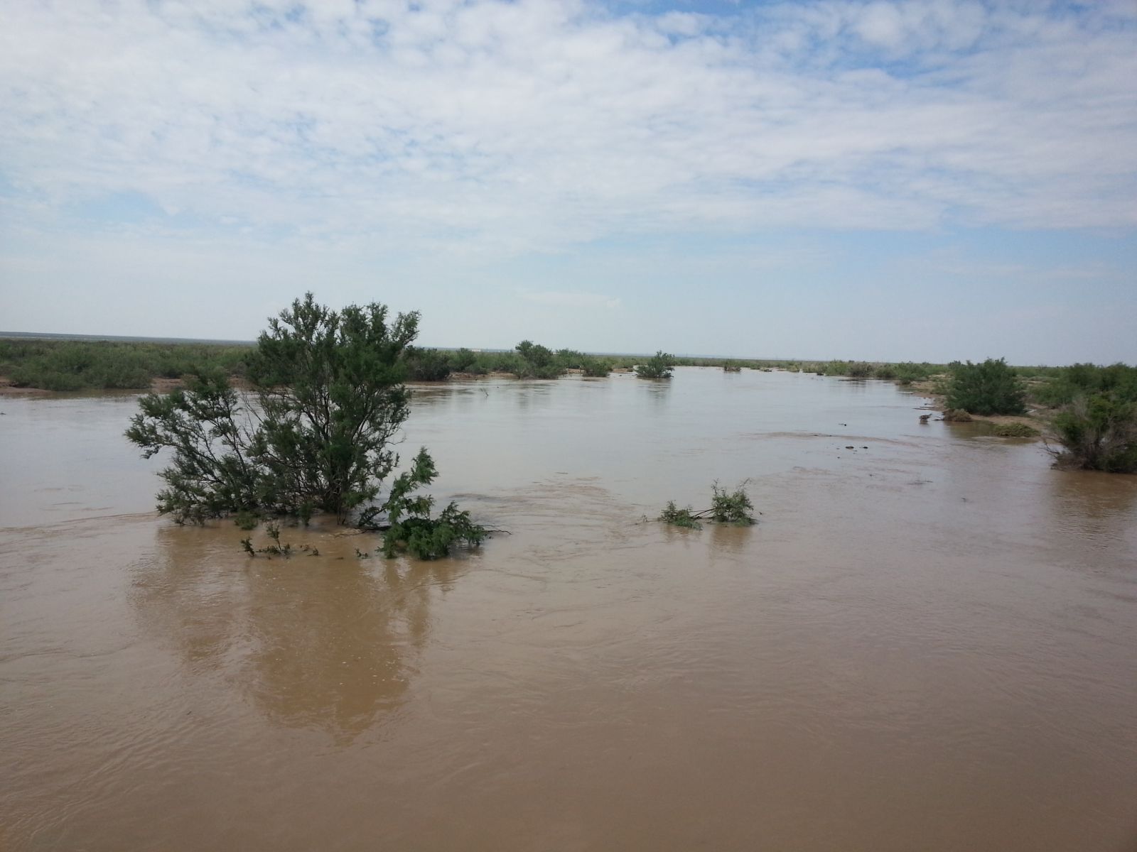
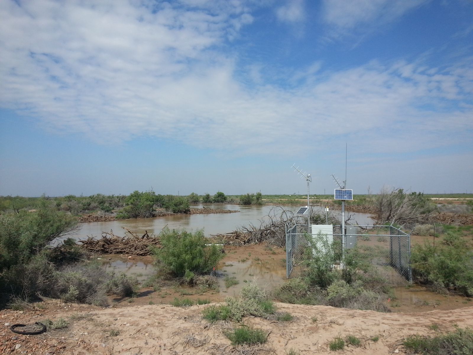
The heavy September rains also caused the Pecos River to rise out of its banks, spilling into the surrounding flood plain and threatening the city of Pecos. On the positive side, the rain did fill the Salt Flats southwest of the Guadalupe Mountains providing the beautiful view above. Also, the excessive runoff helped fill reservoirs that were in desperate need of water, including Lake J.B. Thomas and Lake Alan Henry (discussed earlier in the article), as well as Red Bluff Reservoir. |
|
 |
 |
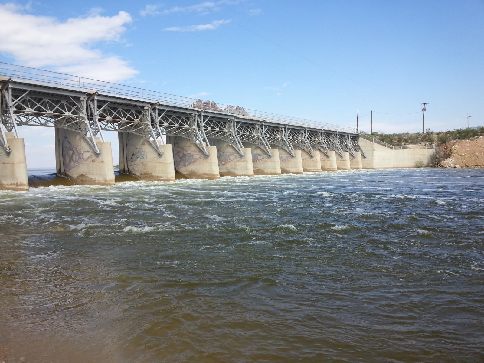
| Water spilling out of Red Bluff Reservoir on September 24, 2014. The reservoir is located on the Pecos River southeast of Carlsbad and east of Guadalupe Mountain National Park. | |
| The excessive runoff from the September rains raised the Red Bluff Reservoir from just over 50% of conservation level to begin the month to over capacity by late in the month. The addition of over 100,000 acre-feet of water also helped to push Red Bluff to heights it hadn't seen since the early 1990s. | |
 |
 |
 |
 |
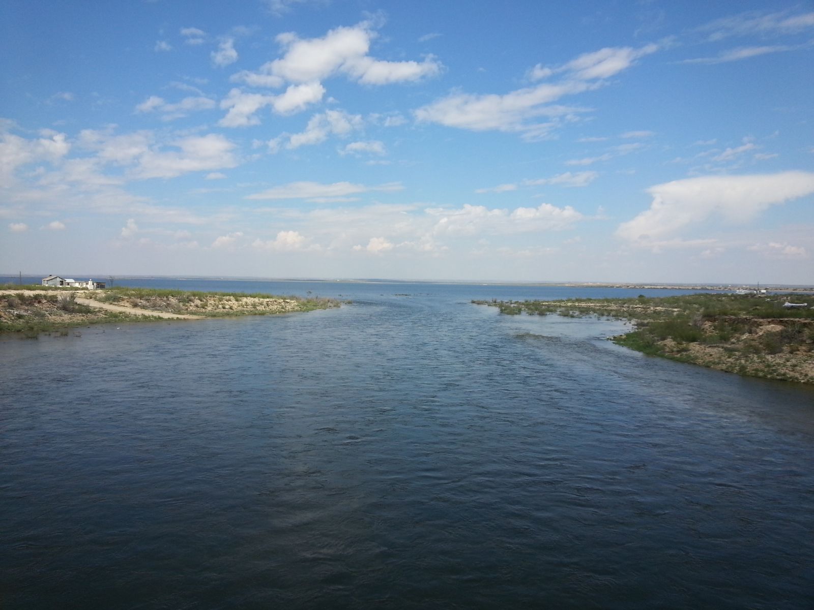
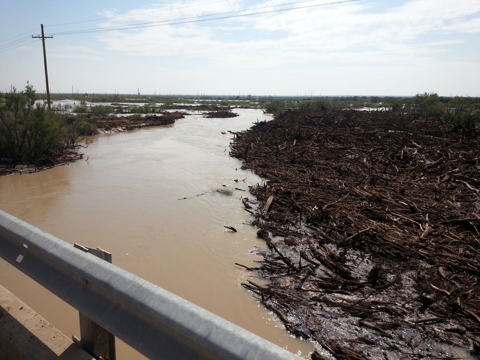
| Several views of the swelling Pecos River between Red Bluff Reservoir and the town of Pecos on September 24, 2014. | |
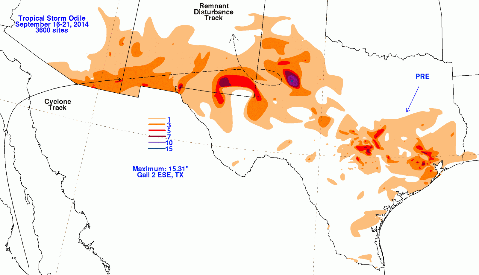
| Below is a post-storm summary of Tropical Storm Odile, produced by the Weather Prediction Center (WPC). Note the loop to the track of Odile's remnants when it paid an extended visit to West Texas. | |
 |
|
| Track of Tropical Storm Odile and its remnants during mid-September of 2014. The observed rainfall (inches) is shaded in. The graphic is courtesy of WPC. | |

