
Scattered thunderstorms with severe gusts, hail and a tornado risk are possible near a cold front from the Ohio Valley to the Mid-Atlantic tonight. Tropical Storm Bertha is expected to bring tropical storm conditions to portions of the Gulf Coast from the panhandle of Florida into Louisiana through Wednesday. Read More >
| A Shot of Winter for West Texas 10-13 November 2014 |
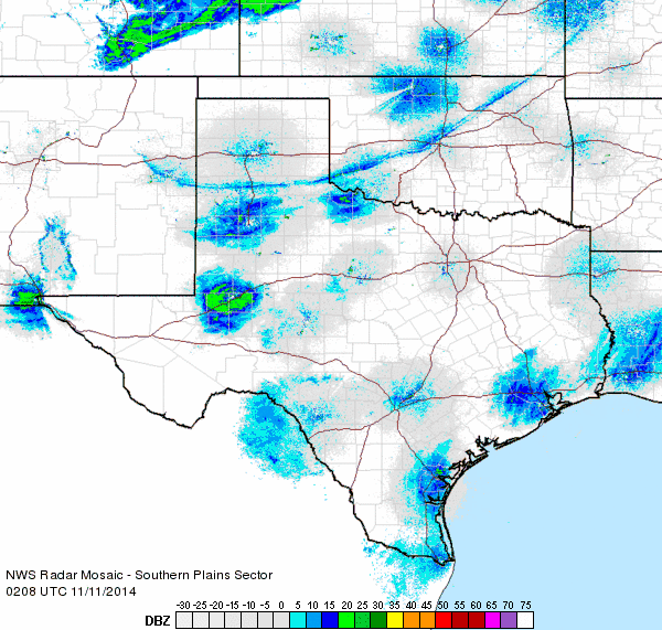 |
| Regional radar loop valid from 8:08 to 9:18 pm on Monday, 10 November 2014. |
| November of 2014 started on the mild side, peaking on Monday the 10th when gusty westerly winds pushed highs into the upper 70s to middle 80s. Childress even broke a record high when it reached 87 degrees, surpassing the previous short-lived record of 85 degrees set in 2012. This unseasonable warmth came to a quick and dramatic end Monday evening as a cold front blasted southward and opened the gates to air that originated in the northern expanses of Canada. Although the frontal passage was a dry one, the leading edge was clearly visible on radar as it pushed southward through Oklahoma and West Texas (see the above animation). |
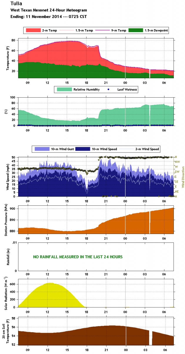 |
| Meteogram showing the 24-hour temperature and dewpoint at the Tulia West Texas Mesonet site ending at 8 am on Tuesday, 11 November 2014. For a more detailed meteogram, click on the image. |
|
Northerly winds sustained at 25 to 35 mph, with gusts around 50 mph were common immediately behind the front. The strong winds quickly carried in much colder air, with temperatures dropping from the 60s and 70s into the 40s in the matter of 10s of minutes, as the above graph illustrates. The gusty northerly winds continued through the night with temperatures gradually dropping into the 20s for all of the South Plains and Rolling Plains by dawn on Tuesday. This dramatic cool off brought the first widespread hard freeze of the fall season. Sunny skies following the front Tuesday did allow temperatures to recover into the lower 40s, but readings then dipped into the teens and lower 20s early Wednesday (Nov. 12th). Lubbock tied its record low for the date when the mercury dipped to 19 degrees. Skies then clouded up and this kept temperatures from climbing much and afternoon highs only climbed into the 20s and lower 30s. Lubbock reached 27 degrees which was the coldest high temperature for the date, breaking the previous record of 32 degrees (set in 1916). More frigid readings followed into Thursday morning with lows again in the teens and lower 20s. In addition, a few spots on the Caprock also saw some snow flurries through much of the night. A few areas even managed to pick up some trace amounts of snow on rooftops and grassy surfaces. |
|
|
||||
|
Toggle High on Monday (2014/11/10)
|
Toggle Lows on Tuesday (2014/11/11)
|
Toggle Low on Wednesday (2014/11/12)
|
Toggle High on Wednesday (2014/11/12)
|
|

