
Numerous severe thunderstorms are expected across a broad region from the Ohio Valley to the Mid-Atlantic and Northeast States today into tonight. Swaths of damaging wind gusts are expected and some tornadoes are possible. Bertha is expected to bring tropical storm conditions to portions of the Gulf Coast from the Florida Panhandle westward to southeastern Louisiana later today and Wednesday. Read More >
| First Round of Severe Storms for the South Plains 10 April 2016 |
||
 |
||
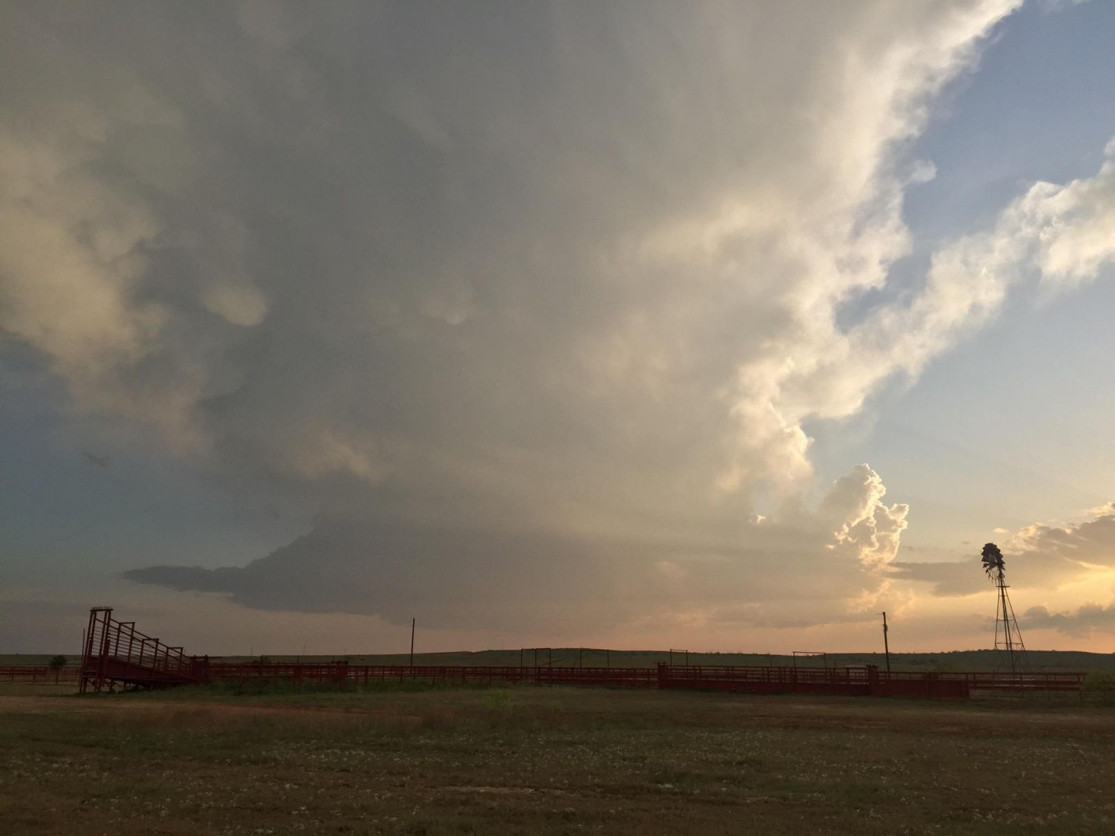
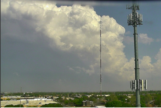
| Picture and radar depiction of a low-precipitation (LP) supercell storm near Spur around 7:30 pm on 10 April 2016. The picture is courtesy of Bruce Haynie. Click on the image for a larger view of the photograph. | ||
| Right on schedule, April supplied West Texas with its first round of severe weather for the 2016 spring season. A few thunderstorms developed early Sunday afternoon (10 April) as an initial upper level disturbance approached from the southwest. This relatively early day activity was rather tame as temperatures and instability were still on the lower side. | ||
 |
||
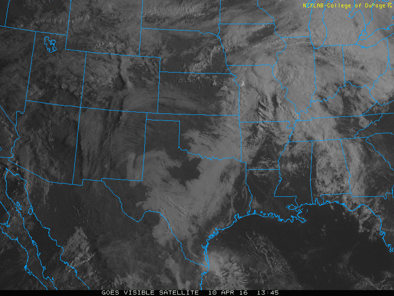
| Visible satellite animation valid from 8:45 am to 2:15 pm on 10 April 2016. | ||
| However, the thunderstorms quickly grew in intensity and coverage during the late afternoon and evening hours as instability was maximized and better lift and stronger winds aloft emerged from the Desert Southwest. The late afternoon thunderstorms were relatively discrete, and started producing large hail shortly after fully utilizing the instability available. | ||
 |
||
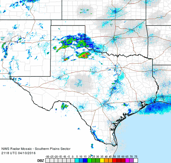
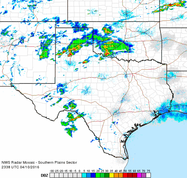
| Regional radar animation valid from 4:18 pm to 5:28 pm on 10 April 2016. | ||
| One isolated and particularly intense rotating storm (supercell) developed just south of Lubbock and then tracked steadily eastward through the Rolling Plains and eventually into North Texas, lasting over 6 hours. A couple of different views of this storm can be found below. | ||
 |
||
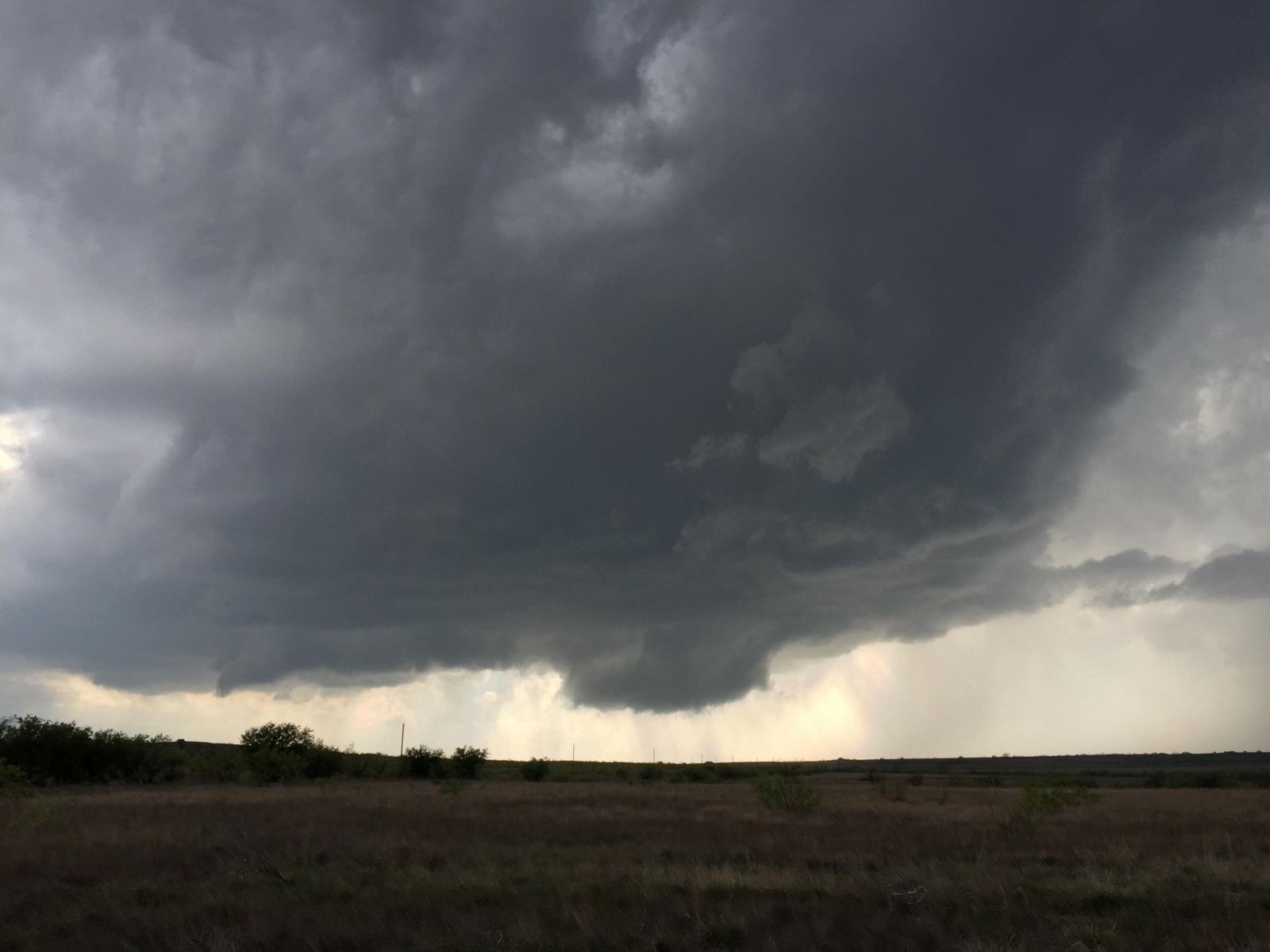
| Base and wall cloud of a storm west of Dickens at 5:48 pm on 10 April 2016. The picture is courtesy of Bruce Haynie. | ||
| The impressive rotating storm did produce a well-defined wall cloud (seen above), though thankfully it never spawned a tornado. Instead, it did produce very large hail, as big as tennis balls in several locations, as it tracked from north of Slaton to south of Ralls, across Dickens and then north of Guthrie. Even well behind the storm it could be seen towering miles up into the atmosphere. | ||
 |
||
| Storm, as viewed from Lubbock, when it was located northeast of Slaton around 4:30 pm on 10 April 2016. | ||
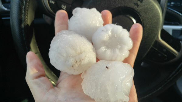
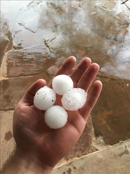
| Below are a couple of pictures of the tennis ball size hail that fell from the long-lived supercell storm that traversed the eastern South Plains and the central Rolling Plains. Unfortunately, this large hail did damage vehicles and buildings, including knocking out several car windows, where it fell. | ||
|
||
| Hail observed in Dickens (left) and north of Guthrie (right) on the evening of 10 April 2016. The left image is courtesy of KCBD and the right image is courtesy of David Drummond. | ||
| In addition to the lone supercell storm, scattered severe thunderstorms also developed across the far northern South Plains into the southern Texas Panhandle. This activity eventually congealed into a complex of storms as it moved eastward, bringing severe wind gusts to southwest Oklahoma during the late evening hours. | ||
 |
||
| Regional radar animation valid from 6:38 pm to 7:48 pm on 10 April 2016. | ||
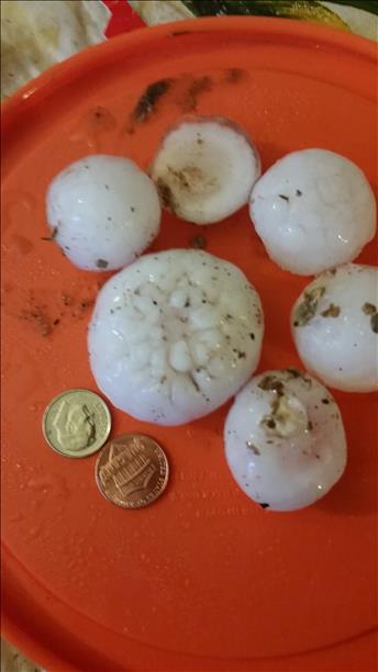
| Although the storms that impacted the southern Texas Panhandle during the evening hours produced no known severe winds, they did also drop large hail in spots. Some of the largest hail here fell with a storm that tracked from Edmonson to Kress. Hailstones of golf ball to tennis ball size were common with this activity too. Eventually, the hail size did decrease somewhat as the storms congealed into a complex and marched across the southeast Texas Panhandle. | ||
|
||
| Hail observed in Edmonson (left) and north of Plainview (right) on the evening of 10 April 2016. The images are courtesy of KCBD. | ||
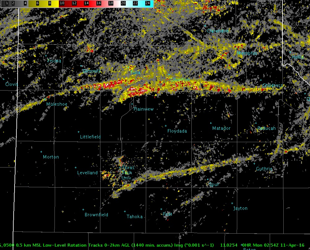
| The below image, derived from radar, nicely depicts where the strongest rotation was sampled within the storms as they tracked across the region. Although no tornadoes were observed with these storms, the added lift from the strongly rotating storms did help to produce the very large hail. The severe thunderstorms did eventually shift east of the area, into southwest Oklahoma and western North Texas, by late evening, leaving a quiet late night in its wake over West Texas. | ||
 |
||
| Low-level rotation track, as derived from radar, for the afternoon and evening of 10 April 2016. | ||
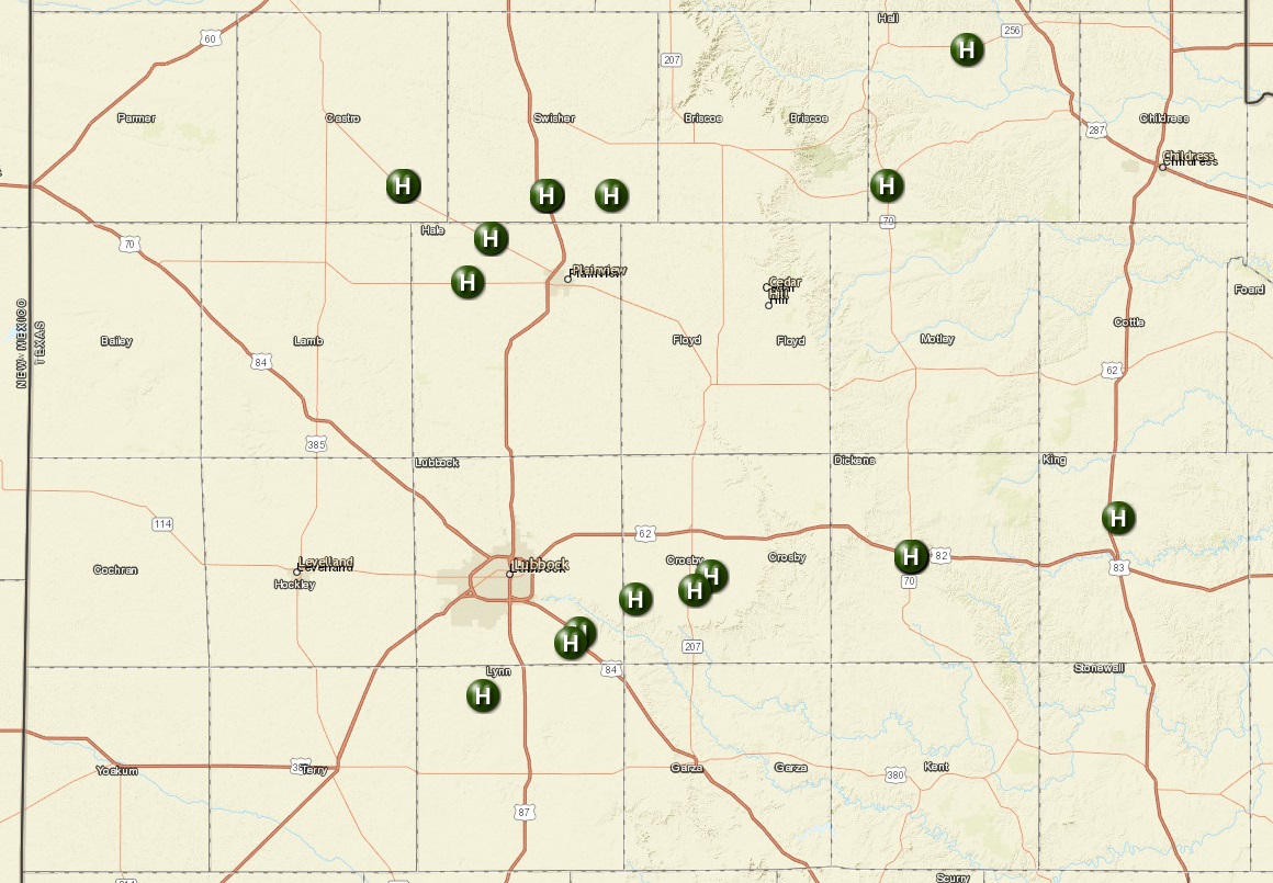
| Below is a plot of the severe hail reports that were received from around the South Plains region during the first severe weather event of the 2016 spring season. A full listing of the Preliminary Storm Reports for the event can also be FOUND HERE. | ||
 |
||
| Plot of the preliminary severe hail reports received from the afternoon and evening of 10 April 2016. | ||
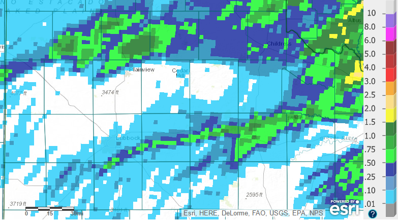
| Outside of the large hail, the thunderstorms did bring welcome rain to portions of the area. A quarter to half inch of rain was fairly common for those that experienced the storms, with more localized spots that recorded over an inch of rain. Unfortunately, though, the rain was rather spotty and many locations missed out altogether. | ||
 |
||
| Bias-corrected radar-derived 24 hour precipitation ending at 7 am on 11 April 2016. Click on the image to see a closer view of the South Plains region. | ||


