Severe Thunderstorms Hit the Rolling Plains
16 April 2016 |
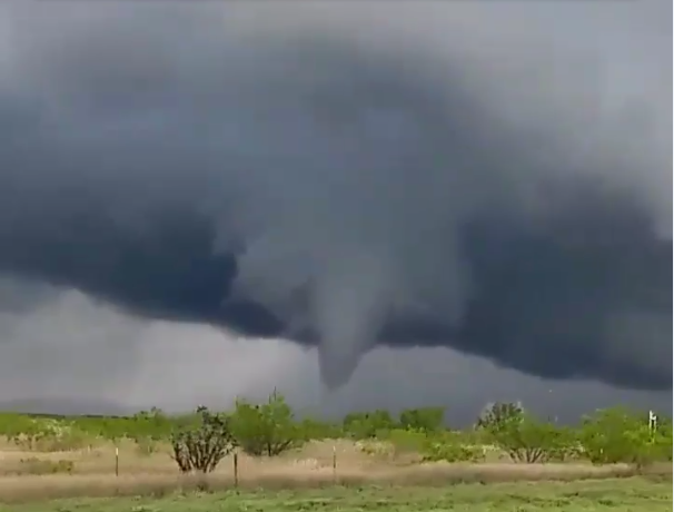 |
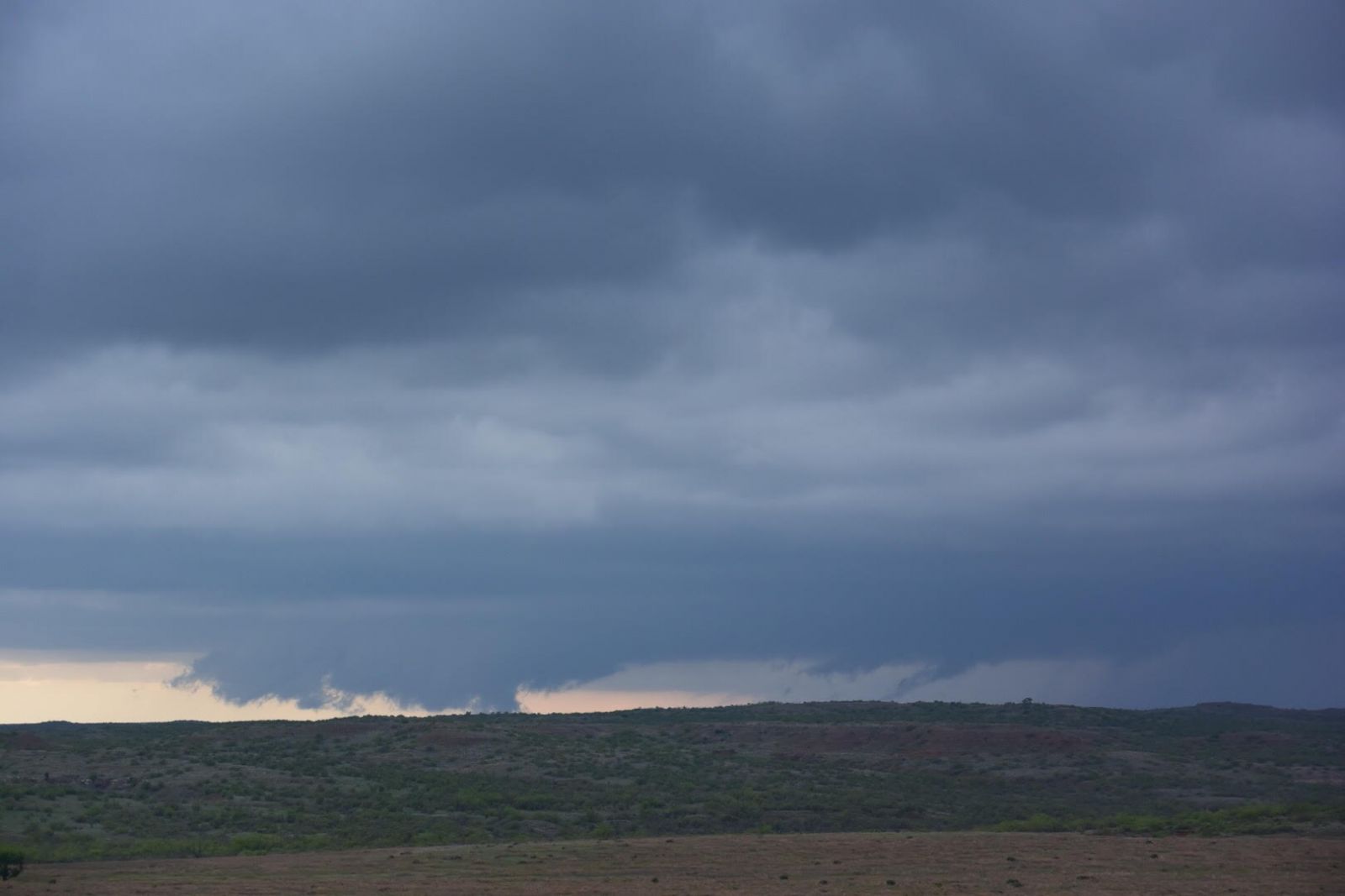
| Funnel clouds (and possible tornado) observed about 8 miles southwest of Girard at 4:55 pm on 16 April 2016. The picture is courtesy of Joe Ponce. |
| |
| A sprawling upper-level storm system moved into the southern Rockies on the weekend of April 15th and 16th, and began to impact the weather from Colorado through West Texas. On Sunday afternoon, scattered thunderstorms formed along a dryline in the eastern South Plains and Rolling Plains. Some of these storms produced large hail, heavy rains, and a few downbursts. One supercell storm produced three EF-0 tornadoes over open land from northeast Kent County into eastern Dickens County. Over three inches of rain fell across portions of Cottle County and caused flooding in the town of Paducah. |
| |
 |
| Water vapor satellite imagery captured between 8:15 am and 7:45 pm on 16 April 2016. |
| |
| The above satellite animation gives a sense of how expansive the slow-moving storm system was. The system dropped feet of snow in portions of Colorado and also contributed to around a foot of rainfall in and around Houston that fell late on the 17th into the 18th. |
| |
 |
| Regional radar animation valid from 6:48 to 7:58 pm on 16 April 2016. |
| |
| The storms fired early Saturday afternoon, then increased in coverage and intensity as they spread eastward through the Rolling Plains producing very heavy rain, large and sometimes copious amounts of hail, and three EF-0 tornadoes. Paducah was particularly hard hit by the rain and hail. |
| |
|
|
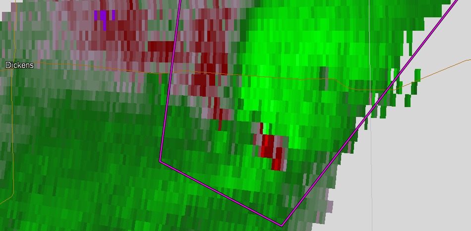
| (left) Storm relative velocity image from the Lubbock WSR-88D at 5:50 PM showing a velocity couplet associated with the second of three tornadoes shown to the right. (right) A large cone tornado around 5:50 PM 13 miles east-southeast of Dickens. This photo is courtesy of Bobby Hines. |
| |
|
|
| (left) Storm relative velocity image from the Lubbock WSR-88D at 6:05 PM showing a distinct rotating couplet associated with the tornado shown to the right. (right) Final tornado 10 miles south of Dumont at 6:05 PM. This photo is courtesy of Bobby Hines. |
| |
|
|
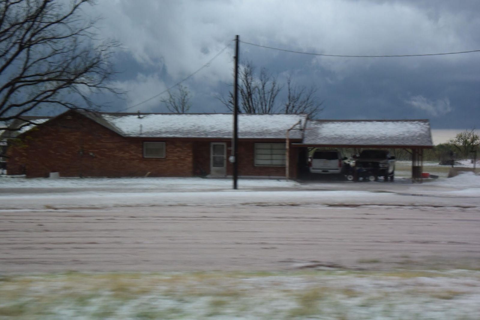
| (left) Low hanging wall cloud southwest of Guthrie during the late afternoon of 16 April 2016. This storm went on to drop bountiful hail in a swath over portions of Dickens, King and Cottle Counties. The pictures are courtesy of Martha and Tim Berry. |
| |
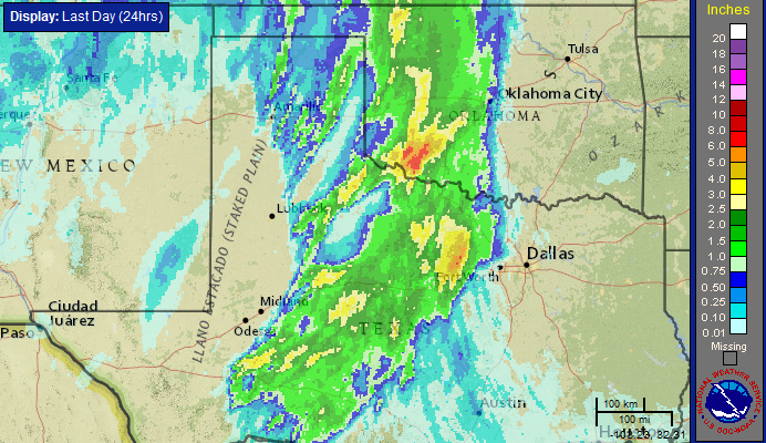
| Although not everyone saw the rain, where the storms tracked repeatedly over the same spots 1 to 3+ inches quickly accumulated. The heavy rain flooded roads and ditches, though no major flooding problems were reported. |
| |
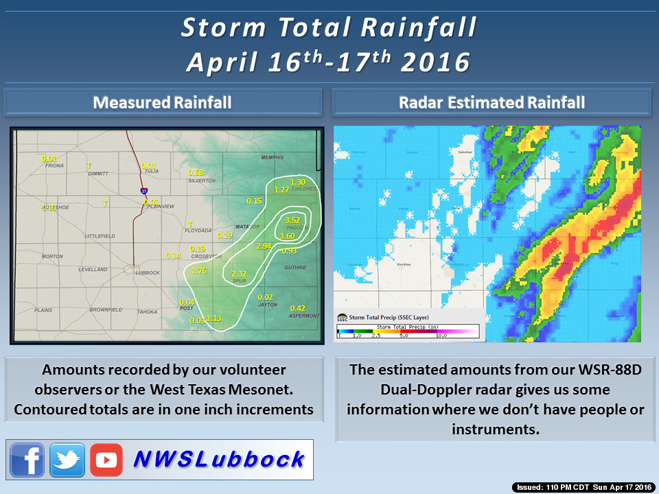 |
| Rainfall measured by gauges (left) and radar (right) from Saturday morning through Sunday morning (16-17 April 2016). For a regional perspective CLICK HERE. |
| |
| Most of the severe weather reports received by the NWS were of large hail, as big as 2.25" (just under tennis ball size) near the town Grow in southern Cottle County, but a wind gust of 73 mph was also recorded by the West Texas Mesonet site in Spur. These strong winds did cause the collapse of one old out-building in Spur. Thankfully, the three tornadoes that occurred were over open land and caused no known damage. |
| |
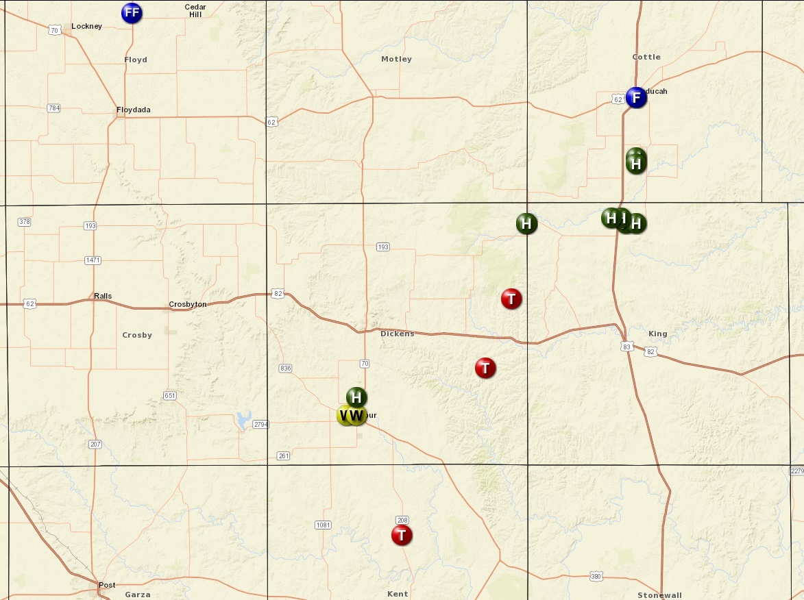 |
| Plot of the preliminary storm reports for 16 April 2016. |
| |
| To view a listing of the Preliminary Storm Reports CLICK HERE. |
| |


