
Scattered thunderstorms with severe gusts, hail and a tornado risk are possible near a cold front from the Ohio Valley to the Mid-Atlantic tonight. Tropical Storm Bertha is expected to bring tropical storm conditions to portions of the Gulf Coast from the panhandle of Florida into Louisiana through Wednesday. Read More >
|
Widespread Raw December Rain 2-3 December 2016 |
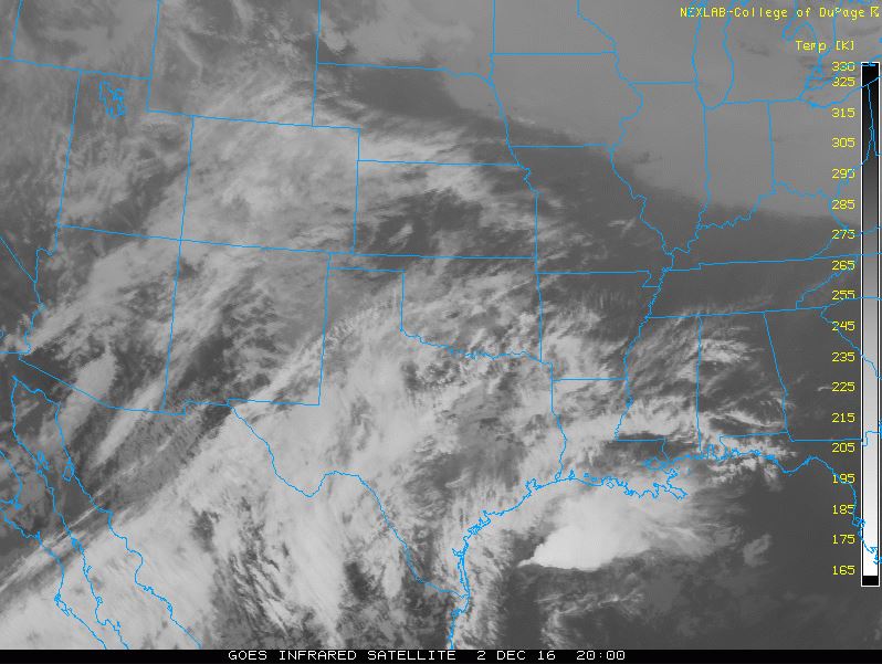 |
| Infrared satellite loop captured from 7:15 am to 8:30 pm on 2 December 2016. The loop is courtesy of the College of DuPage. |
| A developing upper level storm system tracking toward northwest Mexico (seen spinning on the far left side of the above animation) helped pull Gulf moisture northward across Texas as well as abundant middle and upper level moisture off the eastern Pacific. This moisture advanced up and over a weak cold front that had sagged to the south of the region early on Friday (Dec. 2nd). Clouds quickly filled in behind the front early Friday and showers blossomed over West Texas during the afternoon and evening hours (see the below radar animation). A few rumbles of thunder even mixed in over the Rolling Plains Friday afternoon. |
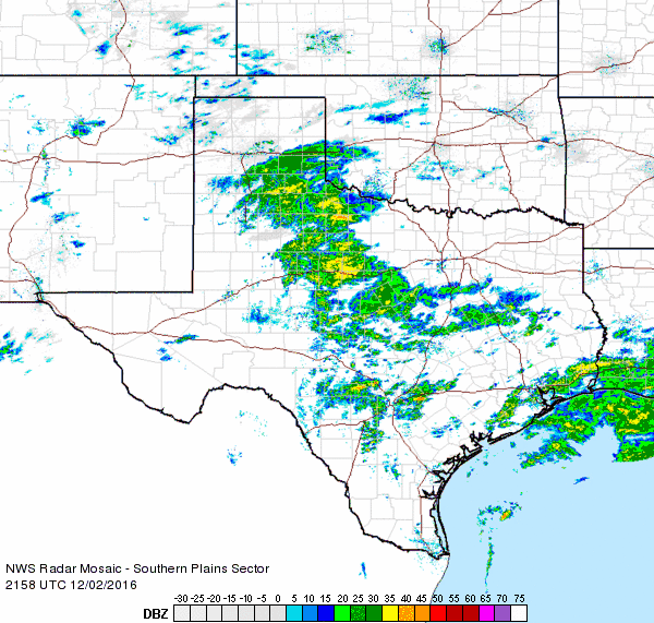 |
| Regional radar animation valid from 3:58 pm to 5:08 pm on 2 December 2016. |
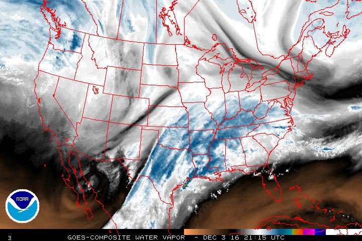
| The satellite image below shows the vast amounts of moisture that was drawn over Texas in advance of the upper level low digging south-southeastward over the Gulf of California Friday evening. |
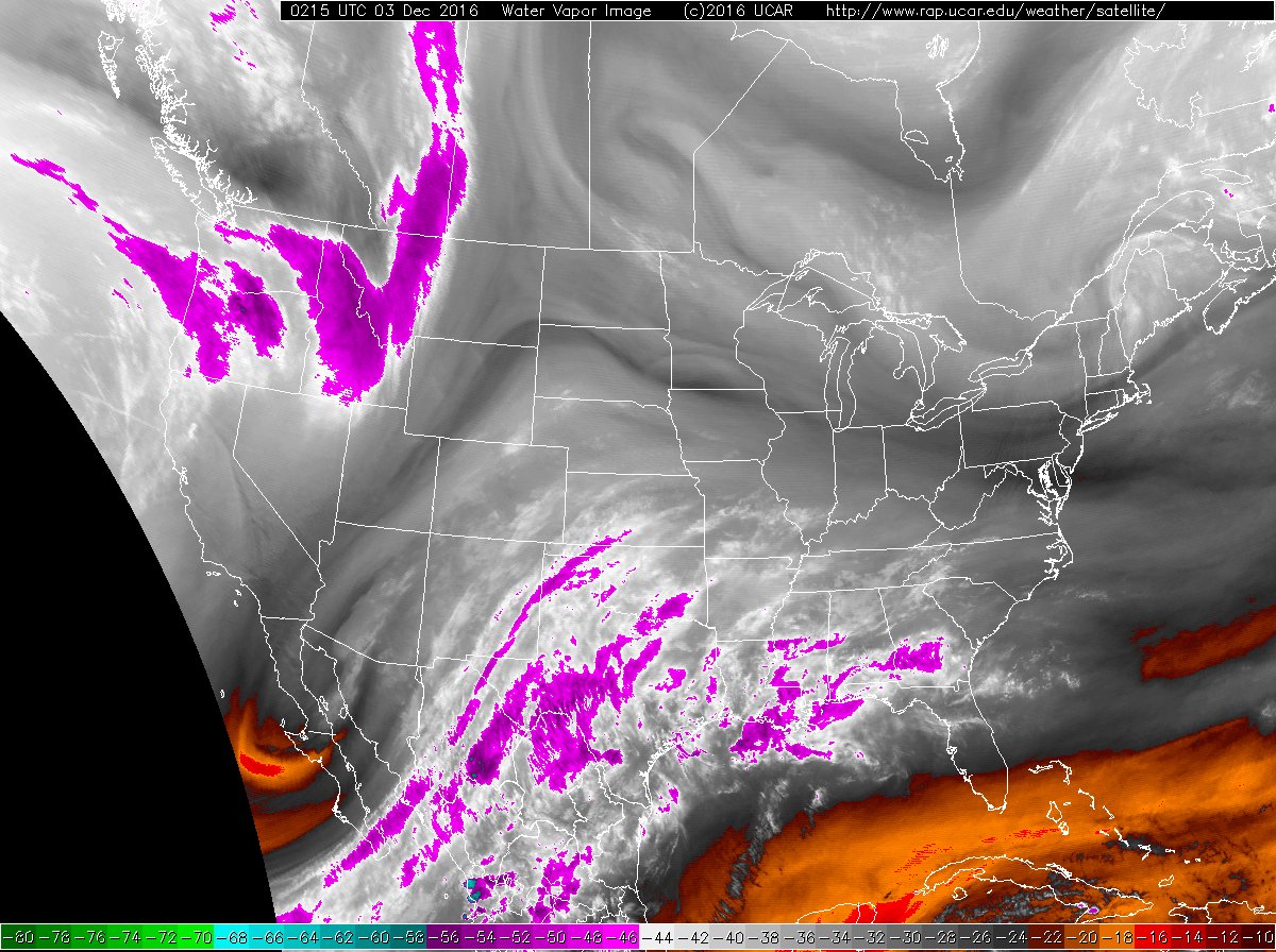 |
| Water vapor image taken at 8:15 pm on 2 December 2016. |
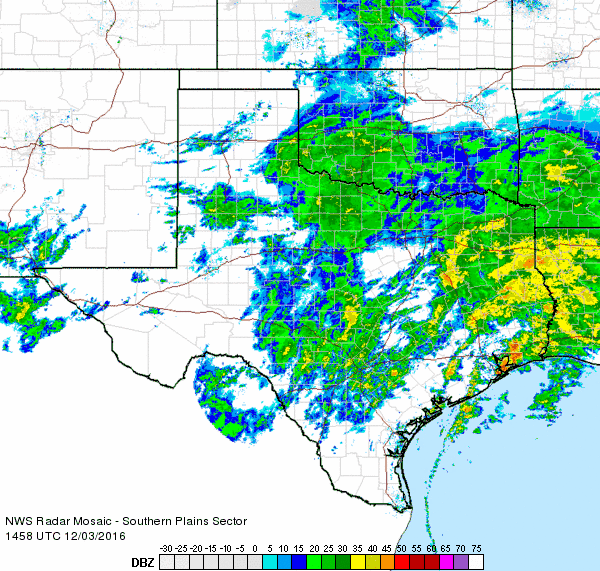
| Periods of rain continued through the night and into Saturday morning (Dec. 3rd) before shifting east into Oklahoma and Central Texas during the afternoon, leaving behind low clouds and drizzle. The combination of the rain and temperatures stuck in the 30s and lower 40s made for a couple of raw days. |
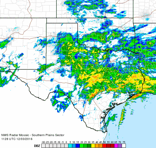 |
| Regional radar animation valid from 5:28 am to 6:38 am on 3 December 2016. An additional animation valid from 8:58 am to 10:08 am can be VIEWED HERE. |
| There was also concern that temperatures could cool just enough to support a wintry mix of precipitation over the southwest Texas Panhandle into the far northwest South Plains late Friday night into Saturday morning. Although a few spots around Muleshoe and Farwell did report a little sleet and snow, marginal temperatures and the lack of more intense precipitation rates prevented any wintry accumulations and roads remained wet. |
 |
| Water vapor image taken at 3:15 pm on 3 December 2016. The image is courtesy of the College of DuPage. |
| One final round of lift ejected from the upper level low still spinning across western Mexico late Saturday, as visualized by the enhanced colors (whites and blues) seen over southeast New Mexico into Far West Texas in the above image. This lift generated another batch of cold rain (see the below radar animation) that moved across a good part of the South and Rolling Plains Saturday evening/night. The rain quickly ended early Sunday morning (Dec. 4th) and skies gradually cleared from north to south as drier air moved in behind a weak frontal boundary. |
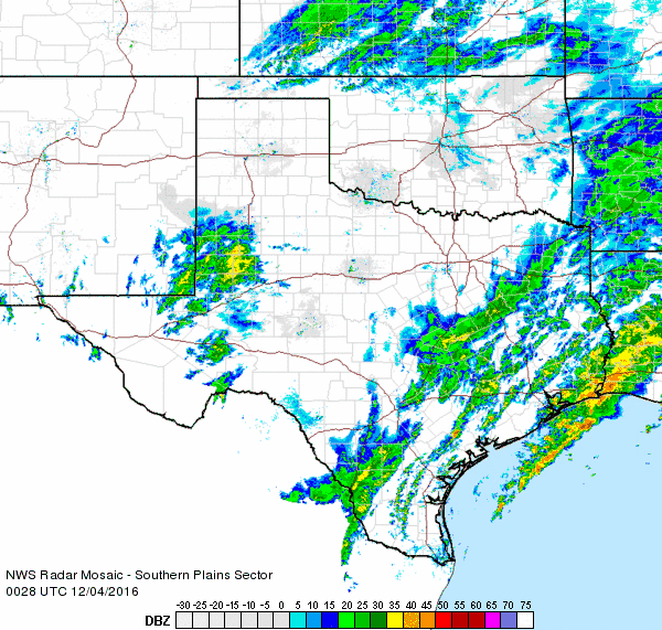 |
| Regional radar animation valid from 6:28 pm to 7:38 pm on 3 December 2016. |
| After all was said and done, most of the region finished with healthy rain totals by December standards, while parts of the southeast Texas Coast into western Louisiana saw excessive rain that measured well into the inches. |
 |
| Radar-estimated and bias-corrected 2-day rain totals at 8 am on Sunday, 4 December 2016. Click on the image for a closer view of the South Plains region. |
| Around the South Plains, one quarter to three quarters of an inch of rain were fairly common, except for the far southwest Texas Panhandle and northwest South Plains, where amounts were lower. Further east, along the edge and off the Caprock, tallies were even higher, from 1.00 to 1.50+ inches. Officially, Lubbock recorded a total of 0.43 inches at the airport for the event. |
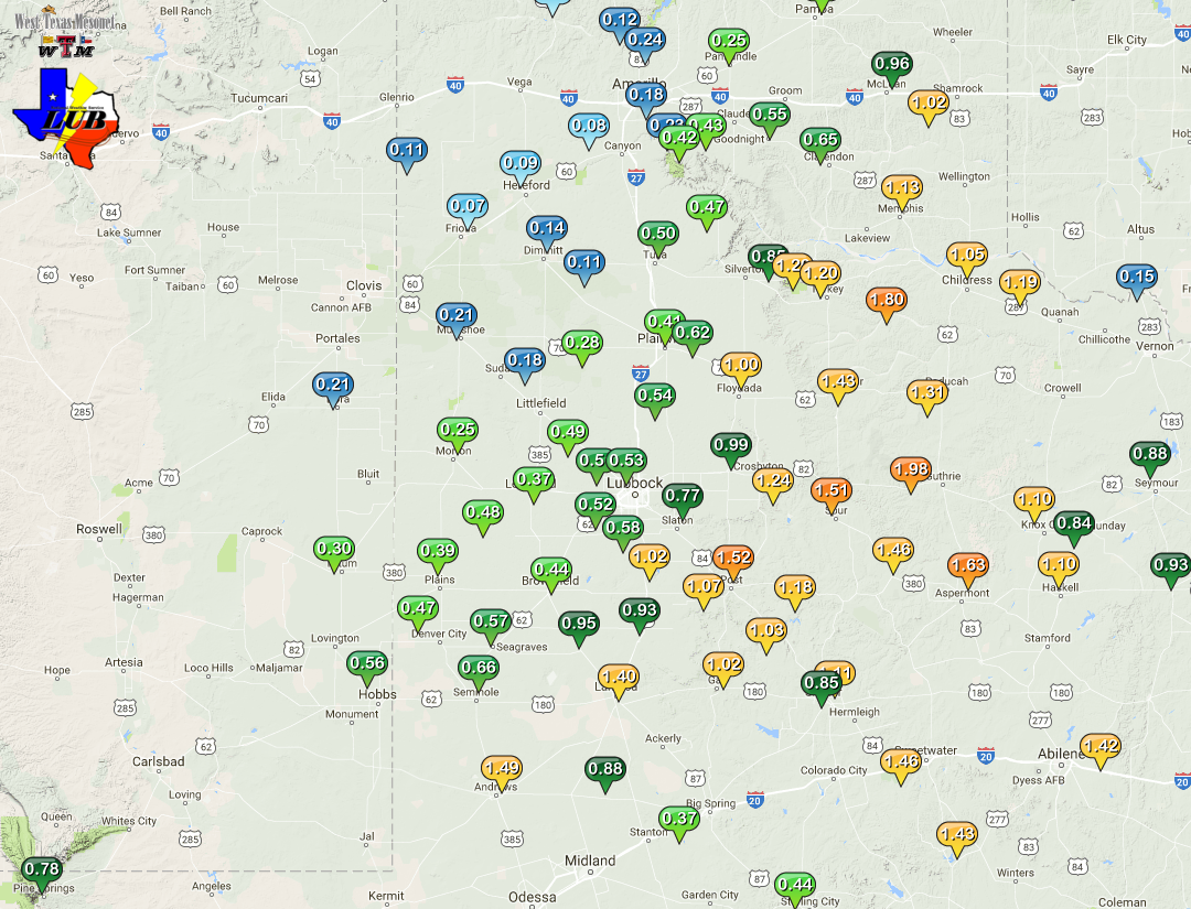 |
| West Texas Mesonet 48-hour rainfall totals measured at 9 am on Sunday, 4 December 2016. Click on the above map for a zoomed out view. |

