
Dangerous heat will expand from the Gulf Coast into the Southern Plains and Desert Southwest through week's end. Additional extreme heat impacting the Pacific Northwest will shift to the northern Plains by the weekend. Tropical Storm Bertha is expected to continue to impact portions of the northwestern Gulf Coast from south central Louisiana to the upper Texas coast today. Read More >
| February Closes with Severe Winds, Blowing Dust and Wildfires 28 February 2017 |
|
 |
|
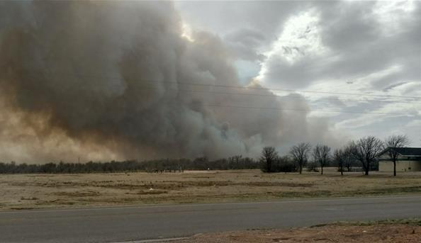
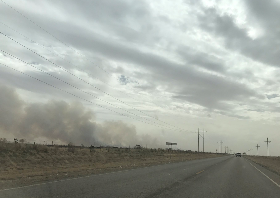
| Large wildfire burning near Sundown, Texas, Tuesday afternoon (28 February 2017). The picture is courtesy of Cindy N. Cole-Mulloy shared via KCBD. | |
| A powerful storm system churning out of the Rockies and into the Plains brought widespread strong winds and blowing dust across the southern High Plains Tuesday afternoon and evening (28 February 2017). The winds also combined with warm and very dry air to create conditions extremely favorable for wildfires. The below water vapor imagery visualizes the eastward moving storm system with very dry air spread out of eastern New Mexico into West Texas. | |
 |
|
| Water vapor imagery valid from 11:45 am to 7:45 pm on 28 February 2017. | |
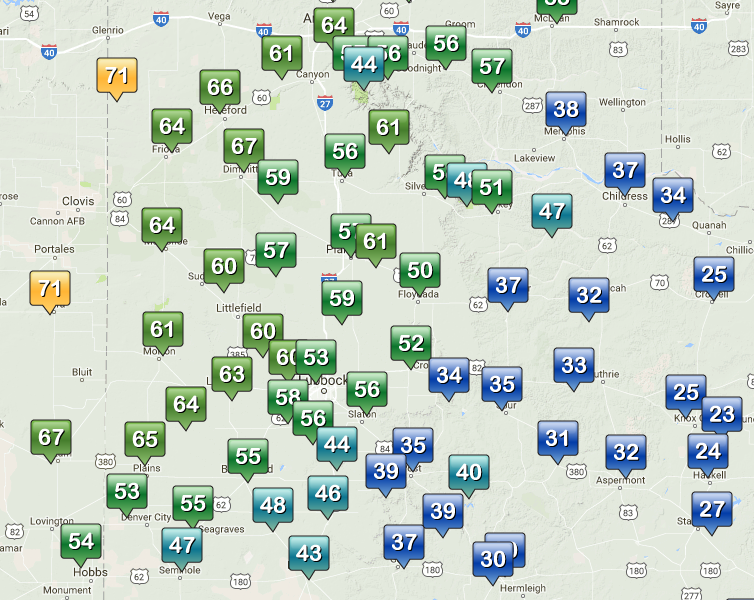
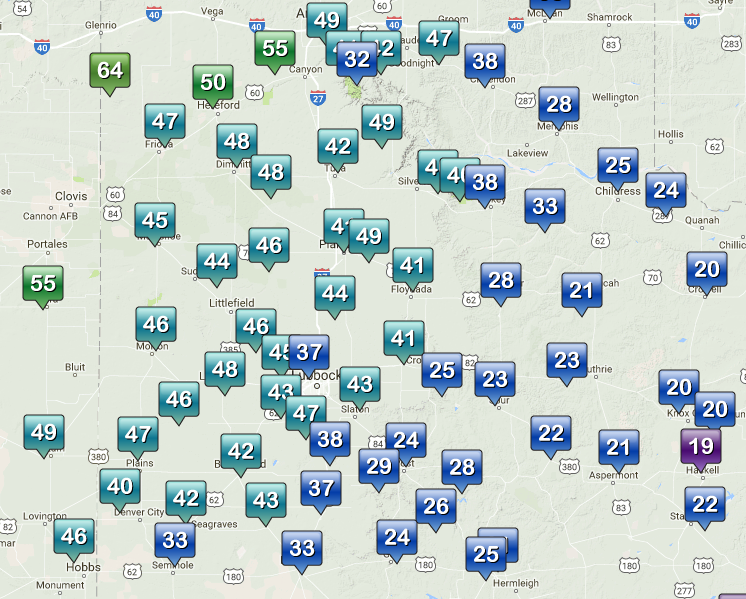
| Early in the day abundant cloud cover helped keep winds in check, but as breaks in the clouds moved in from the west the strong winds quickly followed. The winds peaked from the mid-afternoon into the early evening hours before slowly decreasing through the late evening. Wind gusts of 50 to 60 mph were common over the Caprock with a few gusts in excess of 65 mph near the Texas/New Mexico line. The West Texas Mesonet sites near Bootleg and Dora, NM, had the dubious honor of recorded the highest wind gusts which reached 71 mph. Officially the Lubbock Airport recorded a maximum wind gust of 60 mph. A list of the preliminary storm reports can be VIEWED HERE. | |
 |
|
| Maximum wind gusts observed by the West Texas Mesonet on 28 February 2017. To view the highest sustained wind speeds recorded for the day CLICK HERE. | |
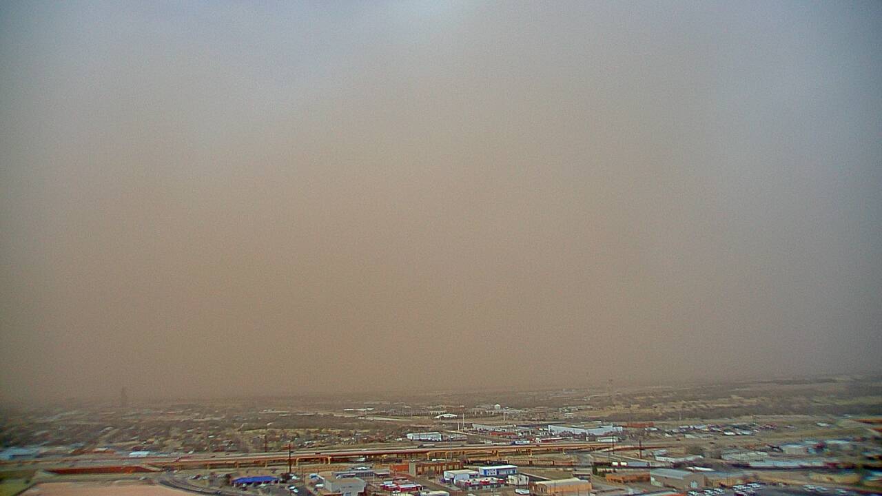
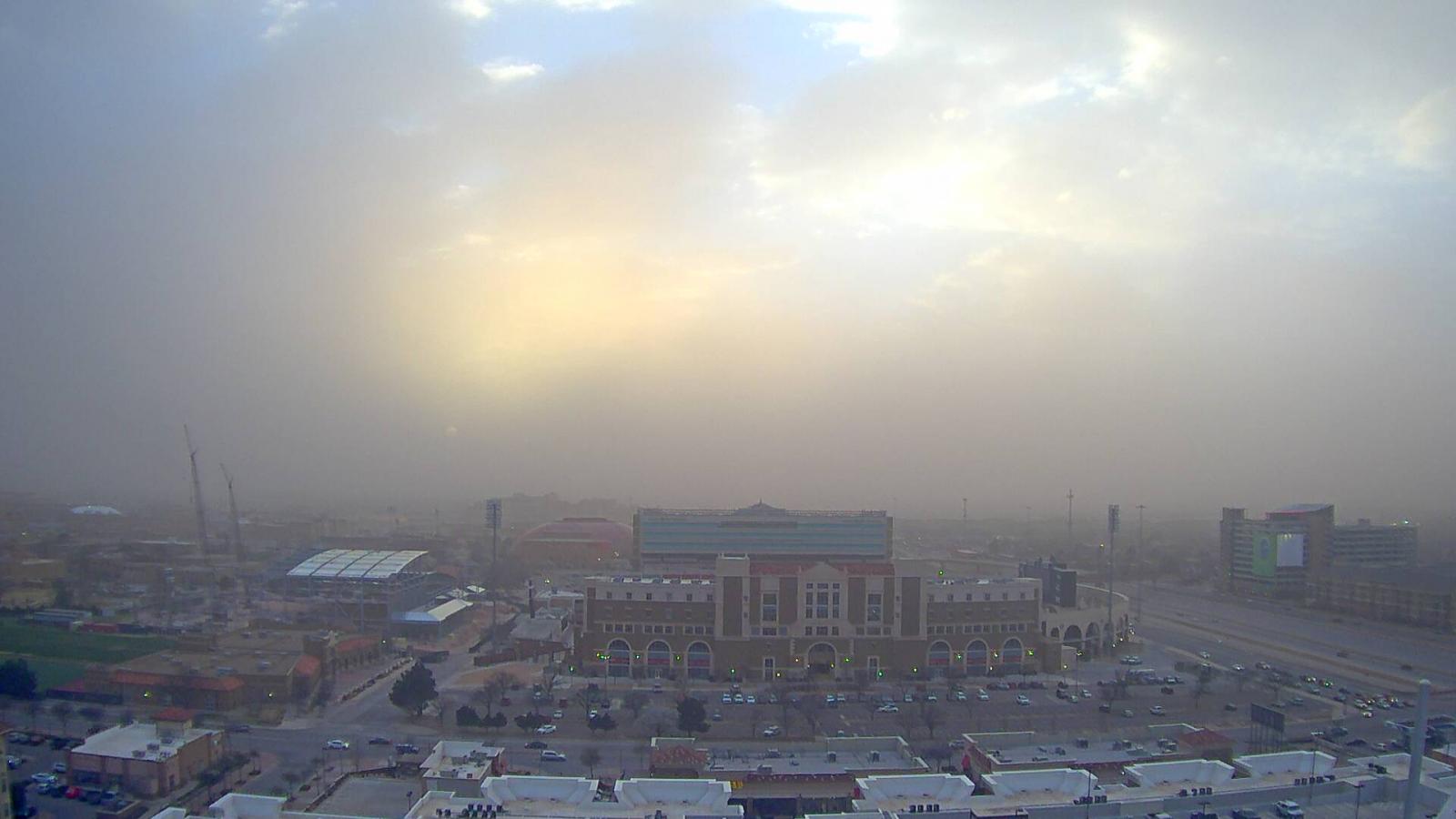
| The winds easily lofted bountiful amounts of dust into the air turning the sky a brownish-red. The visibility, in general, stayed in the 1 to 3 mile range, though in spots it did drop much lower. | |
 |
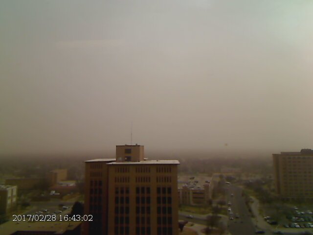 |
| Dusty skies seen from the NTS building (left) and Texas Tech Campus (right) during the afternoon of the 28th. | |
| Although we often use radar to detect precipitation, it can also sense dust when it is in large quantities. The below radar animation shows a particularly intense and persistent dust plume originating south of the radar located on the Cannon AFB. | |
 |
|
| Cannon, NM, radar reflectivity animation valid from 2:41 pm to 8:41 pm on 28 February 2017. | |
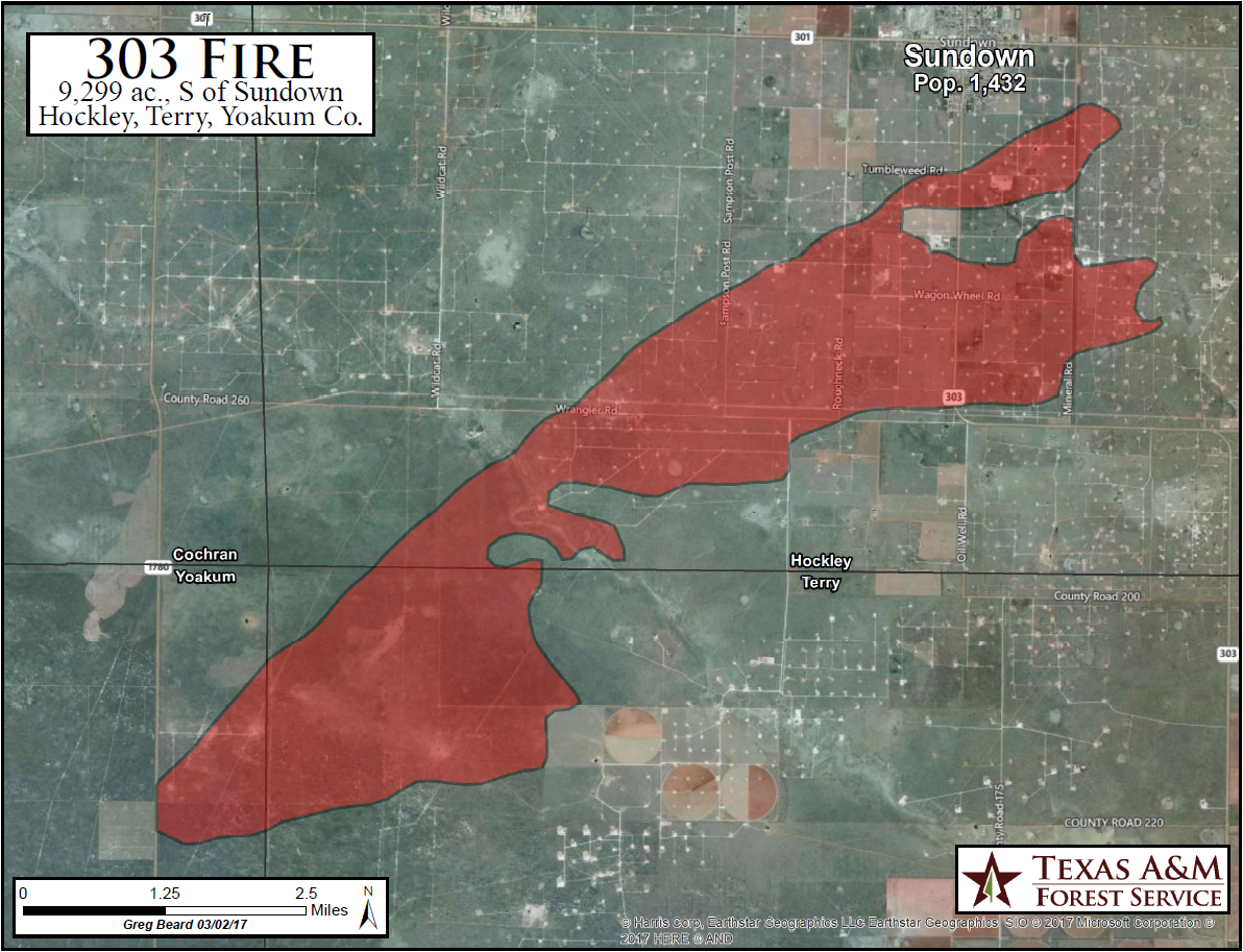
| Unfortunately the strong, dry winds along with the dry grasses created an extreme fire danger. Several fires ignited and quickly spread. One fire threaten Sundown, burning over 9,000 acres before being contained. A map showing the land burned by the Sundown fire can be VIEWED HERE. A few other fires burned land near Wolfforth, west of Levelland as well as around Tulia. Unfortunately the Tulia fire did claim 4 homes and 8 outbuildings before being contained. | |
 |
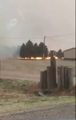 |
| Wildfire west of Levelland (left) and near Wolfforth (right) Tuesday afternoon (28 February 2017). The pictures are courtesy of Levelland News and Veronica Guy (via KCBD), respectively. | |
 |
 |
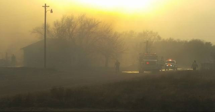
| Wildfire near Tulia Tuesday evening (28 February 2017). The pictures are courtesy of Myhighplains.com. | |
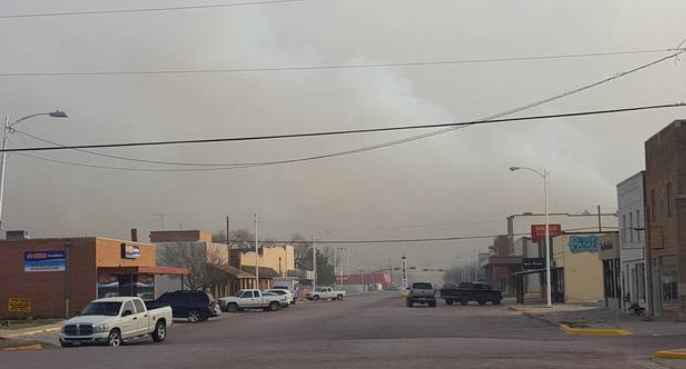
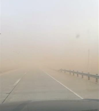
| The blowing dust did significantly reduce the visibility making travel difficult at times, especially immediately downstream of open fields. | |
 |
|
| Low visibility courtesy of copious amounts of blowing dust. Picture is by Anna Rivera (via KCBD). | |
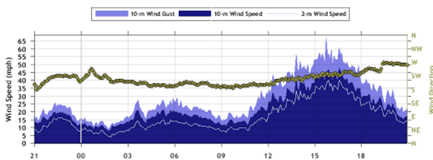
| The following plot of the winds captured near Dimmitt shows that they were fairly tame during the morning, but increased quickly in the afternoon, peaking from mid- to late afternoon. The winds then decreased fairly steadily through the evening hours. | |
 |
|
| Plot of the wind speed and direction measured by the West Texas Mesonet near Dimmitt measured from 10 pm on Monday to 10 pm on Tuesday (27-28 February 2017). | |
| Although unpleasant, the mix of dust, sky, smoke and a few clouds made for an interesting sunset. | |
 |
|
| A dusty, albeit strangely picturesque image captured just before sunset looking over the north side of the Texas Tech Campus. The pictures is courtesy of KAMC. | |

