
Dangerous heat will expand from the Gulf Coast into the Southern Plains and Desert Southwest through week's end. Additional extreme heat impacting the Pacific Northwest will shift to the northern Plains by the weekend. Tropical Storm Bertha is expected to continue to impact portions of the northern Gulf Coast from the western Florida Panhandle to southeastern Louisiana through tonight. Read More >
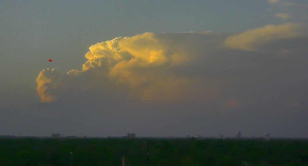
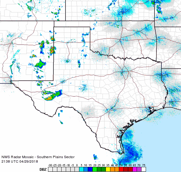
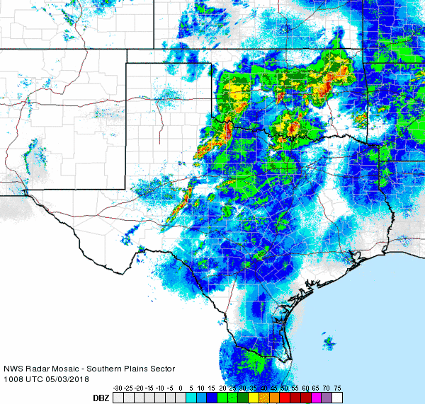
Active spring weather returned to portions of the South Plains region late April into early May. The stormy stretch was fueled by a slow-moving western upper level system, a dryline wandering the region and gradually improving low-level moisture and instability east of the dryline. The initial round of thunderstorms formed in eastern New Mexico and moved into the western South Plains and southwest Texas Panhandle Sunday afternoon and evening (29 April). Moisture levels were not particularly high, but aided by an upper level disturbance ejecting from the western trough, scattered thunderstorms were able to persist well into the Sunday evening. A couple of these storms reached severe levels producing quarter size hail near Muleshoe and Bovina and a 59 mph wind gust near Dimmitt.

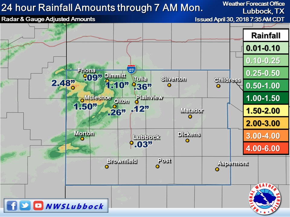
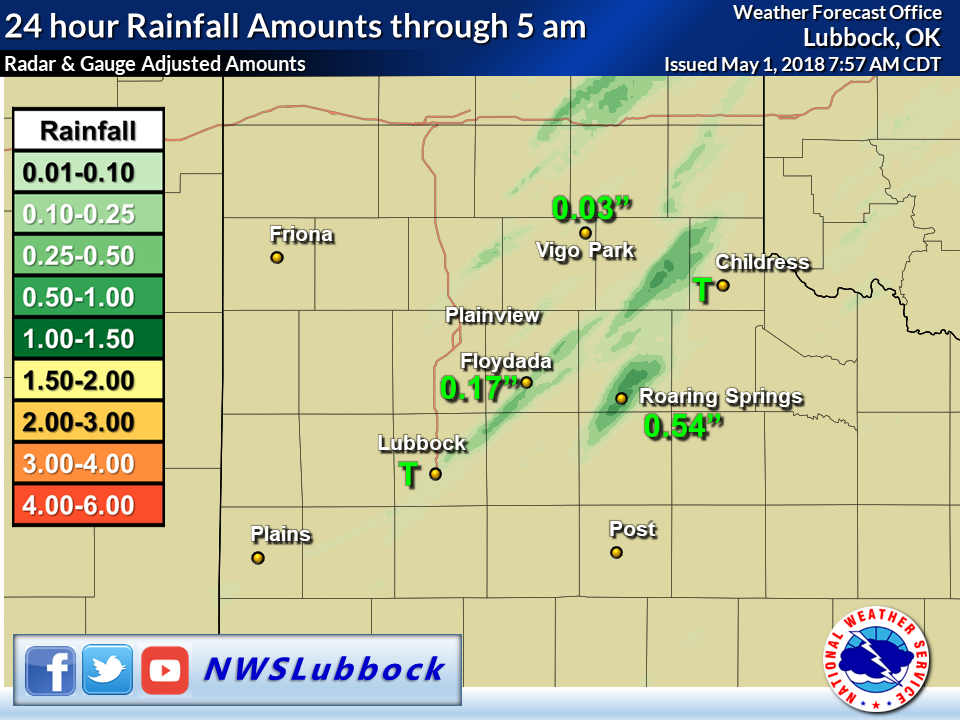
Even though moisture was somewhat limited, the storms moved very slowly and managed to dump heavy rain over portions of the southwest Texas Panhandle and northwestern South Plains. Localized rain totals in excess of 1 to 2 inches were reported, while lighter rain visited a good chunk of the southern Texas Panhandle and northern and central South Plains.
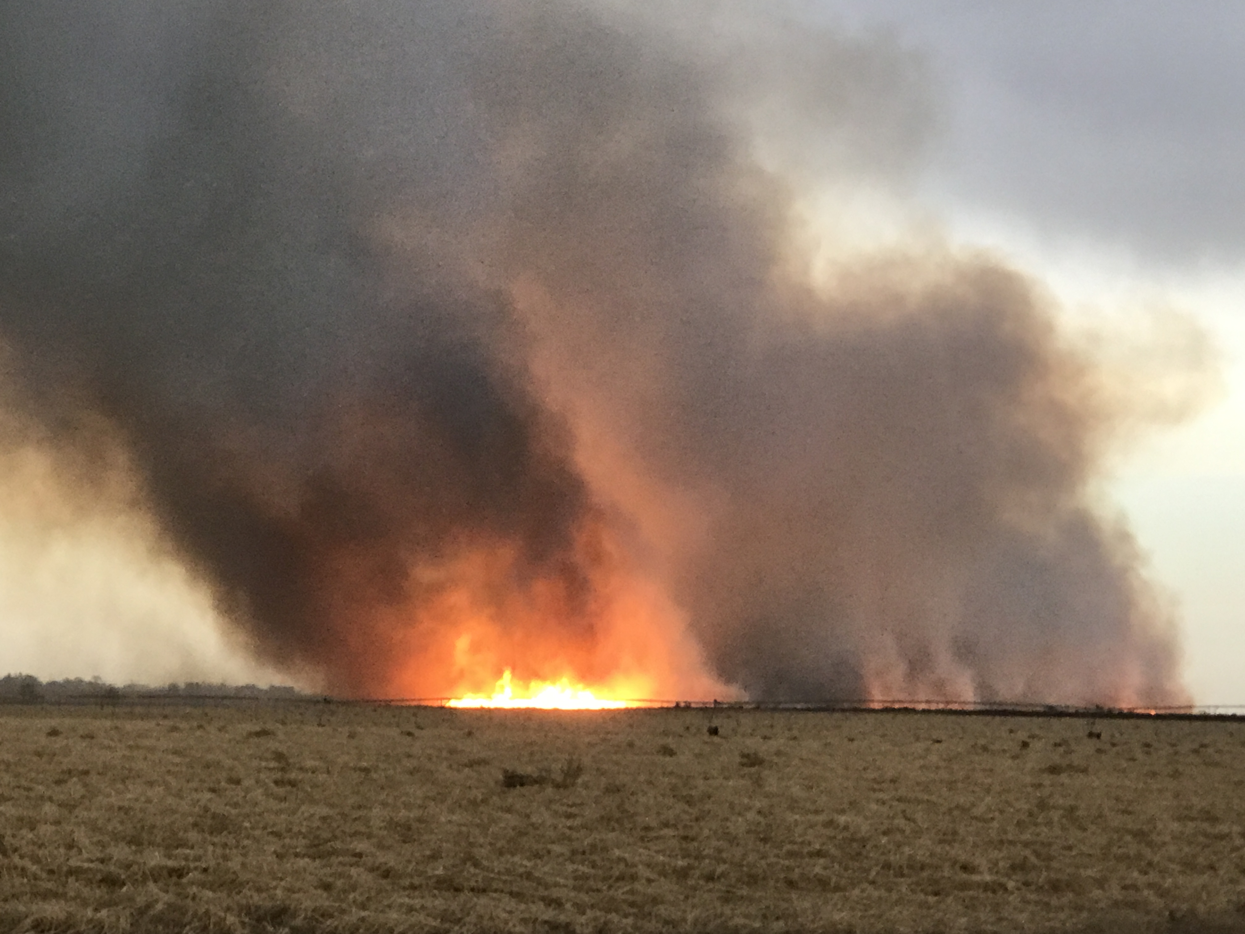
Lightning from the thunderstorms also sparked a few wildfires Sunday evening, including the one seen below that started near Sudan.
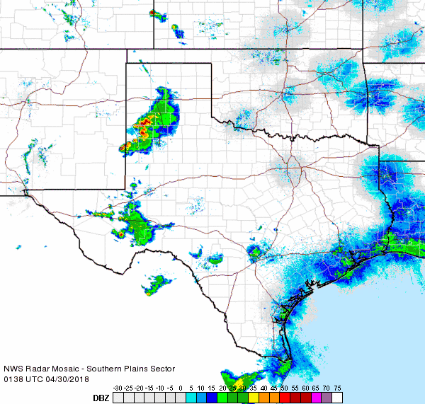
The next day the dryline mixed further east where it provided the focus for another round of showers and thunderstorms. Upper level support wasn't as favorable as the previous day so storm coverage was more limited. Even so, temperatures and instability levels were a little higher than Sunday and did feed a couple of thunderstorms that briefly became severe in the southeast Texas Panhandle and northern Rolling Plains. Ping pong ball size hail was observed near Estelline while quarter size hail fell in Matador.
Given the widely scattered coverage and relatively quick storm motion, rainfall was spotty and light on the 30th. A few lucky locations did manage to squeeze out a quick half inch or more of rain though, including around Roaring Springs.
Tuesday, May 1st, saw the dryline move even further east into the Rolling Plains during the afternoon as gusty, warm and dry southwesterly winds spread across the Caprock. The dryline did spark scattered thunderstorms across Kansas into far northwest Oklahoma, but warmer air aloft effectively capped it further south leading to a dry day for northwest Texas.
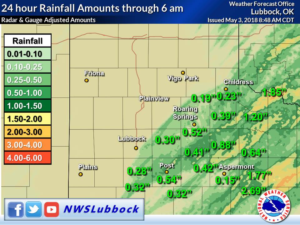
Over the course of the 5-day late April and early May stretch, much of the southern Texas Panhandle, South Plains and Rolling Plains experienced at least a little rain. The exception was the southwest South Plains where they largely missed out. Unfortunately, even where it did rain, the amounts were not overly impressive outside of isolated pockets.
Below is a listing of the preliminary storm reports gathered for the active late April and early May period.
PRELIMINARY LOCAL STORM REPORT
NATIONAL WEATHER SERVICE LUBBOCK TX
1132 PM CDT SUN APR 29 2018

..TIME...   ...EVENT...      ...CITY LOCATION...     ...LAT.LON...
..DATE...   ....MAG....      ..COUNTY LOCATION..ST.. ...SOURCE....
            ..REMARKS..

0539 PM     LIGHTNING        FARWELL                 34.39N 103.04W
04/29/2018                   PARMER             TX   LAW ENFORCEMENT

            GRASS FIRES STARTED ON CNTY RD 8 NE OF FARWELL & CNTY
            RD B NEAR RHEA

0555 PM     HAIL             5 WNW BOVINA            34.54N 102.97W
04/29/2018  E1.00 INCH       PARMER             TX   STORM CHASER

0745 PM     HAIL             MULESHOE                34.23N 102.73W
04/29/2018  E1.00 INCH       BAILEY             TX   LAW ENFORCEMENT

0850 PM     TSTM WND GST     2 NE DIMMITT            34.57N 102.29W
04/29/2018  M59 MPH          CASTRO             TX   MESONET

