
Scattered thunderstorms with severe gusts, hail and a tornado risk are possible near a cold front from the Ohio Valley to the Mid-Atlantic tonight. Tropical Storm Bertha is expected to bring tropical storm conditions to portions of the Gulf Coast from the panhandle of Florida into Louisiana through Wednesday. Read More >
| Widespread Rain Falls over West Texas 1-7 September 2018 |
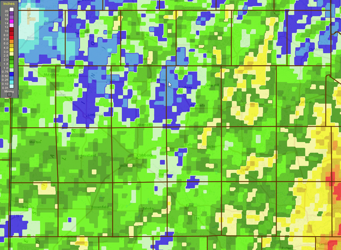 |
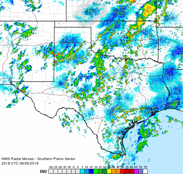
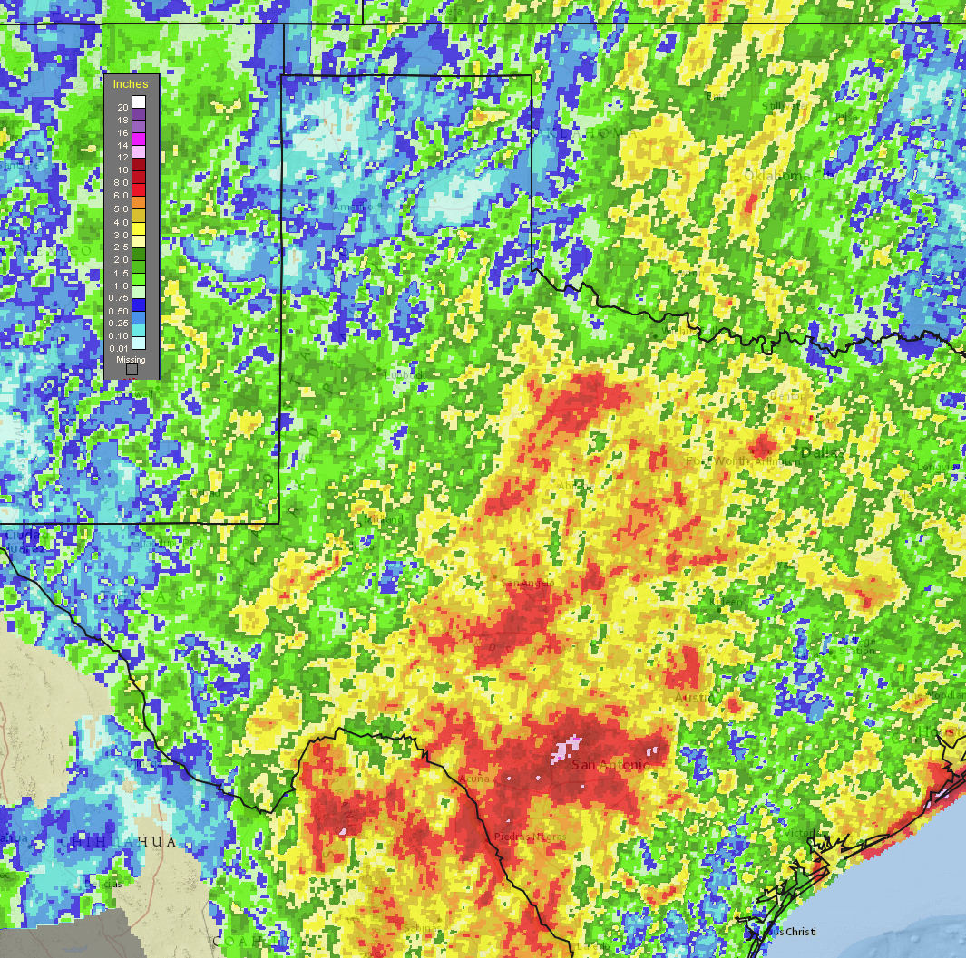
| 7-day radar-estimated and bias-corrected rainfall ending at 5 am on 9 September 2018. A state wide view of the 7-day precipitation can be VIEWED HERE. |
| The first week of September was an unsettled one for West Texas, providing several rounds of showers and thunderstorms. Rich moisture moved into the region just in time to start the month and then lingered overhead. Several passing upper level disturbances used this moisture as fuel, dumping heavy rains in spots. Over the course of week many locations received 1 to 2 inches of rain, with spots that saw 3+ inches. Often times the rain came in very short tropical-like bursts which did occasionally result in minor flooding. |
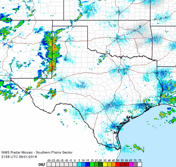 |
| Regional radar animation valid from 4:58 pm to 6:08 pm on 1 September 2018. |
| The first round of fairly widespread rain kicked off Saturday evening (1 September). A broad area of showers and thunderstorms moved out of eastern New Mexico dropping moderate to heavy rain and gusty winds, before weakening overnight. |
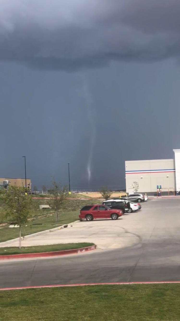 |
| Picture of landspout tornado over southeast Lubbock around 5 pm on 2 September 2018. The picture is courtesy of Preston Tipton and KCBD. |
| The rainfall was more limited and favored locations further east the next day, Sunday afternoon and evening. One small thunderstorm that developed over southeast Lubbock generated a brief landspout tornado (see above). The tornado didn't do any known damage, but it was highly visible. |
 |
| Regional radar animation valid from 8:18 pm to 9:28 pm on 2 September 2018. |
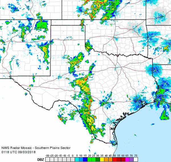
| The focus then shifted back to the west the next day as a line of thunderstorms raced out of eastern New Mexico and across the western and central South Plains before weakening on Monday, September 3rd. In addition to dropping heavy rain, the storms brought gusty winds of 40 to 50 mph. |
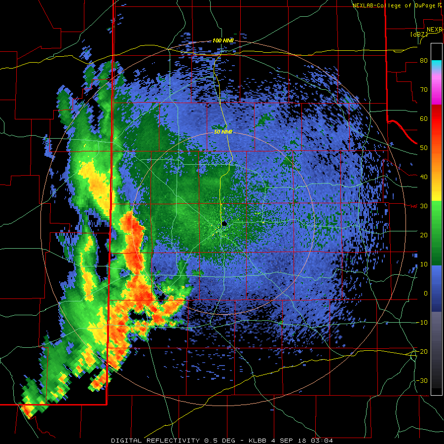 |
| Lubbock WSR-88D radar imagery valid 10:04 pm on 3 September to 12:23 am on 4 September 2018. |
| Rainfall was rather limited September 4th, but scattered thunderstorms returned to the South and Rolling Plains on the 5th. This day the activity moved from north-to-south, producing a smattering of heavy rain before diminishing in the evening. |
 |
| Regional radar animation valid from 3:18 pm to 4:28 pm on 5 September 2018. |
| After a fairly quiet day on the 6th, rain blossomed across the southeast Texas Panhandle and Rolling Plains early Friday morning (7 September). The most intense activity dropped very heavy rain. Caprock Canyons State Park was directly underneath one of these showers. The West Texas Mesonet site at the park recorded 3.24 inches, most of which fell in one hour. The below radar imagery was captured during the period of heaviest rain over Caprock Canyons State Park. |
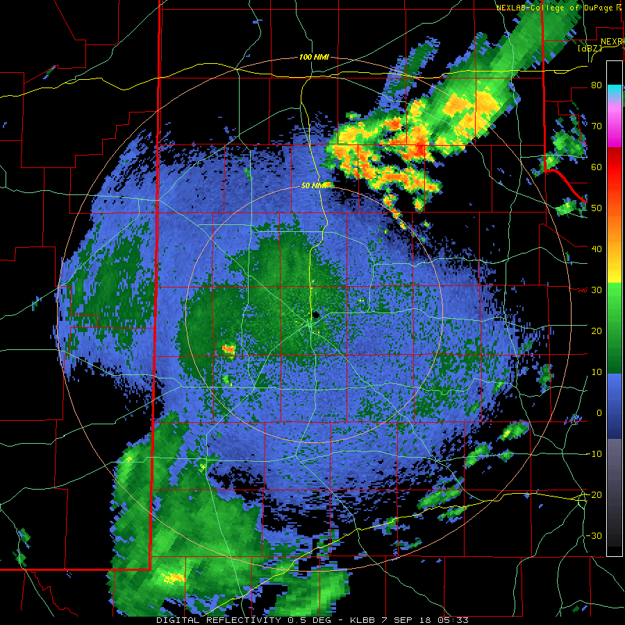 |
| Lubbock WSR-88D radar imagery valid 12:33 am to 4:20 am on 7 September 2018. |
| The rain expanded in coverage over most of the South Plains during the day Friday. Steady light to moderate rain continued through the afternoon before gradually diminished Friday evening. |
 |
| Regional radar animation valid from 2:28 pm to 3:38 pm on 7 September 2018. |
| The deep moisture finally shifted east of the region by Saturday, September 8th, and this caused the widespread showers and thunderstorms to shift south and east of the region. Even so, isolated showers did still affect the region for the next couple of days before completely drying out. Over the course of the first week of September Lubbock officially measured 1.08 inches of rain, though parts of the city saw 2 to 3 inches. |

