
Dangerous heat will expand from the Gulf Coast into the Southern Plains and Desert Southwest through week's end. Additional extreme heat impacting the Pacific Northwest will shift to the northern Plains by the weekend. Tropical Storm Bertha is expected to continue to impact portions of the northern Gulf Coast from the western Florida Panhandle to southeastern Louisiana through tonight. Read More >
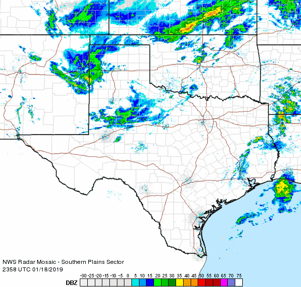
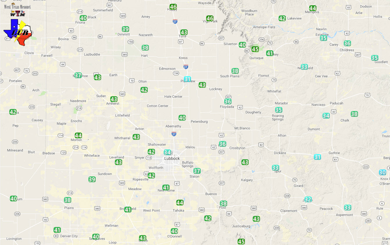
A stout upper level storm system made a beeline for West Texas on Friday, passing over during the evening and overnight hours. This system had an abundance of wind energy, though was more lacking in moisture. As it approached warm and dry air overspread the South Plains Friday afternoon. Temperatures warmed into the 60s and 70s as westerly winds increased to 30 to 40 mph, with higher gusts across the Caprock.
A few high-based showers developed during the afternoon hours. This activity produced little to no rainfall, evaporating before making it to the ground, but it did enhance the wind locally. A cold front then moved through Friday evening, bring strong northwesterly to northerly winds to the entire region. Wind speeds of 35 to 45 mph with gusts of 50 to 55 mph were common behind this front. A few locations even recorded brief gusts in excess of 60 mph including around Levelland, Anton and Graham. The winds continue well into the night, but did gradually decrease early Saturday morning as the storm system moved off to the east.
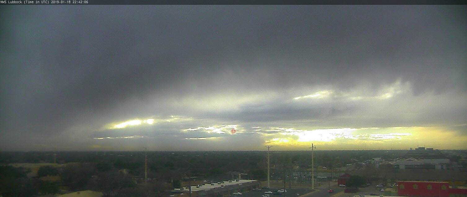
In addition to the wind, rain showers quickly changed to snow as they moved southeastward out of the Texas Panhandle and temperatures tumbled to and below the freezing mark. Light accumulations of 1 to 2 inches of snow were common from around Amarillo west and southwestward to north of Clovis. This included a dusting of snow around Dimmitt and Friona.
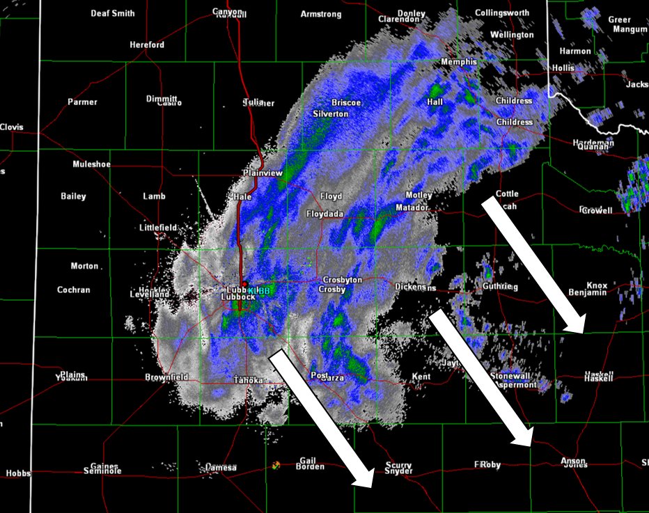
Many other locations, including Lubbock, did see a few flakes fly late Friday night as a final band of precipitation pivoted southeastward before diminishing early Saturday morning. Little to no accumulation was observed with this brief shot of late night snow.
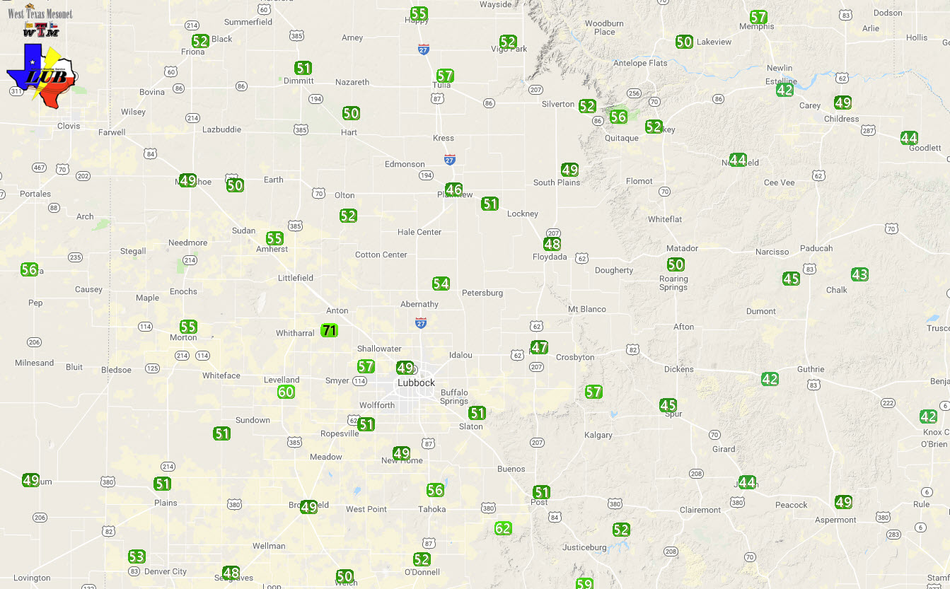
A full listing of wind reports recorded during this event can be found below.
PRELIMINARY LOCAL STORM REPORT...SUMMARY
NATIONAL WEATHER SERVICE LUBBOCK TX
331 PM CST SAT JAN 19 2019

..TIME...   ...EVENT...      ...CITY LOCATION...     ...LAT.LON...
..DATE...   ....MAG....      ..COUNTY LOCATION..ST.. ...SOURCE....
            ..REMARKS..

0538 PM     HIGH SUST WINDS  HAPPY                   34.74N 101.84W
01/18/2019  M42 MPH          SWISHER            TX   MESONET

0552 PM     HIGH SUST WINDS  2 NE FRIONA             34.65N 102.69W
01/18/2019  M40 MPH          PARMER             TX   MESONET

0625 PM     HIGH SUST WINDS  1 ENE MORTON            33.73N 102.74W
01/18/2019  M44 MPH          COCHRAN            TX   MESONET

0630 PM     HIGH SUST WINDS  6 S OLTON               34.09N 102.12W
01/18/2019  M42 MPH          LAMB               TX   MESONET

0635 PM     HIGH SUST WINDS  1 NE AMHERST            34.02N 102.40W
01/18/2019  M43 MPH          LAMB               TX   MESONET

            GUSTING TO 55 MPH

0645 PM     NON-TSTM WND GST 6 SSW ANTON             33.73N 102.19W
01/18/2019  M71 MPH          HOCKLEY            TX   MESONET

            SUSTAINED WINDS AT 40 MPH

0650 PM     NON-TSTM WND GST 6 NNW ROPESVILLE        33.49N 102.19W
01/18/2019  E65 MPH          HOCKLEY            TX   CO-OP OBSERVER

0655 PM     NON-TSTM WND GST 4 S LEVELLAND           33.53N 102.36W
01/18/2019  M60 MPH          HOCKLEY            TX   MESONET

            SUSTAINED WINDS AT 41 MPH

0705 PM     HIGH SUST WINDS  REESE CENTER            33.61N 102.05W
01/18/2019  M42 MPH          LUBBOCK            TX   MESONET

0710 PM     HIGH SUST WINDS  6 SSW WOLFFORTH         33.42N 102.05W
01/18/2019  M42 MPH          LUBBOCK            TX   MESONET

0710 PM     HIGH SUST WINDS  6 NNE LUBBOCK           33.67N 101.82W
01/18/2019  M43 MPH          LUBBOCK            TX   ASOS

            GUSTING TO 51 MPH

0735 PM     HIGH SUST WINDS  3 NNE TAHOKA            33.21N 101.78W
01/18/2019  M42 MPH          LYNN               TX   MESONET

            GUSTING TO 56MPH

0755 PM     HIGH SUST WINDS  6 NW WHITE RIVER LAKE   33.53N 101.17W
01/18/2019  M43 MPH          CROSBY             TX   MESONET

            GUSTING TO 57 MPH

0815 PM     HIGH SUST WINDS  2 WSW TURKEY            34.38N 100.93W
01/18/2019  M41 MPH          HALL               TX   MESONET

            GUSTING TO 51 MPH

0820 PM     HIGH SUST WINDS  5 ENE ABERNATHY         33.88N 101.76W
01/18/2019  M40 MPH          HALE               TX   MESONET

0825 PM     HIGH SUST WINDS  1 NE MEMPHIS            34.73N 100.53W
01/18/2019  M41 MPH          HALL               TX   MESONET

            GUSTING TO 52 MPH

0830 PM     HIGH SUST WINDS  3 WSW AIKEN             34.13N 101.57W
01/18/2019  M41 MPH          HALE               TX   MESONET

            GUSTING TO 48 MPH

0835 PM     HIGH SUST WINDS  2 ENE TULIA             34.54N 101.74W
01/18/2019  M43 MPH          SWISHER            TX   MESONET

            GUSTING TO 52 MPH

0902 PM     HIGH SUST WINDS  HAPPY                   34.74N 101.84W
01/18/2019  M46 MPH          SWISHER            TX   MESONET

            GUSTING TO 55 MPH

0950 PM     HIGH SUST WINDS  1 NE MEMPHIS            34.73N 100.53W
01/18/2019  M44 MPH          HALL               TX   MESONET

            GUSTING TO 57 MPH

1235 AM     NON-TSTM WND GST 5 SSW GRAHAM            33.08N 101.52W
01/19/2019  M59 MPH          GARZA              TX   MESONET

            MEASURED BY THE TTU WEST TEXAS MESONET

