
Numerous severe thunderstorms are expected across a broad region from the Ohio Valley to the Mid-Atlantic and Northeast States today into tonight. Swaths of damaging wind gusts are expected and some tornadoes are possible. Bertha is expected to bring tropical storm conditions to portions of the Gulf Coast from the Florida Panhandle westward to southeastern Louisiana later today and Wednesday. Read More >

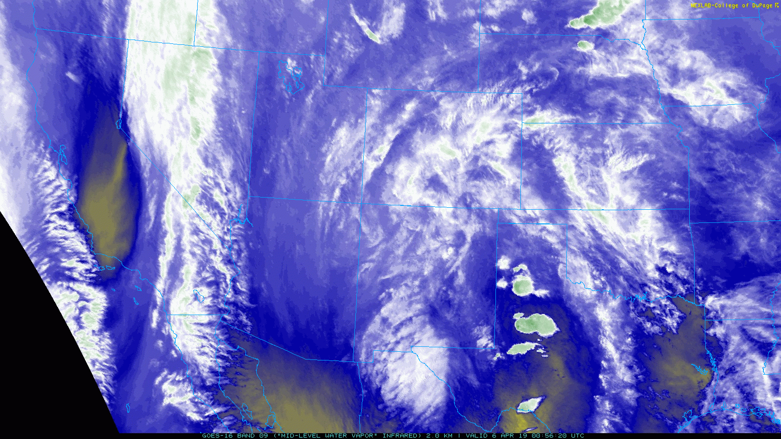
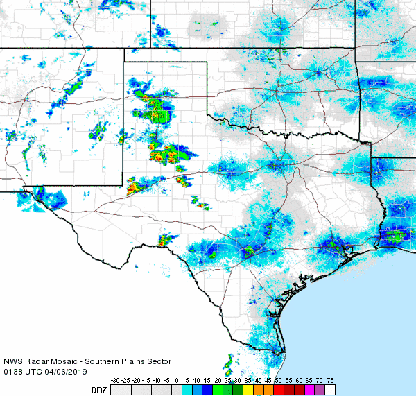
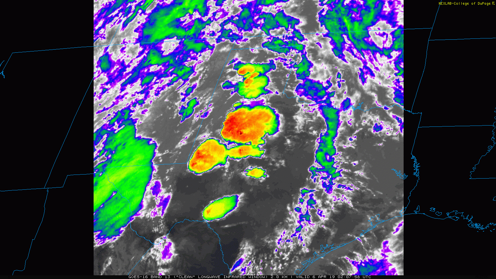
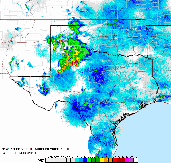
Lift from the approach of a potent upper level disturbance caused thunderstorms to erupt over West Texas Friday evening (5 April). Initially, low level moisture was on the meager side and this limited both the coverage and rainfall efficiency of the storms. As the moisture and instability increased through the evening and overnight hours, so did the thunderstorm coverage and intensity. Several rotating storms and clusters of storms generated hail, gusty winds and very heavy rainfall.
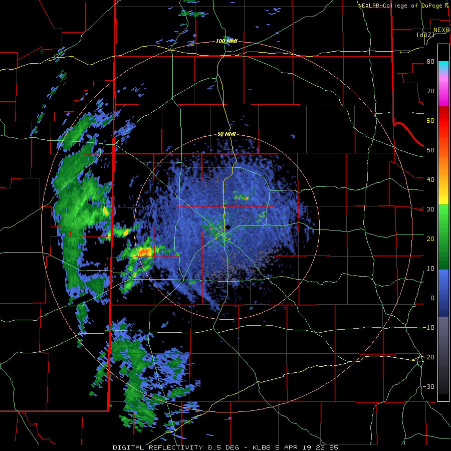
Nickel size hail was observed in Lubbock, along with numerous reports of pea sized hail. To the southeast, a different storm dropped half dollar sized hail near Justiceburg. The hail-producing storms were also accompanied by brief periods of very heavy rain.
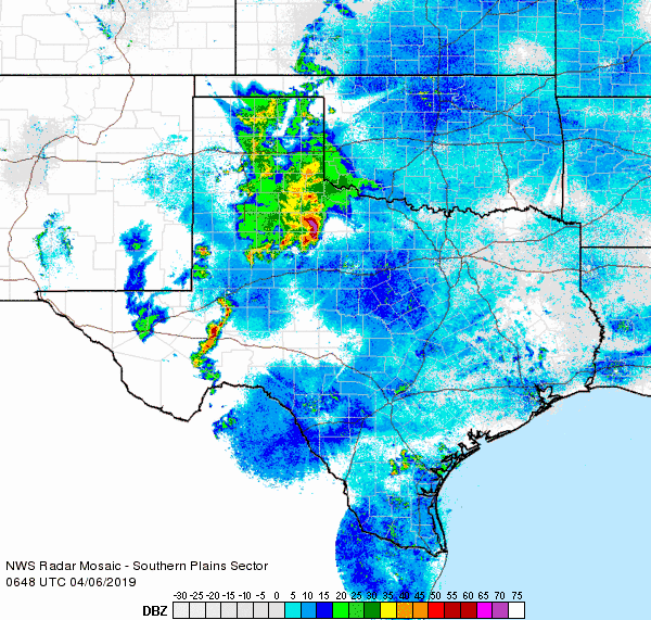
As lift continued to increase through the late evening hours, the thunderstorm activity became more widespread while expanding into the Rolling Plains. Several intense storms tracked repeatedly over the southern Rolling Plains bringing torrential rainfall and swaths of hail and damaging winds.
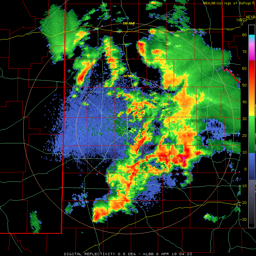
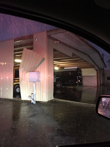
Unfortunately, Jayton was on the receiving end of the more intense activity. One storm brought strong winds that toppled trees and damaged buildings. The rounds of storms also dumped an impressive 4 inches of rain in town, which lead to some flooding problems.
 |
 |
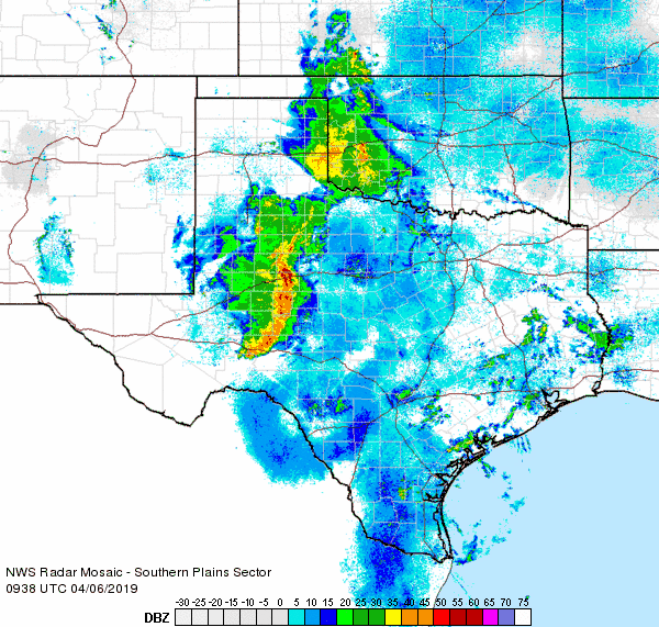
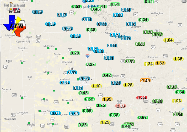
The showers and thunderstorms continued through much of the night off the Caprock before finally winding down Saturday morning. The below image displays the estimated rainfall for this early April event. A corridor of 2.5+ inches of rain fell over southeast Garza County eastward into Kent and King Counties. Rain totals were lighter in Lubbock, generally from around a quarter to half inch, with the Airport officially recording 0.24 inches. Childress officially recorded 0.87 inches early Saturday morning.
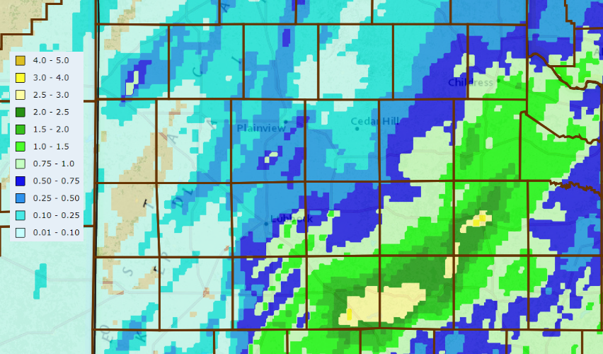
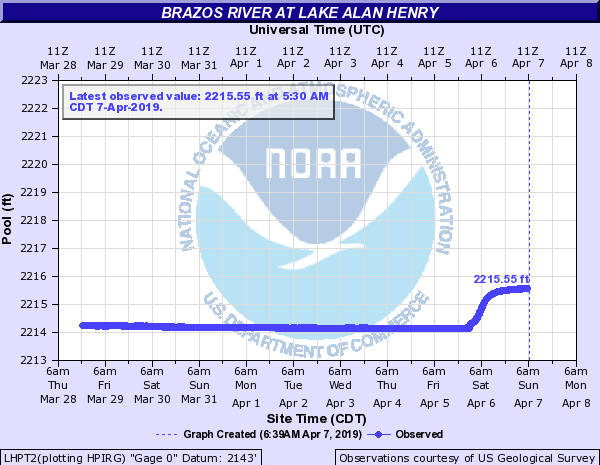
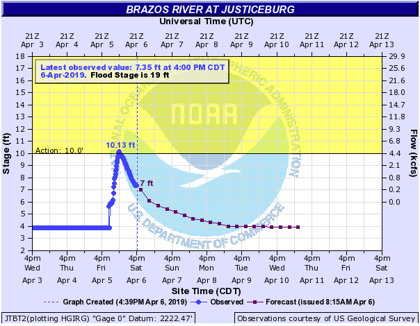
The heaviest core of rain fell over and just upstream of Lake Alan Henry, across southeast Garza County. Runoff from the heavy rain caused the Brazos River near Justiceburg to rapidly rise to action level early Saturday morning before decreasing almost as fast. This water poured into Lake Alan Henry causing it to rise about a foot and a half.
A list of the preliminary storm reports for Friday night (5 April) can be viewed below.
PRELIMINARY LOCAL STORM REPORT...SUMMARY
NATIONAL WEATHER SERVICE LUBBOCK TX
639 AM CDT SAT APR 06 2019

..TIME...   ...EVENT...      ...CITY LOCATION...     ...LAT.LON...
..DATE...   ....MAG....      ..COUNTY LOCATION..ST.. ...SOURCE....
            ..REMARKS..

0645 PM     TSTM WND GST     WOLFFORTH               33.51N 102.01W
04/05/2019  M59 MPH          LUBBOCK            TX   EMERGENCY MNGR

0916 PM     HAIL             LAKE ALAN HENRY         33.06N 101.05W
04/05/2019  E1.00 INCH       GARZA              TX   PUBLIC

            TWITTER REPORT

0920 PM     HAIL             4 WSW LUBBOCK           33.55N 101.94W
04/05/2019  E0.88 INCH       LUBBOCK            TX   NWS EMPLOYEE

0928 PM     HAIL             2 ENE JUSTICEBURG       33.05N 101.17W
04/05/2019  E1.25 INCH       GARZA              TX   PUBLIC

0950 PM     HAIL             5 W CLAIREMONT          33.17N 100.84W
04/05/2019  E0.75 INCH       KENT               TX   CO-OP OBSERVER

1038 PM     HAIL             TULIA                   34.54N 101.77W
04/05/2019  E1.00 INCH       SWISHER            TX   LAW ENFORCEMENT

1150 PM     TSTM WND DMG     JAYTON                  33.25N 100.57W
04/05/2019                   KENT               TX   LAW ENFORCEMENT

            REPORT OF TREES UPROOTED AND TRANSFORMERS BLOWN IN
            JAYTON.

