| Widespread heavy rain falls on the Texas Panhandle and western South Plains 28 September - 4 October 2019 |
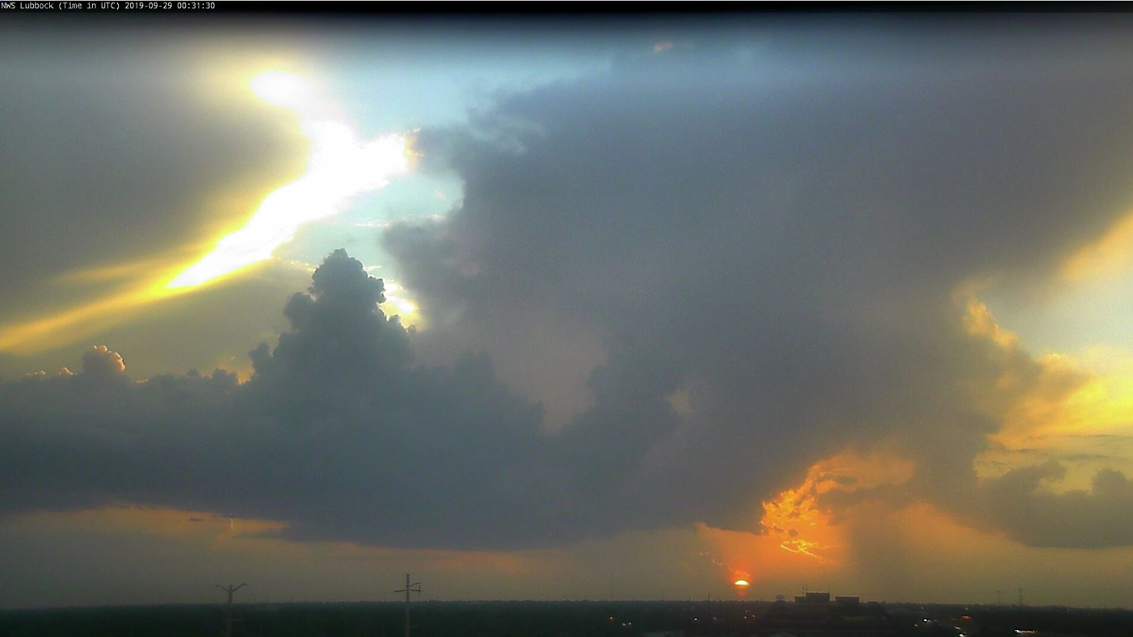 |
| Sun setting behind a weakening thunderstorm west of Lubbock on Saturday, September 28, 2019 |
| Late September and early October 2019 brought several rounds of showers and thunderstorms to West Texas. Early on, a few of the storms were strong to severe, but the main theme with this activity was heavy rainfall. |
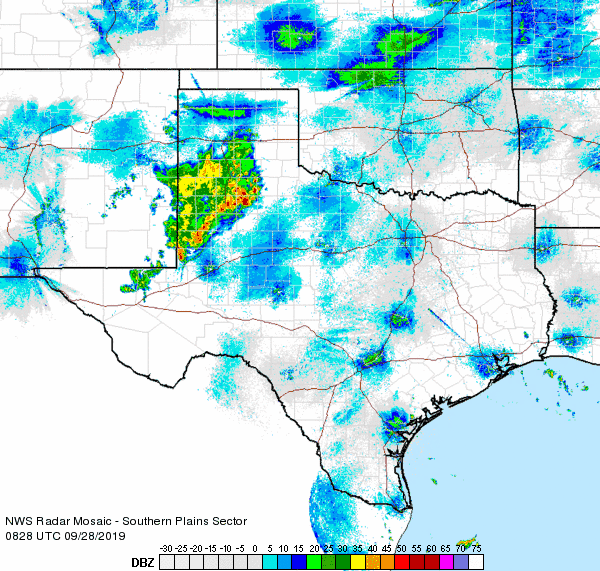 |
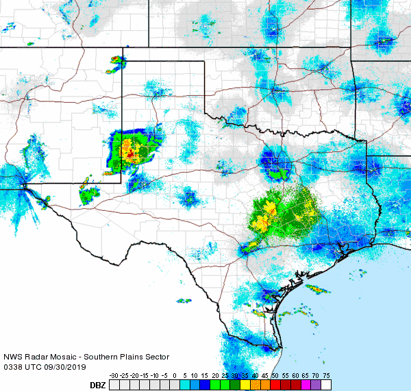
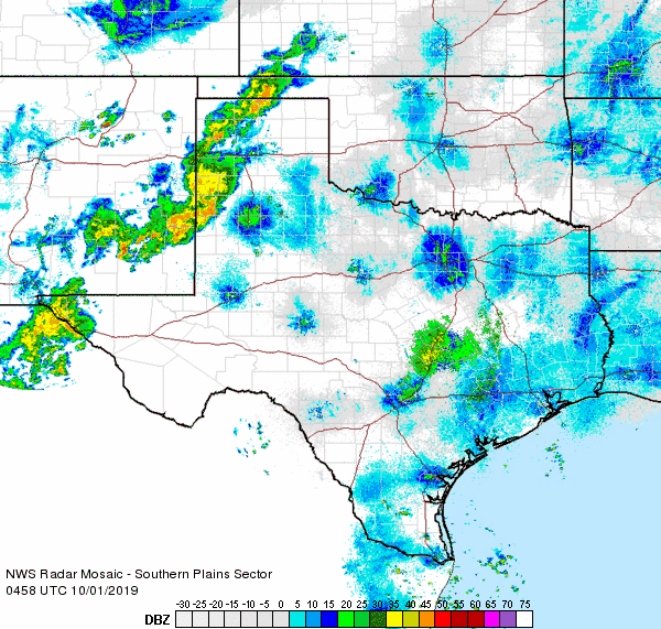
| Regional radar animation valid from 3:28 am to 4:38 am on 28 September 2019. |
| The unsettled stretch started in earnest Friday night into early Saturday (27-28 September) when a complex of thunderstorms moved out of eastern New Mexico and across the Caprock, persisting into the western Rolling Plains. Many locations received a half inch to over an inch of rain from these overnight storms, which also brought a lot of loud thunder. |
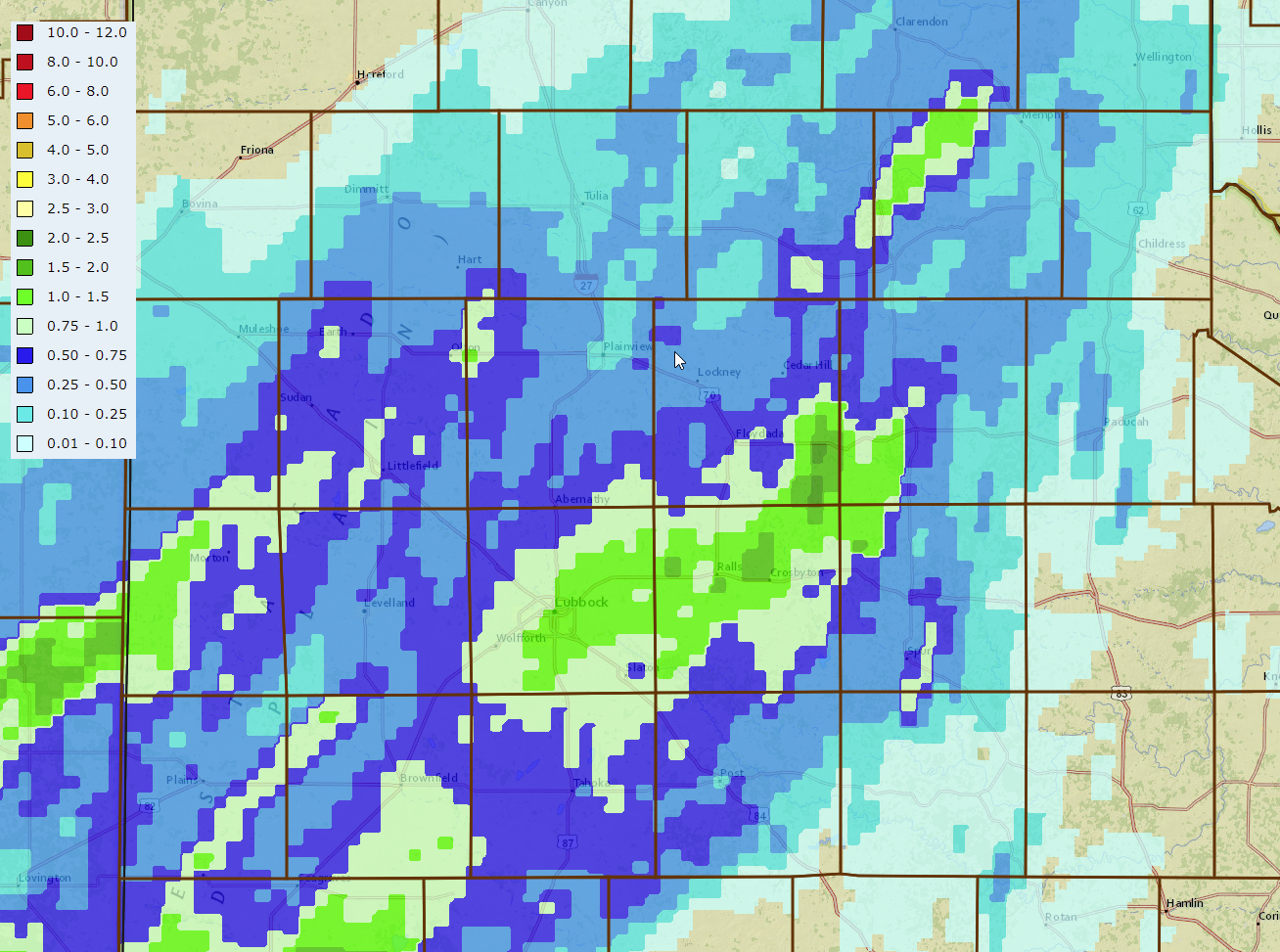 |
| 24-hour radar-estimated and bias-corrected rainfall ending at 10 pm on 28 September 2019. The West Texas Mesonet rainfall totals over this same period can be VIEWED HERE. |
| Saturday afternoon and evening brought isolated thunderstorms to the region. Most spots remained dry, but one storm did strike the Caprock Canyons area during their Bison Fest celebration, complete with a 58 mph wind gust at the park. A separate storm generated a peak gust of 73 mph west of Earth as it collapsed. |
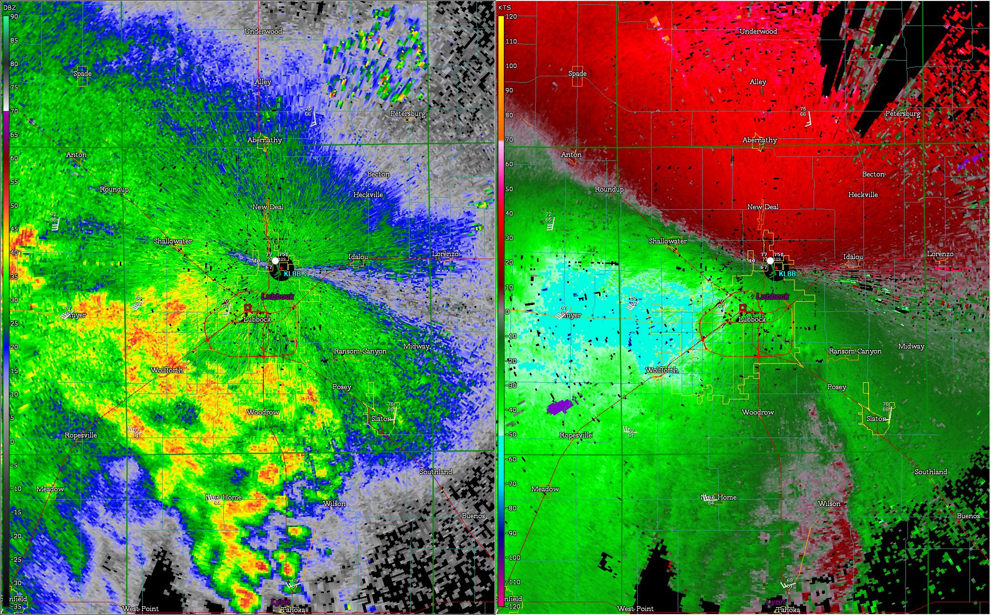 |
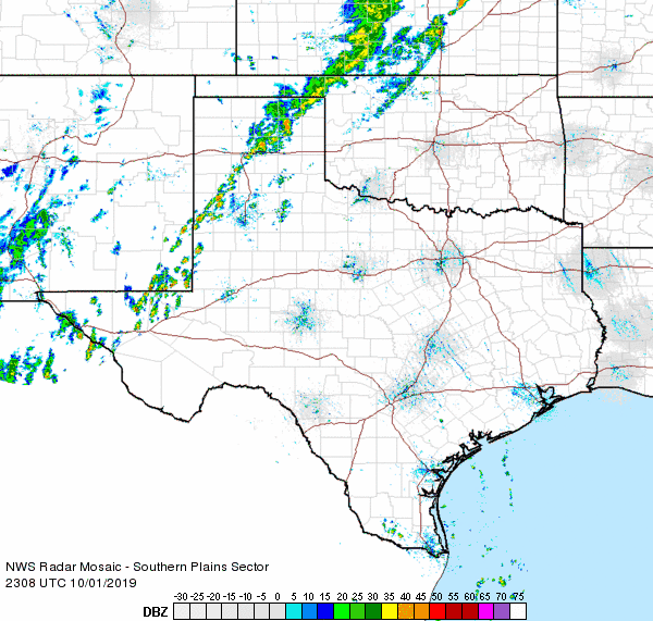
| Lubbock radar reflectivity (left) and velocity (right) captured at 11:45 pm on 29 September 2019. A regional radar animation valid from 10:38 pm to 11:48 pm on 29 September can be WATCHED HERE. |
| The next night (Sunday, September 29th) brought a smaller cluster of thunderstorms out of southeast New Mexico and into the South Plains. Unlike the previous night, drier air was in place aloft. This drier air caused the storms to produce less rainfall while also generating widespread strong to severe wind gusts. Wind gusts near 60 mph were common from Brownfield through the west side of Lubbock and up to Anton. As the remaining showers quickly dissipated, they managed to generate a wind gust measured as high as 70 mph at the Happy West Texas Mesonet at 1:38 am. |
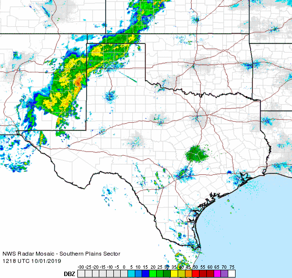 |
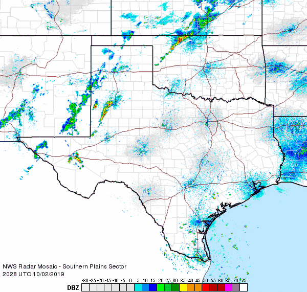
| Regional radar animation valid from 7:18 am to 8:28 am on 1 October 2019. Additional animations can be viewed at: 11:58 pm 30 September to 1:08 am on 1 October 2019; 6:08 pm to 7:18 pm on 1 October 2019; 3:18 pm to 4:28 pm on 2 October 2019; and 7:08 pm to 8:18 pm on 3 October 2019. |
| More widespread heavy rainfall then followed just in time to start the month of October. The initial band of heavy rain, fed by tropical moisture off of Tropical Storm Narda, near the Gulf of California, developed Monday night into early Tuesday. The rain band repeatedly trained over the western Texas Panhandle into southeast New Mexico and Far West Texas. Locations under this band of rain saw 2 to 3+ inches of rain, which did cause some minor flooding issues. Additional rounds of moderate to heavy rain followed Tuesday evening/night, primarily across the Texas Panhandle into the northwestern South Plains, while a few storms strayed further east by Wednesday (October 2nd). One final round of rain followed on Thursday as a cold front sagged through the region. |
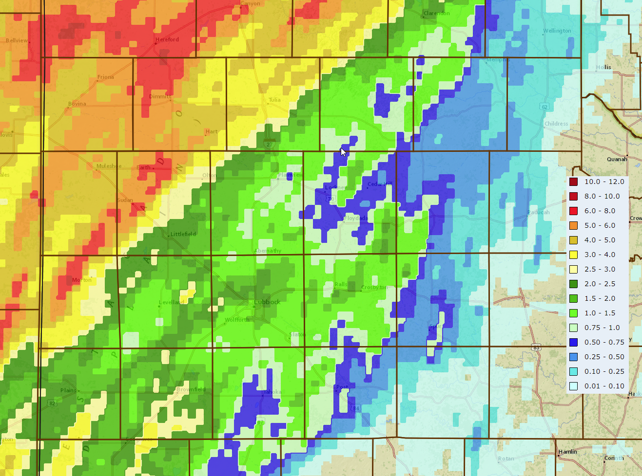 |
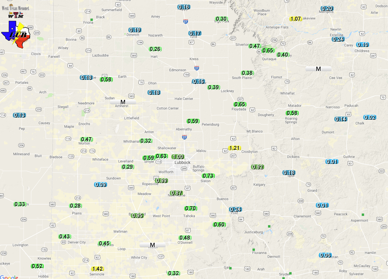
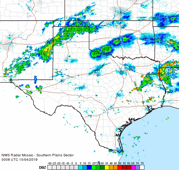
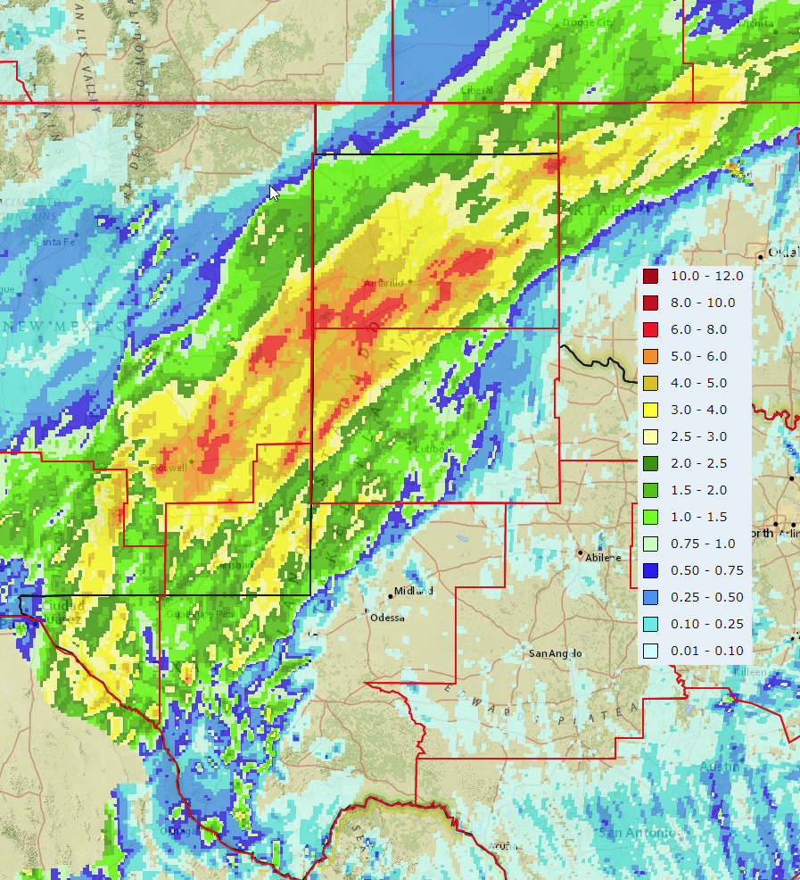
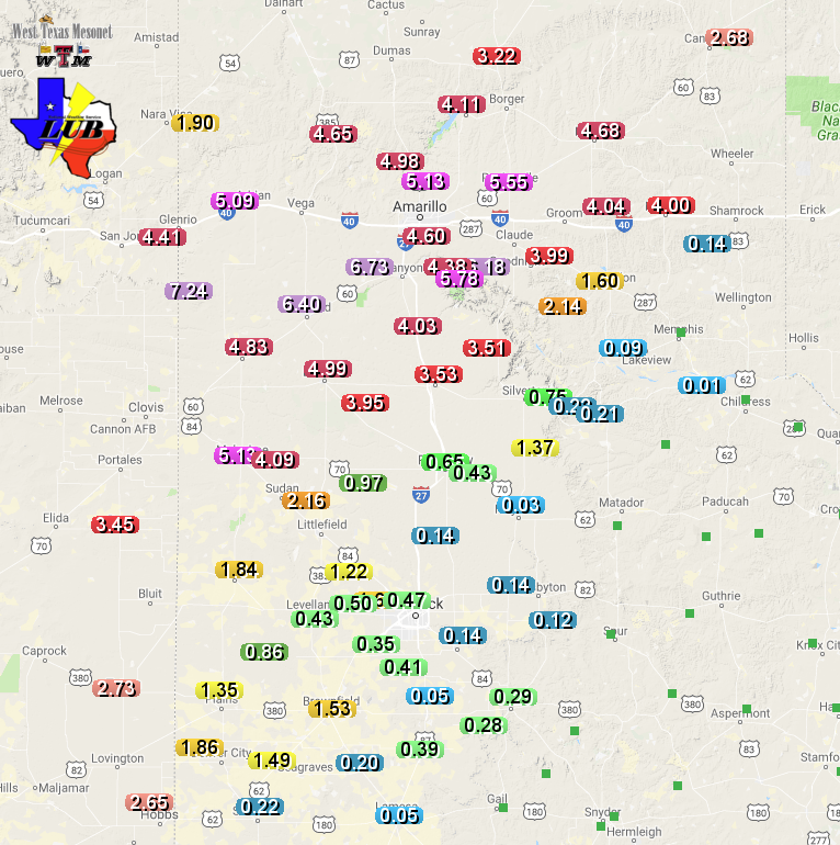
| 7-day radar-estimated and bias-corrected rain totals ending at 9 am on 4 October 2019. A regional view of the same information can be FOUND HERE. A plot of measured rain totals from the West Texas Mesonet over this same stretch can be VIEWED HERE. |
|
By the time all was said and done, 3 to 6+ inches of rain had fallen across the southwest Texas Panhandle and northwest South Plains. The rain totals quickly decreased with eastern extent and the eastern Rolling Plains missed out on the rain altogether. Officially, the Lubbock Airport recorded 2.29 inches of rain between September 28th and October 4th. This boosted the annual rain total 22.55 inches, some 6.71 inches above the normal year-to-date value. The widespread heavy rainfall did help to squish the late summer drought that had briefly tried to rear its ugly head. A listing of the preliminary storm and flooding reports for this active stretch fall weather can be found below. |
PRELIMINARY LOCAL STORM REPORT...SUMMARY
NATIONAL WEATHER SERVICE LUBBOCK TX
518 AM CDT MON SEP 30 2019

..TIME...   ...EVENT...      ...CITY LOCATION...     ...LAT.LON...
..DATE...   ....MAG....      ..COUNTY LOCATION..ST.. ...SOURCE....
            ..REMARKS..

0638 PM     TSTM WND GST     CAPROCK CANYON SP       34.41N 101.06W
09/28/2019  M58 MPH          BRISCOE            TX   MESONET

            REPORTED BY WEST TEXAS MESONET STATION

0700 PM     TSTM WND GST     9 WSW EARTH             34.19N 102.56W
09/28/2019  M73 MPH          LAMB               TX   MESONET

            MEASURED BY WEST TEXAS MESONET STATION. SUTAINED WIND
            SPEEDS OF 50-55 MPH ALONG WITH 5 MINUTES OF GUSTS AT OR
            ABOVE 60 MPH.

0737 PM     TSTM WND DMG     1 S DIMMITT             34.53N 102.32W
09/28/2019                   CASTRO             TX   LAW ENFORCEMENT

            BROKEN POWER POLE SOUTH SIDE OF TOWN ALONG
            FARM-TO-MARKET 3215

1100 PM     NON-TSTM WND GST 1 ENE MORTON            33.73N 102.74W
09/29/2019  M64 MPH          COCHRAN            TX   MESONET

            MEASURED BY THE WEST TEXAS MESONET. OCCURRED ON THE
            PERIPHERY OF A CLUSTER OF STORMS AND DIDN`T APPEAR TO
            DIRECTLY ASSOCIATED WITH THE CORE OF THE STORMS.

1105 PM     TSTM WND GST     2 S BROWNFIELD          33.15N 102.27W
09/29/2019  M58 MPH          TERRY              TX   MESONET

            MEASURED BY THE WEST TEXAS MESONET

1125 PM     TSTM WND GST     6 SSW WOLFFORTH         33.42N 102.05W
09/29/2019  M59 MPH          LUBBOCK            TX   MESONET

            MEASURED BY THE WEST TEXAS MESONET

1150 PM     TSTM WND GST     6 SSW ANTON             33.73N 102.19W
09/29/2019  M61 MPH          HOCKLEY            TX   MESONET

            MEASURED BY THE WEST TEXAS MESONET

0120 AM     NON-TSTM WND GST 2 ENE TULIA             34.54N 101.74W
09/30/2019  M65 MPH          SWISHER            TX   MESONET

            MEASURED BY THE WEST TEXAS MESONET. ASSOCIATED WITH A
            DECAYING AREA OF SHOWERS.

0138 AM     NON-TSTM WND GST 1 E HAPPY               34.74N 101.84W
09/30/2019  M70 MPH          SWISHER            TX   MESONET

            MEASURED BY THE WEST TEXAS MESONET. ASSOCIATED WITH A
            DECAYING AREA OF SHOWERS. THE WIND GUSTED TO 60 MPH OR
            HIGHER BETWEEN 1:36 AND 1:39 AM.

