|
2020 closes out with rain, thunderstorms, then snow |
|||
 |
|||
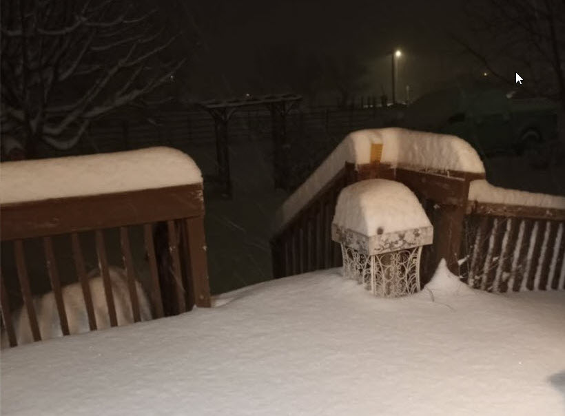
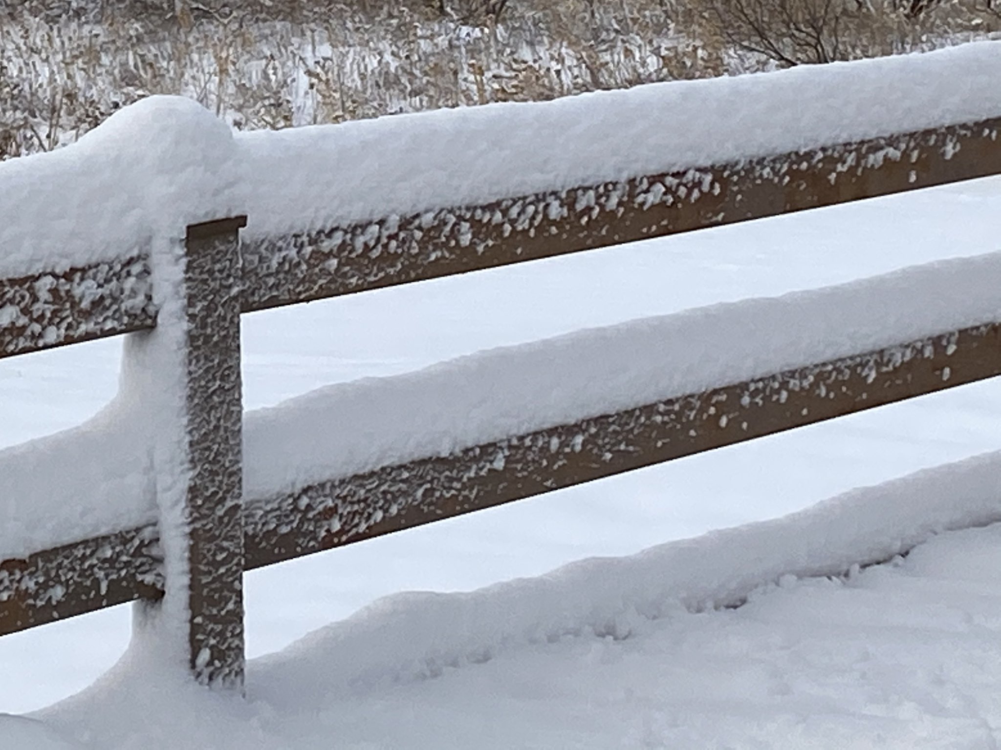
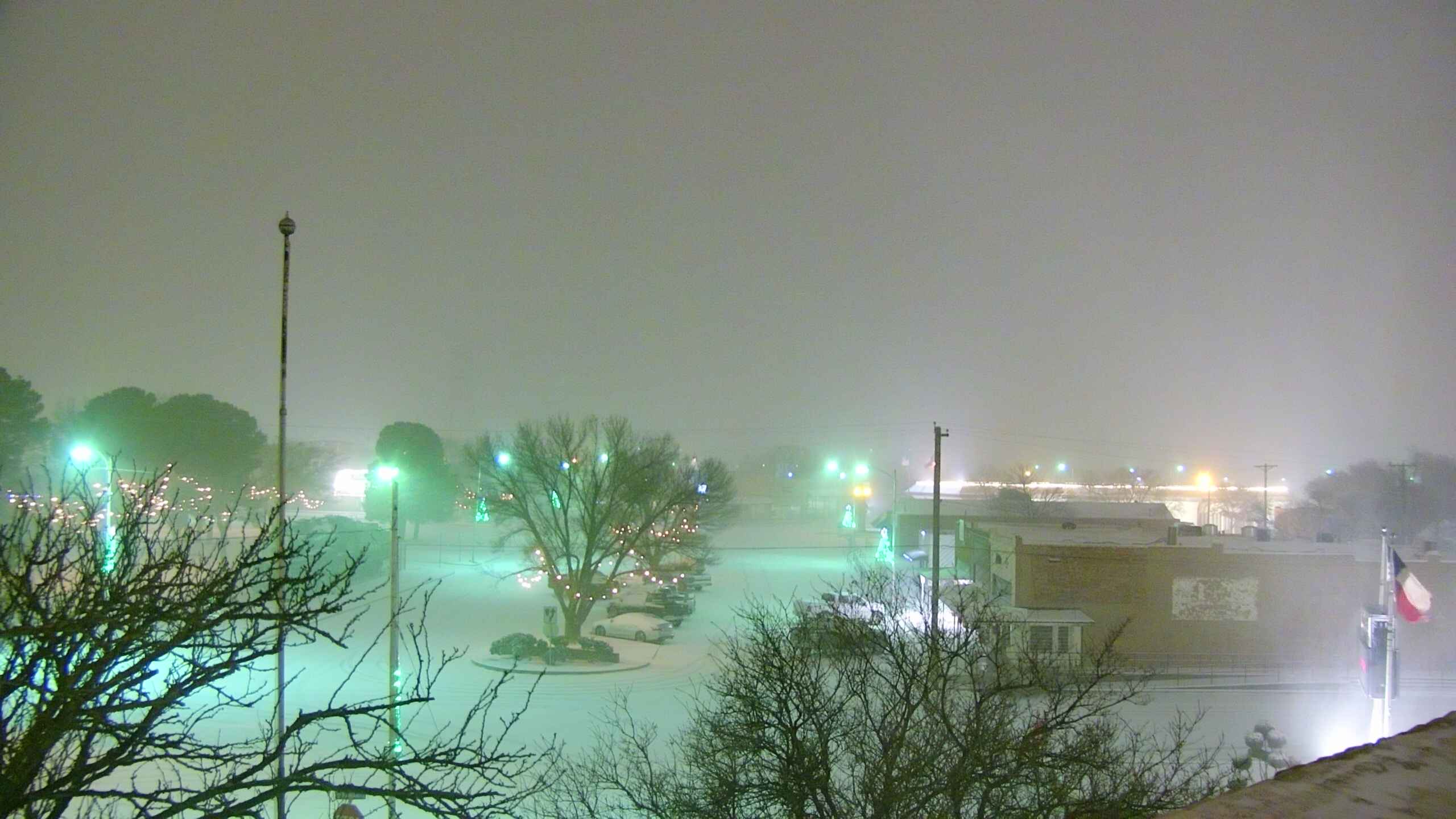
| Deep snow in Post early Friday morning (1 January 2021). The picture is courtesy of Tommy Cole and KCBD. | |||
|
A dry cold front move through late Sunday, December 27th, dropping highs from widespread 60s on Sunday to upper 40s and 50s on Monday. The front stalled across the center portion of the state on Monday, and Gulf moisture was pulled up and over the front late Monday into Tuesday morning. This caused low clouds and thick fog to form over much of the South Plains region by early Tuesday morning, complete with areas of drizzle and very light rain. The drizzle and very light rain yielded up to several hundredths of an inch across the southeast Texas Panhandle into the northern Rolling Plains Tuesday morning. Only trace amounts were recorded further south and west, including in Lubbock. |
|||
 |
|||
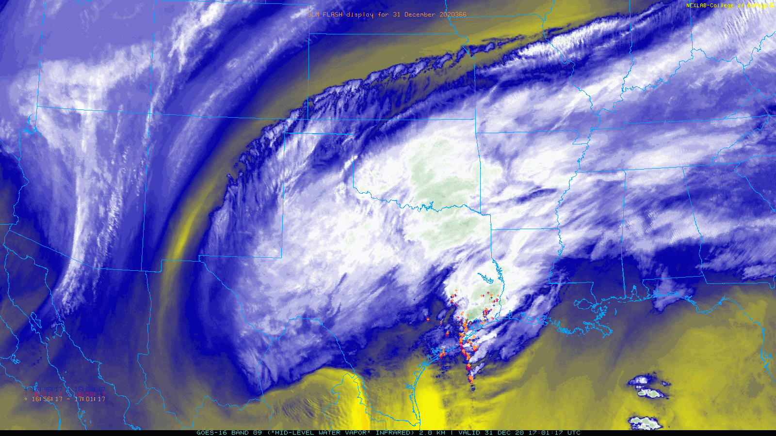
| Mid-level water vapor loop captured from GOES-16 on Thursday morning (31 December 2020) show a large storm system organizing over Texas. The animation is valid from 11:01 am to 11:46 am CST. | |||
| The fog gradually diminished from south-to-north Tuesday morning as a warm front lifted through, with sun returning to much of the region during the afternoon hours. The exception was over the southeast Texas Panhandle, where clouds hung tough and temperatures only warmed into the upper 40s and lower 50s. South of there, highs reached the upper 60s and lower 70s over the South and Rolling Plains. | |||
 |
|||
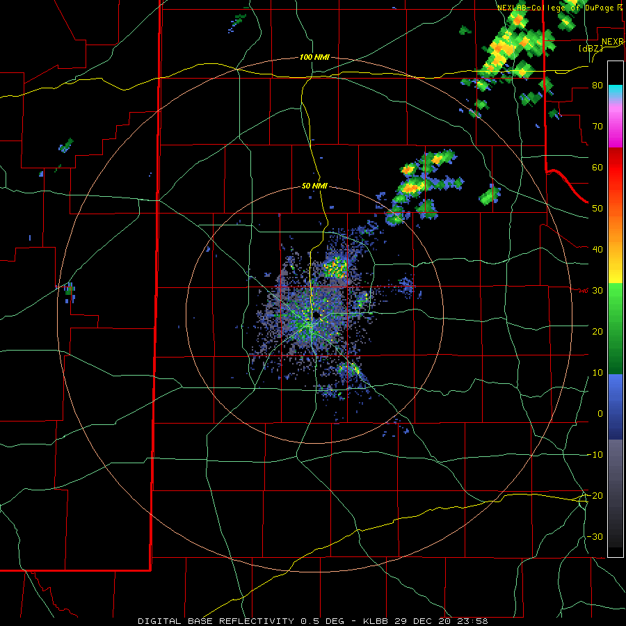
| Lubbock radar animation valid from 5:58 pm to 7:47 pm on Tuesday (29 December 2020). | |||
| The cooler air began to return south and eastward Tuesday evening in the form of a cold front. As this front encountered the warmer and moister air it sparked a line of showers and thunderstorms to develop from western Oklahoma and the southeast Texas Panhandle into the eastern South Plains. The stronger cores within this line produced small hail and brief heavy rain, with the Ralls WTM recording 0.17 inches of rain in just 2 minutes. The heavier rain cores didn't linger in one place very long, but the activity did tend to track over the same locations as the line was slow to move eastward and the individual cores moved repeatedly to the northeast. | |||
 |
|||
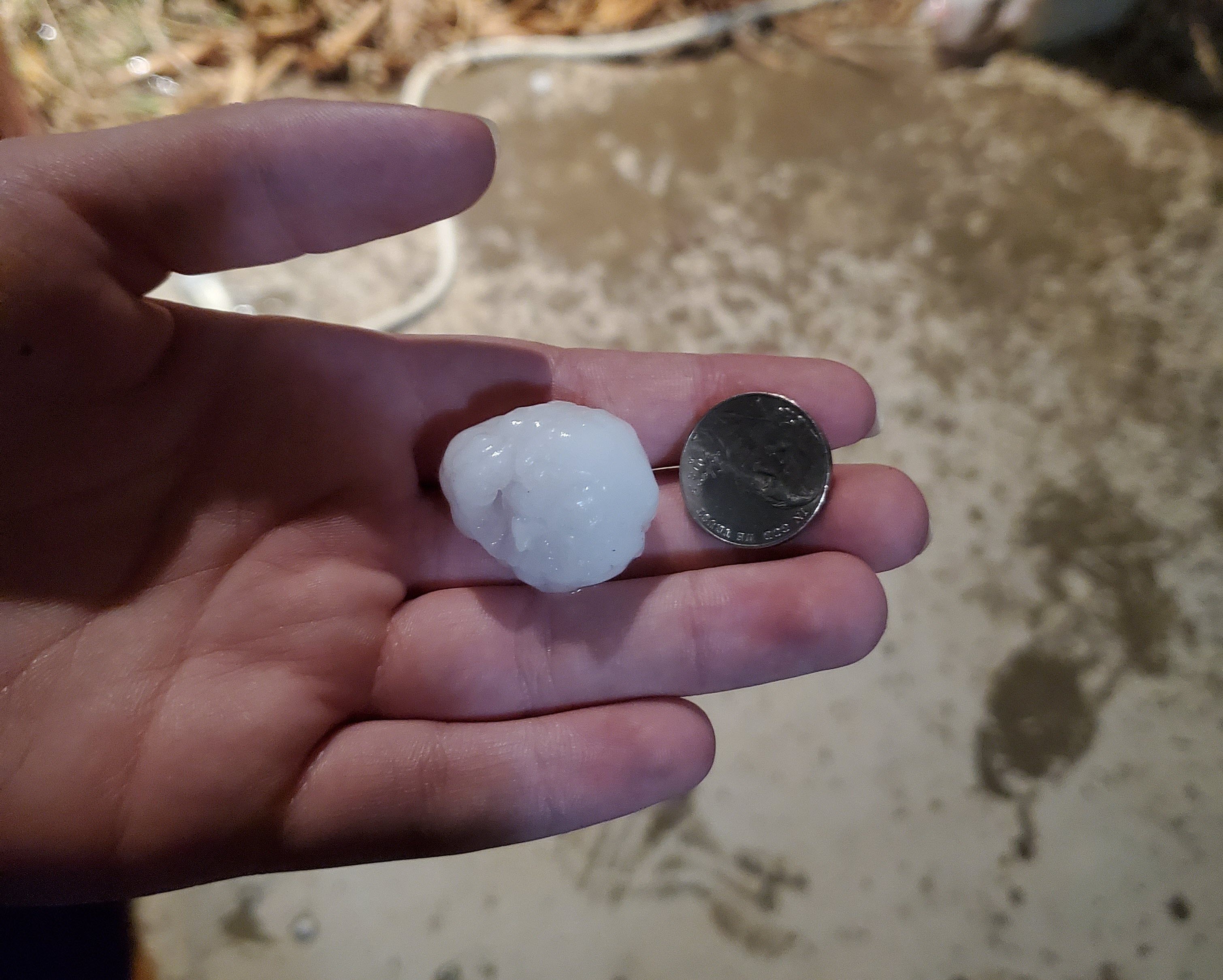
| Hail that fell in Ralls Tuesday evening (29 December 2020). The picture is courtesy of @flutter_jul on Twitter. | |||
| Where the showers and thunderstorms repeatedly tracked, rain totals of a half inch to over an inch were common from the southeast South Plains through the northern Rolling Plains and southeast Texas Panhandle. The West Texas Mesonet site near Hackberry recorded 1.13" over this period, with numerous sites from Post to White River Lake to Roaring Springs and Goodlett measuring near an inch. | |||
|
|
|||
 |
|||
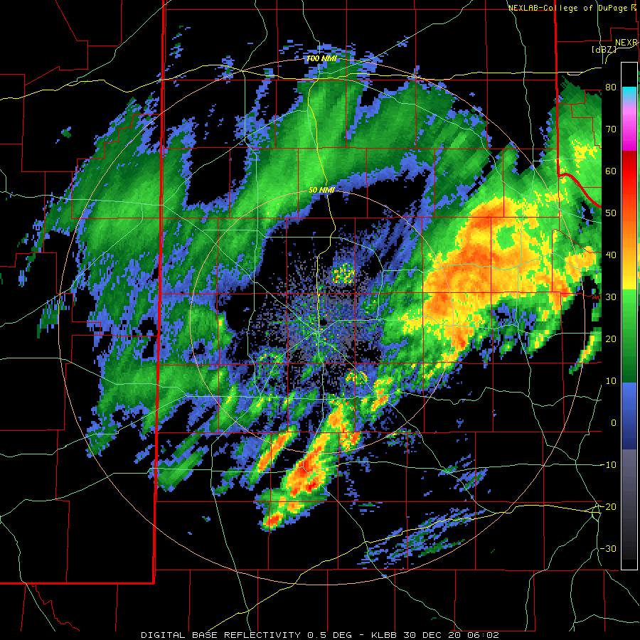
| Lubbock radar animation valid from 12:01 am to 1:49 am early Wednesday morning (30 December 2020). | |||
| The precipitation weakened in intensity early Wednesday morning, but temperatures also tumbled as a strong cold front moved through. North winds of 20-30 mph, with gusts to 45 mph, carried in the much colder air around and after midnight. As the temperature fell, the areas of lingering rain changed over to snow, with light accumulations measured in spots. Many locations for the central South Plains into the southeast Texas Panhandle and northern Rolling Plains picked up a dusting, while a few spots, including Matador, Flomot and Kirkland recorded around an inch of snow. The big snow winner early on the 30th was Floydada, where they measured 2 inches. | |||
|
|||
| A coating of snow blanketing Higginbotham Park in Lubbock early Wednesday morning (30 December 2020). The picture is courtesy of Mike Shaw. | |||
|
The wintry mix of precipitation diminished in coverage during the day Wednesday as the main storm system shifted southward into northern Mexico, while getting better organized. A large shield of wintry precipitation, mostly in the form of snow, then blossomed over southwestern Texas, including the Big Bend up through the Permian Basin Wednesday night. This moisture expanded northeastward through Thursday and Thursday night as the upper level low emerged from Mexico into South Texas, then pivoted and accelerated north-northeastward through Central and North Texas, exiting the region via eastern Oklahoma early Friday. |
|||
 |
|||
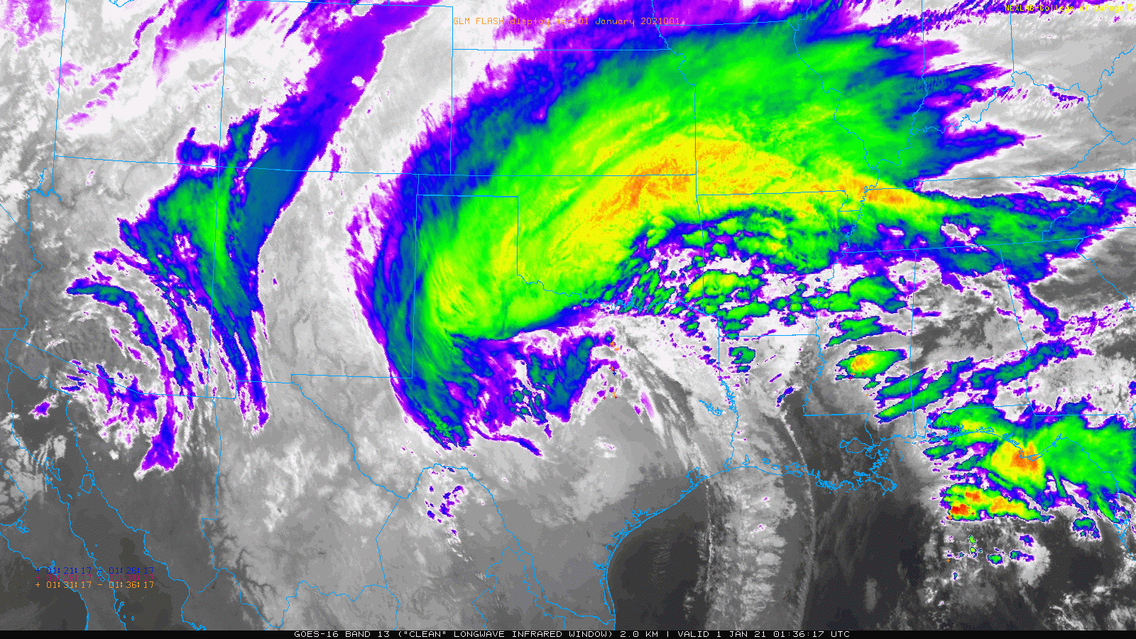
| Infrared satellite loop captured from GOES-16 on Thursday evening (31 December 2020) shows all the moisture and cloud cover wrapping around the storm system into West Texas. The animation is valid from 7:36 pm to 8:21 pm CST. | |||
| This caused the shield of precipitation to move across the southern Rolling Plains during the day Thursday, then gradually expand north and westward Thursday evening. Initially the air in place in the lower levels of the atmosphere was quite dry, so it took time for it to moisten up before the precipitation could reach the ground. This was especially true on the Caprock where dewpoints were in the single digits and lower teens. Although this dry air ate into the precipitation that made it to the ground, it did also promote evaporative cooling, which allowed temperatures to quickly drop to and below freezing once the precipitation began in earnest at ground level. This kept most of the precipitation in the wintry form of snow and sleet. | |||
 |
 |
||
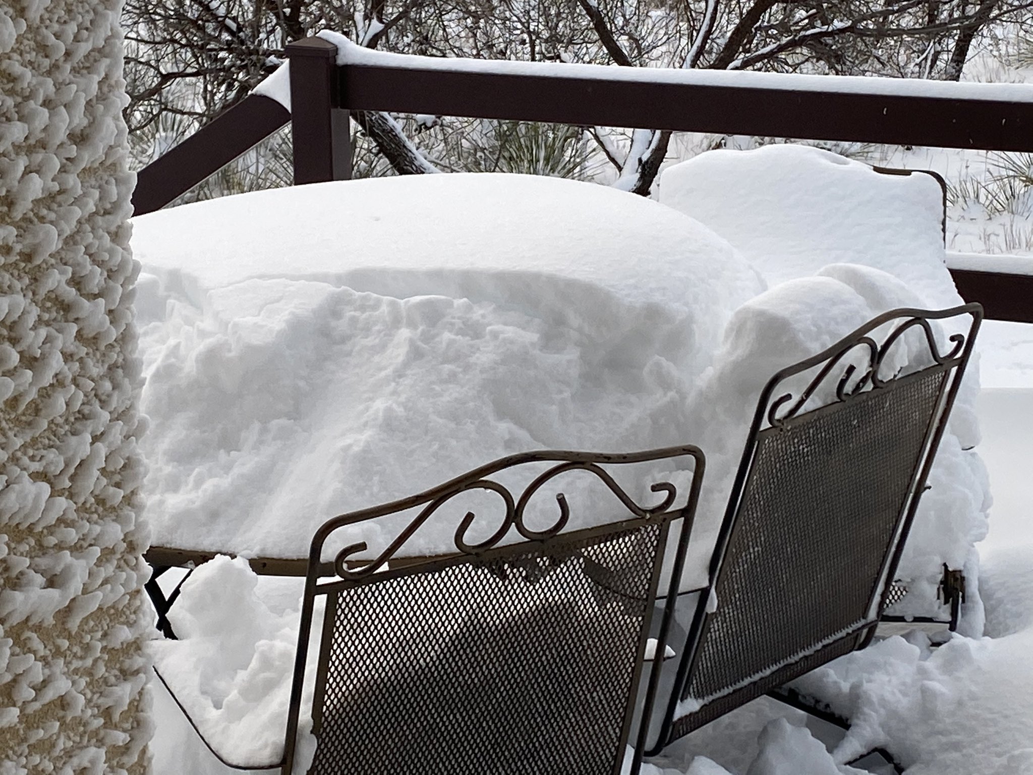
| Heavy snow that accumulated near Lake Alan Henry. The pictures were taken early Friday morning (1 January 2021) and are courtesy of Lake Alan Henry Weather (@lahwx) on Twitter. | |||
| The snow quickly diminished from south-to-north early Friday morning (New Year's Day), but not before dropping 1 to 3+ inches over much of the southeast Texas Panhandle, Rolling Plains and eastern South Plains. A few localized spots recorded even more, particularly in and around Post where 8.5 inches fell. Even heavier snow fell further south, including a foot or more along I-20 around Big Spring and an incredible 2 feet at Panther Junction, in Big Bend National Park. | |||
 |
|||
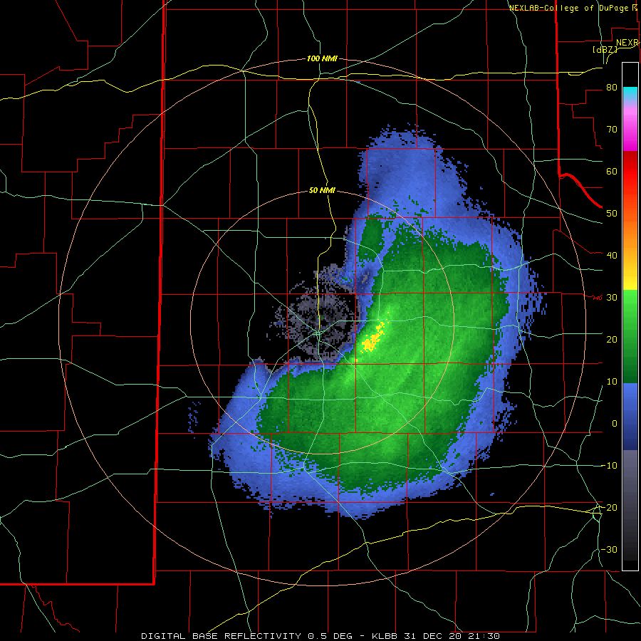
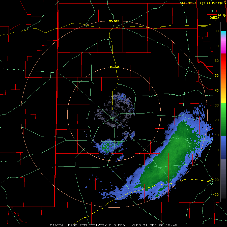
| Lubbock radar animation valid from 4:30 pm to 8:21 pm on Thursday (31 December 2020). The "hole" around Lubbock, surrounding the radar, indicates that the snow was evaporating/sublimating before it reached the ground. Where radar echoes are seen west of Lubbock, it was snowing well above ground level, but the snow was "drying up" before making it to the surface. The stronger radar echoes east of Lubbock did manage to surface and bring moderate to heavy snow to Slaton and points south and east. An additional radar animation, valid from 6:46 am to 11:45 am on the 31st, can be VIEWED HERE. | |||
| Where the heavy snow fell, travel became difficult to impossible. Thankfully, after the storm exited, temperatures rebounded into the 40s in most locations which did help road conditions improve. The combination of the moisture from the snow along with the rain and thunderstorms from the previous couple of days were welcome for the drought-stricken region. | |||
 |
 |
||
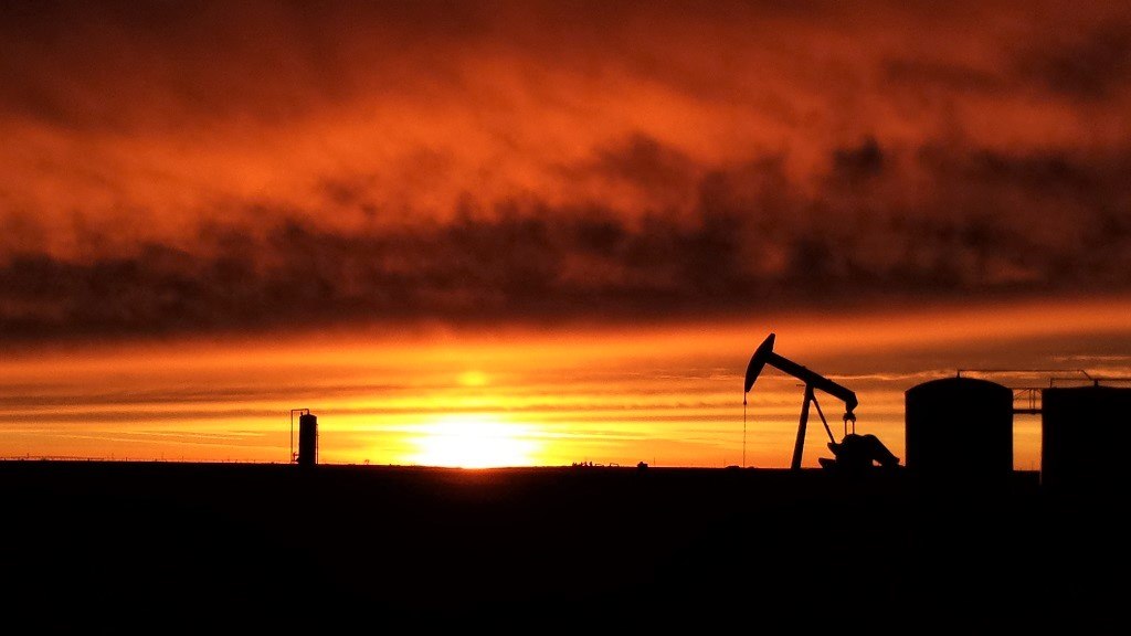
| Pictures taken Thursday evening (31 December 2020) from Slaton (left) and near Sundown (right). The images are courtesy of KAMC and the West Texas Mesonet, respectively. | |||
| The above pictures show the dramatic difference between what the sky looked like east of Lubbock (left) and west of Lubbock (right) Thursday evening. Although the central and western South Plains largely missed out on the snow, at least they were treated to a fine final sunset for 2020. | |||
 |
|||
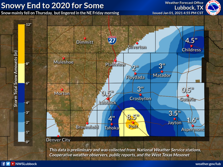
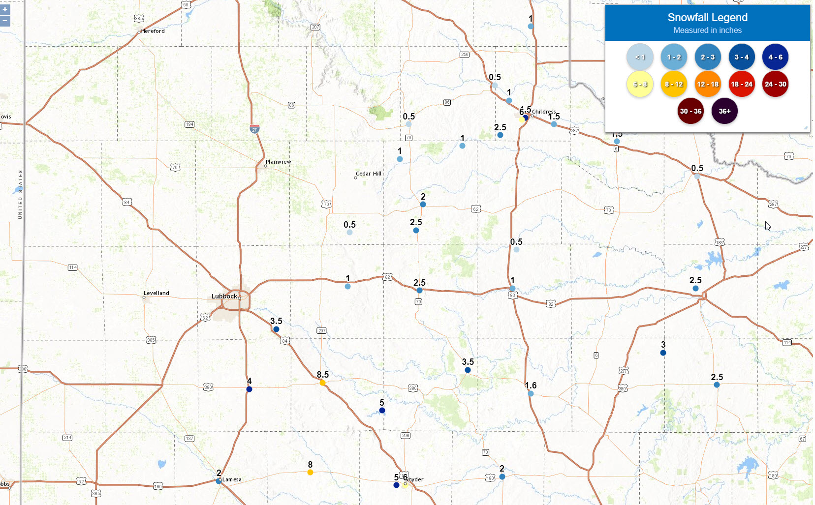
| Graphic displaying the approximate snowfall that fell Thursday into early Friday morning (31 December 2020 to 1 January 2021). Actual snow reports collected by the National Weather Service can be SEEN HERE. A plot of statewide snowfall for this event can be ACCESSED HERE. | |||
| When all was said and done, the heaviest snow fell in a swath from the southeast South Plains and western Rolling Plains into the southeast Texas Panhandle. Post was at the epicenter, though Lake Alan Henry had around a half foot of snow and Slaton, Tahoka and Childress recorded around 4 inches. | |||
 |
|||
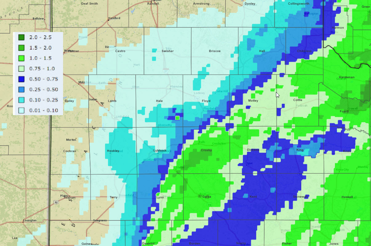
| Radar-estimated and bias-corrected 3-day liquid equivalent ending at 6 am on 1 January 2021. The melted precipitation measured by the West Texas Mesonet for this same stretch can be FOUND HERE. | |||
|
The combination of the rain, thunderstorms and snow resulted in meaningful precipitation for the eastern South Plains, southeast Texas Panhandle and much of the Rolling Plains. When melted down, liquid equivalents of 0.50 to 1.50 inches were common generally along and east of a Childress to Crosbyton to Lamesa line. Lubbock wasn't so lucky, officially only tallying 0.04 inches of rain and a trace of snow. Childress officially recorded 0.90 inches of moisture with this event, with 2 to 4+ inches of snow falling around town. The preliminary snow and rain reports for this end of the year winter storm can be viewed below. |
|||
PRELIMINARY LOCAL STORM REPORT...SUMMARY
NATIONAL WEATHER SERVICE LUBBOCK TX
1111 AM CST FRI JAN 01 2021

..TIME...   ...EVENT...      ...CITY LOCATION...     ...LAT.LON...
..DATE...   ....MAG....      ..COUNTY LOCATION..ST.. ...SOURCE....
            ..REMARKS..

0230 PM     SNOW             LAKE ALAN HENRY         33.06N 101.05W
12/31/2020  M1.5 INCH        GARZA              TX   CO-OP OBSERVER

            AS OF 2:30 PM

0720 PM     SNOW             TAHOKA                  33.16N 101.79W
12/31/2020  M1.0 INCH        LYNN               TX   SOCIAL MEDIA

            APPROX. 1 HOUR`S WORTH OF ACCUMULATION.

0826 PM     SNOW             CROSBYTON               33.64N 101.24W
12/31/2020  E1.0 INCH        CROSBY             TX   LAW ENFORCEMENT

            ROADS ARE ICY.

0140 AM     SNOW             TAHOKA                  33.16N 101.79W
01/01/2021  M3.5 INCH        LYNN               TX   SOCIAL MEDIA

0220 AM     SNOW             POST                    33.19N 101.38W
01/01/2021  M8.0 INCH        GARZA              TX   LAW ENFORCEMENT

0235 AM     SNOW             CROSBYTON               33.64N 101.24W
01/01/2021  E3.0 INCH        CROSBY             TX   LAW ENFORCEMENT

0320 AM     SNOW             TAHOKA                  33.16N 101.79W
01/01/2021  M4.0 INCH        LYNN               TX   LAW ENFORCEMENT

0320 AM     SNOW             CHILDRESS               34.42N 100.25W
01/01/2021  M4.5 INCH        CHILDRESS          TX   LAW ENFORCEMENT

0350 AM     SNOW             MATADOR                 34.02N 100.82W
01/01/2021  M2.0 INCH        MOTLEY             TX   LAW ENFORCEMENT

0400 AM     SNOW             SLATON                  33.44N 101.64W
01/01/2021  M3.5 INCH        LUBBOCK            TX   SOCIAL MEDIA

0425 AM     SNOW             DICKENS                 33.62N 100.84W
01/01/2021  M2.5 INCH        DICKENS            TX   LAW ENFORCEMENT

0715 AM     HEAVY SNOW       JAYTON                  33.25N 100.57W
01/01/2021  E3.5 INCH        KENT               TX   PUBLIC

            ESTIMATED 3-4 INCHES OF SNOW

0730 AM     HEAVY SNOW       ROARING SPRINGS         33.90N 100.86W
01/01/2021  E2.5 INCH        MOTLEY             TX   CO-OP OBSERVER

            ESTIMATED 2-3 INCHES OF SNOW

0740 AM     HEAVY SNOW       2 SW CHILDRESS          34.41N 100.27W
01/01/2021  M6.0 INCH        CHILDRESS          TX   SOCIAL MEDIA

            REPORT FROM FACEBOOK

0745 AM     SNOW             POST                    33.19N 101.38W
01/01/2021  M8.5 INCH        GARZA              TX   LAW ENFORCEMENT

            STORM TOTAL


