
Dangerous heat will expand from the Gulf Coast into the Southern Plains and Desert Southwest through week's end. Additional extreme heat impacting the Pacific Northwest will shift to the northern Plains by the weekend. Tropical Storm Bertha is expected to continue to impact portions of the northern Gulf Coast from the western Florida Panhandle to southeastern Louisiana through tonight. Read More >
|
Active stretch of mid-June weather |
|||||||||||
 |
|||||||||||
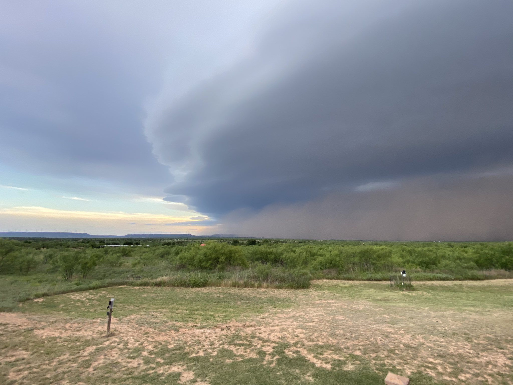
| Shelf cloud, gust front and dust cloud approaching Lake Alan Henry Wednesday evening (17 June 2020). The image is courtesy of @lahwx on Twitter. | |||||||||||
|
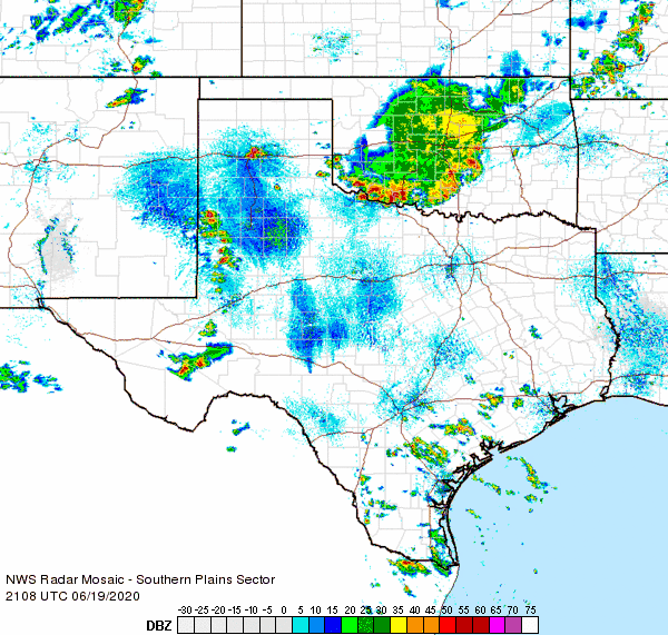
Hot temperatures, a dryline and a weak upper level disturbance were sufficient to initiate a broken line of thunderstorms across the western South Plains Wednesday afternoon (17 June). The storms accelerated eastward producing brief heavy rain and strong to severe wind gusts as they moved across the Caprock through the late afternoon and evening. |
|||||||||||
 |
|||||||||||
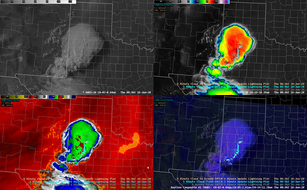
| Several different satellite perspectives (clockwise from upper left - visible, infrared, daytime composite and water vapor) captured at 7:36 pm on 17 June 2020. | |||||||||||
| Wind gusts in excess of 65 mph were measured by West Texas Mesonet sites near Earth, Abernathy, New Home, Tahoka and Graham as the activity raced east and southeast. A peak gust of 71 mph was measured at both Earth and New Home. A particularly strong but small downburst, called a microburst, impacted the south part of Brownfield. Very intense winds leaned over or snapped off numerous power poles, damaged several mobile homes and destroyed one mobile home. Two center pivots were also destroyed and numerous car windows were broken at the Rudd Correctional Facility. Given the magnitude of the damage, a National Weather Service damage survey team estimated peak wind gusts of 100 to 105 mph likely affected the area. | |||||||||||
 |
|||||||||||
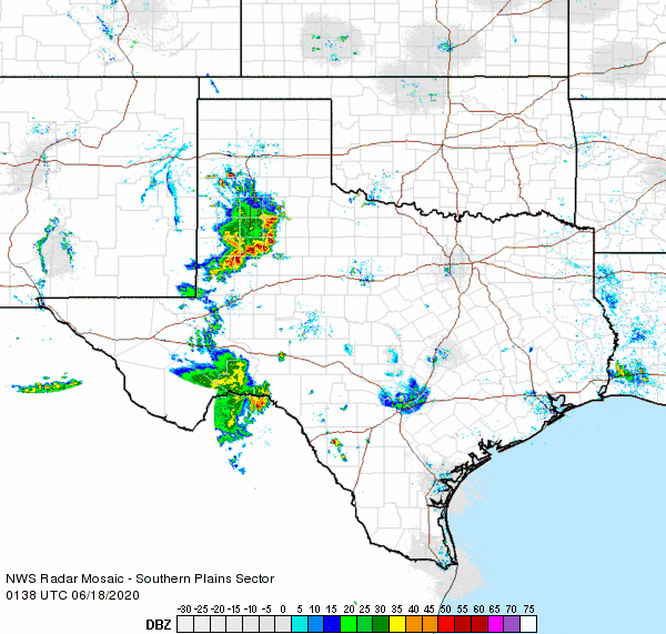
| Regional radar animation valid from 8:38 pm to 9:48 pm on 17 June 2020. | |||||||||||
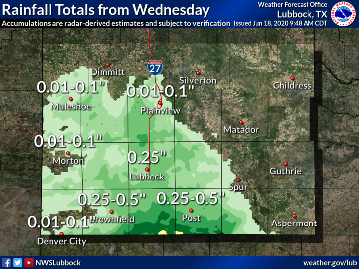
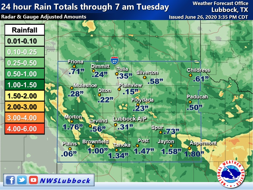
| The thunderstorm weren't all bad, as they also brought beneficial rain to much of the South Plains. The heaviest rain fell over the south-central South Plains where rain totals near and above an inch occurred. | |||||||||||
 |
|||||||||||
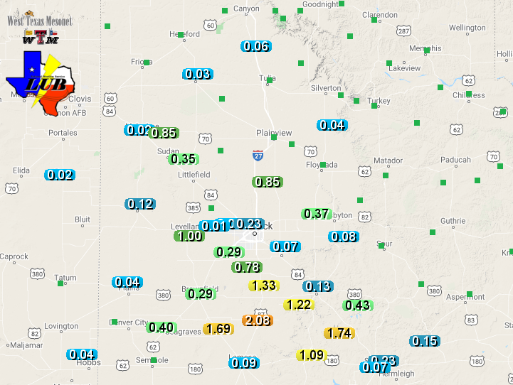
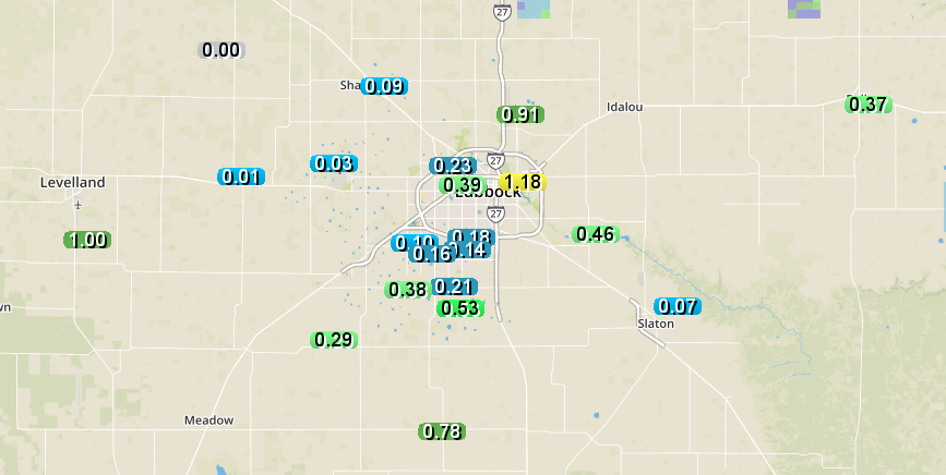
| 24-hour radar-estimated rainfall ending at 7 am on Thursday (18 June 2020). Measured rain totals for this same period, as recorded by the West Texas Mesonet, can be VIEWED HERE. A close up of rain totals near Lubbock can also be FOUND HERE. | |||||||||||
|
|||||||||||
| After a quiet day on Thursday, the weather turned active again Friday afternoon (19 June). Scattered thunderstorms erupted across the western South Plains, producing strong winds as they moved eastward. The storms grew into a large complex as they moved off the Caprock. Wind gusts as high as 69 mph and 66 mph were measured by the West Texas Mesonet sites near McAdoo and White River Lake, respectively. The winds also downed several road signs east of Roaring Springs. | |||||||||||
 |
|||||||||||
| Regional radar animation valid from 4:08 pm to 5:18 pm on 19 June 2020. | |||||||||||
| A final round of widespread showers and thunderstorms traversed West Texas Monday night into Tuesday morning (22-23 June). Numerous strong to severe wind gusts were recorded across the South Plains, including a peak gust of 77 mph near Morton. The intense winds downed power lines in Littlefield and Lubbock. | |||||||||||
 |
|||||||||||
| 24-hour radar-estimated rainfall ending at 7 am on Tuesday (23 June 2020). | |||||||||||
|
On the positive side, the severe squall line did bring widespread precipitation to the region. Rain totals of a quarter to half inch of rain were common, with over an inch measured in many spots across the southern South and Rolling Plains. Over the course of the unsettled middle part of June, Lubbock officially recorded 1.16 inches of rain while Childress measured 2.24 inches. The preliminary storm reports for this active mid-June can be viewed below. |
PRELIMINARY LOCAL STORM REPORT...SUMMARY
NATIONAL WEATHER SERVICE LUBBOCK TX
126 AM CDT THU JUN 18 2020

..TIME...   ...EVENT...      ...CITY LOCATION...     ...LAT.LON...
..DATE...   ....MAG....      ..COUNTY LOCATION..ST.. ...SOURCE....
            ..REMARKS..

0456 PM     TSTM WND GST     9 WSW EARTH             34.19N 102.56W
06/17/2020  M71 MPH          LAMB               TX   MESONET

            WEST TEXAS MESONET

0645 PM     TSTM WND GST     6 SSW WOLFFORTH         33.42N 102.05W
06/17/2020  M61 MPH          LUBBOCK            TX   MESONET

            WEST TEXAS MESONET

0702 PM     TSTM WND DMG     BROWNFIELD              33.18N 102.27W
06/17/2020                   TERRY              TX   LAW ENFORCEMENT

            MULTIPLE POWERLINES DOWN. EXTENSIVE DAMAGE TO MOBILE
            HOME.

0720 PM     TSTM WND GST     5 ENE ABERNATHY         33.88N 101.76W
06/17/2020  M69 MPH          HALE               TX   MESONET

            WEST TEXAS MESONET

0720 PM     NON-TSTM WND GST NEW HOME                33.33N 101.91W
06/17/2020  M71 MPH          LYNN               TX   MESONET

            WEST TEXAS MESONET

0742 PM     TSTM WND GST     3 NNE TAHOKA            33.21N 101.78W
06/17/2020  M66 MPH          LYNN               TX   MESONET

            WEST TEXAS MESONET

0820 PM     TSTM WND GST     5 SSW GRAHAM            33.08N 101.52W
06/17/2020  M69 MPH          GARZA              TX   MESONET

            WEST TEXAS MESONET


