Overview
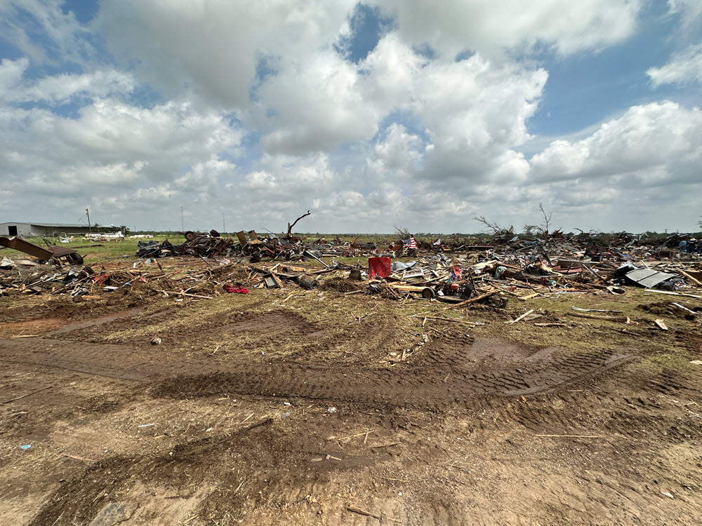
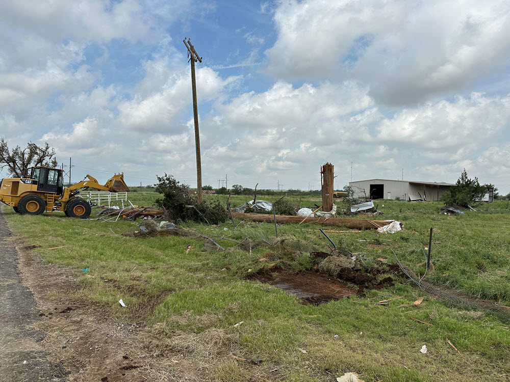
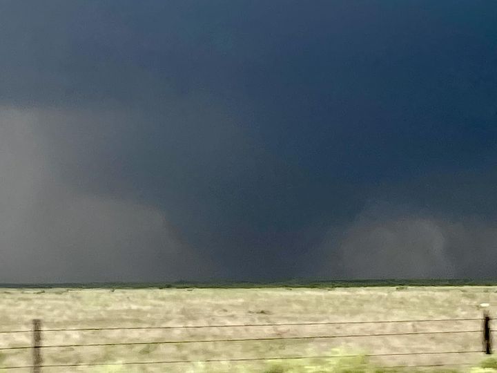
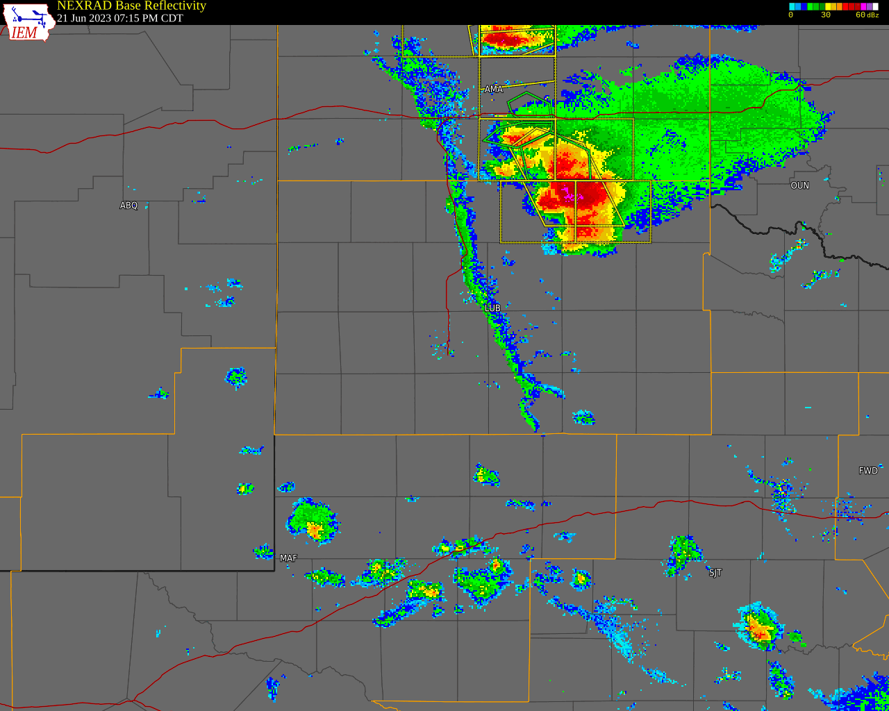
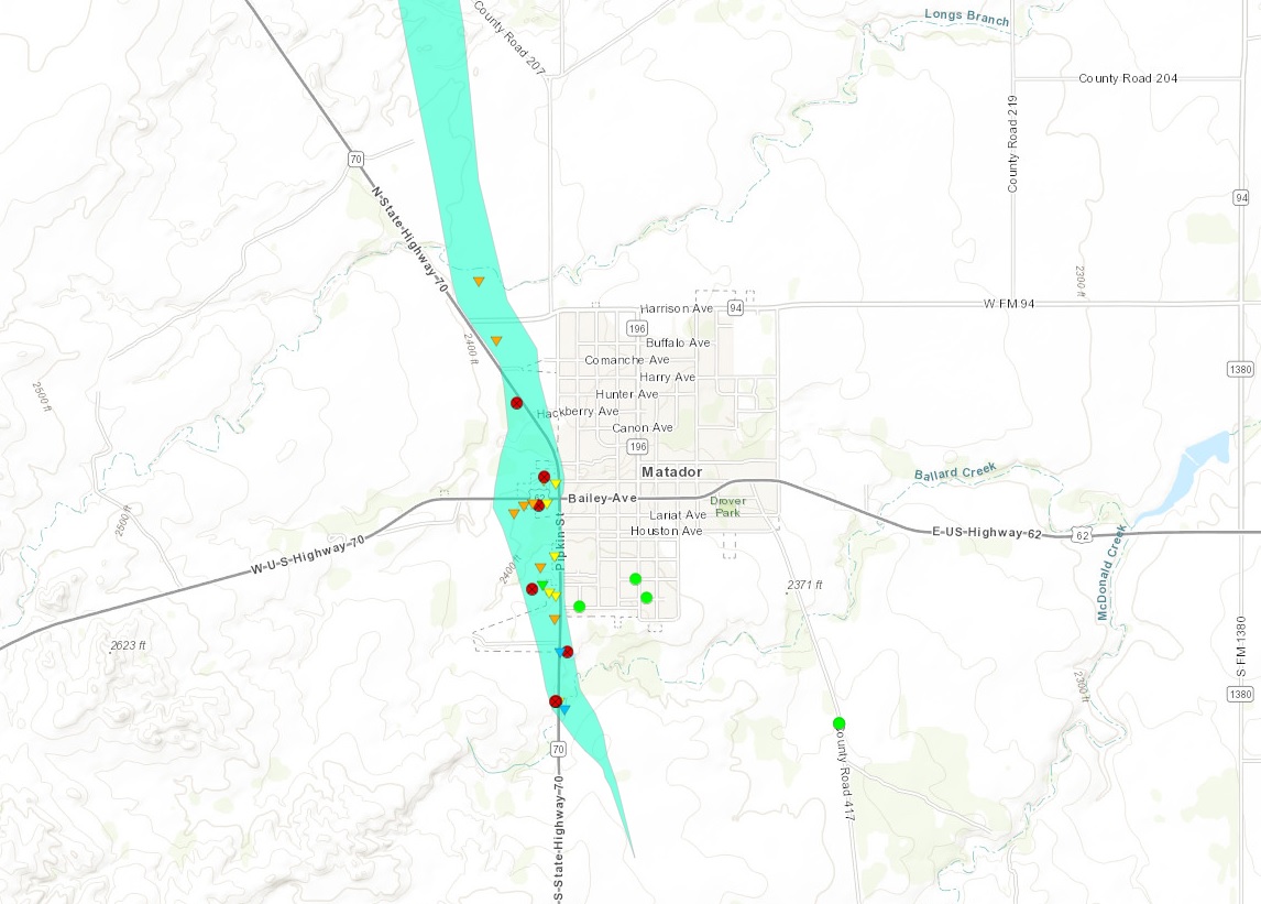
A supercell thunderstorm developed in the far southern Texas Panhandle during the late afternoon of Wednesday, June 21, 2023. This supercell moved south-southeastward through the western Rolling Plains during the evening and eventually moved into the Texas Big Country and the San Angelo National Weather Service forecast area around 11 pm CDT. This storm quickly intensified in Motley County just north of Matador, TX where the first of five reported tornadoes occurred around 7:50 pm CDT, however no survey was conducted as no damage was reported. This storm then produced a third of a mile wide tornado that went through the west side of Matador around 8 pm CDT killing 4 people and injuring 15 others. Peak wind gusts corresponding to the observed damage were estimated to be in the 145 mph to 165 mph range, resulting in an EF-3 rating. This rating was determined through consultation with engineers from the Texas Tech University National Wind Institute, who also performed a damage survey in Matador. It also produced extremely large hail with the largest stone measuring 4.5” in diameter on the east side of Matador.
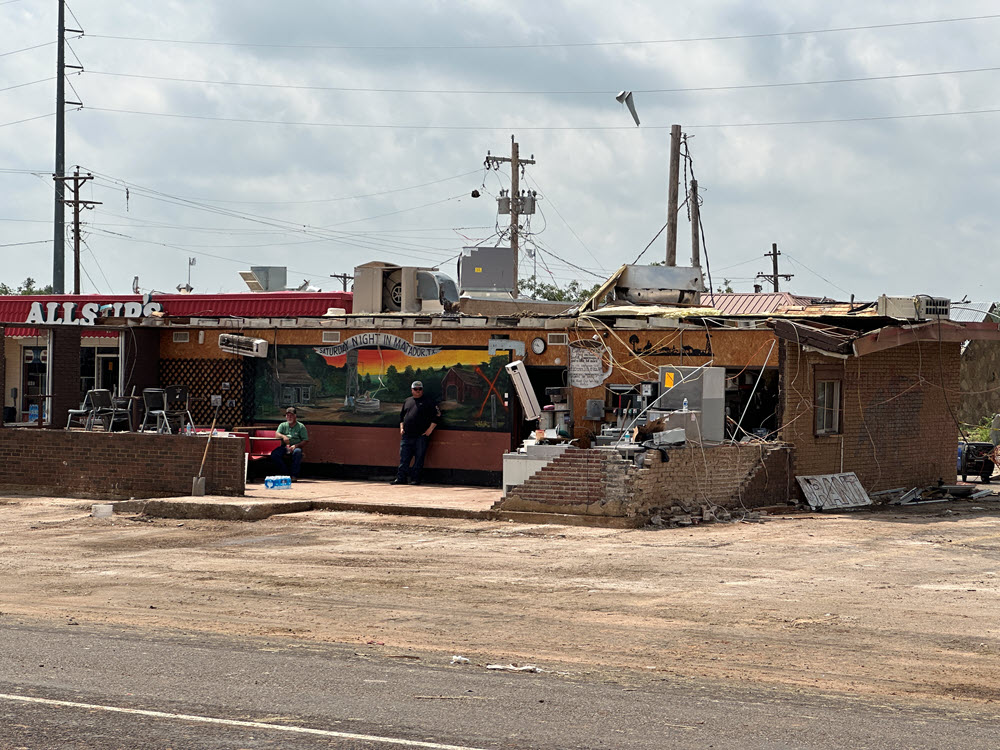
Three of the four deaths that occurred from the tornado in Matador happened on the west side of the intersection of Highways 62 and 70. This included a man who was in or near his semi parked at the gas station on the north side of Highway 62, as well as two men that were inside a Recreational Vehicle parked next to a restaurant on the south side of the highway. Both the tractor-trailer and RV were rolled and completely destroyed. The fourth victim was a woman inside her home located about three-tenths of a mile south of the intersection and west of Highway 70. All of the walls of the home failed, collapsing on the victim and her husband, who was injured but survived.
This killer tornado occurred relatively late in the season for West Texas, which typically experiences the bulk of the its intense severe thunderstorms in April, May and early June. However, this late of a killer tornado in West Texas is not unprecedented. One tornado that touched down in Briscoe County, near Silverton, on June 22, 1975, killed 3 people.
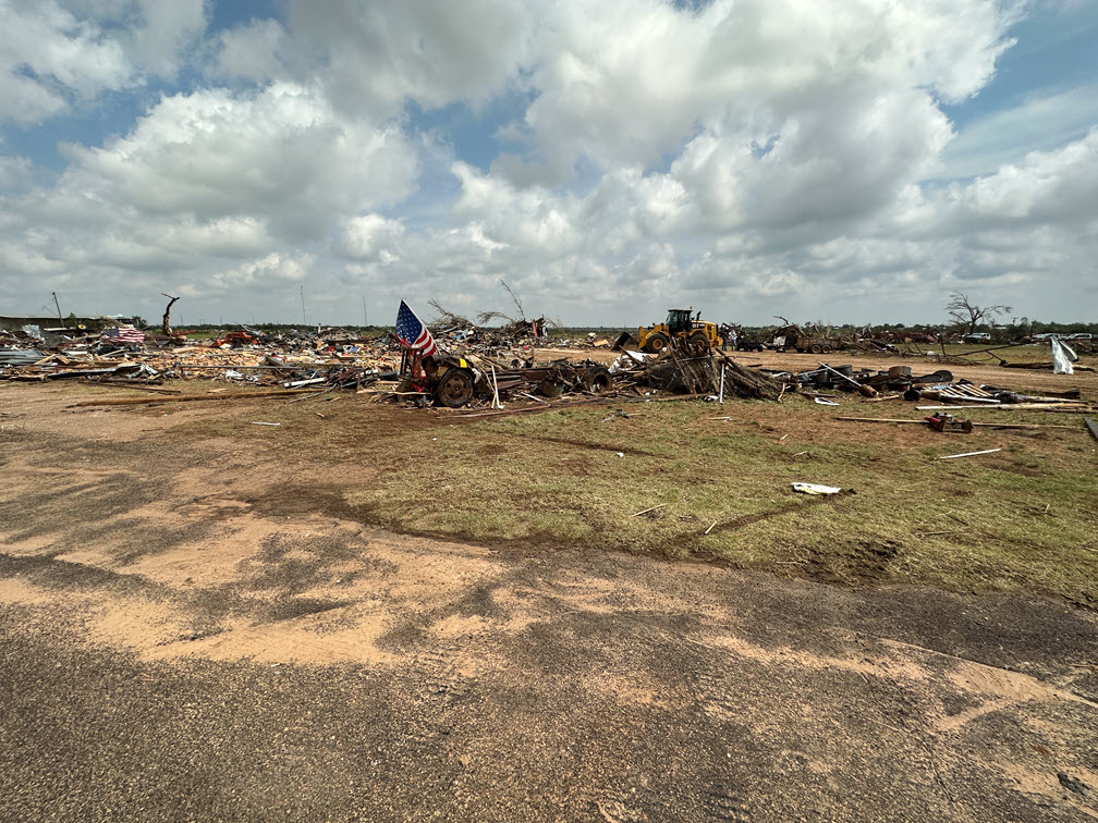 |
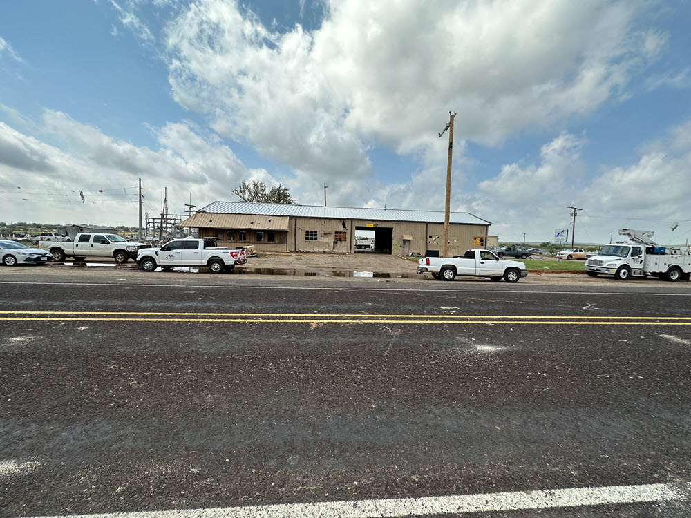
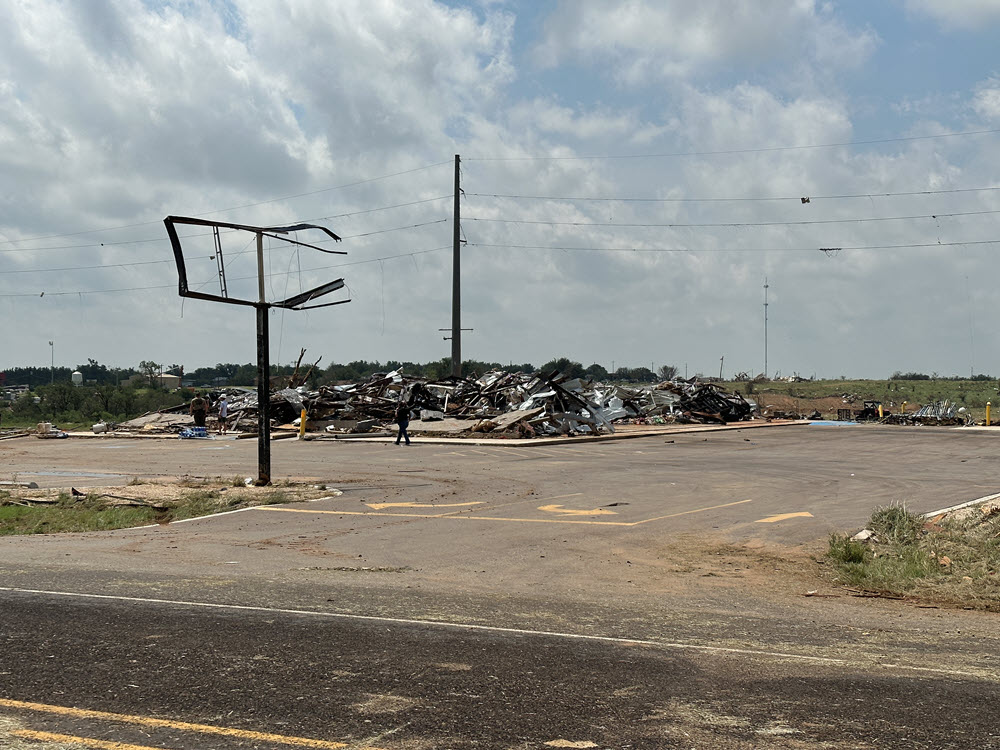
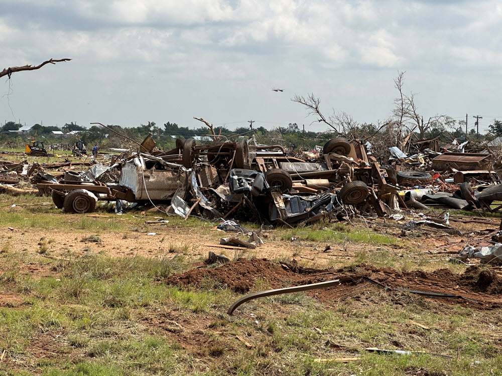
| Widespread severe damage and ongoing cleanup on the west side of Matador the day after a tornado hit town. |
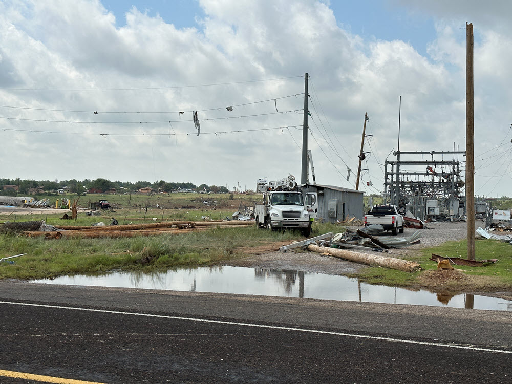
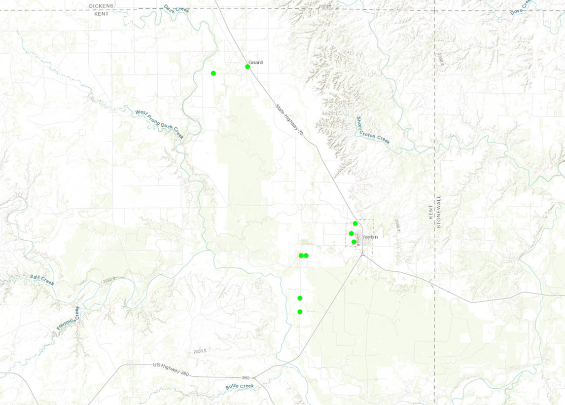
The storm continued moving to the south-southeast where an 80 mph gust was reported at the Roaring Springs West Texas Mesonet site at 8:22 pm CDT, most likely associated with a rear flank downdraft surge. As it entered northern Dickens County another tornado was reported by an off-duty NWS employee approximately 5.5 miles northeast of Afton, however no damage was reported with this tornado. A second supercell produced a brief tornado west-southwest of Matador at 8:37 pm CDT that also produced no known damage. Shortly afterward, that supercell began to merge with the initial supercell with the fifth and final tornado being reported on US Highway 82 approximately 8 miles east of Dickens and no damage was observed with this tornado either. As the storm continued to move to the south-southeast a broad rear flank downdraft was noted on radar with the peak measured gust of 109 mph at the West Texas Mesonet site in Jayton at 10:07 pm CDT with 19 minutes of continuous severe wind gusts. These strong winds also occurred with hail up to four inches in diameter leading to damage observed along State Highway 70 in northeast Kent County including in and around the towns of Girard and Jayton.
Detailed damage survey information gathered from in and around Matador, as well as near Girard and Jayton, can be explored on the Damage Assessment Toolkit (DAT) Viewer located at:
Damage Assessment Toolkit (noaa.gov)
When viewing the DAT, be sure to set the "Begin Time" (located in the upper right corner) back to at least 6/21/2023. Then zoom in to Matador, Girard or Jayton and select the various damage points for additional information and images.
Tornadoes:
|
Tornado - North of Matador
Track Map No survey done
|
||||||||||||||||
|
Tornado - Matador, Texas
|
||||||||||||||||
|
Tornado - near the town of Afton
Track Map No survey done
|
||||||||||||||||
|
Tornado - Southwest of Matador
Track Map No survey done |
||||||||||||||||
|
Tornado - Near the town of Dickens
Track Map No survey done |
||||||||||||||||
|
Severe Winds in Girard and Jayton
|
||||||||||||||
The Enhanced Fujita (EF) Scale classifies tornadoes into the following categories:
| EF0 Weak 65-85 mph |
EF1 Moderate 86-110 mph |
EF2 Significant 111-135 mph |
EF3 Severe 136-165 mph |
EF4 Extreme 166-200 mph |
EF5 Catastrophic 200+ mph |
 |
|||||
Images
 |
 |
 |
 |
| Damage in Matador (Bruce Haynie) |
Damage in Matador (Bruce Haynie) |
Damage in Matador (Bruce Haynie) |
Damage in Matador (Bruce Haynie) |
 |
 |
 |
 |
| Damage in Matador (Bruce Haynie) |
Damage in Matador (Bruce Haynie) |
Damage in Matador (Bruce Haynie) |
Damage in Matador (Bruce Haynie) |
 |
 |
 |
 |
| Damage in Matador (Bruce Haynie) |
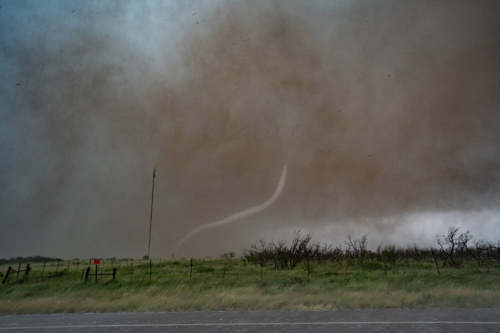
Tornado near Matador (Tim Marshall) |
Tornadic storm near Matador (Bruce Haynie) |
Rope phase of the Matador tornado (Jim LaDue) |
 |
 |
||
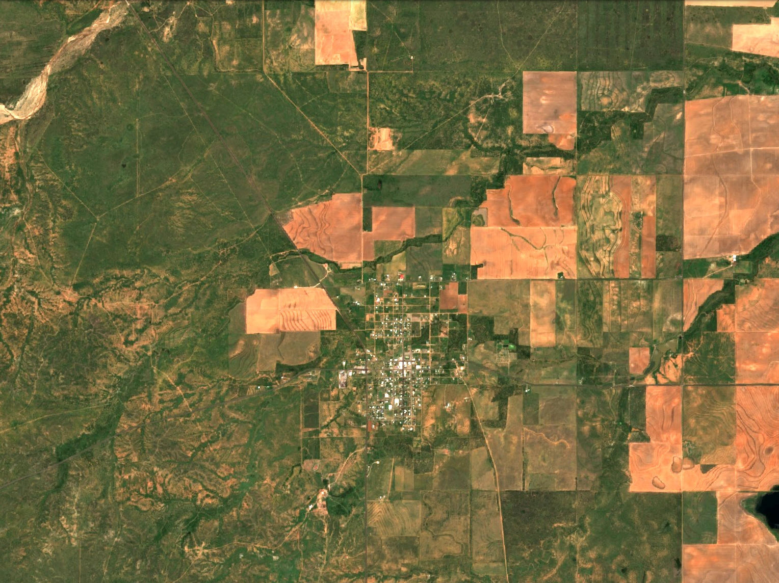
| Satellite imagery of the Matador area before the tornado (https://www.sentinel-hub.com/) |
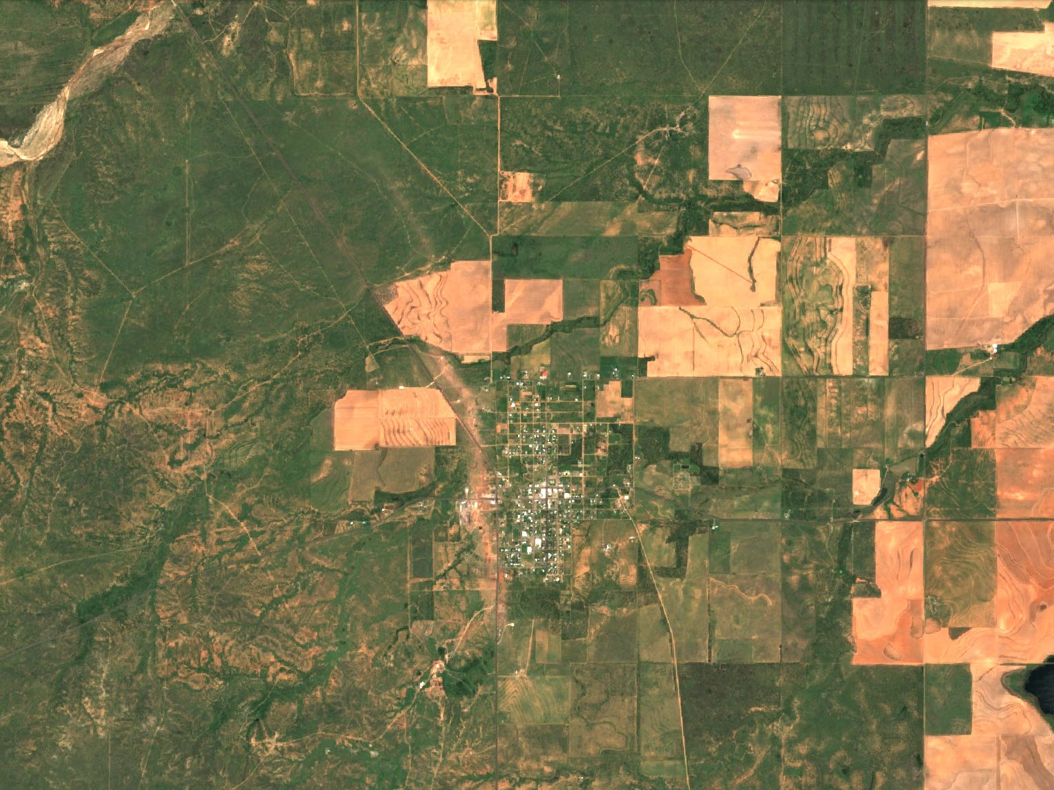
Satellite imagery of the Matador area after the tornado (https://www.sentinel-hub.com/) |
Radar
 |
 |
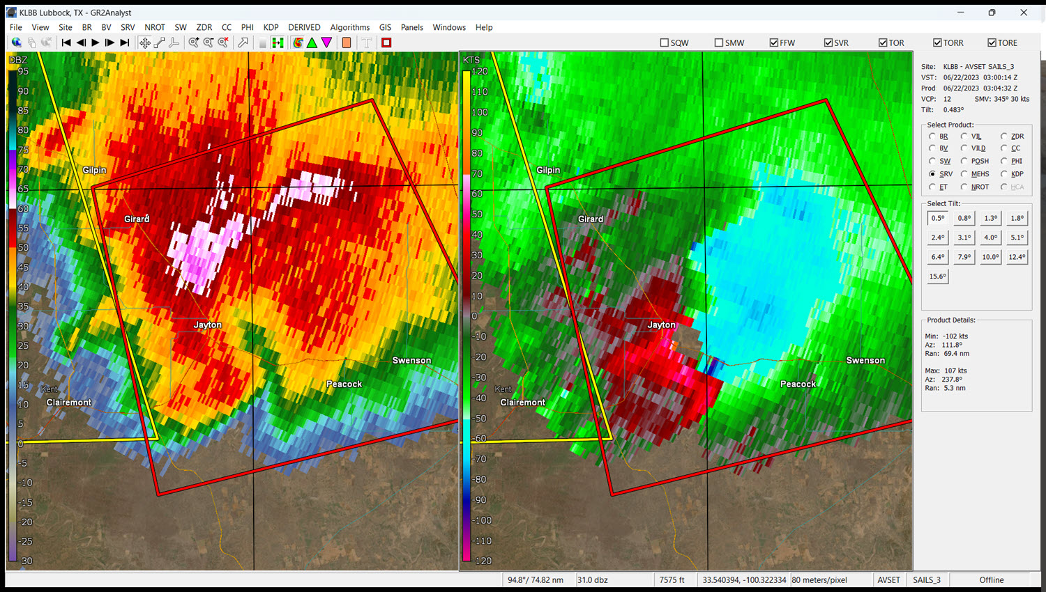 |
| Reflectivity (left) and Velocity (right) Data from the Lubbock WSR-88D while the Matador Tornado is ongoing. | Radar loop of the event | Reflectivity (left) and Velocity (right) Data from the Lubbock WSR-88D while damaging winds are affecting Jayton. |
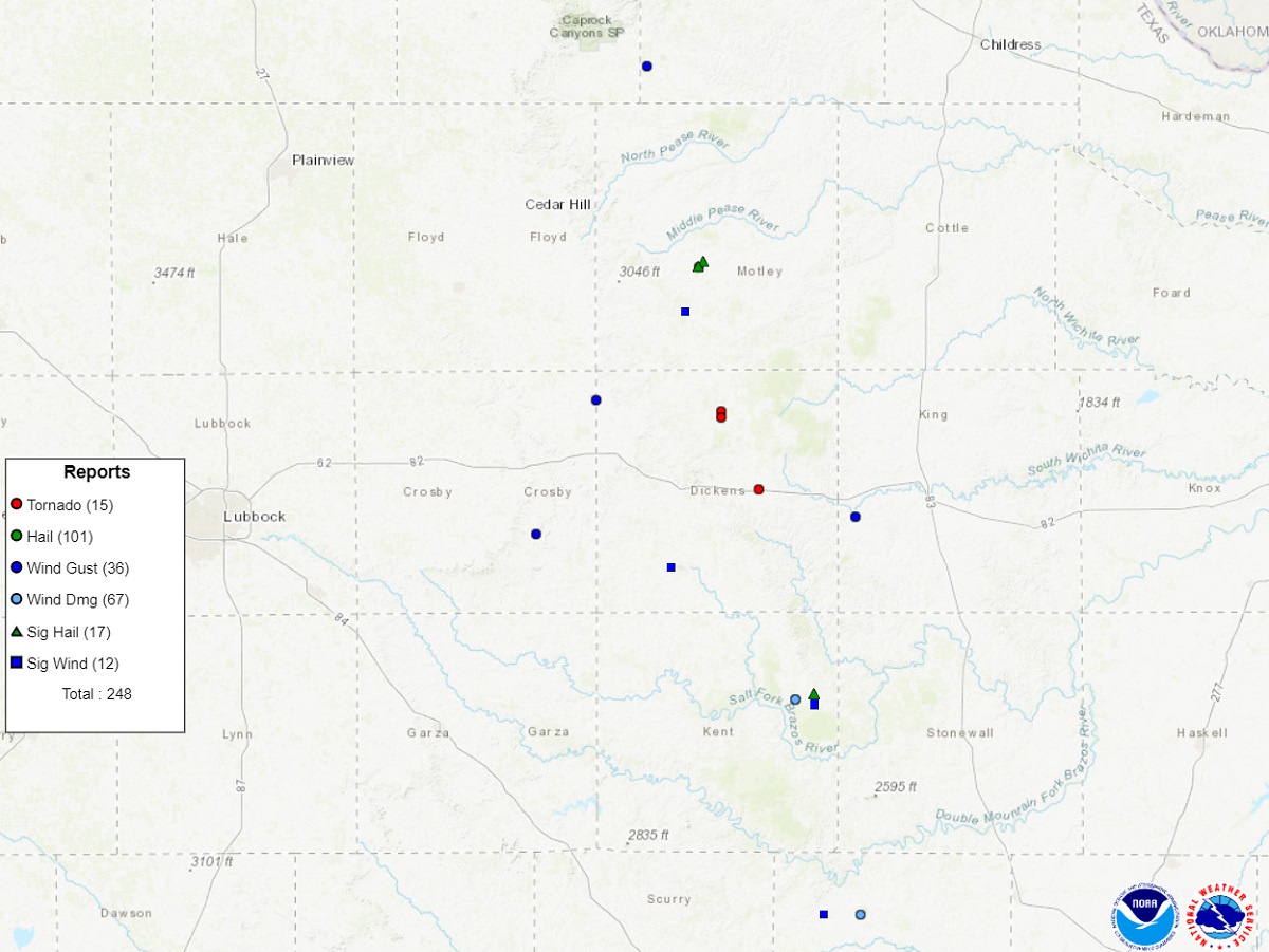
Storm Reports
Environment
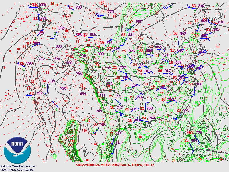
Synoptic Maps
 |
 |
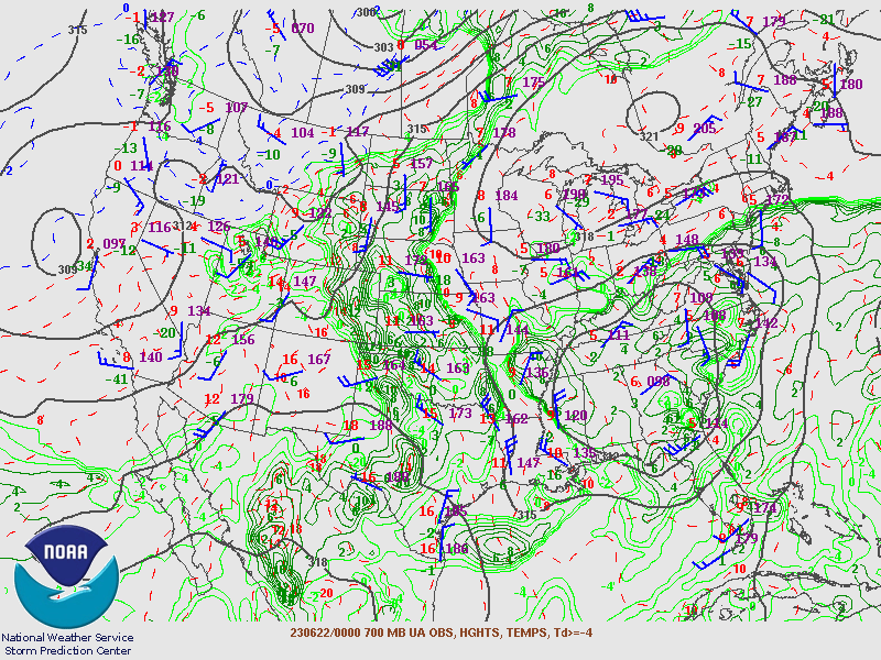 |
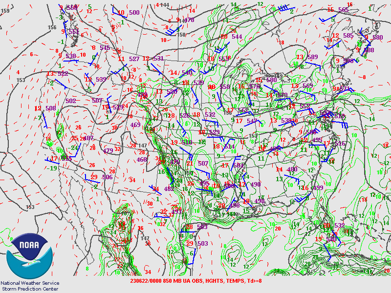
| 925 mb observations, with heights, temperatures and dewpoints contoured at 00Z on 22 June 2023 | 850 mb observations, with heights, temperatures and dewpoints contoured at 00Z on 22 June 2023 | 700 mb observations, with heights, temperatures and dewpoints contoured at 00Z on 22 June 2023 |
 |
 |
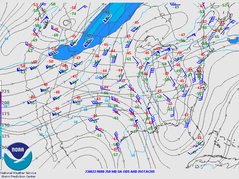 |
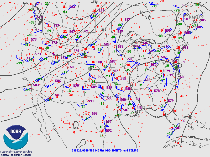
| 500 mb observations, with heights and, temperatures contoured at 00Z on 22 June 2023 | 300 mb observations, with isotachs, streamlines and divergence plotted at 00Z on 22 June 2023 | 250 mb observations, with isotachs plotted at 00Z on 22 June 2023 |
Mesoscale Analysis
 |
 |
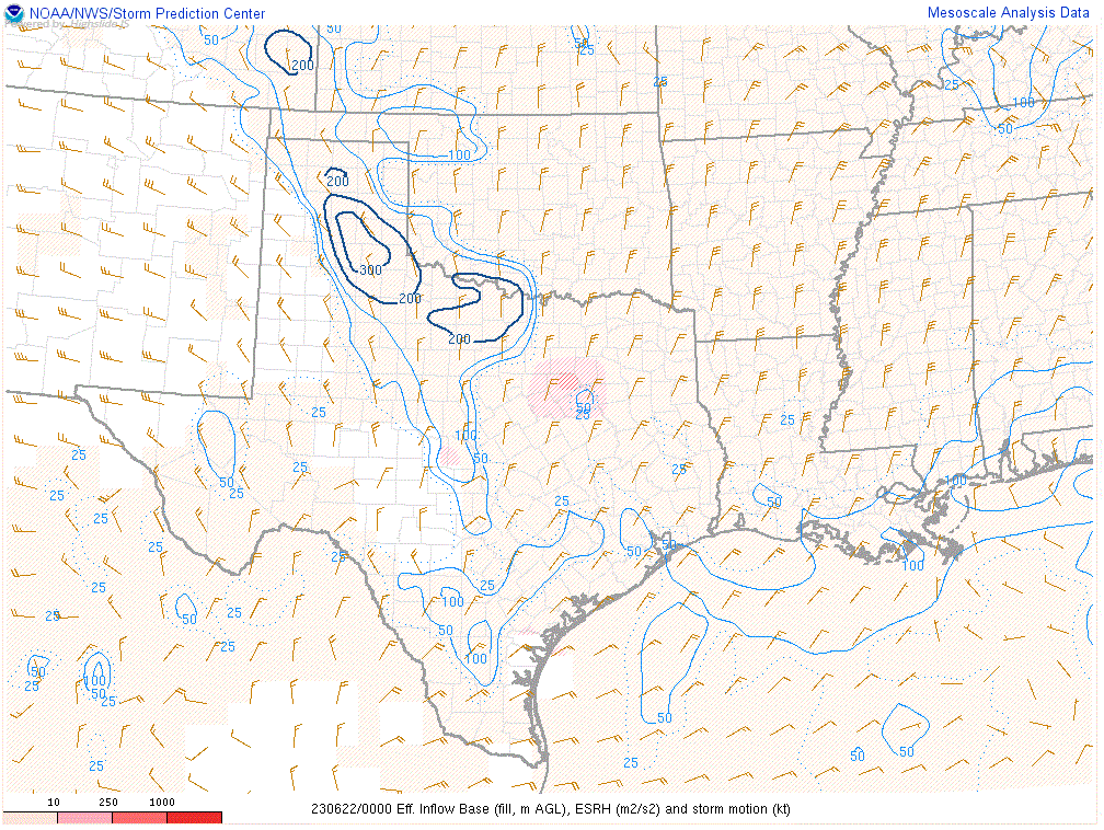 |
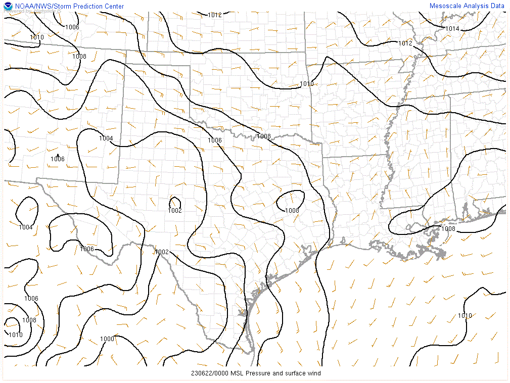
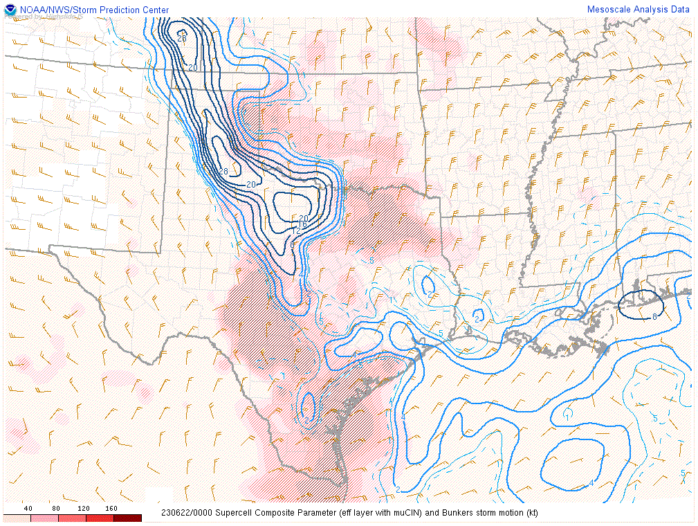
| Mean sea level pressure and surface wind at 00Z on 22 June 2023 | Supercell Composite Parameter and Bunkers storm motion at 00Z on 22 June 2023 | Effective Storm Relative Helicity and Bunkers storm motion at 00Z on 22 June 2023 |
 |
 |
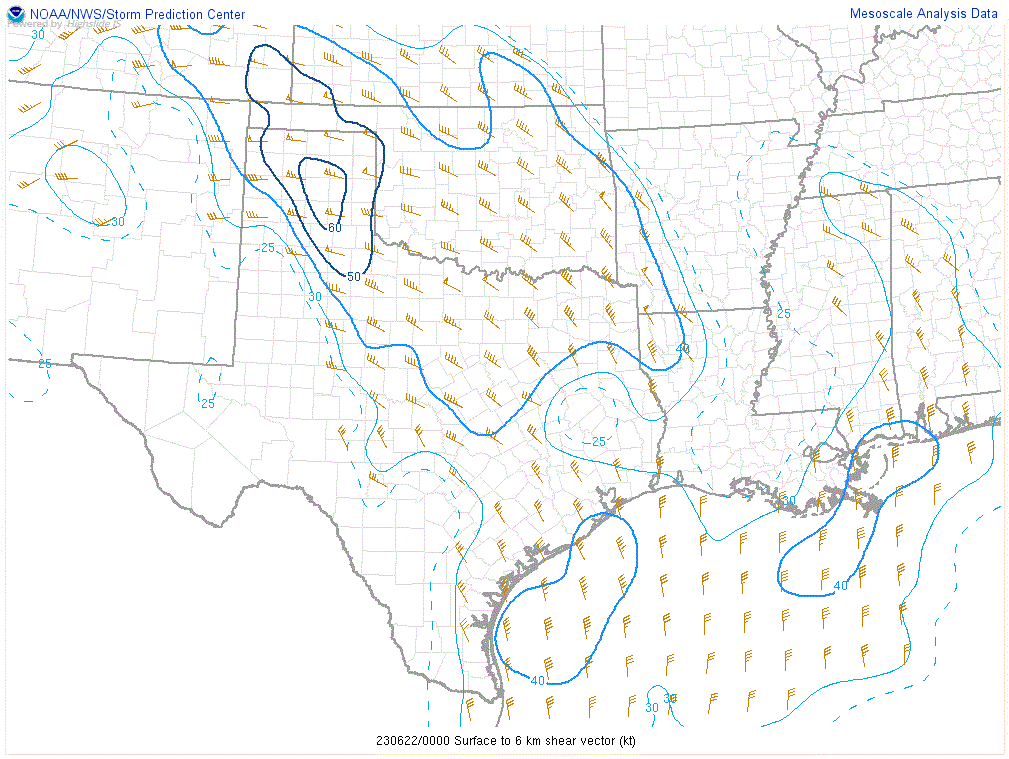 |
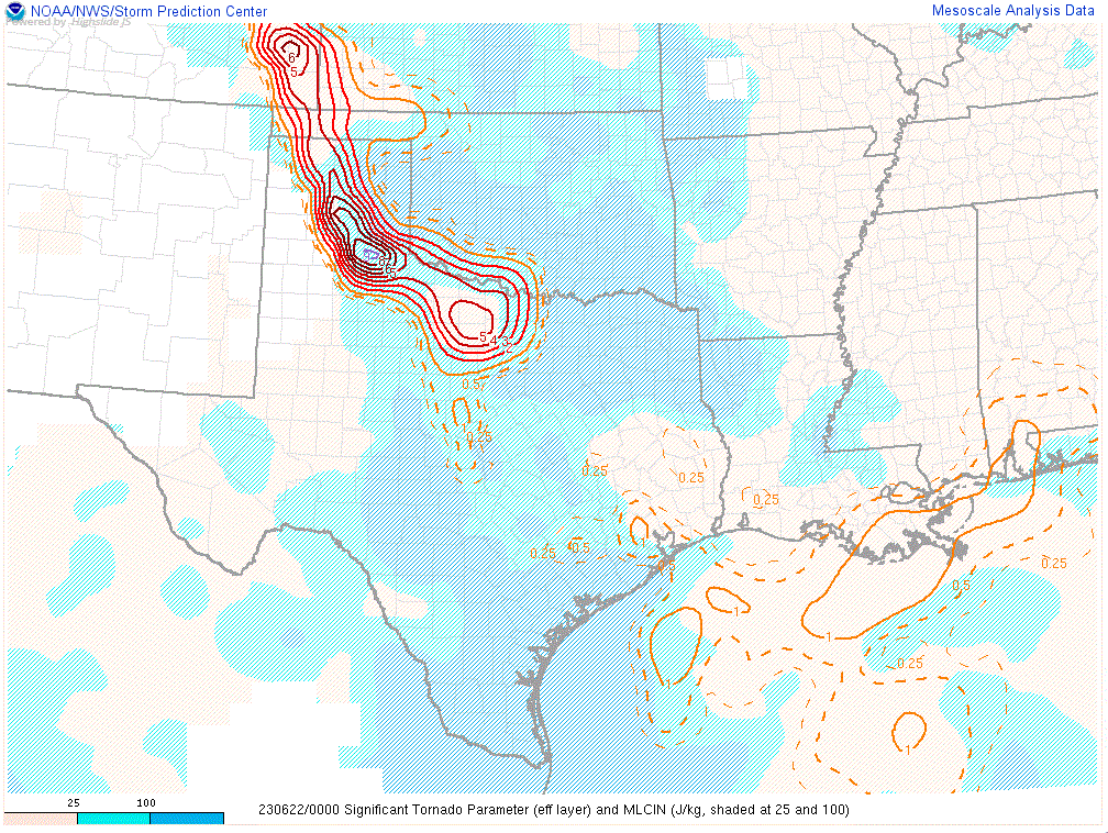
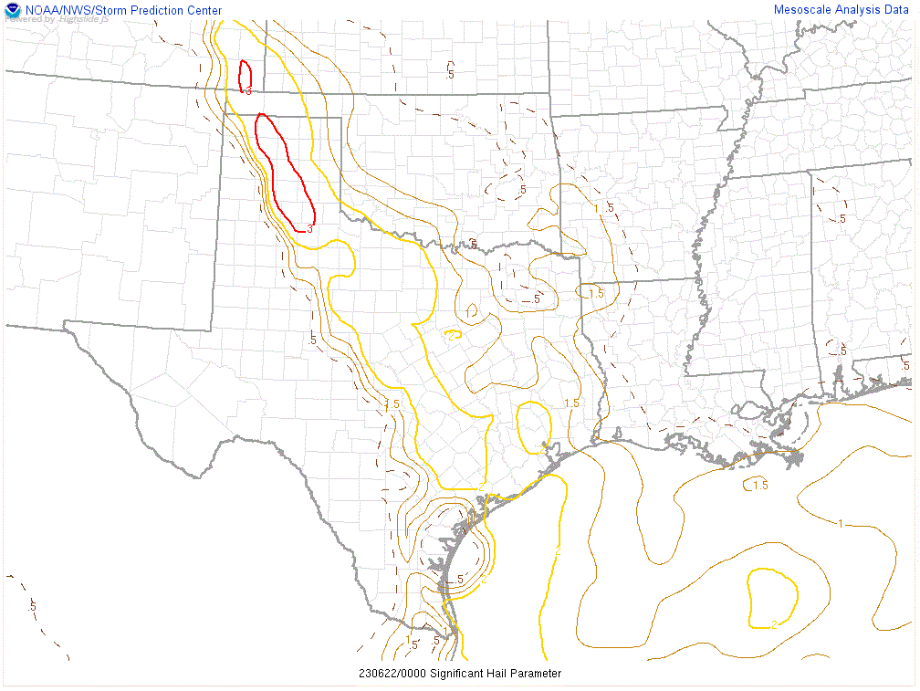
| Significant Tornado Parameter (effective layer) and MLCIN at 00Z on 22 June 2023 | Significant Hail Parameter at 00Z on 22 June 2023 | Surface to 6 km shear vector at 00Z on 22 June 2023 |
 |
 |
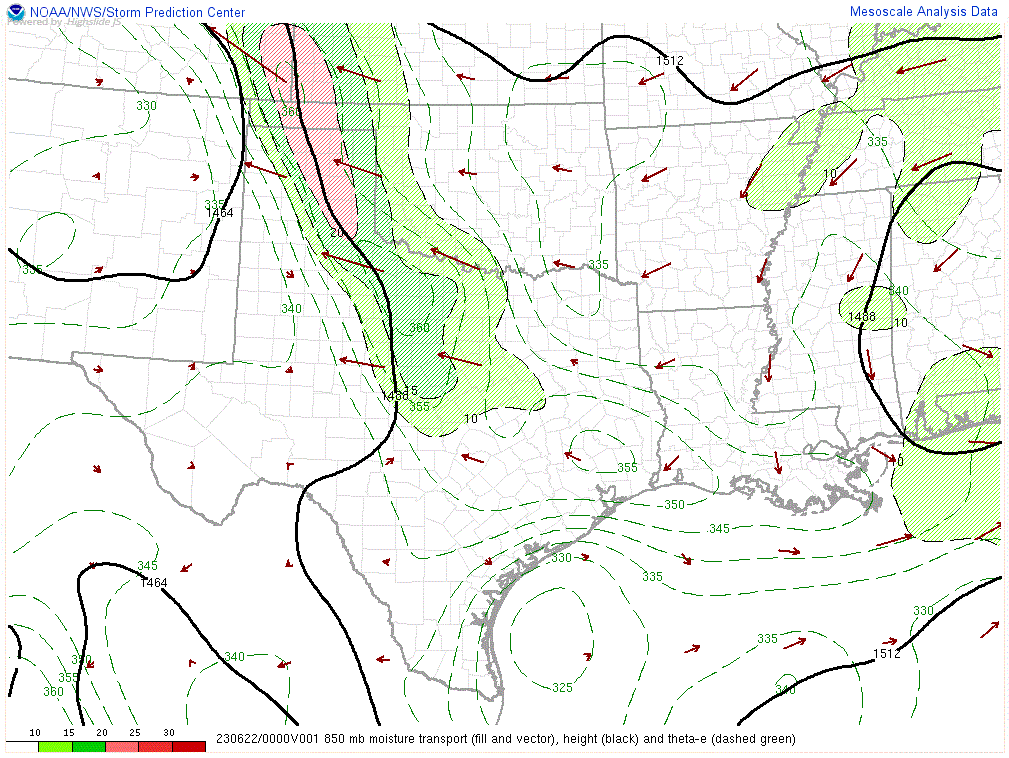 |
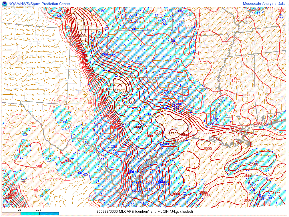
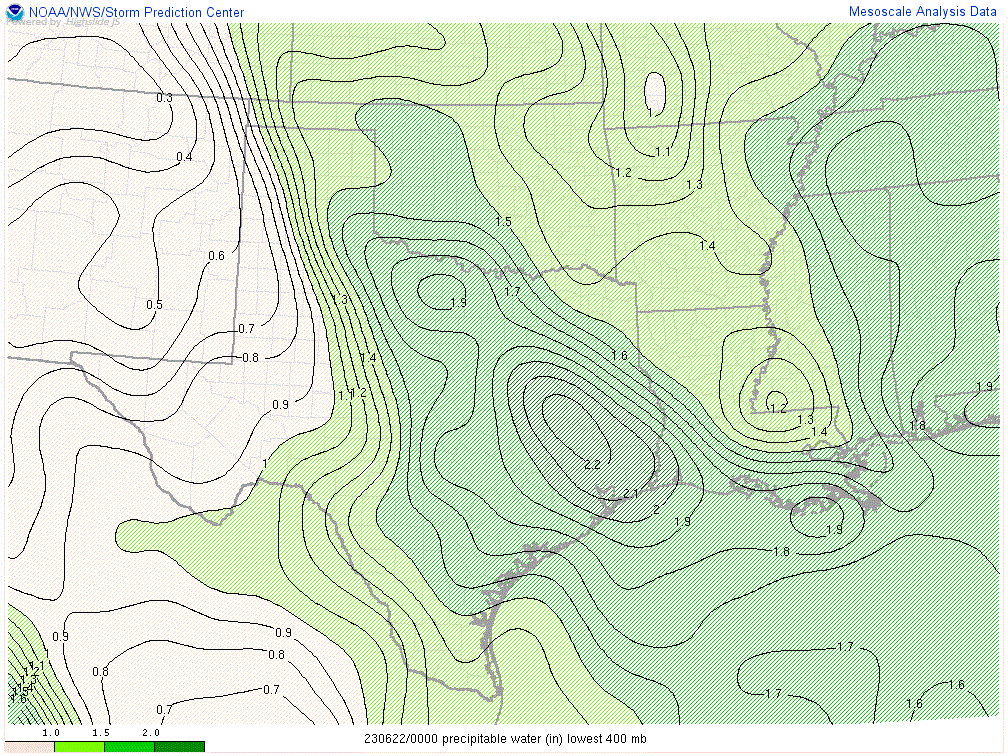
| MLCAPE and MLCIN at 00Z on 22 June 2023 | Precipitable water at 00Z on 22 June 2023 | 850 mb moisture transport, height and theta-e at 00Z on 22 June 2023 |
 |
Media use of NWS Web News Stories is encouraged! Please acknowledge the NWS as the source of any news information accessed from this site. |
|


