|
Widespread rain for the South Plains |
|
 |
|
|
Lubbock WSR-88D radar animation valid from 2:12 pm to 8:44 pm on Monday (23 October 2023). |
|
|
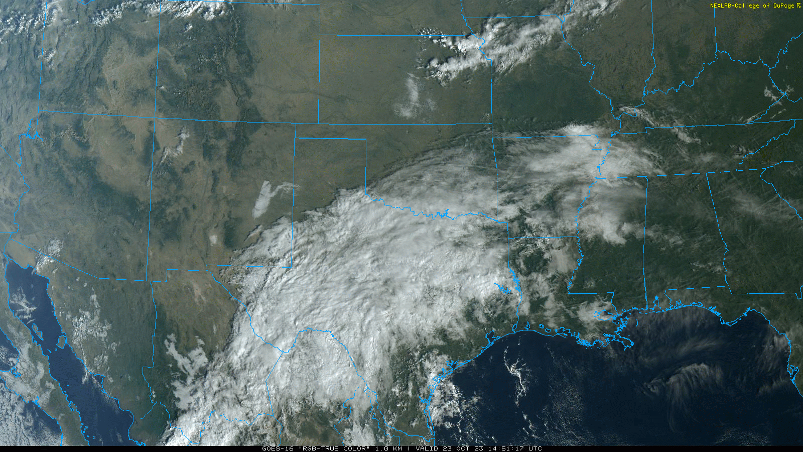
Late October brought two distinct rounds of rain to West Texas. The first round unfolded as rich tropical mid-upper level moisture from the remnants from Hurricane Norma, in the eastern Pacific Ocean, combined with Gulf moisture on Monday (October 23rd). Moisture, clouds and areas of rain streamed northward out of the Permian Basin Monday morning, spreading across the central and eastern South Plains and all of the Rolling Plains Monday afternoon into Monday evening. |
|
 |
|
| RBG "True Color" satellite image captured at 9:51 am on Monday (23 October 2023). Note the plume of clouds, remnants from eastern Pacific Hurricane Norma, stretching from northern Mexico across much of Texas and points east. | |
| The deep moisture supported locally heavy rain in spots, though relatively warm temperatures aloft and a lack of instability kept lightning limited Monday afternoon and evening. Even so, some locations recorded rain rates well in excess of 1 inch in an hour, which did create runoff and minor flooding in spots. | |
 |
|
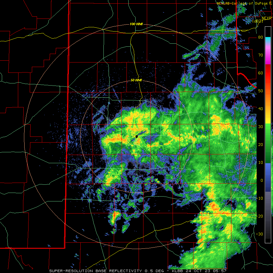
| Lubbock WSR-88D radar animation valid from 12:57 am to 5:48 am on Tuesday (24 October 2023). An additional radar animation can be found at: 4:32 am to 11:45 am on Tuesday (24 October). | |
| The rain lingered into Tuesday morning, primarily off the Caprock, before shifting east of the area by afternoon. A fine afternoon followed with mostly sunny skies and temperatures rebounding into the 70s and 80s. | |
 |
|
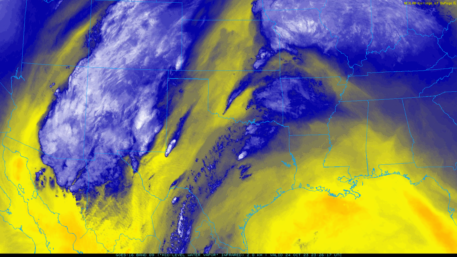
| Regional water vapor satellite loop valid from 6:26 to 7:21 pm on Tuesday (24 October 2023). | |
| Quickly after the departure of the remnants of Norma, a well-developed storm system approached the region via the Desert Southwest and northwest Mexico. Strong lift from this system generated numerous thunderstorms over New Mexico Tuesday afternoon, which spread across the Texas state line during the late evening hours. The large area of showers and thunderstorms continued eastward, bringing rain to the entire region through early Wednesday morning before exiting to the east. | |
 |
|
| Lubbock WSR-88D radar animation valid from 9:44 pm on Tuesday to 6:27 am on Wednesday (25 October 2023). | |
|
Over the course of the two events, spanning from late Monday through early Wednesday, the entire region received measurable rainfall. The heaviest rain targeted the central and southern South Plains into the Rolling Plains, where totals of 1 to 3 inches were common. Lighter amounts, from 1/3 to 3/4 of an inch were generally found along and north of a Plains to Abernathy to Matador to Wellington line. A couple locations, including Guthrie and Lake Alan Henry, even recorded over 3 inches or rain. |
|
 |
|
| Total rain that fell between Monday and Wednesday (23-25 October). The background image is radar-estimated, while the numeric values were measured by the West Texas Mesonet (WTM) and the National Weather Service (NWS). | |
| Runoff from the heavy rain produce a good surge through the Double Mountain Fork of the Brazos near Justiceburg. This water spilled into Lake Alan Henry, lifting the lake level about 1.5 feet from 88% to 92% of conservation level. | |
 |
|
| Event rainfall (inches) measured around Lubbock. The data are courtesy of the WTM and the NWS. A similar plot, expanded over much of the South Plains and Rolling Plains, can be VIEWED HERE. | |
|
Officially, the Lubbock Airport measured 1.41 inches of rain over this 3-day period, boosting the year-to-date total to 16.09 inches, which is just shy of the long term average. Childress officially recorded 1.12 inches over this same period, increasing their annual total to 24.01 inches, nearly 3 inches above average. In addition to the widespread rain, a few spots saw gusty winds and even small hail. Preliminary storm reports collected late October 2023 can be found below: |
|
Preliminary Local Storm Report
National Weather Service Lubbock TX
1237 AM CDT Wed Oct 25 2023

..TIME...   ...EVENT...      ...CITY LOCATION...     ...LAT.LON...
..DATE...   ....MAG....      ..COUNTY LOCATION..ST.. ...SOURCE....
            ..REMARKS..

1220 AM     Tstm Wnd Gst     5 NNW Woodrow           33.51N 101.88W
10/25/2023  M68 MPH          Lubbock            TX   Mesonet

