
Scattered thunderstorms with severe gusts, hail and a tornado risk are possible near a cold front from the Ohio Valley to the Mid-Atlantic tonight. Tropical Storm Bertha is expected to bring tropical storm conditions to portions of the Gulf Coast from the panhandle of Florida into Louisiana through Wednesday. Read More >
|
Chilly and damp, with a taste of snow for some |
|
 |
|
|
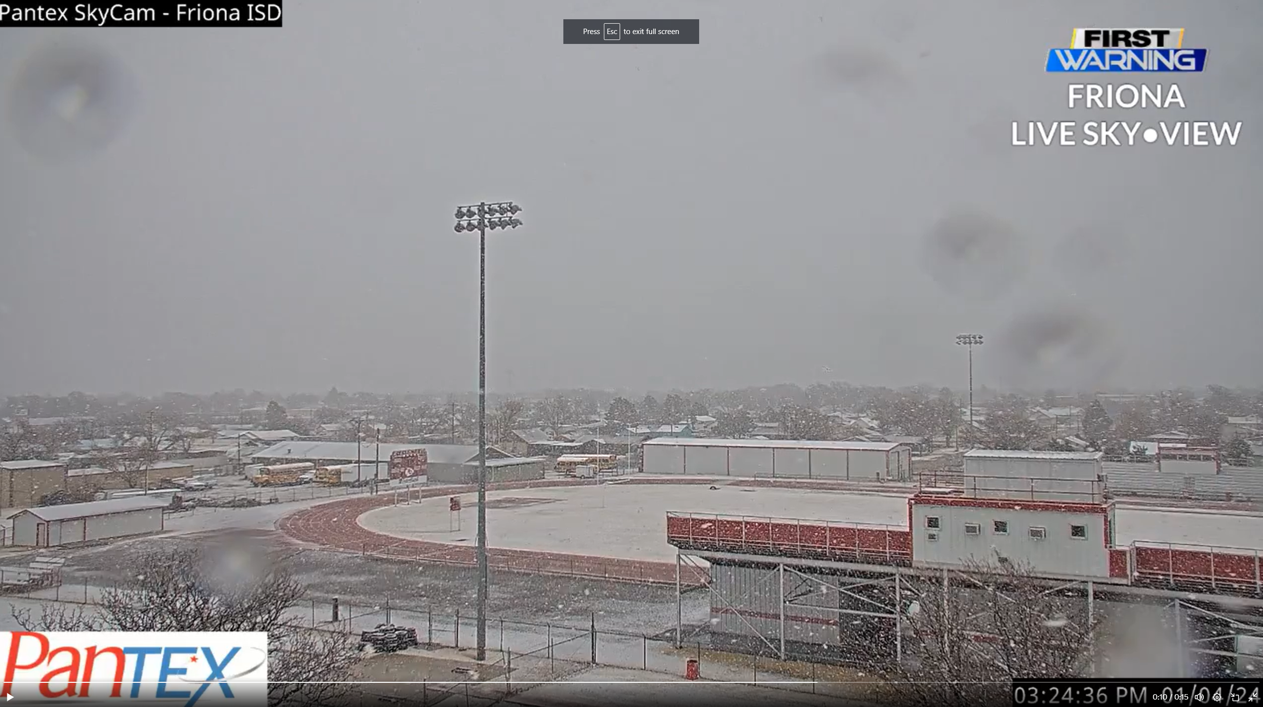
Snow falling in Friona Thursday afternoon (4 January 2024). The image is courtesy of Pantex and Jacob Riley. |
|
|
The first week of 2024 brought a strong storm system through the southern High Plains. The system didn't have a lot of cold air to work with (by January standards), but it was just cool enough for the southwest Texas Panhandle to see a period of heavy, wet snow Thursday afternoon (4 January). Further south and east a cold rain prevailed over the South Plains and Rolling Plains. |
|
 |
|
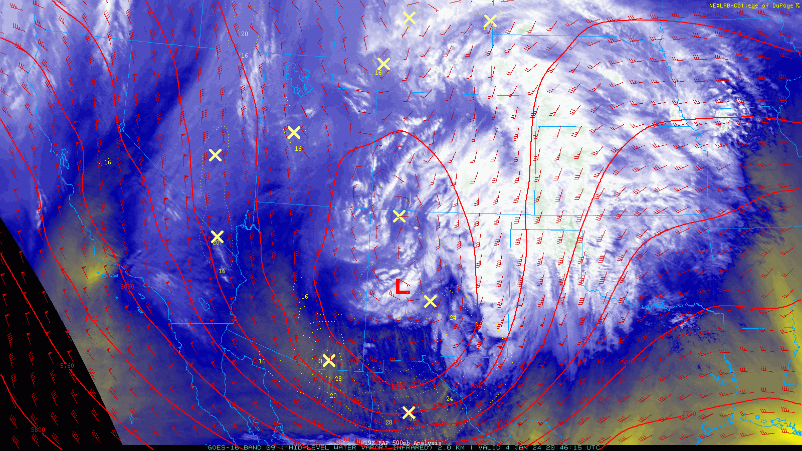
| Regional water vapor satellite animation Thursday afternoon (4 January 2024). A well-defined counter-clockwise circulation (mid-upper level storm system) is seen advancing through New Mexico. Also plotted are the 500 mb (mid-level) wind barbs and heights. | |
| In advance of the system, returning moisture off of the Gulf led to widespread low clouds, fog and drizzle Thursday morning. In fact, much of the region experienced a prolonged period of dense fog, before it gradually lifted in the afternoon. | |
 |
|
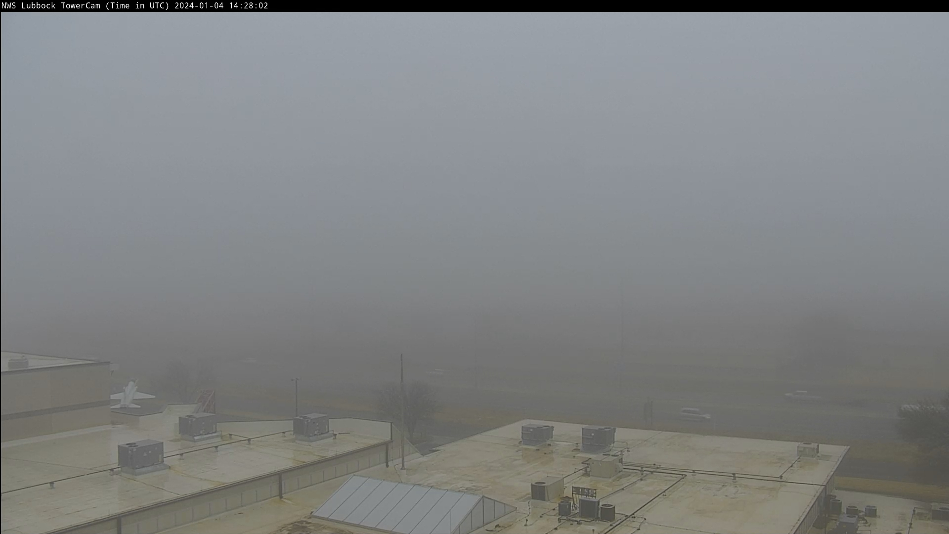
| Foggy start to the day in Lubbock Thursday morning (4 January 2024). The picture was taken at 8:28 am. | |
|
As the stronger lift from the approaching storm system spread over the southern High Plains, precipitation expanded in area and intensity through the afternoon hours. |
|
 |
|
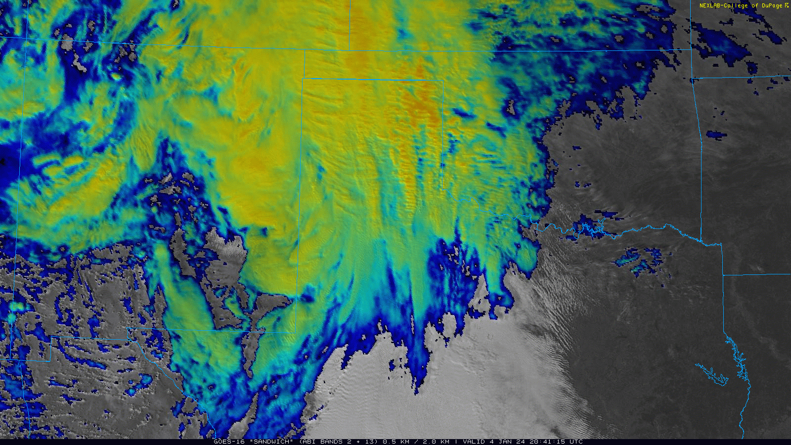
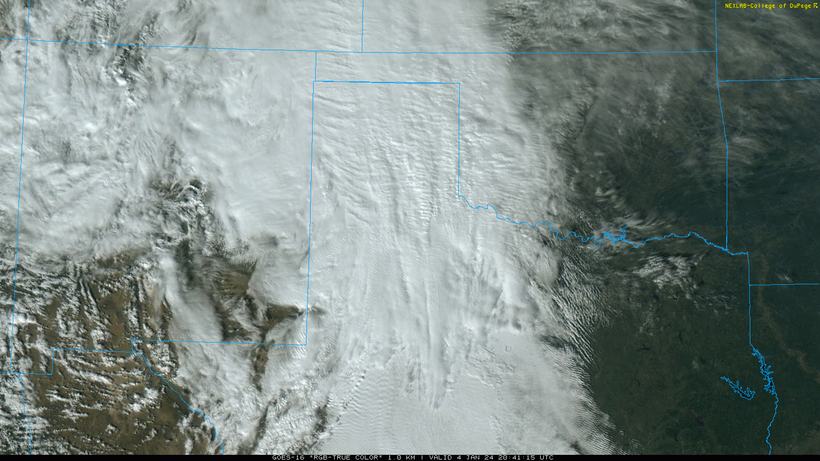
| RGB "Sandwich" satellite animation valid Thursday afternoon (4 January 2024). The brighter colors represent colder/higher clouds comprised of ice/snow, while the white clouds are lower clouds comprised of liquid water. A "RGB-True Color" satellite animation, also valid Thursday afternoon, can be VIEWED HERE. | |
| Temperatures were hovering in the middle and upper 30s as the precipitation shield spread out of eastern New Mexico and into West Texas Thursday afternoon. Most locations experienced this precipitation in the form of a cold rain through the afternoon and evening hours. However, across the southwest Texas Panhandle temperatures were just cool enough to support snow, or a rain/snow mix, even though readings were slightly above the freezing mark. | |
 |
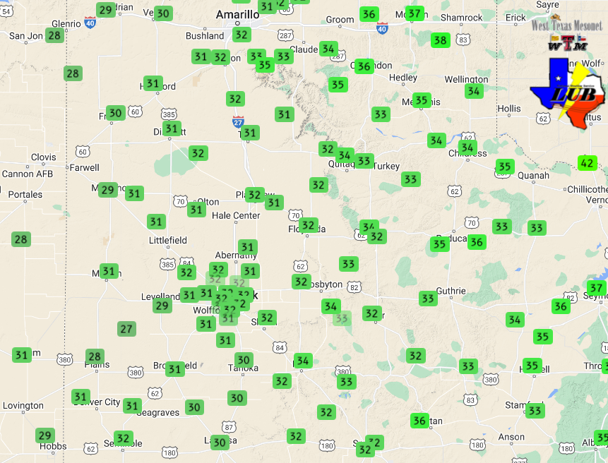 |
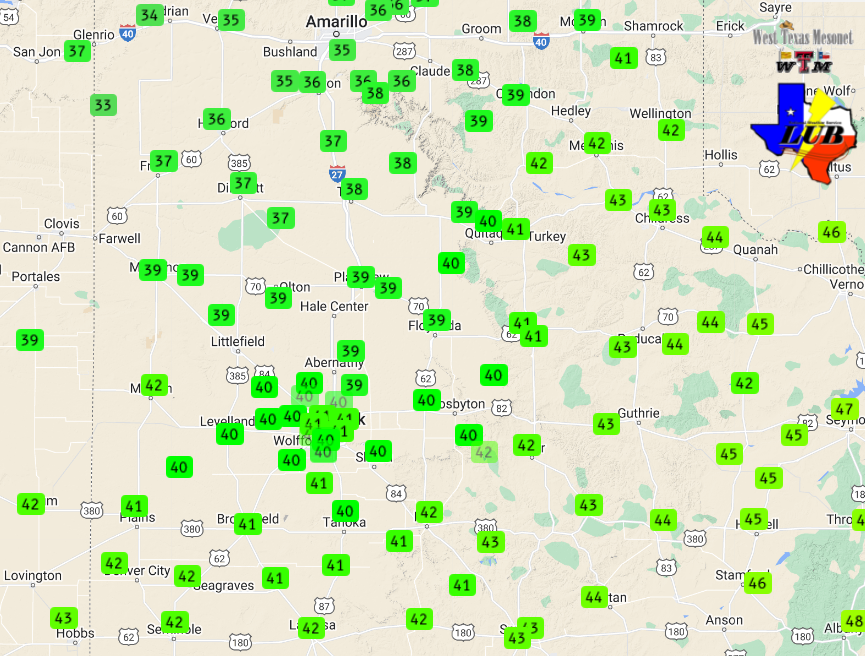
| (Left) High temperatures recorded on Thursday (4 January 2024) and (right) low temperatures measured Friday morning (5 January 2024). The data are courtesy of the West Texas Mesonet. | |
|
The precipitation moved rapidly eastward across the South Plains and Rolling Plains through the afternoon and evening hours. A few additional showers, even a couple of rumbles of thunder, redeveloped behind the main wave of precipitation Thursday evening, before coming to an end altogether early Friday morning. |
|
 |
|
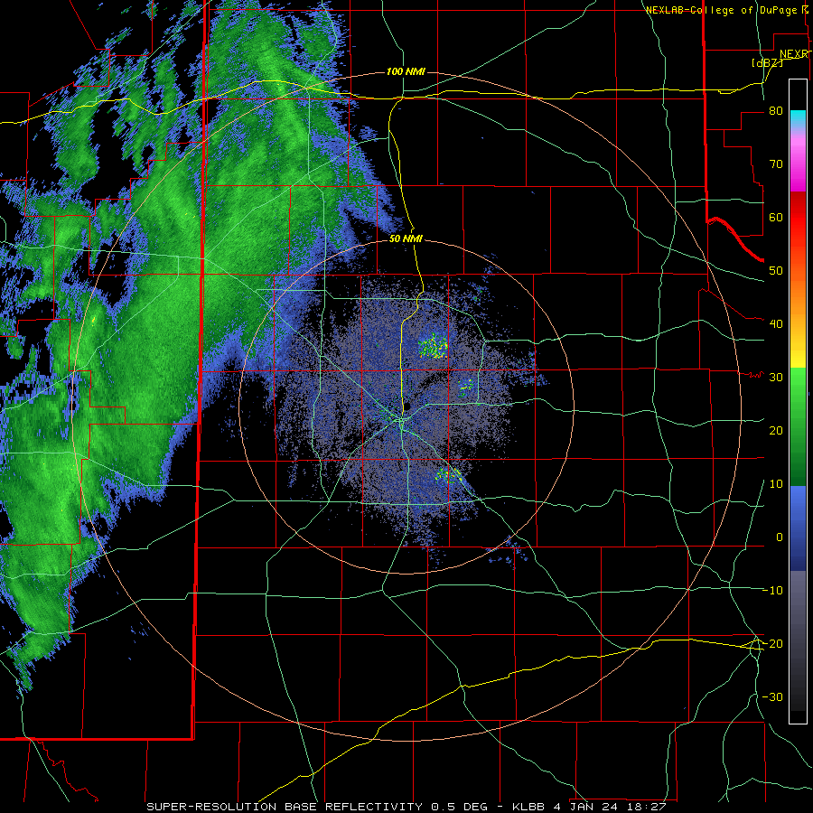
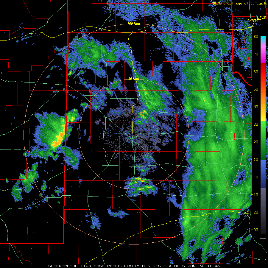
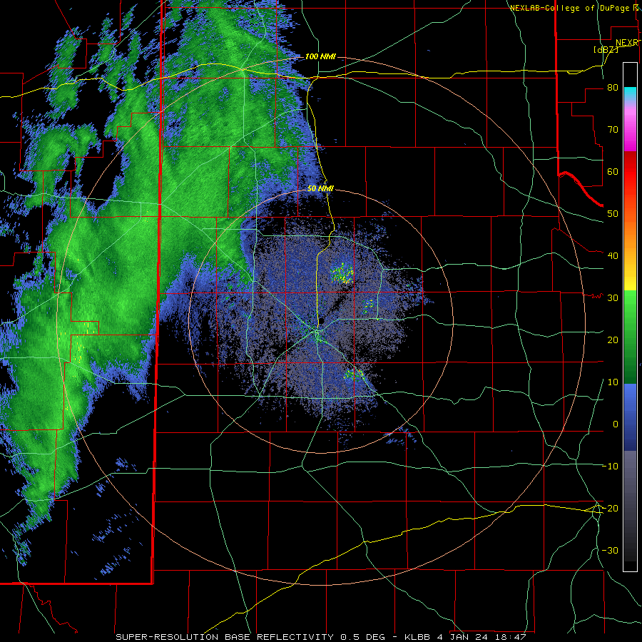
| Lubbock WSR-88D radar animation valid from 12:27 pm to 5:51 pm on Thursday (4 January 2024). Additional radar animations can be accessed at: 7:43 pm on January 4th to 3:43 am on January 5th; and 12:47 pm on January 4th to 6:27 am on January 5th. | |
| The "mild" conditions kept impacts on the roadways to a minimum through the course of Thursday afternoon and evening. However, where skies cleared, temperatures fell to and slightly below freezing early Friday morning. This created patchy slick spots on area roadways where moisture lingered from the earlier rain. Unfortunately, the black ice did lead to several accidents in and around Lubbock Friday morning. | |
 |
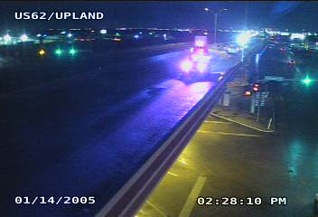 |
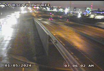
| Wet and slick roadways in Lubbock Friday morning (5 January 2024). The images are courtesy of TXDOT. | |
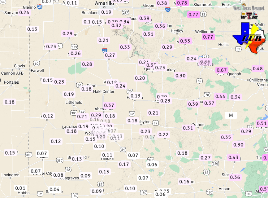
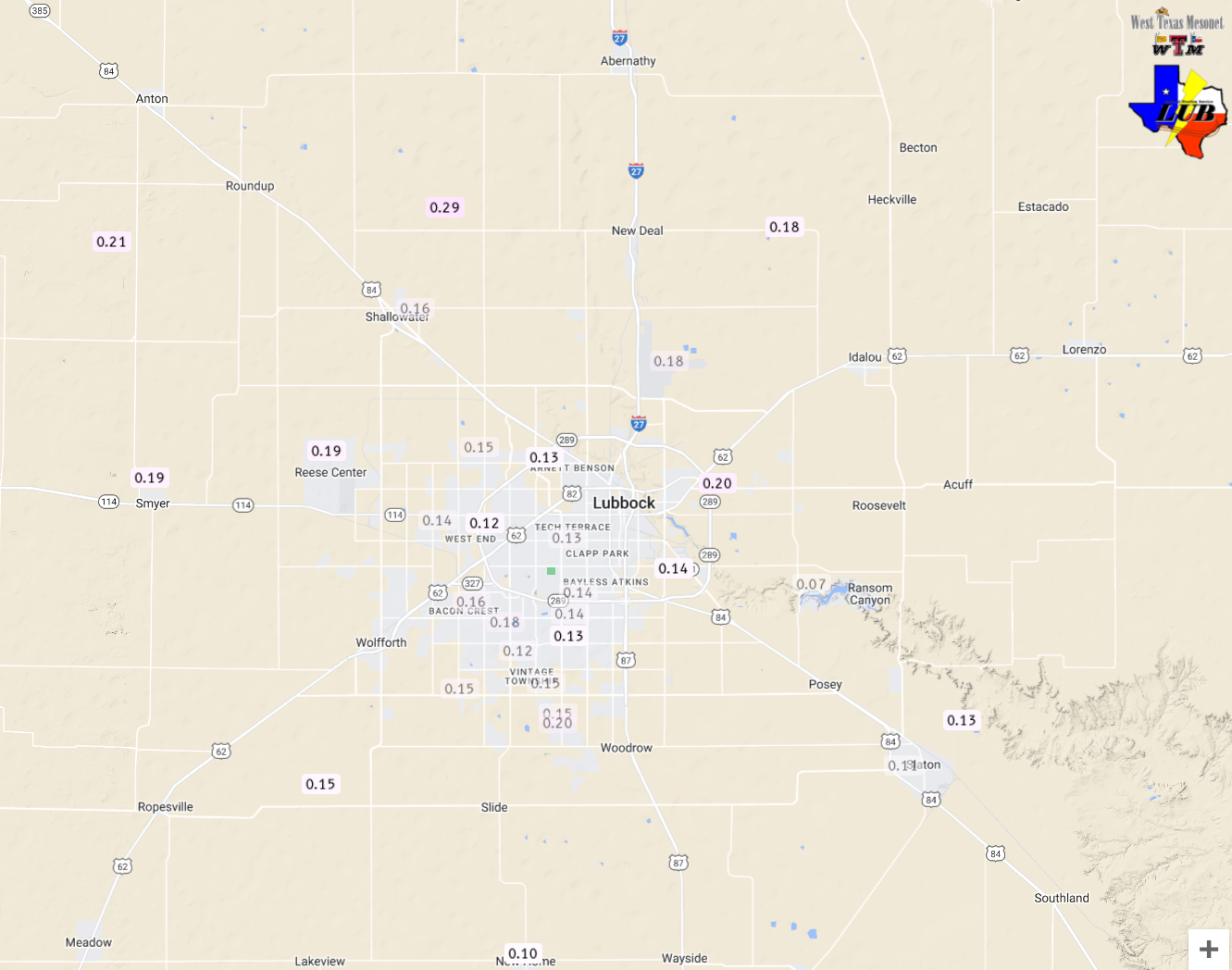
| The early January rain (and snow) did provide widespread moisture for the region, though amounts were generally on the lighter side. Rain totals (and melted snow) ranged from around a tenth of an inch across the southern South Plains to near a quarter inch over the southern Texas Panhandle, with somewhat higher amounts from the southeast Texas Panhandle into the eastern Rolling Plains. | |
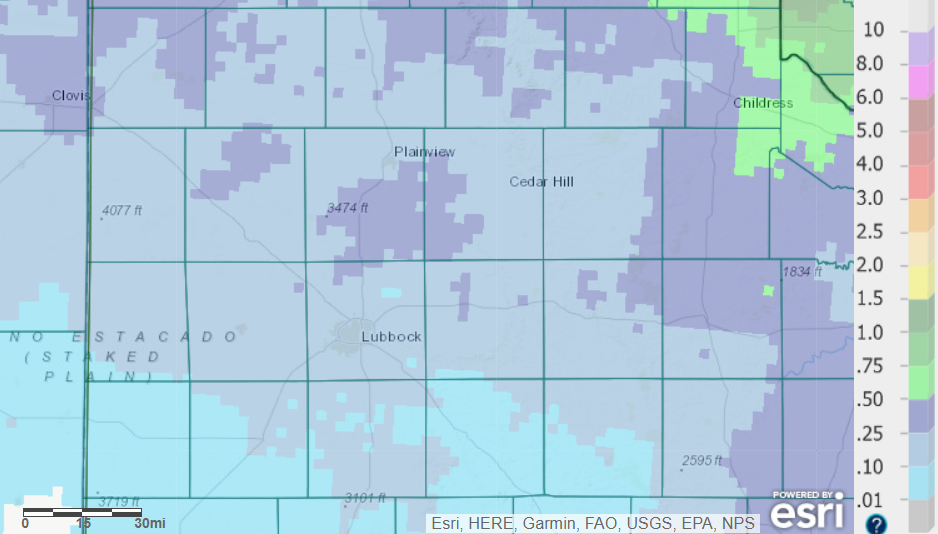 |
|
| 24-hour radar-estimated and bias-corrected rain totals (and melted snow) ending at 6 am on January 4th. The rainfall measured by the West Texas Mesonet (WTM) during this period can be FOUND HERE (or a close up of the Lubbock area). | |
|
Officially, the Lubbock Airport recorded 0.16 inches of rain on Thursday, marking the first measurable precipitation of the new year. Childress fared even better, measuring 0.29 inches. |
|

