
Heat expands across the Desert Southwest, Plains, Mississippi Valley and Midwest into Monday. Fire weather concerns continue for portions of the Intermountain West. Active monsoonal moisture fuels thunderstorms over the Southwest with possible flash flooding. Tropical cyclone Fausto in the Pacific, should weaken as it approaches Hawaii; Dangerous surf, swells and rip currents are expected. Read More >
|
Leap day starts off wet, and wintry for some |
||
 |
||
|
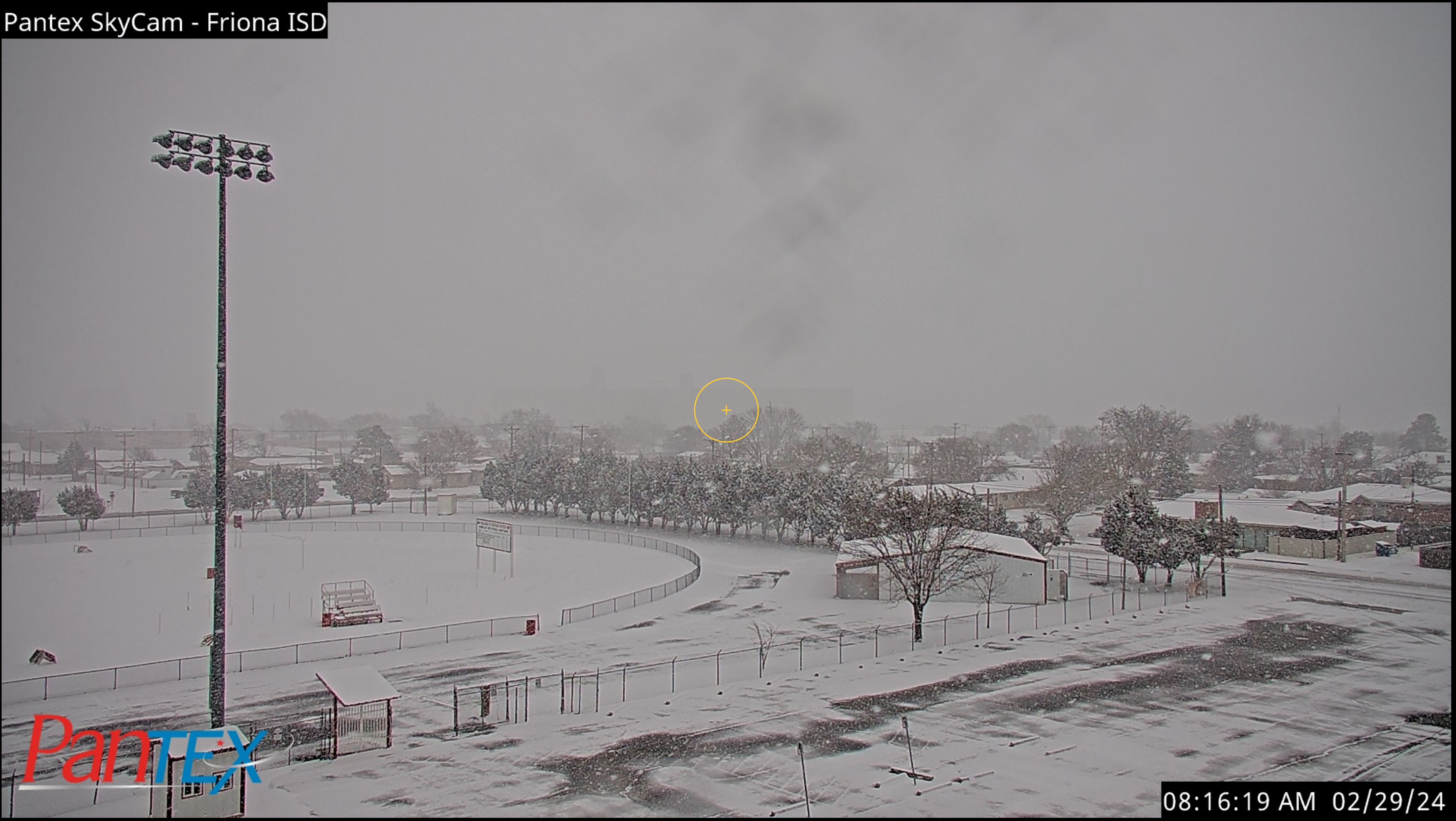
Snow falling and accumulating in Friona Thursday morning (29 February 2024). The image is courtesy of Pantex. |
||
|
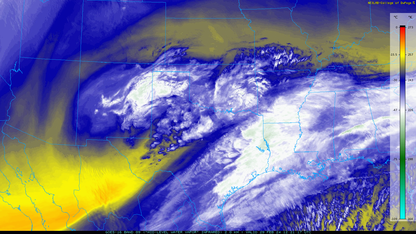
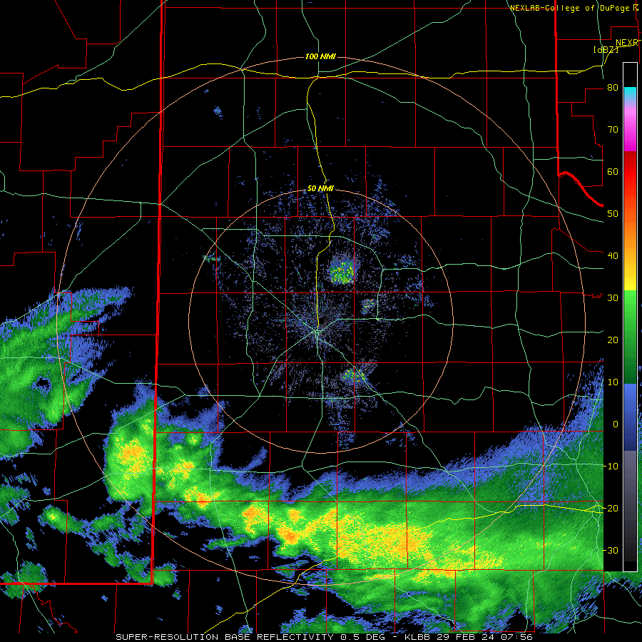
A quick-moving, but potent, disturbance ejecting from New Mexico and Far West Texas brought strong lift and enough moisture to generate widespread precipitation as it moved across the South Plains region. Initially, the lower atmosphere was quite dry, but as it moistened from cloud level downward, the precipitation did make it all the way to ground level. |
||
 |
||
| Water vapor satellite loop valid from 6:21 am to 6:56 am on Thursday, 29 February 2024. | ||
| To complicate things, at least from a forecasting standpoint, temperatures were mostly in the 30s when the precipitation started falling early Thursday morning. This resulted in a wintry mix, anything from a cold rain, to sleet and snow. | ||
 |
||
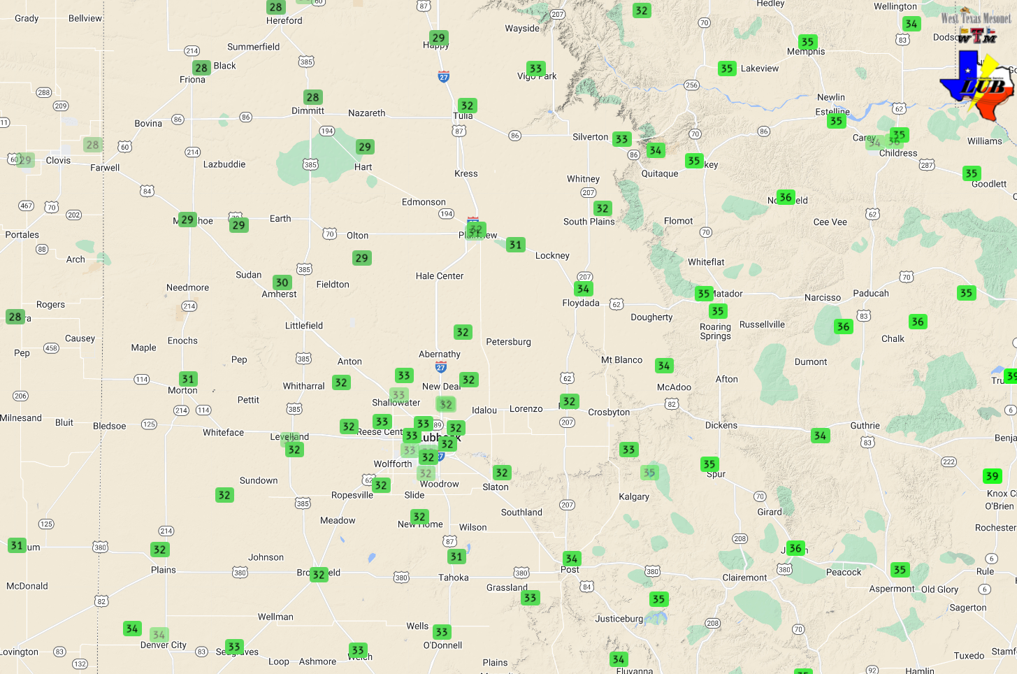
| Temperatures measured at 7:55 pm on Thursday (29 February 2024). The data are courtesy of the West Texas Mesonet (WTM). | ||
| The coolest temperatures, which fell into the upper 20s, were across the highest elevations of the northwest South Plains and southwest Texas Panhandle, where accumulating snow (and sleet) fell. | ||
 |
||
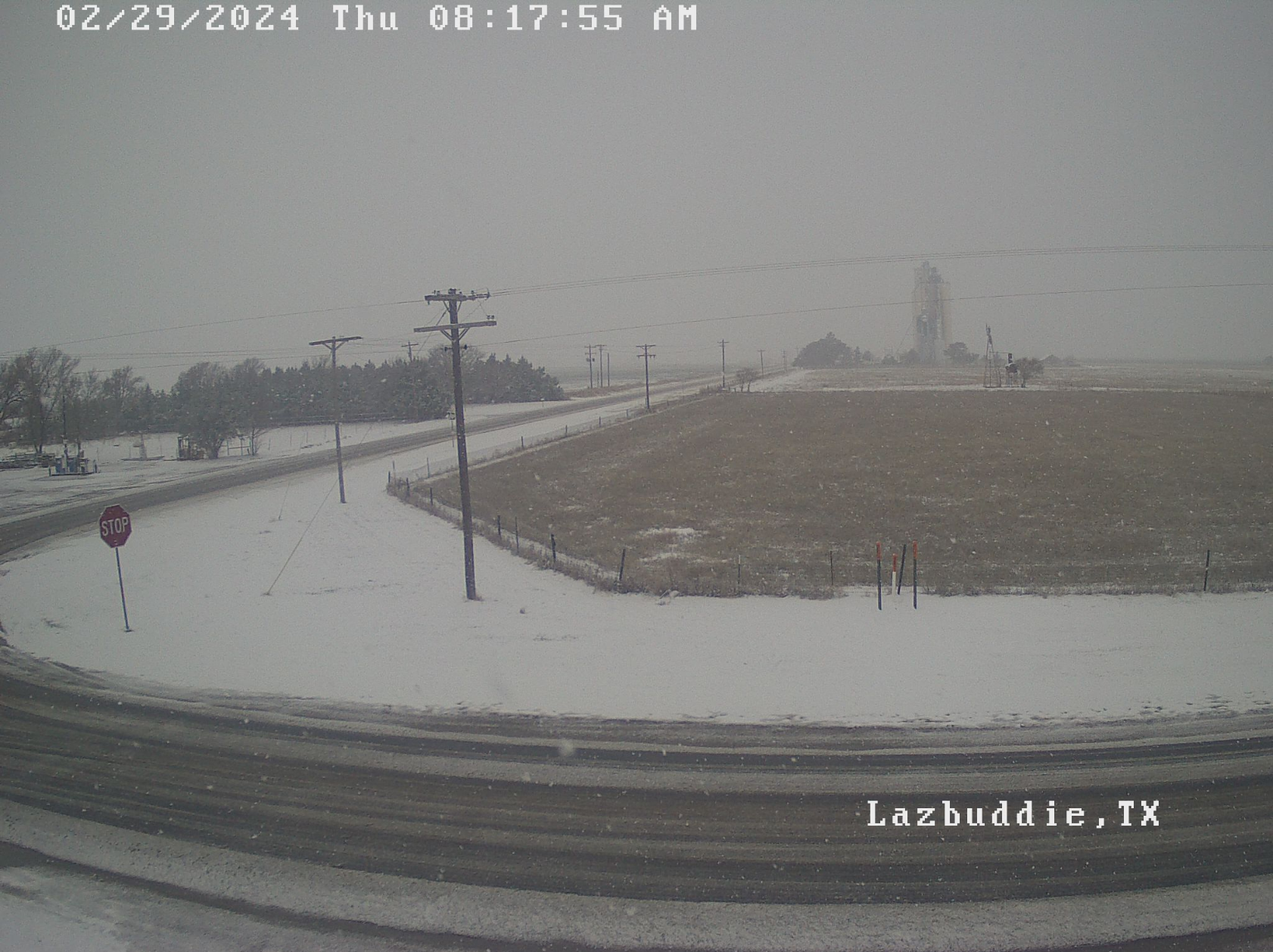
| Snow falling and accumulating in Lazbuddie on Thursday morning (29 February 2024). The image is courtesy of KVII. | ||
| The snow and sleet even created slushy accumulations on the roadways, which resulted in slick travel in a few places from around Lazbuddie and Farwell northeastward through Friona, Hereford and Amarillo. | ||
 |
||
| Lubbock WSR-88D radar animation valid from 1:56 am to 10:04 am on Thursday (29 February 2024). | ||
| Farther to the southeast, many locations, including in and around Lubbock, experienced a cold rain and sleet mix, sometimes even mixing with or switching to all snow. Thankfully, temperatures were mild enough that roadways across the central South Plains remained wet, as the sleet and snow melted after it hit the ground. | ||
 |
 |
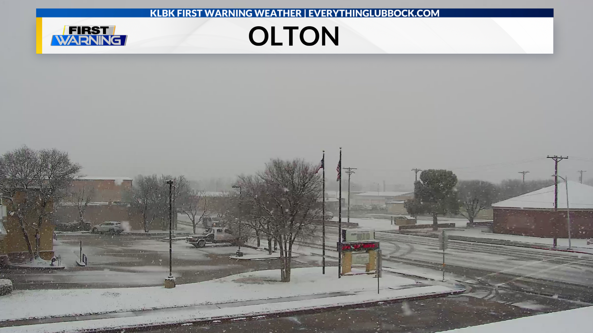 |
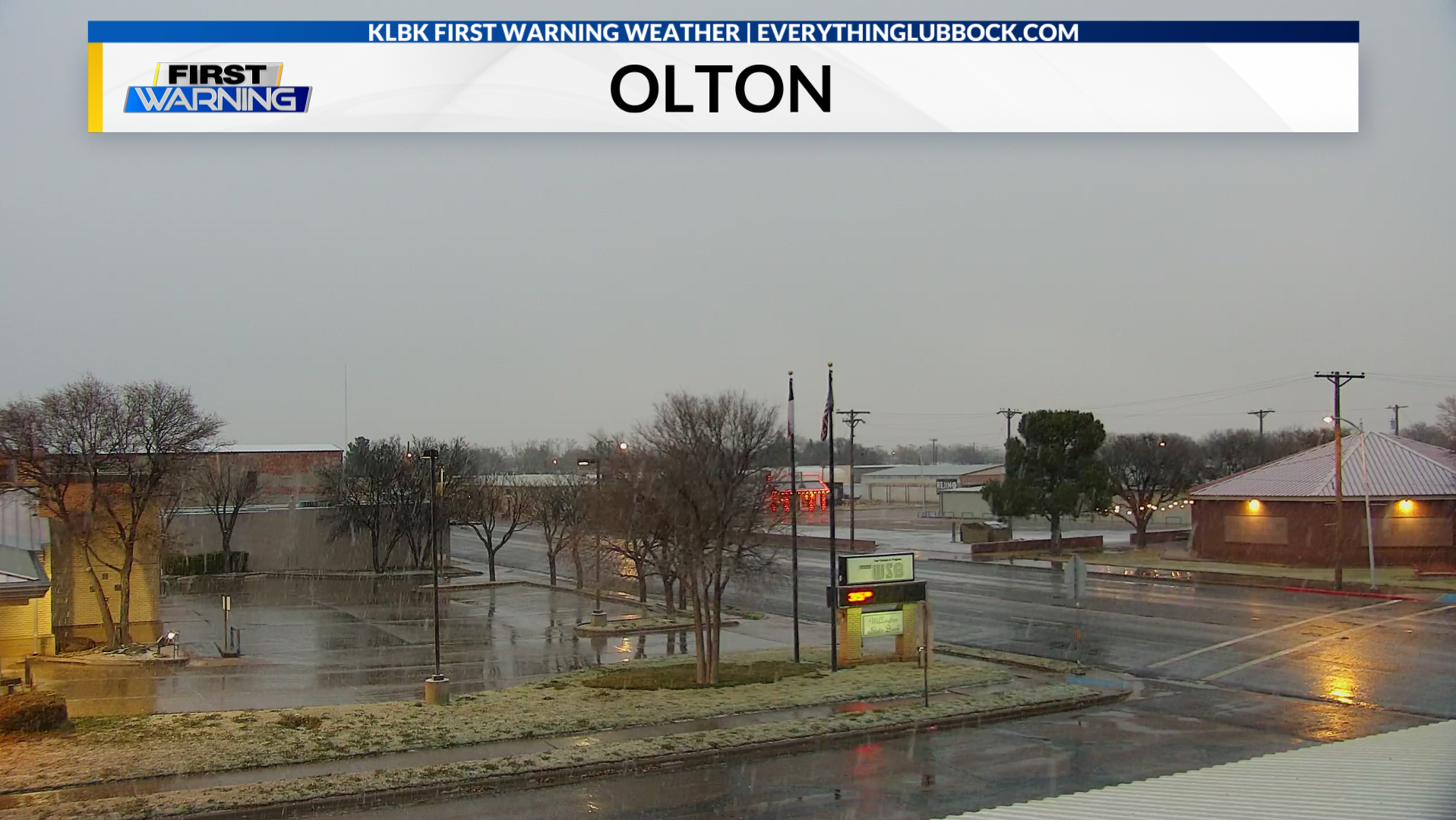
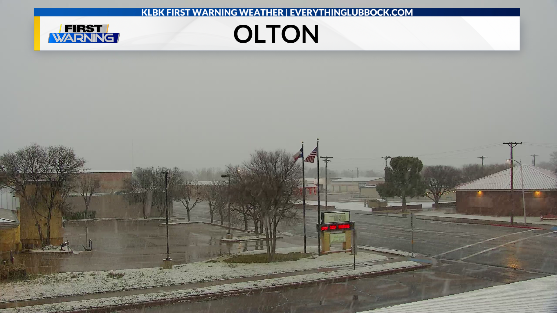
| Series of pictures from Olton Thursday morning (29 February 2024). From left-to-right, the images were taken at: 7:30 am; 7:38 am and 10:22 am. The images are courtesy of KLBK. | ||
| The Lubbock Airport observed rain, freezing rain, sleet and snow Thursday morning, though it only melted down to 0.04" total. Regardless, this was only the third leap day on record with any snowfall, including a trace back in 1912 and 1960. | ||
 |
||
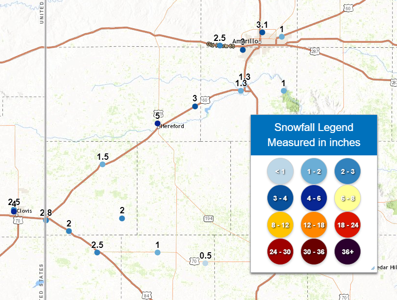
| Snow totals reported to the National Weather Service on Thursday (29 February 2024). | ||
|
Altogether, the heaviest snow, generally from 1 to 3 inches, fell across the northwest South Plains and southwest Texas Panhandle. The highest snowfall report was 5 inches in Hereford. Snow reports collected in late February 2024 can found below: |
||
Preliminary Local Storm Report
National Weather Service Lubbock TX
1124 AM CST Thu Feb 29 2024

..TIME...   ...EVENT...      ...CITY LOCATION...     ...LAT.LON...
..DATE...   ....MAG....      ..COUNTY LOCATION..ST.. ...SOURCE....
            ..REMARKS..

0720 AM     Snow             Earth                   34.23N 102.41W
02/29/2024  E1.0 inch        Lamb               TX   Public

            Social media photo shows about 1 inch of
            accumulation, mainly on grassy surfaces with
            lesser amounts on roadways.

0800 AM     Snow             Friona                  34.64N 102.72W
02/29/2024  M1.5 inch        Parmer             TX   CO-OP Observer

            Total snow as of 8 am with moderate snow
            still falling.

0805 AM     Snow             Olton                   34.18N 102.14W
02/29/2024  M0.5 inch        Lamb               TX   CO-OP Observer

            Accumulation limited to grassy surfaces with
            roads remaining wet.

0848 AM     Snow             Lazbuddie               34.39N 102.61W
02/29/2024  E2.0 inch        Parmer             TX   Public

            Webcam shows accumulation mainly on grassy
            surfaces, but also some slushy accumulation
            on roadways.

0920 AM     Snow             1 WNW Muleshoe          34.23N 102.75W
02/29/2024  M2.5 inch        Bailey             TX   CO-OP Observer

1000 AM     Snow             Farwell                 34.38N 103.04W
02/29/2024  M2.8 inch        Parmer             TX   Broadcast Media

1030 AM     Snow             8 ESE Farwell           34.33N 102.91W
02/29/2024  M2.0 inch        Parmer             TX   Broadcast Media

