Lubbock, TX
Weather Forecast Office
|
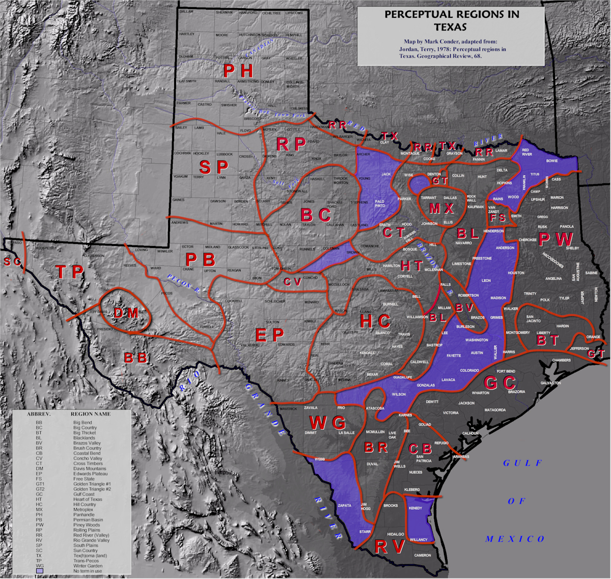
Our office is located in the city of Lubbock, on the South Plains of West Texas. The map below shows the location of Lubbock. As a point of reference, a map of the perceptual regions Texas is also included below.
|
 |
| Click on the map to view a closeup of our 24-county warning area (CWA). Incidently, Lubbock is located the same distance (463 miles) from both Denver, Colorado and Houston. |
|
|
| The above map displays the perceptual regions of Texas. Click on the map for a larger view. |
Page last modified: January 13, 2006

US Dept of Commerce
National Oceanic and Atmospheric Administration
National Weather Service
Lubbock, TX
2579 S. Loop 289
Suite 100
Lubbock, TX 79423-1400
806-745-3916
Comments? Questions? Please Contact Us.


 Follow us on X
 Follow us on Facebook
 Follow us on YouTube
 LUB RSS Feed


