
Excessive rainfall may produce locally considerable flash flooding over parts of South Texas, the western Gulf Coast, and Lower Mississippi River Valley through Thursday. Hot temperatures will persist over central and northern California and the Pacific Northwest through today. Read More >
Baltimore/Washington
Weather Forecast Office
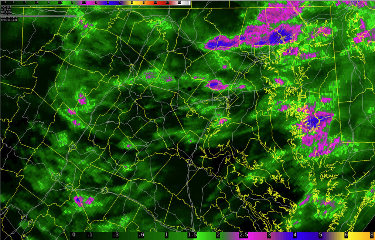
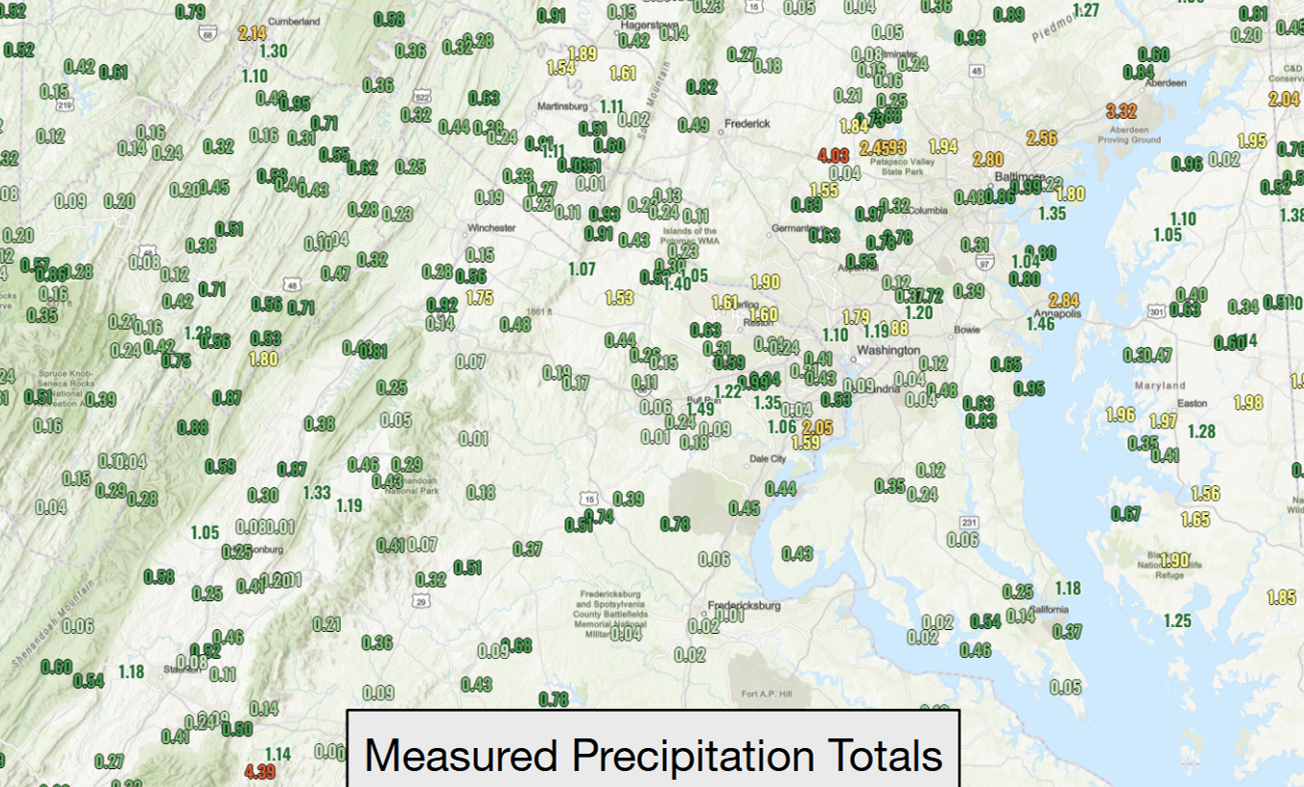
Radar estimated rainfall, followed by measured rainfall map, followed by county-by-county listing of rainfall reports for Thursday July 31st 2025.
Radar estimated rainfall: (in inches)
Map of Rainfall Reports: (in inches)
Public Information Statement (linked)
(County-by-County listing of rainfall reports)
US Dept of Commerce
National Oceanic and Atmospheric Administration
National Weather Service
Baltimore/Washington
Weather Forecast Office Baltimore/Washington
43858 Weather Service Rd.
Sterling, VA 20166
(571) 888-3500
Comments? Questions? Please Contact Us.


 Coastal Flood
 FAQ
FAQ