
Severe thunderstorms and heavy rain are expected across the central High Plains into parts of the central and southern Plains and in the the Mid-Atlantic today. Intense, dangerous heat will persist across the West, Southwest, and Southern Plains into the end of the week. Elevated to critical fire weather conditions expected in the Great Basin and Four Corners region. Read More >
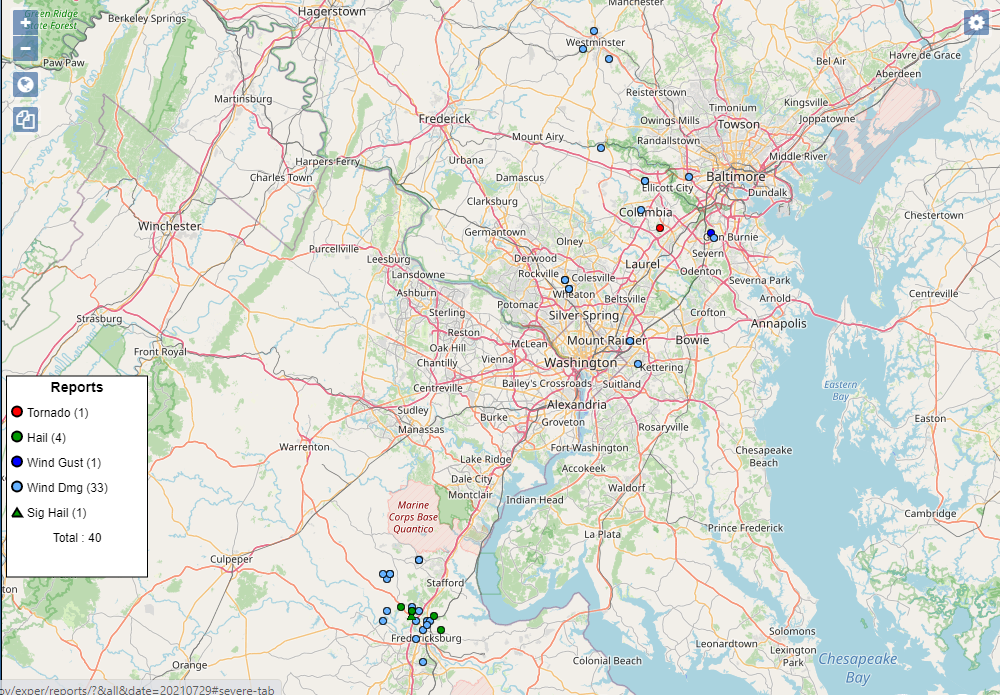
On the afternoon and evening of Thursday July 29th, severe storms created damaging winds, hail, and a brief EF0 tornado within our forecast area.
Here is all the reported damage in our area with a map.
NWS staff surveyed significant storm damage in Fredericksburg VA with 90 mph peak winds, as well as damage near Columbia MD that was confirmed as a brief EF-0 tornado with 70 mph peak winds. The preliminary storm survey report for both is here.
Additional information continues to come into our office, and all information is preliminary until published in Storm Data.


 Coastal Flood
 FAQ
FAQ