
A storm system will continue to produce widespread showers and thunderstorms as it progresses eastward across the central U.S. into the Northeast through the weekend. There are risks of severe thunderstorms and excessive rainfall on Saturday from the Ozarks into the mid-Mississippi River Valley with potential for damaging winds, large hail, tornadoes, and flash flooding. Read More >
|
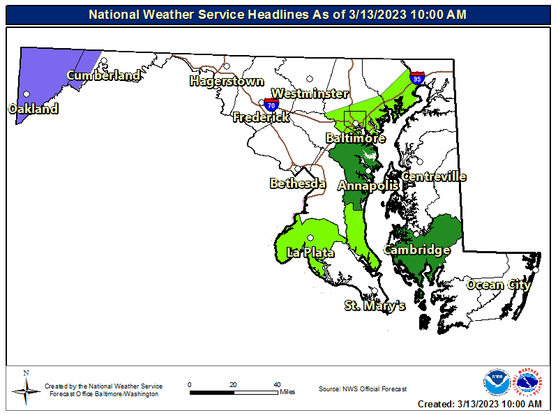
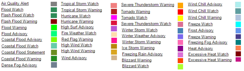
Warnings, Watches, and Advisories
|
|
|---|---|
|
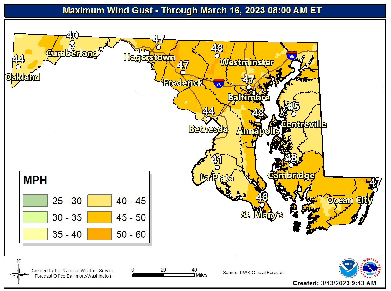
Maximum Wind Gust
|
|
|
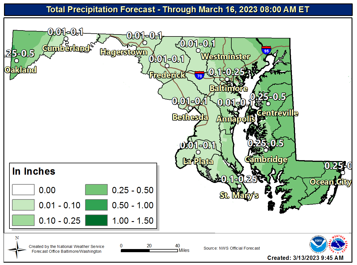
Total Precipitation Forecast
|
|
|
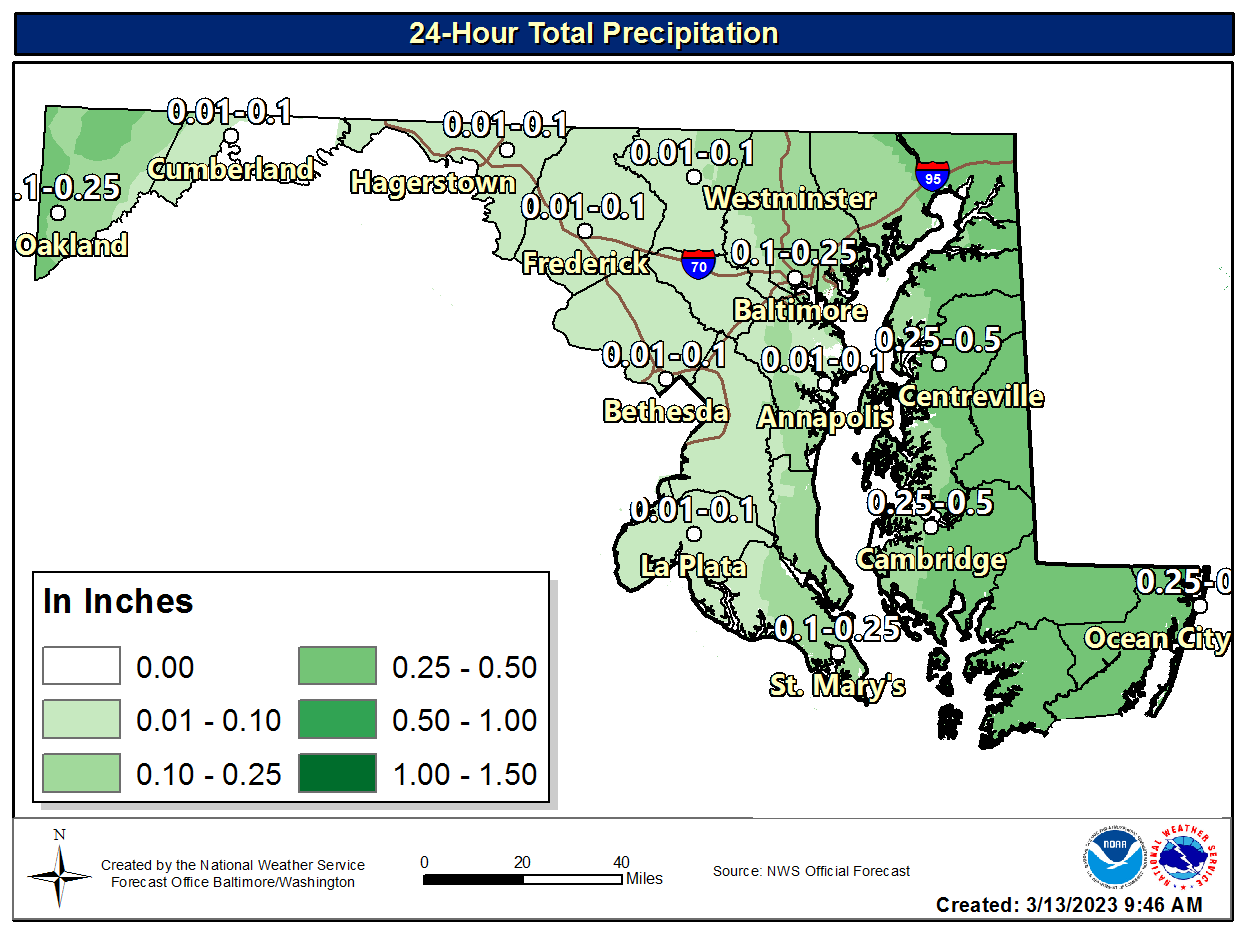
24-Hour Total Precipitation
|
|
|
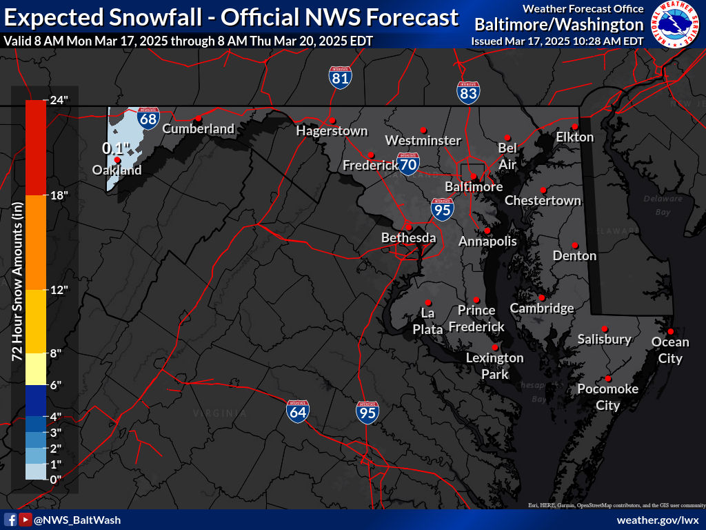
Expected Snowfall - Official NWS Forecast
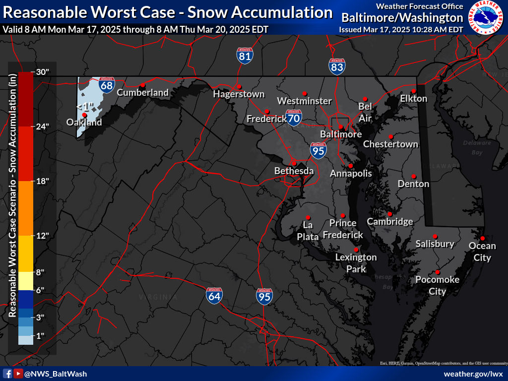
Snow - High End Amount
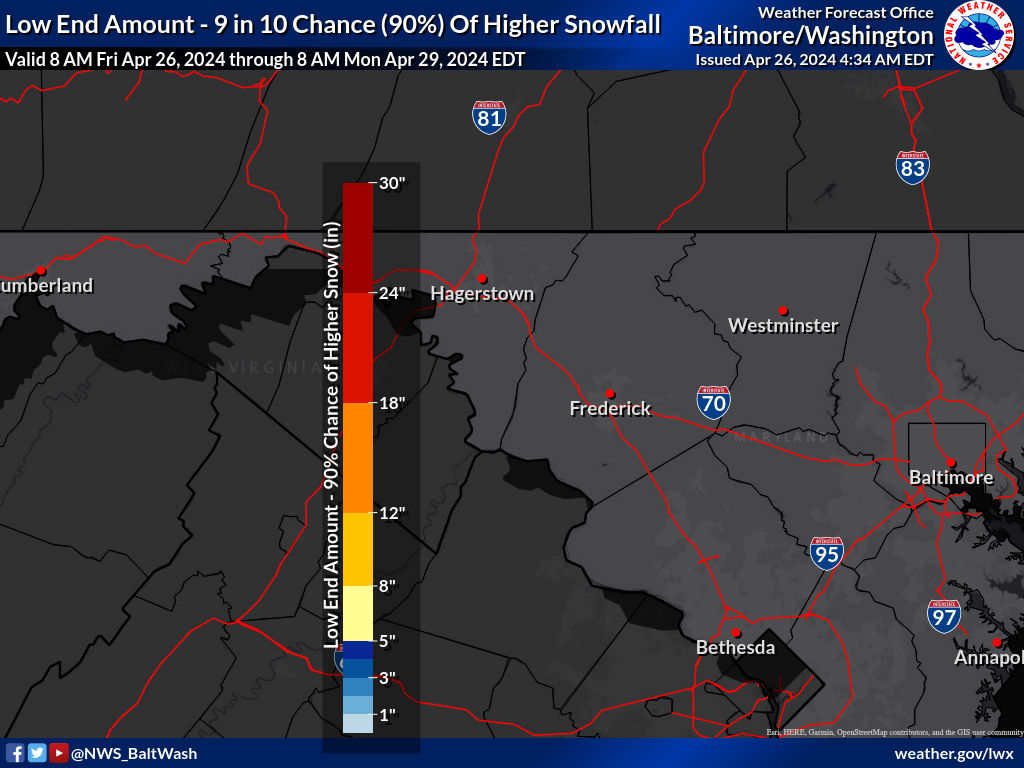
Snow - Low End Amount
Total Ice Accumulation Forecast
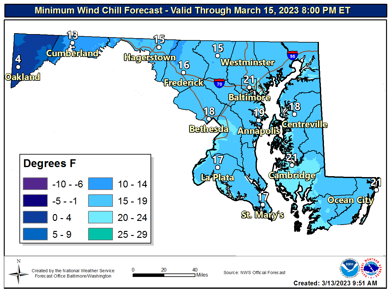
Minimum Wind Chill
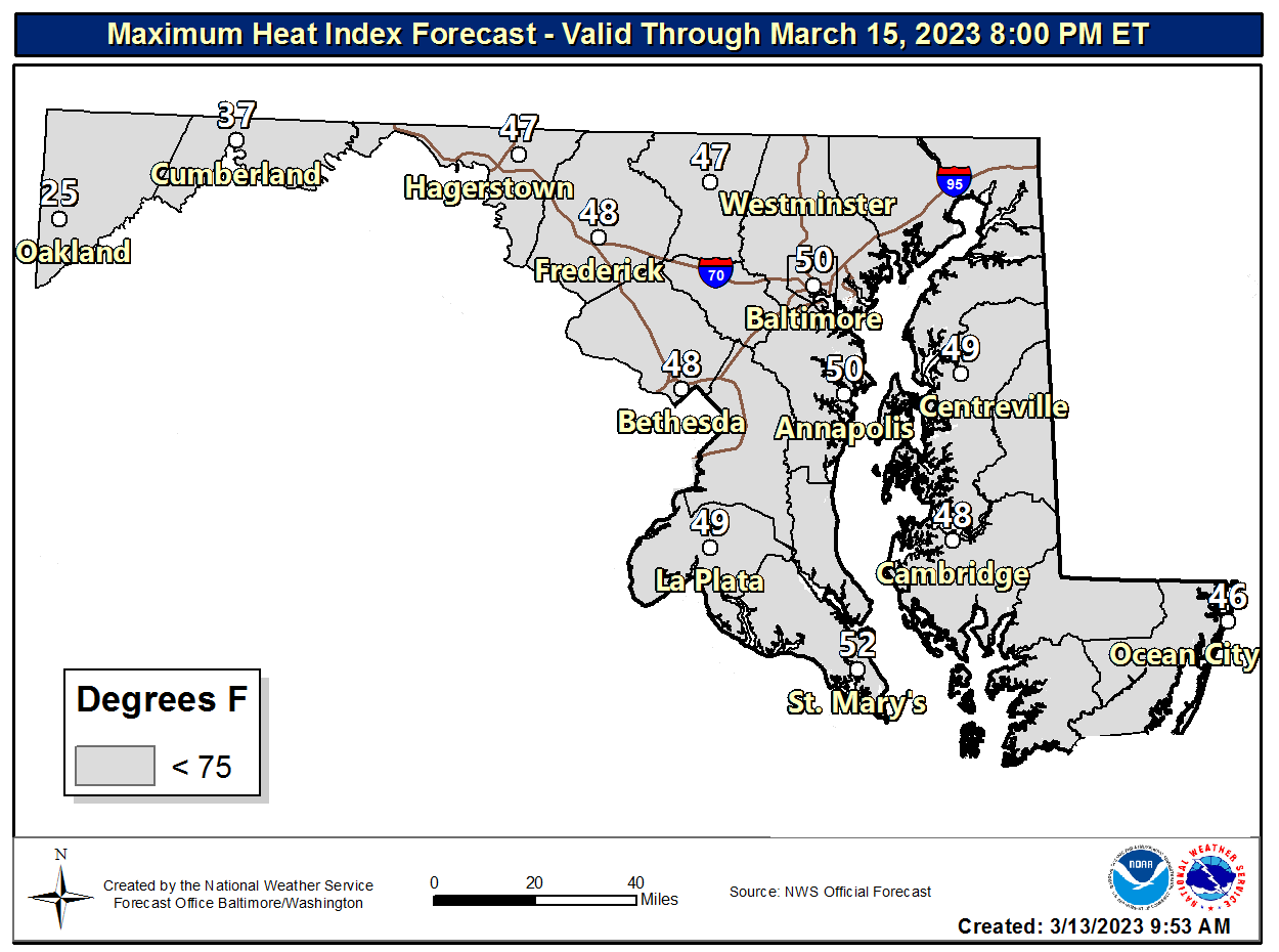
Maximum Heat Index
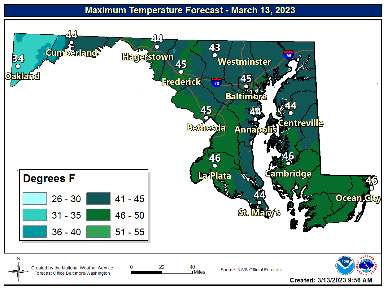
Maximum Temperature Day 1
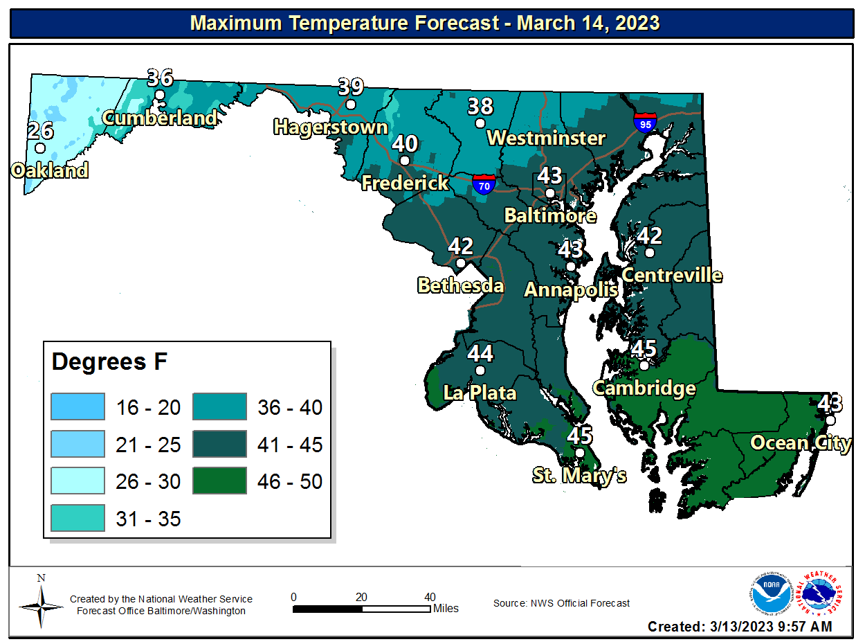
Maximum Temperature Day 2
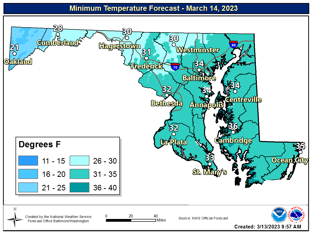
Minimum Temperature Day 1
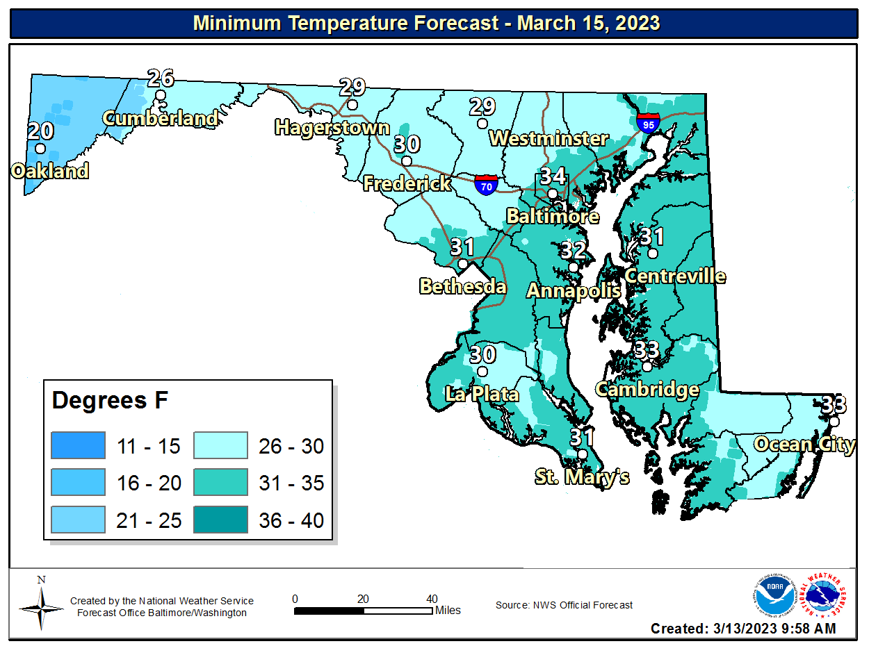
Minimum Temperature Day 2
|
|


 Coastal Flood
 FAQ
FAQ