
Heavy rain and widely scattered severe storms capable of large hail, damaging winds, and possibly a tornado are expected over portions of the central and southern Plains into the Lower Missouri Valley. Unseasonable warmth will continue for a few more days across the Midwest and Southeast where several daily record highs could fall. Read More >
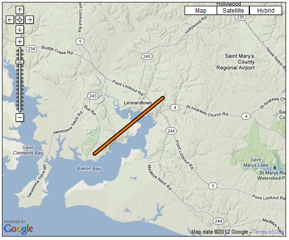
...EF-1 TORNADO CONFIRMED IN BRETON BAY MARYLAND...

LOCATION...BRETON BAY IN SAINT MARYS COUNTY MD
DATE...APRIL 28 2011
ESTIMATED TIME...11:25 AM TO 11:29 AM EDT
MAXIMUM EF-SCALE RATING...EF-1
MAXIMUM WIND SPEED...90 MPH
MAXIMUM PATH WIDTH...50 YARDS
LENGTH...3.3 MILES
BEGINNING LAT/LON...38.263N / 76.666W
ENDING LAT/LON...38.294N / 76.618W
* FATALITIES...NONE
* INJURIES...NONE

* THE INFORMATION IN THIS STATEMENT IS PRELIMINARY AND SUBJECT TO
CHANGE PENDING FINAL REVIEW OF THE EVENT/S/ AND PUBLICATION IN NWS
STORM DATA.

...SUMMARY...

A GROUND SURVEY CONDUCTED BY SAINT MARYS COUNTY EMERGENCY MANAGEMENT
AND THE NATIONAL WEATHER SERVICE...TOGETHER WITH RADAR AND
EYEWITNESS REPORTS DETERMINED THAT AN EF-1 TORNADO TRACKED ACROSS
BRETON BAY IN SAINT MARYS COUNTY MARYLAND. THE TORNADO SNAPPED AND
UPROOTED NUMEROUS LARGE TREES AND CAUSED SOME HOME ROOFING AND
SIDING DAMAGE. IT ALSO BLEW A CINDER BLOCK WALL OUT FROM A STORAGE
SHED AND DAMAGED ITS ROOF. THE TORNADO PASSED OVER CAMP CALVERT.



 Radar
Radar Current Weather
 Rivers & Lakes
 Satellite
 Forecast Maps
 Hour by Hour Forecast
 Tropical Weather
 Graphical Hazards
 Marine Forecasts
 Forecaster's Discussion
 Text Bulletins
 Fire Weather
 Weather Hazard Briefing
 Climate Plots
 Coastal Flood
 Skywarn
 Submit Storm Report
 FAQ
FAQ Follow us on X
 Follow us on Facebook
 Follow us on YouTube
 LWX RSS Feed