
Extreme heat continues across the Southwest as temperatures may top 120 degrees. The heat may expand across the West and south-central U.S. into the middle of the month. Severe thunderstorms capable of severe wind gusts and large hail will be the primary hazards today across the northern Plains into the upper Midwest. Rainfall could be locally heavy across the Eastern U.S. today. Read More >
Baltimore/Washington
Weather Forecast Office
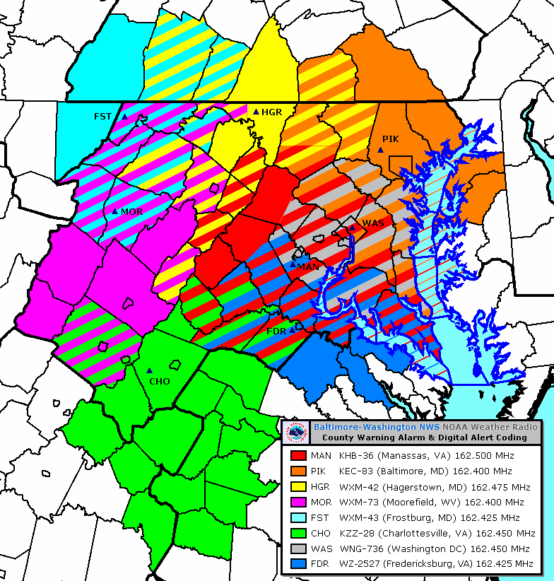
Map Last Updated: December 23, 2009
US Dept of Commerce
National Oceanic and Atmospheric Administration
National Weather Service
Baltimore/Washington
Weather Forecast Office Baltimore/Washington
43858 Weather Service Rd.
Sterling, VA 20166
(571) 888-3500
Comments? Questions? Please Contact Us.


 Coastal Flood
 FAQ
FAQ