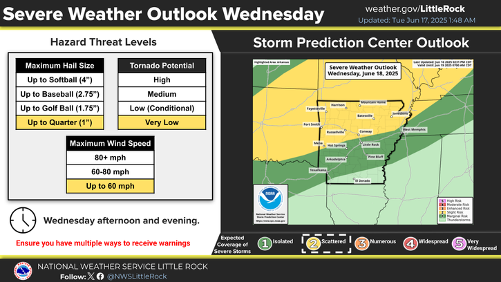
Heat index values will continue to climb over the next few days. A Heat Advisory is in place across portions of the Arkansas River Valley today and Friday.
Scattered storms will return to the area next week in the afternoons and early evenings. Severe weather threat will be low, but there will be a minor flooding risk with 2-3" possible if an area gets multiple storms each day.
The local forecast remains dry and settled through this week, however, you may have noticed increasing attention towards the tropics. As we move into August, we are headed towards peak climatological tropical activity in the Atlantic.
Note: "N/A" or "MISG" will be displayed if values are not available. In the LOCATION column, click on links for a list of recent observations at sites of interest. In the WIND column, VRB is "variable" and G is "gust". Wind speeds are in MPH. In the BARO (pressure) column, values are in inches. In the REMARKS column, HX is "heat index", WCI is "wind chill index", and VSB is "visibility" (if shown).


 Regional Radar
 Weather Map
 Social Media Dashboard