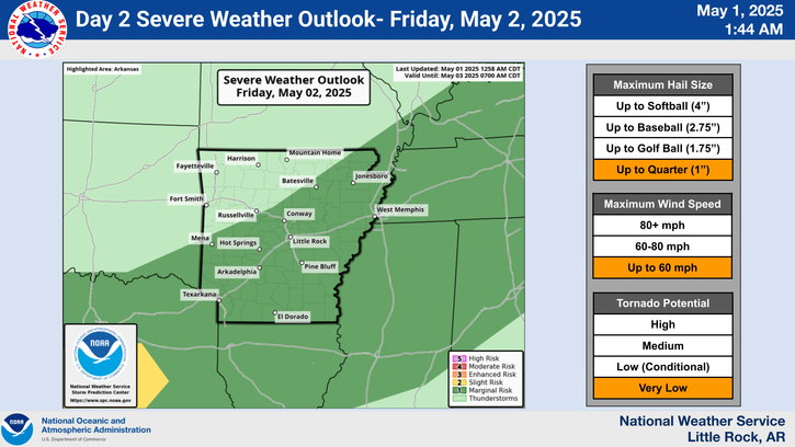
An active pattern will continue into the weekend. The threat for strong to severe thunderstorms will be seen from Thursday through Saturday across Arkansas.
A very unsettled pattern will be unfolding through the weekend with numerous rounds of showers and storms. While it will not be raining all the time, these amounts will add up over time.
The area looks to be in a favorable pattern for the development of Mesoscale Convective Systems or MCSs. Here is evertyhing you ever wanted to know about these complexes of storms.
NOAA is predicting an above normal season Atlantic Hurricane Season. Between 13 and 19 named storms are forecast. Hurricane season runs from June 1st to November 30th.
Note: "N/A" or "MISG" will be displayed if values are not available. In the LOCATION column, click on links for a list of recent observations at sites of interest. In the WIND column, VRB is "variable" and G is "gust". Wind speeds are in MPH. In the BARO (pressure) column, values are in inches. In the REMARKS column, HX is "heat index", WCI is "wind chill index", and VSB is "visibility" (if shown).


 Regional Radar
 Weather Map
 Social Media Dashboard