National Weather Service United States Department of Commerce
Click a location below for detailed forecast.

Last Map Update: Thu, Jul 3, 2025 at 6:30:13 pm CDT

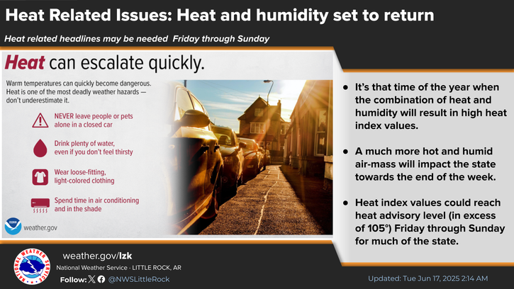
Hot and humid conditions are likely to continue through the rest of the workweek and into the weekend. The hottest temperatures are expected to return by Friday and last into the weekend with heat index values getting near or close Heat Advisory criteria (>105 degrees).
Low end rain chances will be possible each afternoon over portions of the state. Mainly during the afternoon and evening.
The July 4th forecast includes a slight chance of rain across western AR and warm temperatures.
The pattern ahead favors drier (for most areas of Arkansas) and hotter conditions thanks to an area of high pressure residing just east of the region. The image on left denotes the weather pattern on Thursday. Looking at the image on right, this map depicts potential cumulative rainfall amounts over the next few days. This map shows where high pressure will be in control suppressing rainfall locally around the aforementioned high.
 
Hourly Weather Roundup ( )
Location Sky/Weather Temp Dewpt RH Wind Baro Remarks
Fayetteville
N/A
N/A
N/A
N/A
N/A
N/A
N/A
Harrison
N/A
N/A
N/A
N/A
N/A
N/A
N/A
Mountain Home
N/A
N/A
N/A
N/A
N/A
N/A
N/A
Jonesboro
N/A
N/A
N/A
N/A
N/A
N/A
N/A
Fort Smith
N/A
N/A
N/A
N/A
N/A
N/A
N/A
Russellville
N/A
N/A
N/A
N/A
N/A
N/A
N/A
Mount Ida
N/A
N/A
N/A
N/A
N/A
N/A
N/A
Hot Springs
N/A
N/A
N/A
N/A
N/A
N/A
N/A
Little Rock
N/A
N/A
N/A
N/A
N/A
N/A
N/A
North Little Rock
N/A
N/A
N/A
N/A
N/A
N/A
N/A
West Memphis
N/A
N/A
N/A
N/A
N/A
N/A
N/A
Texarkana
N/A
N/A
N/A
N/A
N/A
N/A
N/A
El Dorado
N/A
N/A
N/A
N/A
N/A
N/A
N/A
Pine Bluff
N/A
N/A
N/A
N/A
N/A
N/A
N/A
Monticello
N/A
N/A
N/A
N/A
N/A
N/A
N/A
Note: "N/A" or "MISG" will be displayed if values are not available. In the LOCATION column, click on links for a list of recent observations at sites of interest. In the WIND column, VRB is "variable" and G is "gust". Wind speeds are in MPH. In the BARO (pressure) column, values are in inches. In the REMARKS column, HX is "heat index", WCI is "wind chill index", and VSB is "visibility" (if shown).
 
 
Point Forecasts
Cities in Arkansas Coordinates (make sure "Lon" is negative)
Lat:   Lon:
 
Local Hazards
Local Hazards
Decision Support
Decision Support
Submit Storm Report
Submit Storm Report
Local Forecast Page
Local Forecast Page
Radar Links
Radar Links
Local Climate Page
Local Climate Page
Local Observations Page
Local Satellite Page
Local Drought Page
Local Drought Page
Local Hydrology Page
Local Fire Page
Local Fire Page
Text Product Viewer
Text Product Viewer